
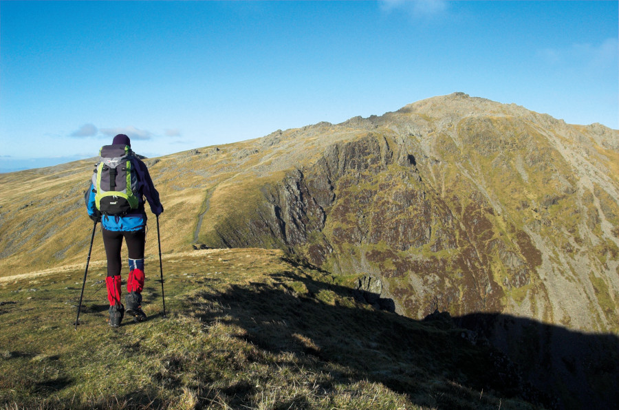
Cadair Idris is a beloved mountain steeped in myth and history. A comparatively simple route with steep ascent, it’s a favourite to introduce you to hillwalking in Eryri.
Below is the full route description for this simple mountain climb up Cadair Idris.
Hike Cadair Idris: route guide
Start/finish: Dôl Idris car park; GR: SH732115 | Maps: OS Explorer OL23 (1:25k), OS Landranger 124 (1:50k) | Distance: 9.5km/6 miles Ascent: 964m/3164ft | Duration: 5-6 hours | Transport: Buses from Machynlleth and Dolgellau
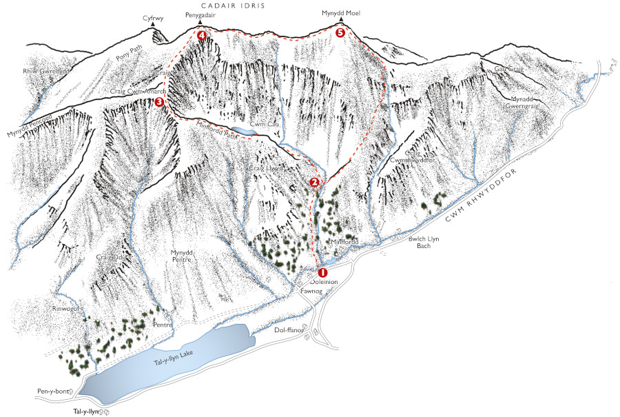
START/FINISH: Dôl Idris car park
- GR: SH732115: Leave the car park through the gate next to the pubic conveniences and turn R to head up the broad tree-lined lane that leads up to the National Trust buildings at Dôl-y-Cae.Turn L beneath the house and cross a bridge. Now turn R through a gate to start the long clamber up the steep steps of the Minffordd Path. This leads through glorious woodland above the turbulent Nant Cadair, with the gradient eventually easing slightly at a gap in a wall.
- SH727120 Bear L by a flagstone bridge then keep ahead, around the hillside, until you eventually gain the level ground of Cwm Cau. For the lake, break R to the shore; or to continue the climb, bear L to ascend steeply onto the ridge above. Continue around the cliff tops to a stile near the summit of Craig Cau.
- SH710120 Cross this and keep ahead to drop into Bwlch Cau, with great views down over Cwm Cau and the lake. Now climb again on a clear path that winds through a rocky landscape towards the summit. Avoid the temptation to straight-line this section, as the boulders are almost impassable in places. You’ll eventually join the Pony Path coming up from the W. Follow this to the trig point or just beyond where there’s a small bothy – the remains of an old tea house!
- SH711130 To continue, keep the bothy to your L and follow a faint path that leads down onto a huge plateau. Keep ahead as this drops into a broad, shallow saddle, then continue easily onto the summit of Mynydd Moel, where there’s a good windbreak
- SH726136 To descend, bear R to follow first the escarpment edge, then a fence, steeply down the mountain’s S ridge. Cross a stile and stay with the path, which is clear and easy to follow, and you’ll eventually drop to cross the Nant Gadair on the flagstone bridge you passed earlier. Turn L to descend back to the car park.
If you’d like to see other Eryri (Snowdonia) routes then check out our guide to the best here.


