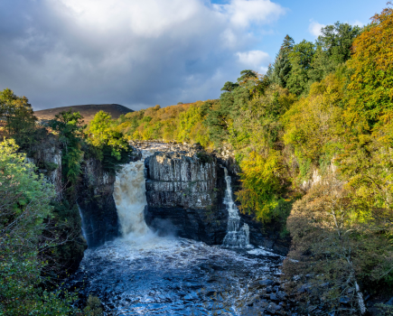
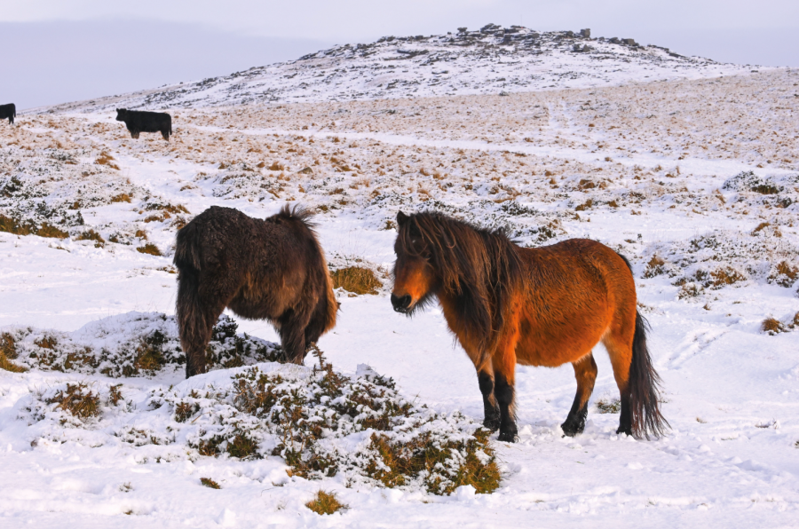
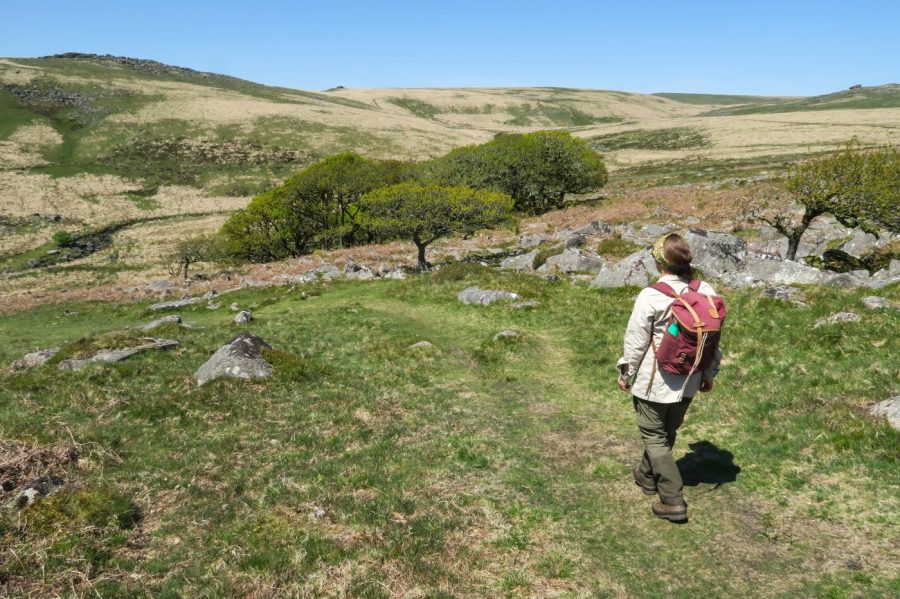
You’ve likely come across these hotly contested high tors in the news recently. Indeed, some of the best walks in Dartmoor – and of course, camping spots – owe their existence to a rare Right to Roam in England. But to scratch the surface of this fine national park – a place of wild ponies, sweeping tor vistas and welcoming pubs – you need local expertise. Here, local guidebook author Tim Gent and Dartmoor guide Emily Woodhouse share some routes you may be yet to ramble.
The right to wild camp on Dartmoor was hard-won. When you visit, respect the local environment and follow leave no trace principles. Please also ensure your skillset is suitable and be prepared for the conditions that await you in the hills.
Walks in Dartmoor: mapped
These routes can be walked in a day or extended to include overnight camps. To access the full mapped routes, please see the detailed route descriptions. If you prefer to spend a while in the national park, Tim Gent has put together a guide to having the ultimate adventurous weekend in Dartmoor.
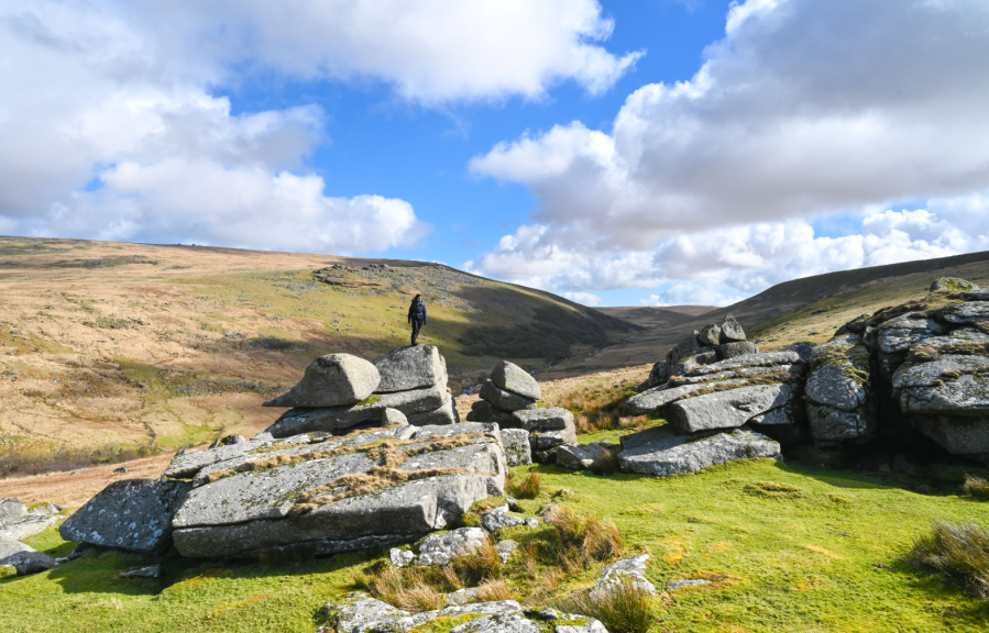
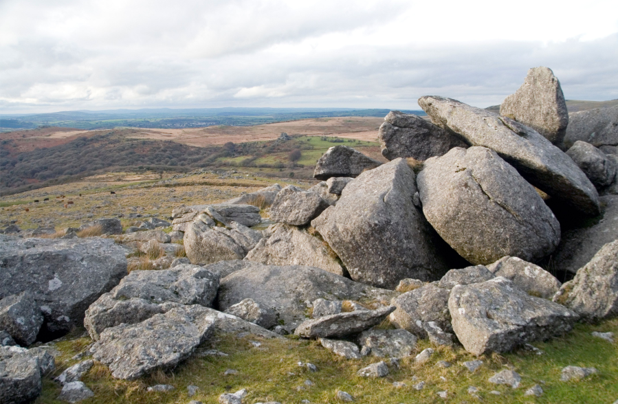
Cox Tor, White Tor & Middle Staple Tor
Dartmoor is rich in archaeological sites, but few corners hold quite as many as White Tor, says Tim Gent.
START/FINISH: Free parking on the south side of the B3357 (SX 530 751) | MAPS: OS Explorer OL28 | DISTANCE: 10.5km/6.5 miles | ASCENT: 250m | DURATION: 3-4 hours
For a short winter walk, this route certainly packs things in: five Dartmoor tors, prehistoric enclosures, standing stones and a stone circle, medieval tracks and historic tinworks. Even so, White Tor still manages to stand out. On a good day, the views form the tor are extraordinary. Bodmin Moor sits off to the west, a wavy horizon beyond a broad sea of green farmland. Know where to look, and you can pick out Brown Willy, Cornwall’s highest point.
Dartmoor fills the outlook in the other direction: Great Links Tor, Tavy Cleave, Fur and Great Mis Tors, each easy to identify. Look again, and you’ll spot High Wilhays and Hangingstone Hill, the most elevated ground on this moor. Drop your gaze and things remain just as interesting. The spread of stone here represents more than just the tumbled remains of the tor. There are many prehistoric settlements on Dartmoor, but few as old as this.
Read more: the full route description for White Tor as mapped by Tim Gent
Wild Tor & Cranmere Pool
Dartmoor needs no introduction to British wild campers, but you don’t need a long visit to benefit from those excellent camping opportunities – such as this one on Wild Tor – suggests Tim Gent.
START/FINISH: The carpark just to the north of Belstone (GR: SX621938) | MAPS: OS Explorer OL28 | DISTANCE: 19.6km / 12.2 miles | ASCENT: 373m / 1,225ft | DURATION: 6 hours (or overnight)
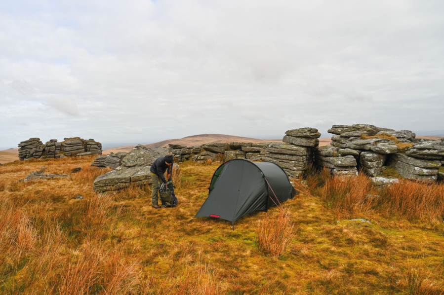
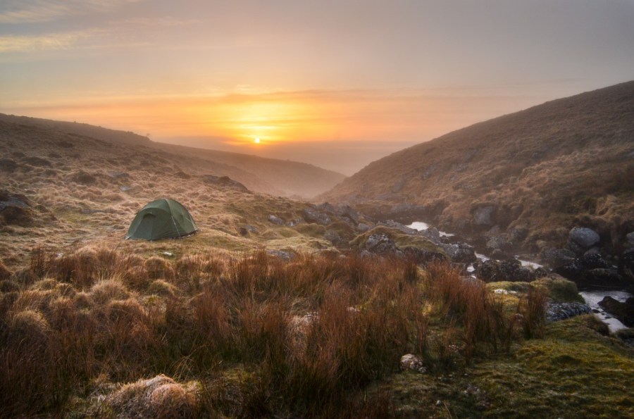
There are countless multi-day camping opportunities spread out across Dartmoor. All very enticing, but perhaps you don’t have a week to spare, or even a weekend. That’s when a lightning camping sortie comes into its own. Even a relatively short walk can be utilised, simply by stopping for the night at some pleasant spot along the way.
In summer, when the days are long, you can even set off after work on a Friday, walking into the moor for a few miles before pitching a tent. Up early the next morning, you could make the most of the new day and still be back to meet up with family for lunch. This, on Wild Tor and bypassing Cranmere Pool, is one of these short yet ever so satisfying Dartmoor camping walks.
Read more: the full route description for Wild Tor as mapped by Tim Gent
The Liberty Walk: Shelstone Tor
Tim Gent ponders on one of the more troubling events in our past on The Liberty Walk in Dartmoor.
START/FINISH: Free parking in Sourton close to the church, but avoiding church spaces (SX 535 903) | MAPS: OS Explorer OL28 | DISTANCE: 10.5km/6.5 miles | ASCENT: 328m/1076ft | DURATION: 4-5 hours
Aircraft 63926 transmitted its last message at 10.15 on a December night in 1943. A return to base was expected in five minutes. The plane never arrived. Setting out from RAF Dunkeswell in East Devon, the US Navy Liberator had been hunting enemy ships in the Bay of Biscay. They’d been fired upon, but pilot William Parish reported only ‘slight problems’ as a result. Perhaps the altimeter was damaged. Whatever the reason, the aircraft hit Dartmoor’s Corn Ridge, before tumbling into the West Okement valley. All ten aircrew lost their lives. Considering the complete destruction of the plane, and subsequent recovery of three of the four engines, enough still survives to mark this sorry event.
Reaching the valley edge overlooking the steep drop to the river, the topmost collection of tangled aluminium can just be made out amongst the granite boulders below. Clambering down, a second cairn lies a little lower, then the remaining engine. Despite the very pretty surrounding, perhaps because of them, the mood is sombre. Thankfully, the climb out of the valley to Shelstone Tor soon lifts the spirits, and returns us to the present day and a world in which at least this country is free from such waste.
Read more: the full route description for The Liberty Walk as mapped by Tim Gent
Great Links Tor via The Fox and Hounds
A clutch of Dartmoor tors, including Great Links Tor, and then back to the pub, suggests Tim Gent.
START/FINISH: Fox and Hounds car park (free, in exchange for a visit on your return) SX 525 867 | MAPS: OS Explorer OL28 | DISTANCE: 14km/8.6 miles | ASCENT: 440m/1440ft | DURATION: 4-5 hours
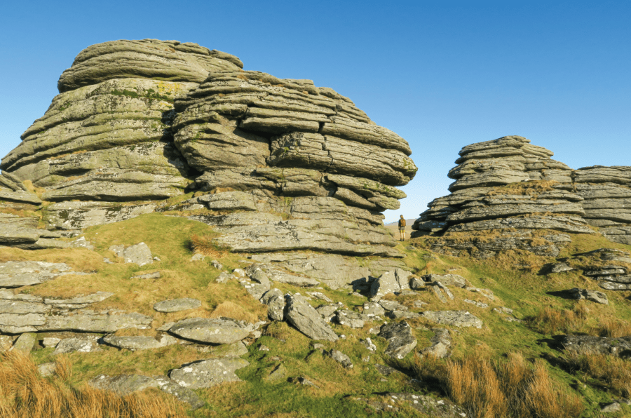
Setting out from the Fox and Hounds car park, five tors will be just enough on a short winter day before returning to the warmth of the bar. Arms Tor is first up, spread out well, with much seeming to have slipped down the hill over the millennia. Great Links Tor (pictured above) seems almost reluctant to show off from this direction, and it’s not until you bump right up against the imposing mass of once molten rock that its prefix makes sense. A very impressive lump of granite. Which Kitty Tor isn’t.
But what this dispersed stone scatter lacks in exuberance, it makes up in views, even if Branscombe’s Loaf, next in line, isn’t actually visible. Although fairly close to the moor’s edge, Shelstone Tor is relatively seldom visited, but this multi-faceted stone pile calls out to be clambered over and inspected. Finally, with superb views out over the farmland below, Sourton Tors always manage to feel slightly set apart. It’s not just the location, as Sourton represents one of only a handful of limestone tors on the moor.
Read more: the full route description for Great Links Tor as mapped by Tim Gent
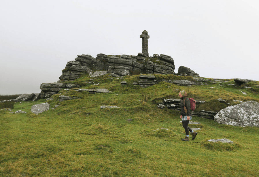
Feather Tor via the Upper Walkham Valley
Tim Gent rejoices in high ground on a healthy spread of access land in Dartmoor’s Upper Walkham Valley.
START/FINISH: Car park at SX 539 749 | DISTANCE: 10.5km/6.5 miles | ASCENT: 331m / 1087ft | TIME: 4 hours | MAP: OS 1:25,000 Explorer OL28

Whitchurch Common bristles with granite exuberance, and it is our past response to this hard igneous stone that forms a persistent refrain throughout the walk of Upper Walkham Valley. Close scrutiny of the granite fragments spread around the Whitchurch tors will reveal frequent examples of ad hoc quarrying. Numerous surface ‘moorstones’ still bear the scars of having been split, ready to be carted away.
No close inspection is needed to spot quarrying evidence on the other side of the valley, where quite astonishing efforts were made in the 19th century to remove vast tonnages of stone. A fair stretch of this walk takes place along the bed of an abandoned railway, built in large part to carry this stone off the moor and away to build sizable chunks of Plymouth. Of course, these Victorian quarrymen were not the first to exploit the local geology. Not far on to the north, and spread out across a rare piece of flat moorland ground, are a remarkable collection of prehistoric standing stones, stone circles, cairns and stone rows, pressed close by the nearby B3357.
Read more: the full route description for Feather Tor as mapped by Tim Gent
Bleak House & Bray Tor
Tim Gents visits Bleak House, a ruined remote home with a history of spies on Dartmoor.
START/FINISH: The car park to the east of Dartmoor Inn, Lydford (SX 522 852) | MAPS: OS Explorer OL28 | DISTANCE: 12.5.km / 7.8 miles | ASCENT: 349m / 1,145ft | DURATION: 4-5 hours
Dartmoor has experienced various attempts to strip it of its assets. Even swathes of the peat that blanket the hills have been dug up and hauled away. The remains of these endeavours are still visible today, and one of the most enigmatic is Bleak House. It’s worth a visit.
A license to extract peat near Great Links Tor was granted in 1878. Only a year later, The Rattlebrook Peat Works had installed a railway and drying kilns and built a home for the manager. Originally named Dunnagoat Cottage, early photos show an imposing dwelling, built using granite from nearby outcrops. Despite the investment in time and money, the works never flourished. The rails for the railway were lifted in 1932, and the army soon demolished the drying buildings. At some point, the crumbling remains of the manager’s isolated home became known as Bleak House. All Dartmoor features carry a tale of course, and during WWI, Bleak House was said to have been the hiding place of a German spy. The fact that the works employed a scientist called Muller at the time, may provide a rather less sensational explanation.
Read more: the full route description for Bleak House as mapped by Tim Gent
Devil’s Tor via Wistman’s Wood
Dartmoor abounds with tales and legends, and the upper reaches of the West Dart River are no exception. So, why not visit Devil’s Tor and Wistman’s Wood and see what emerges from the undergrowth, suggests Tim Gent.
START/FINISH: The car park at Two Bridges; SX 609 751 | MAPS: OS Explorer OL28 | DISTANCE: 13.5km / 8.5 miles | ASCENT: 310m / 1,020ft | DURATION: 3-4 hours
Scientists will tell you that Wistman’s Wood is a fragmentary remnant of a once sizeable upland temperate rainforest. They will cite the many species of epiphytic moss, fern and liverwort that clothe the trees, or tell us that this is one of only two sites in Britain that provides a home for the horsehair lichen. They can name the lizards and shrews that skitter across the fallen leaves and the birds that flit amongst the branches, yet still fail to list every creature that lurks amongst those gnarled and ancient oaks. For the devil hunts these moors at night, and as dawn approaches, this wood is where he kennels his hounds. Walk here as dusk approaches and it is claimed the Wisht Hounds can be heard baying for release.
And don’t feel too safe once back at your car. The road between Two Bridges and Postbridge is reputed to be home to the Hairy Hands. First reported in the 1920s, these fiendish disembodied hands are said to grasp at steering wheels or motorcycles handlebars, forcing the helpless motorist off the road. But let’s start this walk with a visit to the devil, or at least his tor, lying close to one of the tallest standing stone on the moor.
Read more: the full route description for Devil’s Tor as mapped by Tim Gent
Walkhampton Common & King’s Tor
Roger Butler takes an old railway line to King’s Tor to walk the sculptural and weather-beaten outskirts of Dartmoor.
Start/Finish: Car park by small pool on south side of B3212 (GR: SX557706) | Distance: 8 miles/12.9km | Ascent: 1,000ft/305m | Duration: 4 to 5 hours | Maps: OS Explorer OL28 – Dartmoor (1:25k), OS Landranger 191 – Okehampton & North Dartmoor (1:50k)
The wild heart of Dartmoor is infamously boggy, but you don’t always need to hike into the squidgy interior to enjoy this granite-hewn landscape, where bronze-coloured heath sweeps in every direction and hilltops always seem to be capped with a sculptural weatherbeaten tor.
The line of the former Princetown Railway, high to the east of Tavistock, provides straight-forward access to a number of granite outcrops but also serves up some fascinating history: a scattering of ancient hut settlements, wriggling leats that once took fresh water down to Plymouth, and quarries where stonemasons grafted to create Nelson’s Column. There are fine views too: the eerie shapes and shadows around distant Great Mis Tor and the deep wooded valleys down by the River Tamar. From up here, Cornwall looks like a faraway kingdom. The walk also cuts across open moorland to North Hessary Tor and returns via tussocky Walkhampton Common and a couple of rocky tops. You’ll even peep over the gaunt rooftops of Dartmoor Prison!
Read more: the full route description for King’s Tor as mapped by Roger Butler
The Two Moors Way
For something a little longer, Devon’s south to north Coast to Coast route takes in both Dartmoor and Exmoor before reaching the sea. Emily Woodhouse shows us the Two Moors Way.
START/FINISH: Start in Wembury, finish in Lynmouth | MAPS: Harvey National Trail Maps – Two Moors Way (1:40k doesn’t include Wembury to Ivybridge) – Cicerone Two Moor’s Way Map Book – Ordnance Survey Landranger 1:50,000 180, 181, 191, 202 – Ordnance Survey Explorer 1:25,000 9, 20, 28, 113, 114, 127 | DISTANCE: 188km / 117 miles | ASCENT: 4,545m / 14911ft | DURATION: 5.5 days
Devon is a surprisingly enormous county and one of very few in the UK that has coastline on two sides. Better still, these are opposite sides, separated by 117 miles of fields and moorland, towns and woodland. There is no quick way around and connecting these diametrically opposite beaches is a journey of discovery into what makes up Devon. There are two main moorlands on the Two Moors Way which give the route its name. Starting on the beach at Webury, the route climbs up and onto Dartmoor, skirting the right hand edge and back down into countryside. Crossing mid-Devon, the route passes through Exmoor and finally straight off the moors to the cliffs of Lynton and the shingle beach at Lynmouth Bay.
It is possible to complete the route in several shorter sections or in one continuous walk. Similarly, it can be done at any time of year, but a lucky spell of sunshine in early summer or early autumn would probably be the most pleasant. It does rain a lot in Devon. The official Two Moors Way website recommends 13 stages of between 4 and 16 miles. But it is commonly done in less than a week. There are many options for accommodation and camping is possible, though you may need to walk a little further off route to get there.
Read more: the full route description for the Two Moors Way as mapped by Emily Woodhouse
BONUS: The Dartmoor ‘Mystery Walk’
Can you take on this Dartmoor ‘mystery walk’ navigation challenge set by local Mountain Leader, Emily Woodhouse?
START/FINISH: Parking at the large pub car park at the Fox and Hounds. This is for patrons only so make sure to grab a refreshment if it is open or stay at the campsite. (GR: SX 5253 8668) | MAPS: OS Explorer OL28 (1:25k) Dartmoor | DISTANCE: 8km / 5 miles | ASCENT: 366m / 1,201ft | DURATION: 4 + hours
Dartmoor has many wonderful qualities including the proliferation of man made objects, going back as far as the Bronze Age. So many exist that hundreds of precise navigation points haven’t made it onto your paper map. When you mix these geographical features with the lack of distinct paths and tendency towards abysmal weather and you’ve got yourself a great little Dartmoor ‘mystery walk’ navigation challenge – if you know where to look.
This route is designed to be challenging. Every point is a clearly identifiable object not on the map. You’ll know you’ve found it when you get there. You can do the whole route point to point direct with bearing and pacing. I’ve included clues in the route description. These are suggestions if you get stuck or lose confidence. After all, on a navigation challenge like this, GPS is completely banned! All you need is an 8 figure grid. Learning to correct course yourself and fix a miss is a more valuable skill than getting it right first time, so no cheating. Bonus points for doing it in the dark. Good luck!
Read more: the full route description for the Dartmoor Mystery Walk as mapped by Emily Woodhouse