Tim Gent rejoices in high ground on a healthy spread of access land in Dartmoor’s Upper Walkham Valley.
Whitchurch Common bristles with granite exuberance, and it is our past response to this hard igneous stone that forms a persistent refrain throughout the walk of Upper Walkham Valley. Close scrutiny of the granite fragments spread around the Whitchurch tors will reveal frequent examples of ad hoc quarrying. Numerous surface ‘moorstones’ still bear the scars of having been split, ready to be carted away.
No close inspection is needed to spot quarrying evidence on the other side of the valley, where quite astonishing efforts were made in the 19th century to remove vast tonnages of stone. A fair stretch of this walk takes place along the bed of an abandoned railway, built in large part to carry this stone off the moor and away to build sizable chunks of Plymouth.
Of course, these Victorian quarrymen were not the first to exploit the local geology. Not far on to the north, and spread out across a rare piece of flat moorland ground, are a remarkable collection of prehistoric standing stones, stone circles, cairns and stone rows, pressed close by the nearby B3357.
Upper Walkham Valley: route description
START/FINISH: Car park at SX 539 749 | DISTANCE: 10.5km/6.5 miles | ASCENT: 331m / 1087ft | TIME: 4 hours | MAP: OS 1:25,000 Explorer OL28
1. SX 540 750: Dartmoor walkers can rejoice in the fact that much of the moor’s high ground sits within a healthy spread of access land, but there are still a few areas that remain out of bounds. To explore the upper reaches of the Walkham Valley therefore requires a little road tramping, most of it quiet and leafy. The result is a varied circular walk with one enduring theme. From the small but free car park below Little Staple Tor, cross the road to head south-west, dropping to cross the stream before climbing gently on the other side of the valley to Feather Tor. Continue along the broad ridge in the same direction to reach Prew Tor, following a clear path that falls gently beyond the outcrop to the end of the common. This corner of access land is criss-crossed by paths, so as you approach a small area enclosed by a wall, aim to take the path that passes this field on the right (the western side).
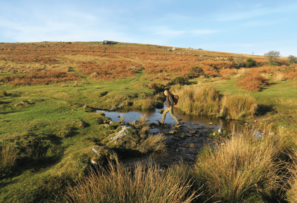
Crossing the stream below Whitchurch Common. Credit: Tim Gent
2. SX 531 727: Reaching the road, a T-junction will be obvious. Take the narrow lane ahead (with a large white 40 in a circle painted on the tarmac). This drops gently through the edge of Sampford Spiney and on to Stoneycroft, where you bear left onto a good track (marked by a blue sign – unsuitable for motor vehicles) that continues downhill.
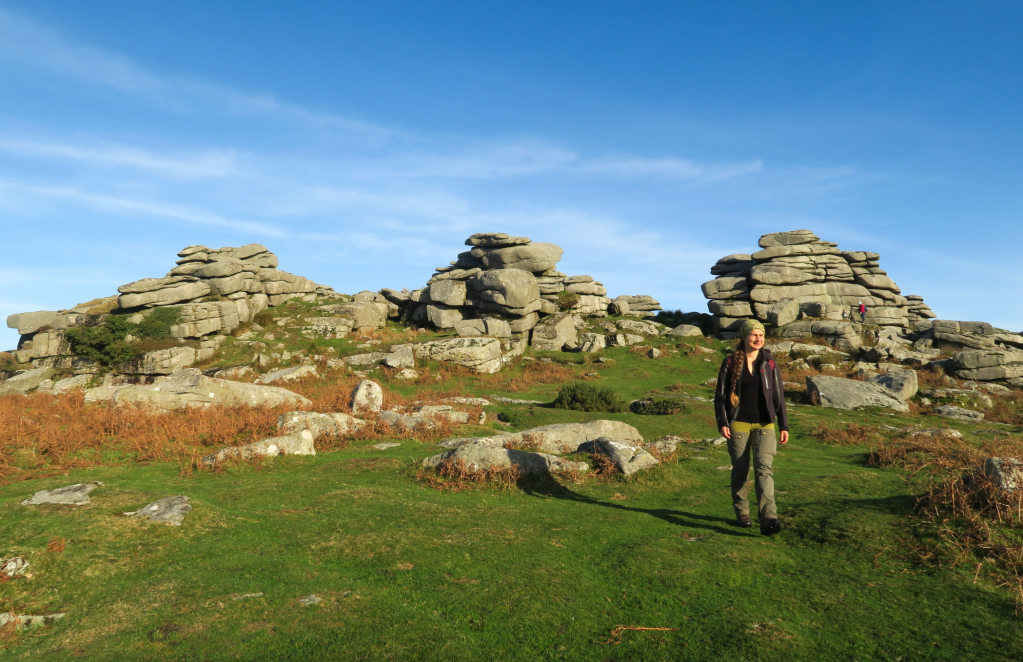
Feather Tor. Credit: Tim Gent
3. SX 539 719: Turn left as you meet the road again, continuing to drop before crossing the river Walkham. Head straight on from Ward Bridge, up and back out onto the open moor, where you turn left to follow a track towards Criptor. Here, a sign will direct you along a footpath to a crossing of a stream and a gentle climb to the abandoned railway (a split moorstone lies to this section of path).
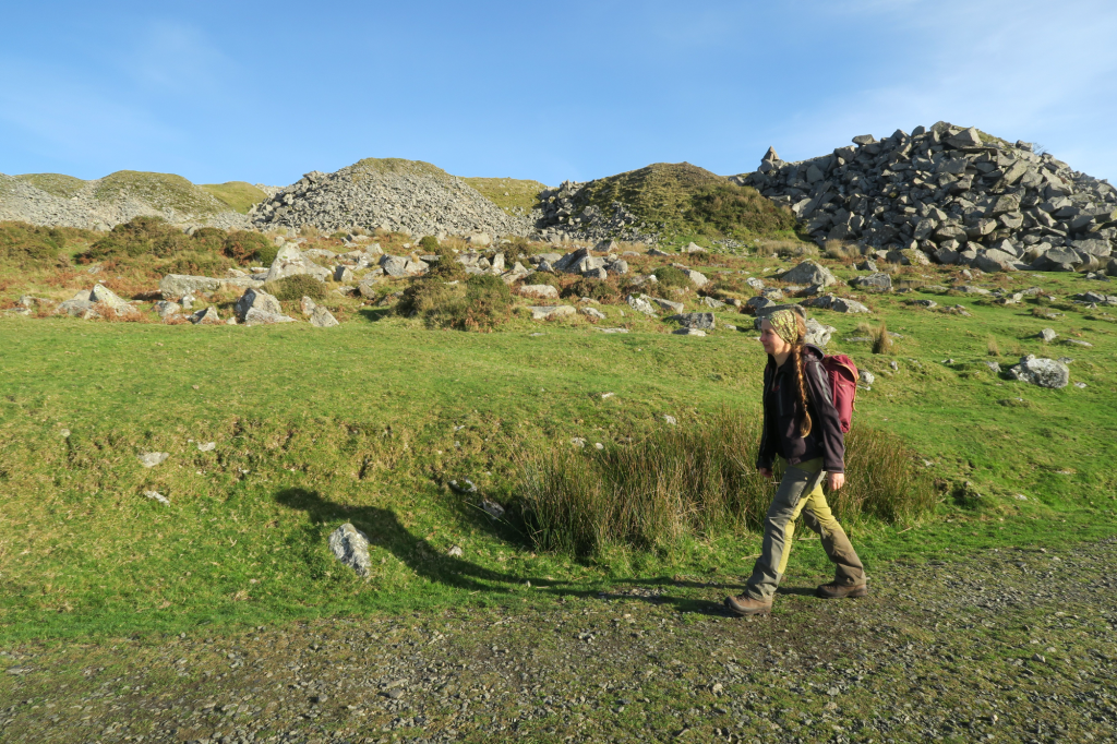
Walking along the abandoned railway, past plenty of quarry waste. Credit: Tim Gent.
4. SX 560 729: Meeting the old rail line, turn left to follow the wide level track, passing the impressive remains of past activity at the Swelltor Quarries. After about 1km, the track will swing around to the right below King’s Tor, and at the northernmost corner you leave it to the left to skirt an area of enclosed land (ignore the inviting stile over the field boundary wall). The stream can be a little tricky to cross with dry feet, but once on the far bank, bear north-west to find a 3m high prehistoric standing stone.
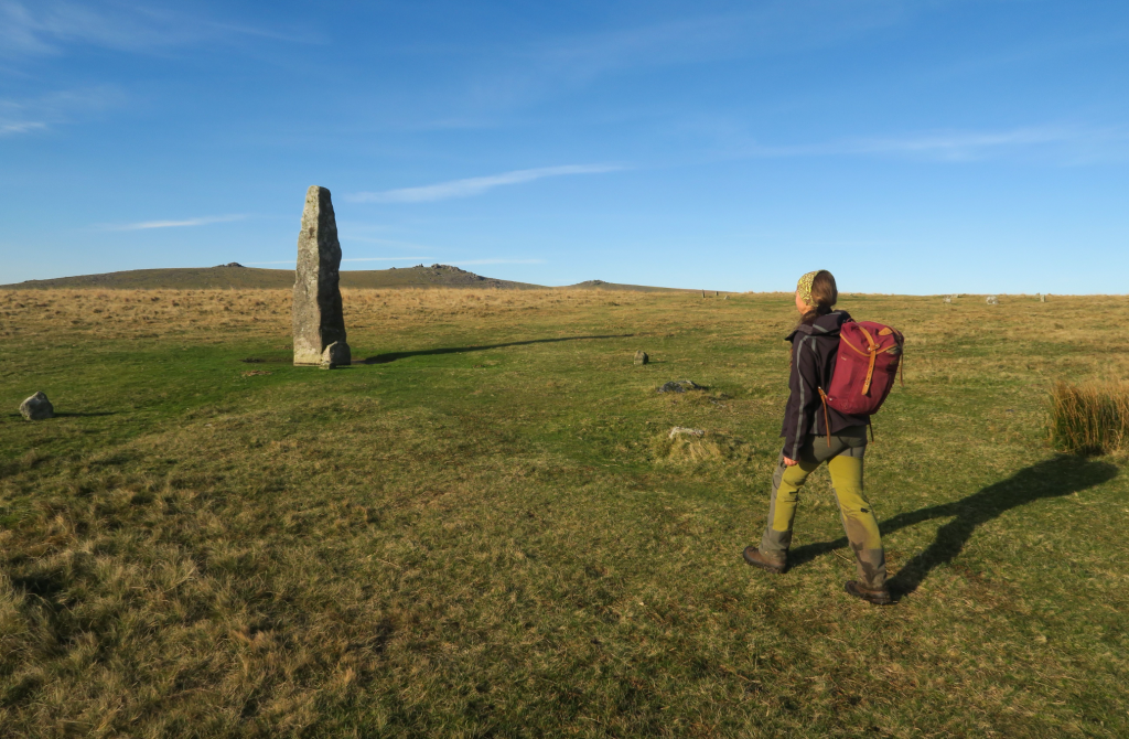
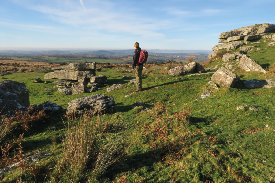
The standing stone at Merrivale. Credit: Tim Gent
5. SX 554 746: Continue north from the standing stone to meet a pair of low double stone rows (and here you may well wish to wander about a bit, marvelling at the efforts of our late Neolithic and early Bronze Age predecessors. There are quite a few hut circles beyond the stone rows, the area marked on the OS OL28 sheet). The B3357 can be found beyond all the archaeology, where you turn left. Care needs to be taken as this road can be quite busy at times. There is a path, of a sort, along the left-hand verge, and you can cross the road beyond Merrivale Quarry (also now abandoned) to walk back to the car park along the edge of the moor (this area is a favourite haunt of the remaining moorland ponies).
Further information
TOURIST INFORMATION: National Park Visitor Centre, Princetown (01822 890414)
PUBLIC TRANSPORT: Oakleys Coaches bus 98 (01752 729866)
NEAREST YHA: Dartmoor
Discover more walks in Dartmoor as mapped by our expert contributors.