Whether you climb rocks, scramble up and down them, hug them, pose for daring photos on them – you can’t deny that they’re a highlight of any walk. Here’s some of our favourite walks to amazing rock formations as mapped by our experts – plus 10 more bonus rock stars – from the Old Man of Storr in Skye to Alport Castles in the Peak District.
Some of these routes require scrambling skills. Please ensure your skillset is suitable and be prepared for the conditions that await you in the hills – and if in doubt, hire a local guide. When you visit, respect the local environment and leave no trace.
Meet the rock stars
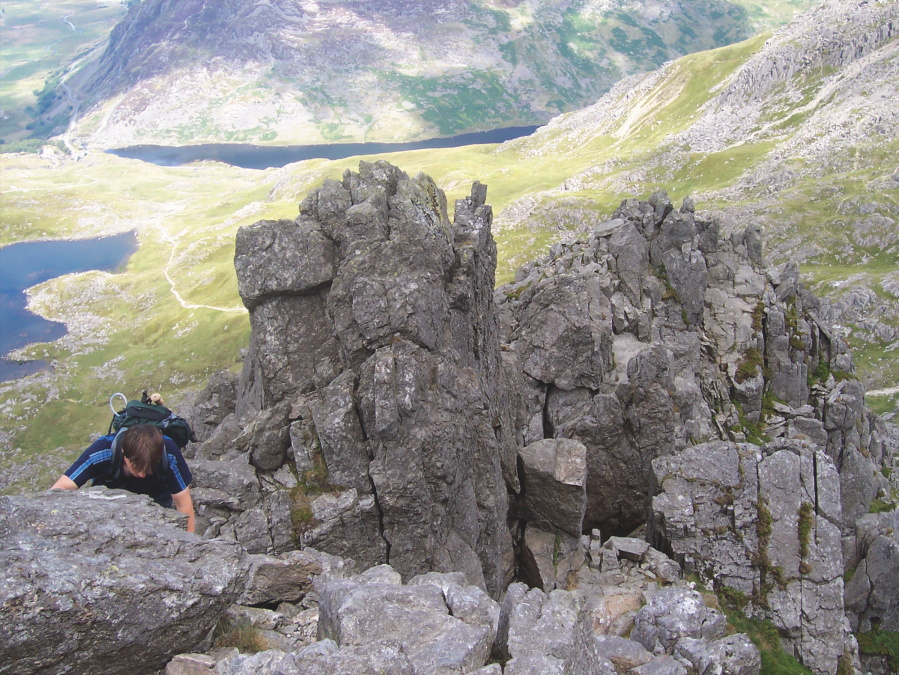
Aonach Eagach, Glen Coe
James Roddie takes on a big route with a big rep – plus the obligatory Clachaig pub stop!
Start/finish: NN 1710 5688 – The Lost Valley carpark on the A82 | Ascent: 5729ft/1609m | Duration: 8-12 hours | Distance: 10.6 miles/17km | Maps: OS Explorer 384 – Glen Coe and Glen Etive

The Aonach Eagach is a big route with an even bigger reputation. This is as good as it gets in Scotland – a pinnacled, narrow ridge linking two Munros, with excellent scrambling and exceptional views. Unlike most of the scrambling on the Liathach and An Teallach ridge traverses, the main technical difficulties on the Aonach Eagach cannot be safely bypassed. It is a committing undertaking which should not be underestimated, involving exposed Grade 2/3 scrambling over a considerable distance.
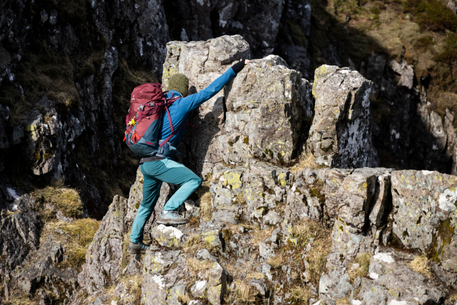
Route-finding is largely straightforward, as following the crest of the ridge itself is usually the best option. If you have any doubts about your scrambling abilities or head for heights, hire a professional mountain guide. Leave it for a dry day if you can and enjoy it – days in the hills don’t get much better than this. As a reward, Clachaig Inn provides a welcome stop for refreshments on the return walk. If you are lucky, you may be able to get a lift from other walkers driving from the Clachaig back towards the start of the route.
Read more: the full route description for Aonach Eagach as mapped by James Roddie
Tyfan North Ridge, Eryri/Snowdonia
Classic scrambles don’t come much better than the North Ridge of Tryfan – and Glyder Fach’s Bristly Ridge and Y Gribin make a fine coda, says Alex Roddie.
Start/finish: Milestone Buttress car park beside Llyn Ogwen in Ogwen Valley (GR: SH659602) | Distance: 6.7km/4.2 miles | Ascent: 869m/2,851ft | Duration: 5 to 6 hours | Maps: OS 1:25,000 Explorer sheet OL17 (Snowdon/Yr Wyddfa), OS 1:50,000 Landranger sheet 115 (Snowdon/Yr Wyddfa), Harvey 1:40,000 British Mountain Map (Snowdonia North)
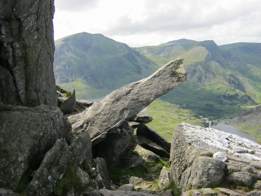
There are many scrambling opportunities in North Wales, and especially around the Ogwen Valley, but nothing has the cachet as Tryfan. This blade of rock, with a summit at 917m (3,009ft), rises in a sheer stepped ridge from the valley, and it’s this prominent North Ridge that offers one of the finest easy scrambling experiences in Britain. At Grade 1, it’s exposed enough to be exciting, but easy enough to be within the capabilities of most fit and experienced hillwalkers.
The logical continuation of the Bochlwyd Horseshoe over Bristly Ridge to Glyder Fach (994m / 3,261ft) and down to Cwm Bochlwyd via Y Gribin also involves plenty of easy Grade 1 scrambling for some hands-on-rock excitement. It is a route to be savoured – but wait for good weather, as these mountains can feel a lot more intimidating in poor visibility, high winds, or with wet rock.
Read more: the full route description for Tryfan North Ridge as mapped by Alex Roddie
Pillar Rock, Lake District
Want to gaze over Lakeland’s most handsome crag? This adventurous hike’n’scramble via the High Level Route and Shamrock Traverse is the finest way to experience Pillar Rock, says James Forrest.
START/FINISH: Gatesgarth Farm pay and display car park (NY194149) | MAPS: OS Explorer OL04 (1:25k), OS Landranger 89 (1:50k), Harvey British Mountain Map Lake District (1:40k) | DISTANCE: 13.9km / 8.6 miles | ASCENT: 1,395m / 4,577ft | DURATION: 6 hours
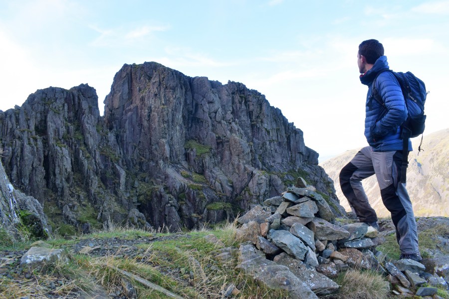
Alfred Wainwright described this adrenaline-inducing scramble up Pillar from Buttermere as a “glorious walk…for strong walkers only”. A trio of passes – twice up Scarth Gap and once up Black Sail Pass – are to blame for the exertion, but the reward is worth the graft. You’ll get up close and personal with Pillar Rock – a seemingly impenetrable tower of rock that juts out of Pillar’s north face like a dark, craggy cathedral. The summit of Pillar Rock is the preserve of rock climbers, but this route enables hillwalkers to get close to the action. From its start, west of Looking Stead, the High Level Route is a rough trod over rugged terrain via Robinson’s Cairn, while the Shamrock Traverse is a tilted rake featuring a heart-in-mouth shuffle across a slab of rock with precipitous drops on one side.
It’s a tricky walk with some exposure and sections of rocky scrambling. Losing the trod could be fatal. But nowhere is it technically difficult and the views of Pillar Rock are something to behold.
Read more: the full route description for the Shamrock Traverse as mapped by James Forrest
Gordale Scar & Malham Cove, Yorkshire Dales
Ian Battersby uses a dry spell to scramble Gordale Scar up to Malham Cove, a jewel in Yorkshire’s geographical crown
START/FINISH: Water Sinks car park south of Malham Tarn; SD894658 | MAPS: OS Explorer OL02 (1:25k), OS Landranger 98 (1:50k) | DISTANCE: 15.1km / 9.4 miles | ASCENT: 400m / 1,312ft | DURATION: 5 hours
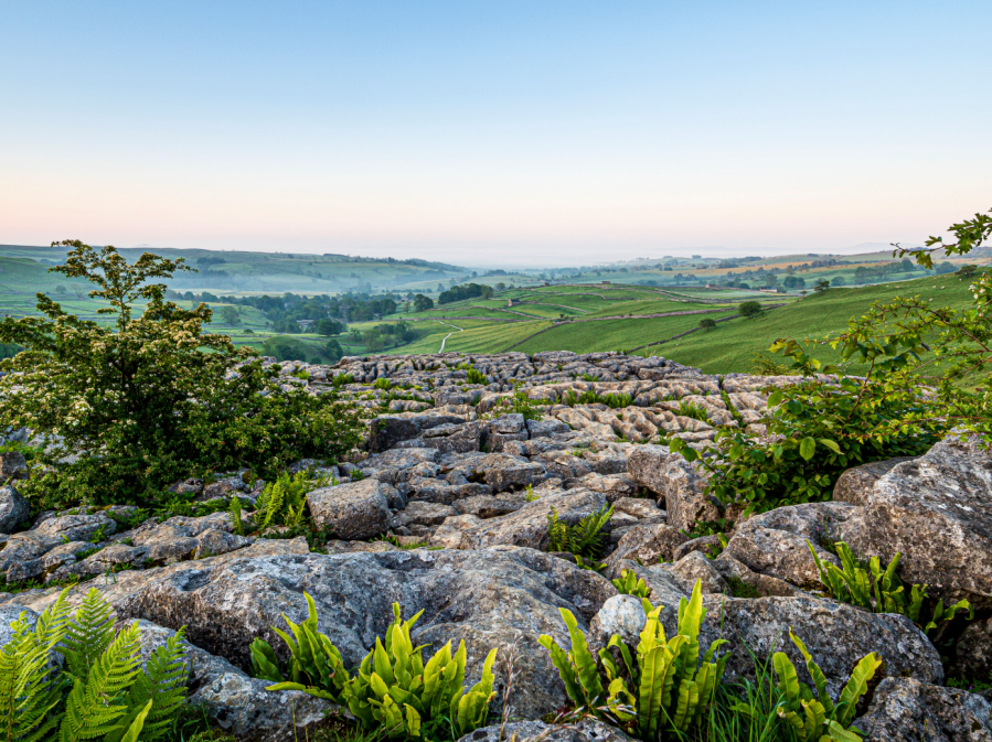
The classic way to experience Malham Cove’s colossal crescent of crag is to approach its foundation from Malham village, and marvel up at the enveloping limestone enclosure from the base. But this renders its manifestation by degrees. Our way offers no such consideration, unless sauntering down Watlowes dry valley, scarred with cliffs and cave, can coach for a world beheld from the brink of phenomenal limestone pavement perched 80m over Malhamdale. It is rightly held in the highest esteem.
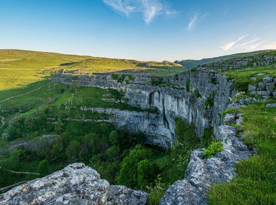
There is only one way to escape its compelling spell; to want for more, but that isn’t a problem in this land of limestone lures. Janet’s Foss is an impressive cascade coupled with enchanting pool, behind which Janet, the fairy queen, resided, just downstream from arguably the national park’s most impressive gorge. Gordale Scar draws visitors into its looming jaws, and after the sky is all but gone there is only one onward way if the torrent allows: a stimulating scramble up secure holds in rock bulging between the lower falls (experience preferred).
Read more: the full route description for Malham Cove as mapped by Ian Battersby
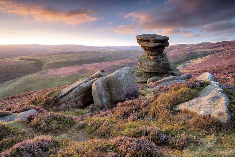
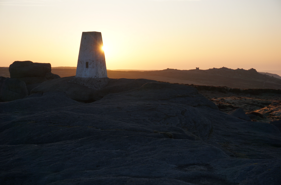
The Tower at Alport Castles, Peak District
Starting your scrambling journey? Take a jaunt up The Tower at Alport Castles for some low-stakes family-friendly fun, says Francesca Donovan.
Start/finish: Haggwater Bridge car park (GR: SK 162 886) | Maps: OS Explorer OL1, The Peak District – Dark Peak area (1:25k) | Distance: 10 miles/17km | Duration: 6 hours | Ascent: 522m/1,713ft
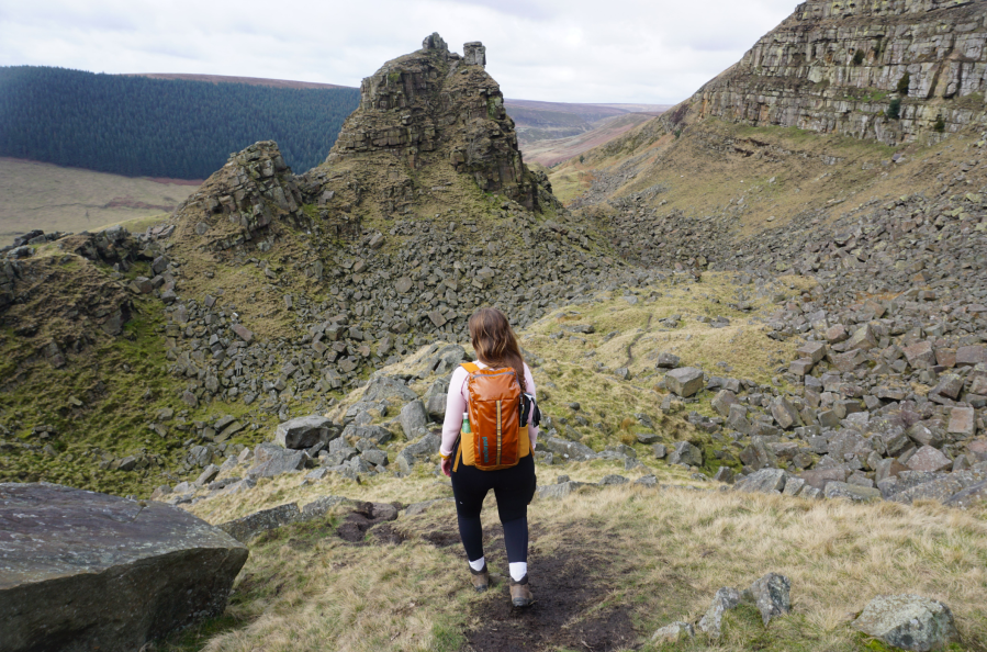
The Peak District isn’t well-known for scrambling. The gritstone edges are favoured instead by boulderers and climbers and scrambling the cloughs up to Kinder can be tricky in wet weather. But there’s another spot where you can cut your teeth; Alport Castles. Here sits The Tower, the geologically impressive consequence of a huge landslide, the causes of which are still debated. This area is well-trodden by walkers who skirt the gritstone boulders lying dormant below Alport Moor, admiring The Tower from afar. Here, you can spend some time with hands on rock.
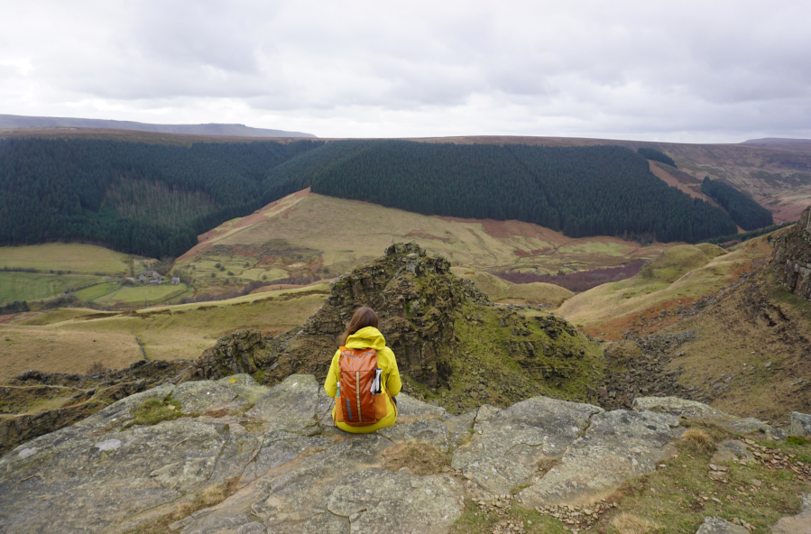
The scrambling is very easy grade 1 (a grade 0.5, if you like) if you stick to the obvious east route up The Tower. Or pick your own route, tackling it straight on for a vertical ascent from Little Moor. Keep an eye out for the resident peregrine falcons who nest in the layers of rock over on the other side of the landslide site. It’s a short scramble but there’s plenty of chance to scamper through the boulder fields before heading back above the farmland with views over to The Great Ridge.
Read more: the full route description for Alport Castles as mapped by Francesca Donovan
Bleaklow Head & Higher Shelf Moor, Peak District
Andrew Galloway goes in search of the wreckage of aeroplanes in the Peak District on Bleaklow.
Start/Finish: The crossroads of High Street and Victoria Street in the centre of Glossop. (GR: SK035940) | Distance: 19.5 km (12 miles) | Ascent: 560m | Time: 6 hours | Maps: Ordnance Survey 1:25,000 Peak District OL1
Just a few hundred metres north of the trig-point we found the first piece of twisted aluminium lying against black peat, shining in sunlight as if newly cast. In fact it has lain here, high on the moor near Bleaklow, for seventy years. It takes a while to orientate yourself among the wreckage, spread out over a hundred square metres. The fragments of an aeroplane slowly begin to knit together to form a whole: four engines first, followed by undercarriage, wings, tail-plane. Then you think of the crew. This USAF Boeing RB-29 known as “over-exposed” was taking payroll and mail from Scampton in Lincolnshire to the USAF supply base at Burtonwood near Warrington on 3 November 1948. In poor weather conditions the flight was conducted on instruments, the pilots effectively flying blind. It is thought that the captain understood his position to be further west and began to descend too early to make his approach with disastrous consequences. All thirteen crew were instantly killed as the aircraft ploughed into the ground.
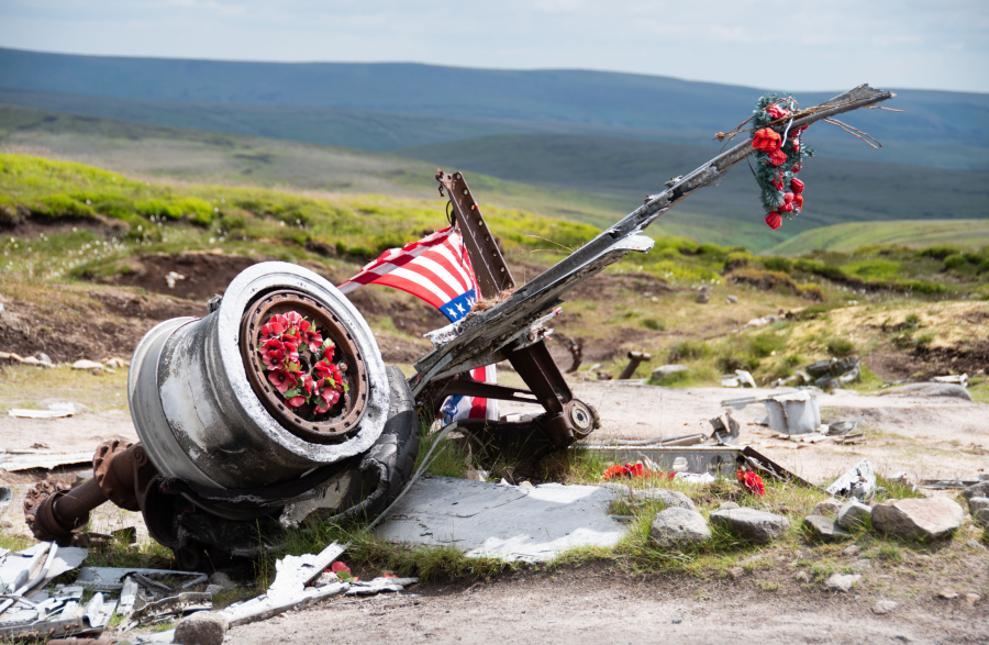
Some years ago, local historian Gerald Scarratt discovered what he thought to be a washer at the crash site. On later inspection, he found it to be a gold ring. It was engraved with the name of the aircraft’s captain, Langdon P. Tanner. Gerald was able to trace the captain’s daughter in America and return the ring to her. Shrouded in history, I have used this route of Bleaklow as part of a navigation course for the Ramblers. Participants are provided with the grid references for the aircraft wrecks, sent to locate them and take a moment to commemorate those lost.
Read more: the full route description for Bleaklow Head & Higher Shelf Moor as mapped by Andrew Galloway
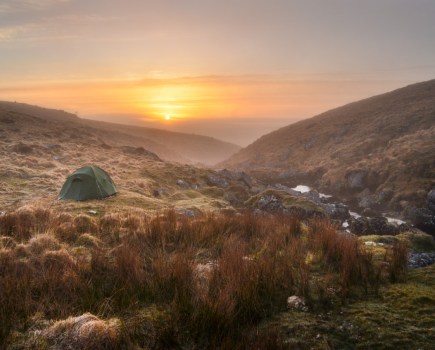
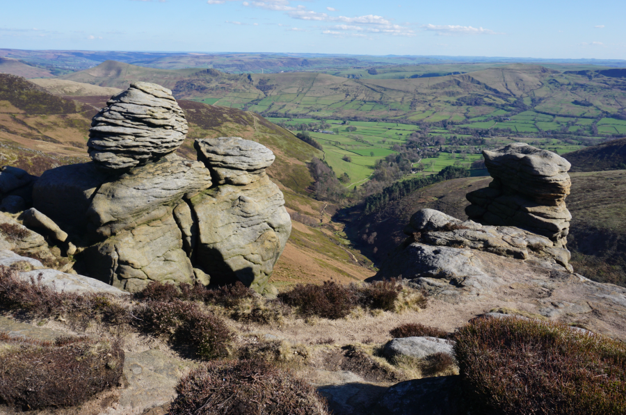
Kinder Low, Peak District
Francesca Donovan makes a night of it on a Kinder traverse between train stations, taking in the Peak District heights atop Win Hill and Kinder Low out of hours.
Start: Hope train station (GR: SK180 832) | Finish: Chinley train station (GR: SK038 826) | Maps: OS Maps Explorer OL1 – Dark Peak Area (1:25k) | Distance: 25km / 15.5 miles | Duration: 9 hours with an optional overnight camp | Ascent: 858m / 2,815ft
The Kinder plateau comprises some of the highest points and most rugged views in the Peak District (Kinder Scout sits 2,087ft above sea level). You can’t help but admire the natural forces that created the formations of gritstone, akin to a monsters’ graveyard, and the cloughs carved into the side of the landscape. Yet, the walkways that cling to its edge between the Win Hill honeypot and the mouth of Grindsbrook Clough – from which sweaty scramblers are spat out – are also relatively quiet.
We shared hellos with perhaps ten other walkers here even on this (very) Good Friday bank holiday. It’s quite a treat to watch the steady stream of footfall along The Great Ridge from your vantage point of peace. Best of all, this linear train-to-train route allows you to skip dropping down into Edale to face the perils of parking. Kinder’s wide plateaus also provide plentiful space for a tent or two. On this good weather window, complete with sunrise temperature inversion, I knew of at least three other backpackers who chose to pitch on this Peak District high place. But, with enough nooks, crannies and quiet corners for everyone, we barely saw a soul besides one woman bivvying on Kinder Low.
Read more: the full route description for Kinder Low as mapped by Francesca Donovan
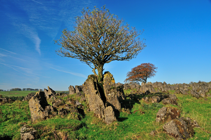
Roystone Rocks & Minninglow, Peak District
Roger Butler discovers hills and history at Roystone Rocks and Minninglow in the pastoral White Peak.
Start/Finish: Lay-by parking on A515, 1km south of Newhaven, grid ref SK165592 | Map: OS Explorer OL24 (1:25k); OS Landranger 119 (1:50k) | Distance: 13.5km / 8½ miles | Ascent: 280m / 920 feet | Duration: 5 hours
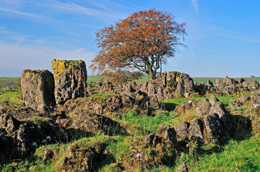
Our hills and dales never fail to surprise and the unexpected stone-splattered top known as Roystone Rocks is unlike anywhere else in the White Peak. This is the sort of place where you are allowed to use your imagination: it’s a ruined village; it’s a mini-Utah; it’s the cover of a famous Pink Floyd LP; it’s a jumble of boulders that must have been melted and moulded by a malevolent wizard. Chequerboard walls and crumpled shallow valleys stretch in every direction but, from the low ragged summit, the real eye-catcher is the distant clump of trees on top of Minninglow Hill.
This resembles a crown topped with half a dozen jewels – the result of new planting which encloses tall over-mature beech trees – and it marks the location of important tombs which date back to 4,000BC. Take the path to the top and you’ll soon be asking yourself questions. Who was buried here? Was there a grand ceremonial march up the hillside? And did those Neolithic peoples appreciate the distant views and ever-changing horizons? You certainly will!
Read more: the full route description for Roystone Rocks and Minninglow as mapped by expert Roger Butler
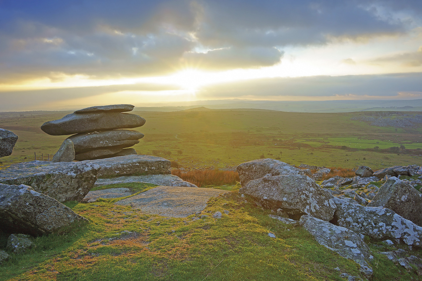
Feather Tor, Dartmoor
Tim Gent rejoices in high ground on a healthy spread of access land in Dartmoor’s Upper Walkham Valley.
START/FINISH: Car park at SX 539 749 | DISTANCE: 10.5km/6.5 miles | ASCENT: 331m / 1087ft | TIME: 4 hours | MAP: OS 1:25,000 Explorer OL28

Whitchurch Common bristles with granite exuberance, and it is our past response to this hard igneous stone that forms a persistent refrain throughout the walk of Upper Walkham Valley. Close scrutiny of the granite fragments spread around the Whitchurch tors will reveal frequent examples of ad hoc quarrying. Numerous surface ‘moorstones’ still bear the scars of having been split, ready to be carted away.
No close inspection is needed to spot quarrying evidence on the other side of the valley, where quite astonishing efforts were made in the 19th century to remove vast tonnages of stone. A fair stretch of this walk takes place along the bed of an abandoned railway, built in large part to carry this stone off the moor and away to build sizable chunks of Plymouth.

Of course, these Victorian quarrymen were not the first to exploit the local geology. Not far on to the north, and spread out across a rare piece of flat moorland ground, are a remarkable collection of prehistoric standing stones, stone circles, cairns and stone rows, pressed close by the nearby B3357.
Read more: the full route description for Feather Tor as mapped by Tim Gent
The Seven Sisters & Birling Gap, South Downs
Fiona Barltrop recommends a rare snowy walk along the Sussex cliffs to the iconic Beachy Head and the Seven Sisters.
START: Eastbourne railway station (TV609990) | END: Seaford railway station (TV481991) | MAPS: OS Explorer OL25 (Eastbourne & Beachy Head) | DISTANCE: 21.4km/13¼ miles | ASCENT: 552m/1810ft | DURATION: 6½ hours
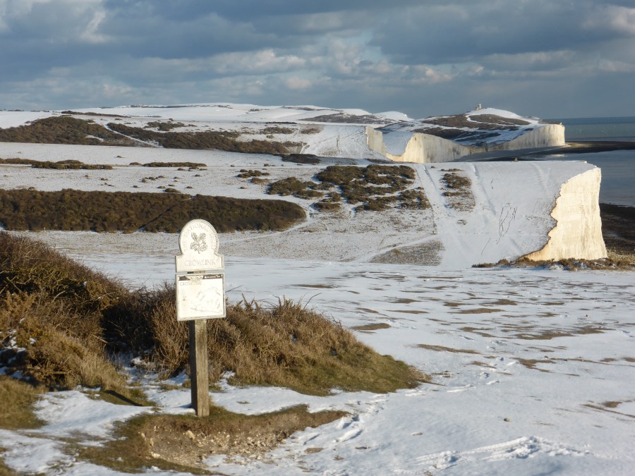
Excellent though the walking is anywhere on the South Downs, there’s no finer stretch than that along the Sussex cliffs, from Beachy Head to Seaford Head via the incomparable Seven Sisters. However, over the past decade these iconic chalk cliffs have suffered from excessive visitor numbers, notably from the far east, resulting in overtourism, especially in the summer months. But visit in the winter, ideally on a weekday, and you should enjoy a much quieter experience. Indeed, a coastal walk can be a great tonic in winter, the reflection of sun on water intensifying the light, and if, perchance, there’s been any snowfall (admittedly uncommon) it’s all the more of a memorable experience. No two days are ever the same here, depending on the tide and state of the sea.

A couple of years ago the new England Coast Path waymarks were installed along this stretch of coast, with the South Downs Way between Eastbourne and Beachy Head diverted to align with it. The original route, as shown on OS maps and in guidebooks, is still fine to use however.
Read more: the full route description for Seven Sisters as mapped by Fiona Barltrop
Bonus: 10 more amazing rock formations in the UK
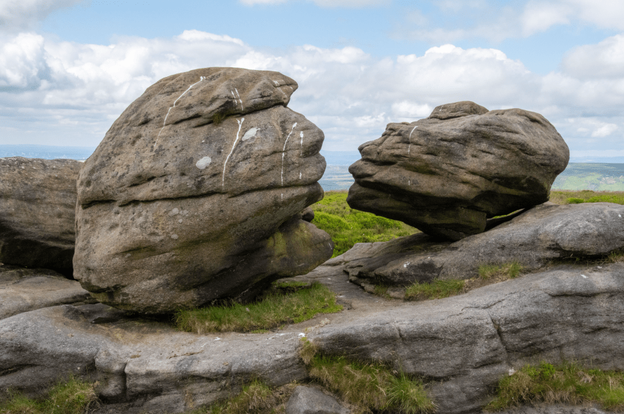
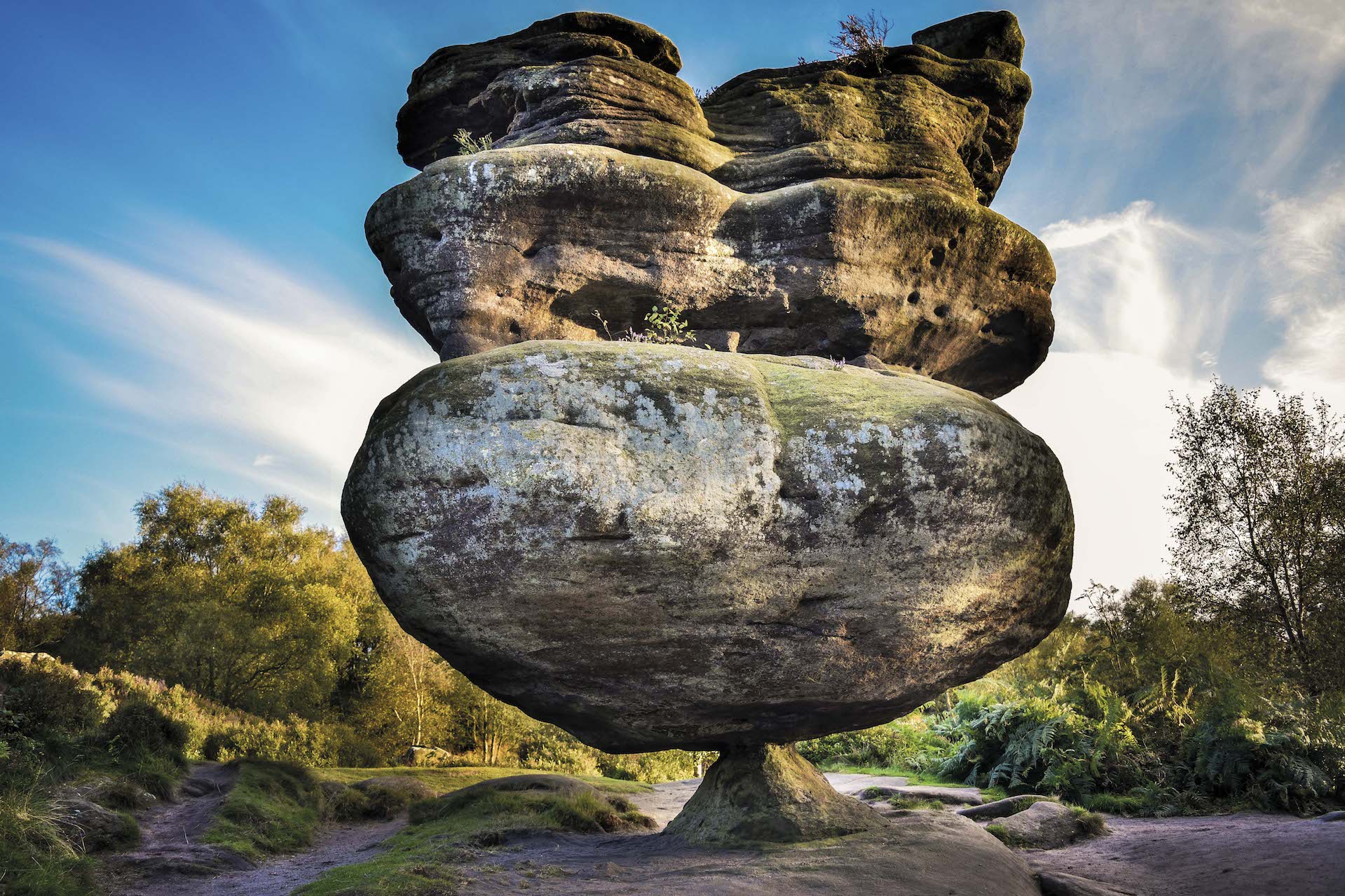
Brimham Rocks, North Yorkshire
These balancing rocks are perhaps the most imaginatively named of the lot and can be found on Birham Moor. Featuring the iconic Idol Rock (pictured), this area is perfect for climbing, wandering and generally scrambling around. If you want to spot as many of these structures as you can, a circular walk starting at the Brimham Rocks carpark and heading up past Brimham House is your best bet – it’s also suitable for families. You’ll spot the Cannon Rocks, Dancing Bear, Druids Writing Desk, Mushroom Rock and The Gorilla. More at nationaltrust.org.uk.
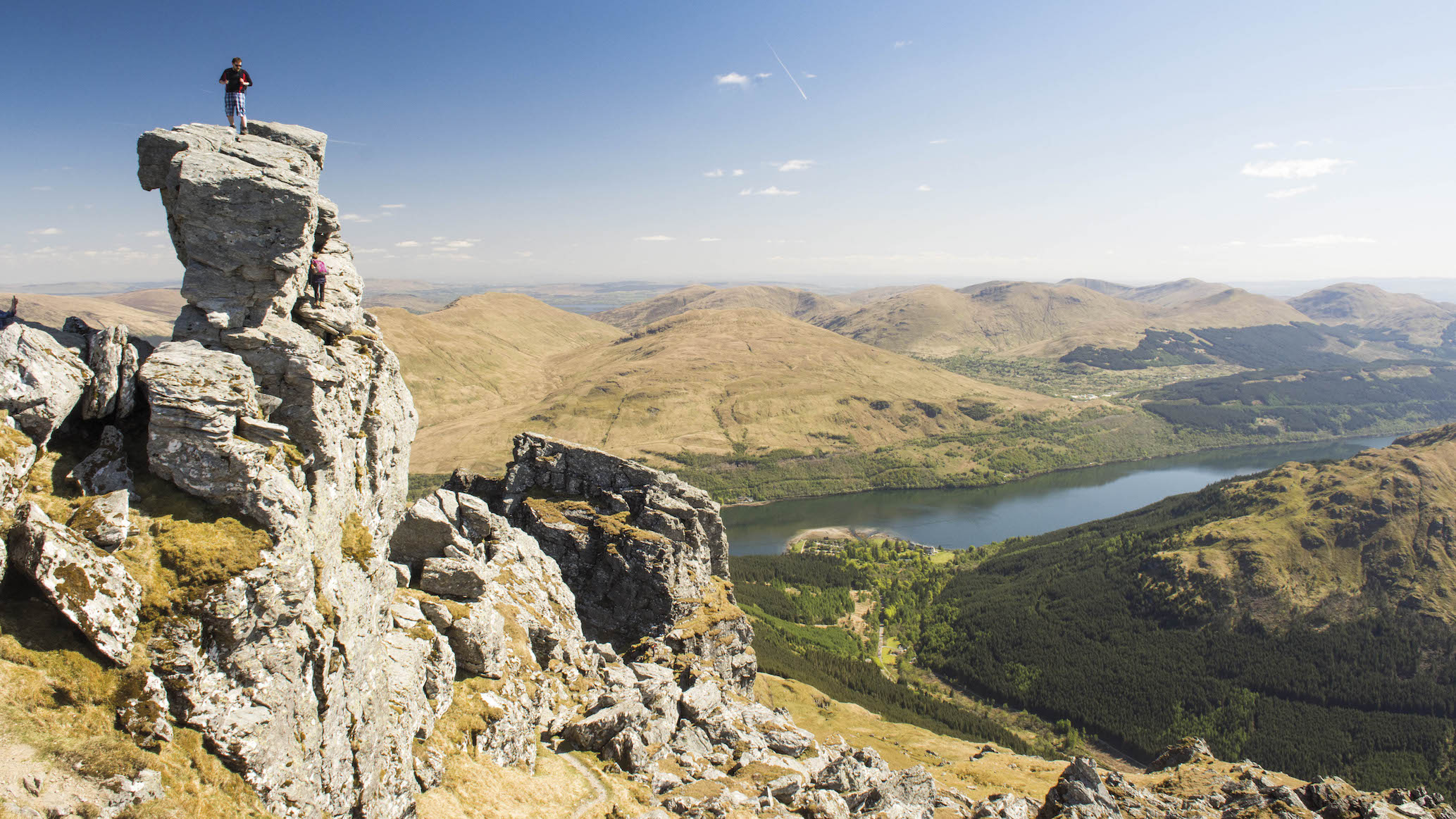
The Needle, Argyll and Bute
This tricky hanging rock formation is known as the ‘true summit’ of Ben Arthur (more commonly known as The Cobbler). The winding Corbett has three summits and this is the highest, with only the most daring scramblers attempting to reach the top. Climbers must squeeze through a small hole to reach it, hence those who achieve it boast they have ‘threaded the needle’. The Needle is easily reached by the path starting from the village of Succoth, and if you fancy some scrambling on the way down return to the col between the summits and take the northeast path.
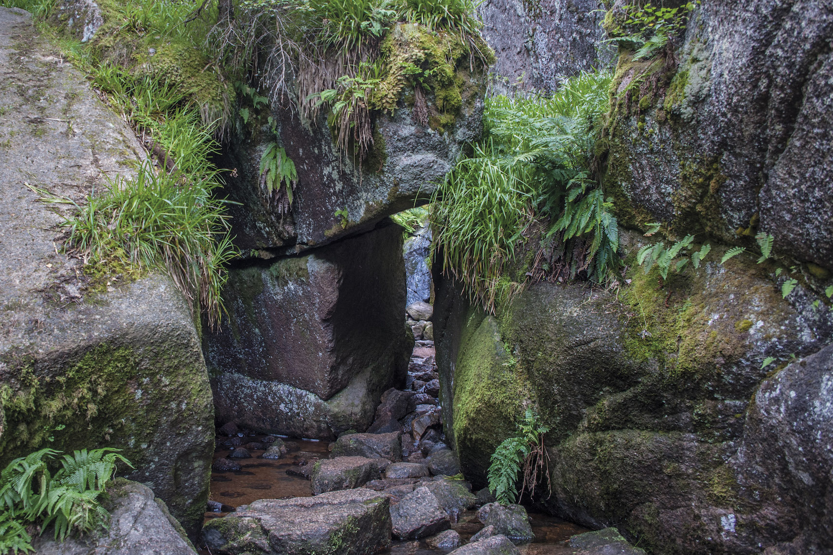
Burn O’Vat, Aberdeenshire
A little bit different from the rest on this list but no less impressive, the Vat is a deep water gouged sub-glacial bowl that you can scramble into. It’s believed to have formed when large quantity of rocks became lodged in the river bed, causing a whirlpool that carved out the granite bedrock. Start at the carpark between the Ballater to Aboyne Road and follow the path to the large rocks seemingly blocking your way. Squeeze and scramble your way through to behold this wonder. On your way back, you can head uphill to enjoy more of the Muir of Dinnet National Nature Reserve.
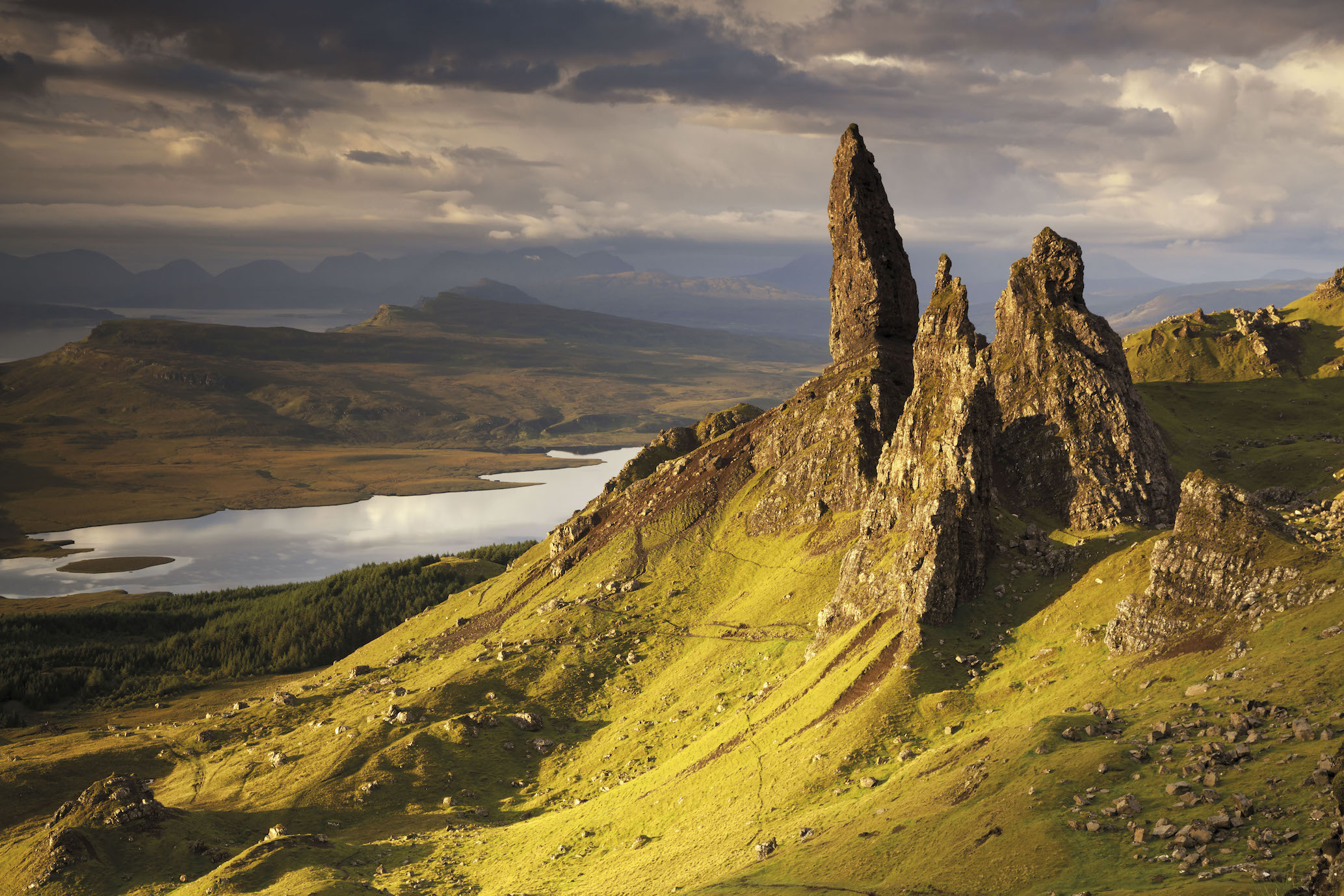
The Old Man of Storr, Isle of Skye
Perhaps Scotland’s most iconic standing rock formation, these picturesque towers attract thousands of visitors each year to Skye (and it’s on that note that we’d request you take the utmost care for the local environment if you do decide to visit). Suffering from congestion and crowding during the peak summer season, we recommend you take the 57A bus before heading along the waymarked path at the drop-off to reach these behemoths.
The Cheesewring, Cornwall
Local legend has it that this towering pile of rocks was the result of a contest between man and giant. Looking at the sheer scope of the structure, it’s not too far-fetched. The Cheesewring sits on Stowe’s Hill, and you can easily reach the nearby Hurlers stone circle to make the most of your time here.
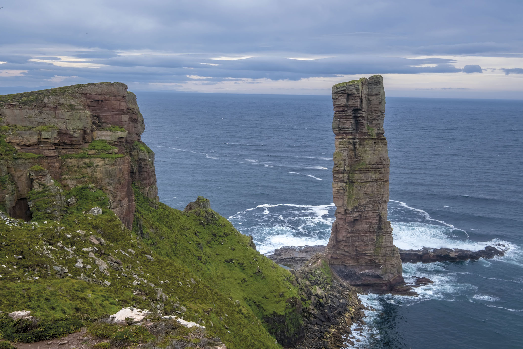
Old Man of Hoy, Orkney
This impressive 449ft sea stack looms starkly over the west coast of Hoy. It’s one of the tallest stacks in the UK and is said to resemble a human figure from afar. A popular waymarked route from Rackwick carpark will have you there in just over an hour, and will allow you to experience beautiful views of Rackwick bay.
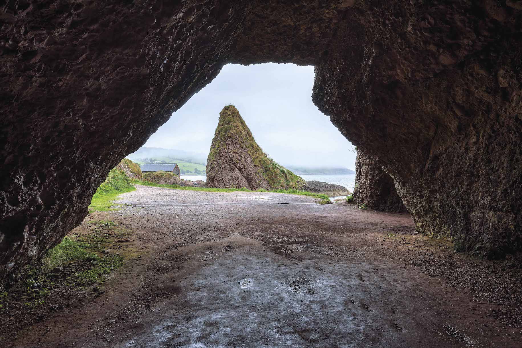
Cushendun Caves, County Antrim
If you’re not up for the hustle and bustle of Northern Ireland’s most famous rock formation along the Causeway Coast, the Cushendun Caves are well worth a visit. A little more popular now thanks to a feature on Game of Thrones, the 400-million-year-old caves feature some eerie walks and interesting formations throughout. The nearby village, Cushendun, is the simplest place to start your route, and you can enjoy a striking coastal walk when you’re done with the caves.
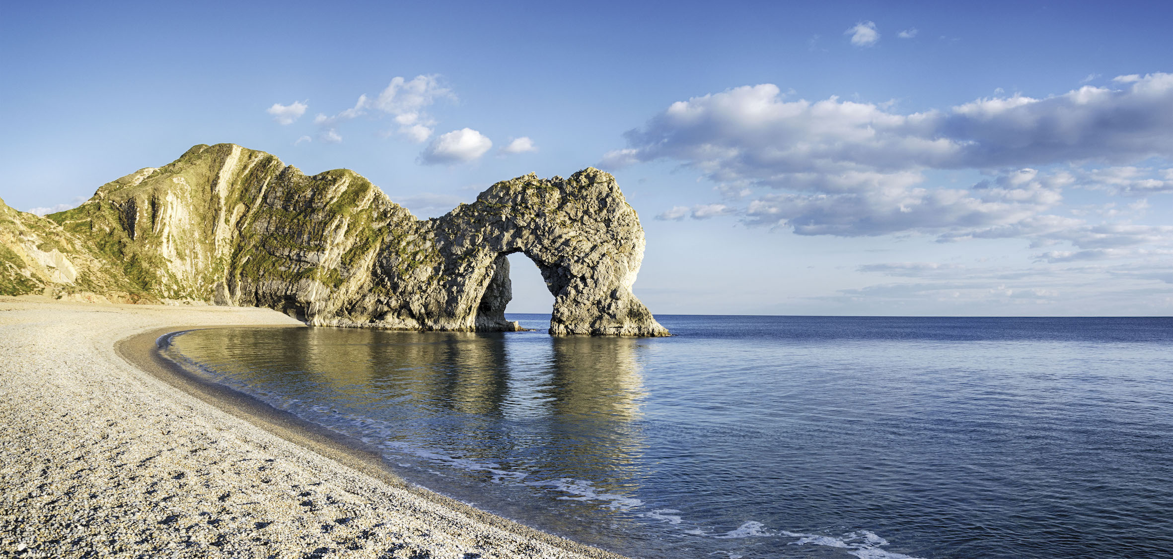
Durdle Door, Dorset
This is a truly spectacular sight and a highlight of the Jurassic Coast. Durdle Door is a natural limestone arc formed by powerful waves eroding a hole in the middle of the structure. Starting from Lulworth Cove, you can reach the structure by following the path situated behind the carpark for just over a mile. If you’re a keen swimmer, heading out to swim through the arc is said to be a wondrous experience.
Explore more of our expert-mapped route guides.