
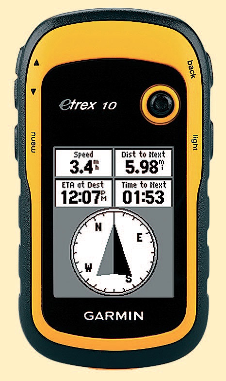
The latest version in Garmin’s long established eTrex range feels like a throwback to another age with its tiny monochrome screen. This is not a mapping GPS. There is a pretty crude world base map, which basically shows which country you’re in when you zoom out far enough. Zoom in and just the line of your route is shown along with selectable information, of which I think the most important is the grid reference, followed by the compass heading, elevation and trip odometer. Record your route and all the data is stored and can be downloaded to a computer. As you can’t see your position on a map on the screen this is a GPS that really does need to be used with a paper map, for which you need to be able to plot grid references.
Unsurprisingly there isn’t a touchscreen. Control is by keys and a joystick. The latter is more pronounced and slightly easier to use with cold fi ngers than on other GPS units. The screen is reasonably clear and bright and the lack of colours and complexity makes it easy to read.
The eTrex 10 is small and light and the cost is low. Battery life is excellent. It’s waterproof and seems pretty tough too. If you just want a GPS as a backup this is a good choice. Garmin also say that the new eTrex GPS units are the fi rst consumer ones able to use the Russian GLONASS systems, which means 24 more satellites to lock onto. So really this is a Chris GPS/GLONASS unit.


