
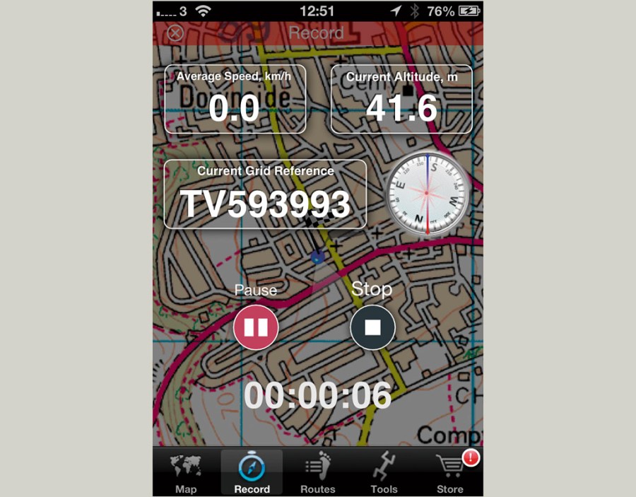
This was the first smartphone mapping I used and have recorded several Wild Walks for TGO with it. I have since found it accurate and fairly reliable – early stability issues seem to have been resolved. The map screen is basic and recording a track is very simple. Like the RouteBuddy app, it shows a compass and the grid reference on the record screen (I’d like more information on the map screen), as well as the altitude and speed. It also works well on an iPad. Routes are then very easily seen on the company’s website – the easiest of all the apps – where the routes can be edited and exported as a GPX map. Another good feature is the ability to very easily email a map and GPX file from your phone. Like ViewRanger, routes from other users can also found and downloaded – some are paid for. A very simple and easy to use app. There’s a lot of overseas mapping too. The app bundle with National Parks OS 1:50,000 maps is a bargain.
App OutDoors Great Britain
Overview
Pros: User interface, easy sharing with onlineеКinterface
Cons: Would like more information on mapеКscreen
Manufacturer:
This was the first smartphone mapping I used and have recorded several Wild Walks for TGO with it


