Straddling the England-Scotland border, the Cheviot Hills cover some of the remotest ground in England. Reaching the heart of these rolling hills requires commitment, but there is one town that makes an excellent base camp – Wooler. Vivienne Crow is your guide.
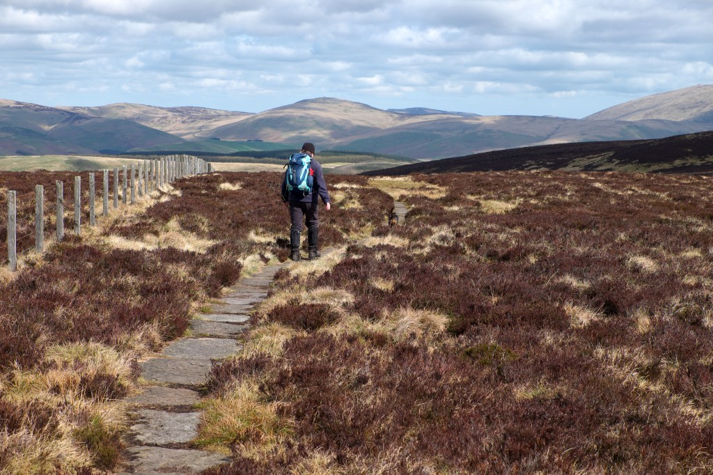
Located in the north-east of Northumberland, this friendly little market town sits at the base of the range, near Northumberland National Park’s northern edge. Wooler is a place that’s used to the sight of walkers marching along its High Street. The 62-mile St Cuthbert’s Way passes through the town on its undulating way from Melrose to Lindisfarne and footpaths come and go in all directions, giving access to both low-level and more demanding walks. The peaty lump that is The Cheviot lies just seven miles away as the crow flies, although you’ll need private transport to reach the start point for most routes climbing to the county’s highest point.
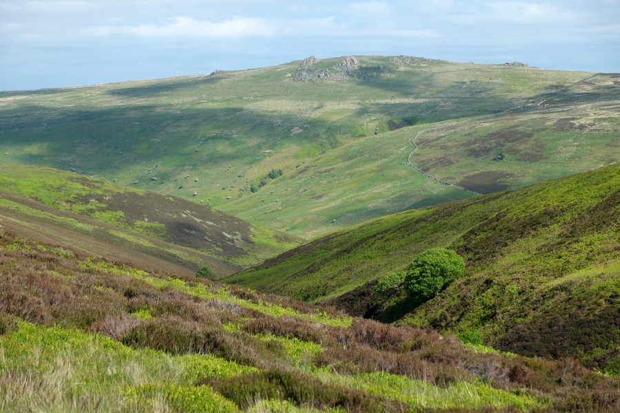
Main image: On the descent from The Cheviot | Credit: Vivienne Crow
Visitor facilities are good, with plenty of accommodation and dining options as well as a small Co-op supermarket and several independent retailers. If there’s anything else you need to know, pop into the community-run Tourist Information Centre on Padgepool Place (01668 282123). The staff there are always helpful.
One last thing before you lace up your boots and go, if you’ve got an hour or two to spare, Ad Gefrin is well worth visiting. This Anglo-Saxon Museum and whisky distillery opened to the public last year, and is located in a smart, new building a few minutes’ walk from the town’s Market Place.
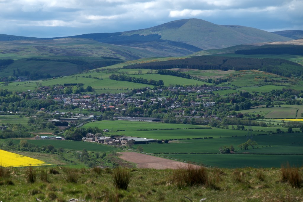
Wooler sits at the foot of the Cheviot Hills. Credit: Vivienne Crow
Your weekend in Wooler, sorted
- The weekend itinerary
- Other walks near Wooler
- Accommodation
- Food and drink
- Guides and activity providers
- Guidebooks
- Getting there
Your itinerary
Saturday
Are the hills calling today? Or are you planning to take it easy? Maybe you’re still undecided…
Well, head west on the St Cuthbert’s Way and see what takes your fancy. You could just have a walk on to Wooler Common and return via Humbleton (5 miles/8km; 850ft/259m; 2 hours). It’s a pleasant enough stroll, but… well… this is a hillwalking weekend, isn’t it? We could at least stretch to a walk taking in the Iron Age hillfort atop Humbleton Hill (7 miles/11.3km; 1400ft/427m; 3½ hours). Better still, grab a copy of last month’s TGO and check out the Wild Walk up both Humbleton Hill and Yeavering Bell (12 miles/19.3km; 2570ft/784m; 6-6½ hours).
Yeavering Bell, the ‘hill of the goat’, is the site of one of the region’s many Iron Age hillforts, and its stone ramparts are still evident. It’s also home, as its name would suggest, to goats – hairy, wild-looking beasties that have been wandering these lonely uplands since Neolithic people first began practising animal husbandry. Okay, so maybe it wasn’t the most arduous of walks, but that’s no reason, après-hike, not to indulge in one of local restaurant Milan’s delicious pizzas followed by a generous helping of tiramisu.
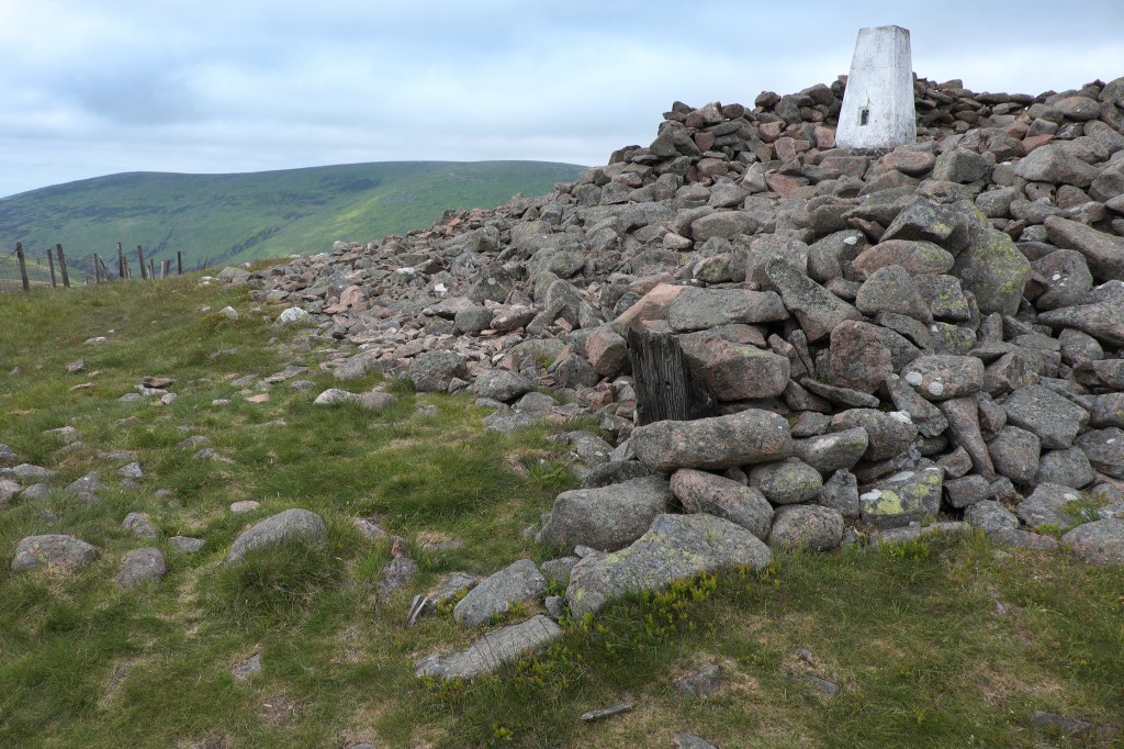
The summit of Hedgehope Hill. Credit: Vivienne Crow
Sunday
If you were impressed by the far-reaching views from Yeavering Bell, just wait until you see what’s on offer from the highest ground in the Cheviot Hills…
Starting from the road-end near Langleeford, 5 miles south-west of Wooler, the Harthope Round takes in both The Cheviot and Hedgehope Hill. At 815m (2673ft) and 714m (2342ft) respectively, these are the highest and second highest summits in Northumberland National Park. The route doesn’t look like much on paper – 10 miles (16.1km) with almost 3000ft (900m) of ascent – but there’s a fair bit of bog-trotting involved, so you’ll be glad you filled up on carbs the previous night.
Alternatively, head into the remote College Valley to take in the grassy ridges and prehistoric sites in the tranquil border country above Hethpool (8 miles/12.8km; 555m/1820ft; 4½-5 hours).
Other walks near Wooler
Breamish Valley Hillfort Trail
Distance: 4.5 miles/7.3km | Ascent: 335m/1100ft | Duration: 2 ½ hours
The low hills to the west of Ingram (8 miles south of Wooler) are dotted with hillforts, ancient cultivation terraces and burial cairns. The waymarked hillfort trail is an easy way to explore this fascinating and atmospheric landscape.
Craster to Bamburgh
Distance: 13 miles/21km | Ascent: 350ft/107m | Duration: 5-5½ hours
It might be lacking the drama of high cliff scenery, but the Northumberland coast is a magical spot – clifftop castles; long, sandy beaches that see relatively few visitors; and massive dune systems to get lost in. Walk the England Coast Path from Craster to Bamburgh using the X18 bus.
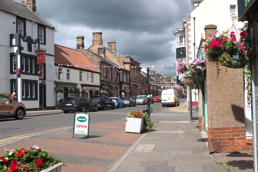
Wooler town centre. Credit: Vivienne Crow
Accommodation in Wooler
For such a small town, there’s a good range of accommodation in Wooler, including B&Bs, holiday cottages and several hotels. The latter includes the Black Bull Inn and the No 1 Hotel, both on High Street, and the Tankerville Arms, a 10-minute walk from the town centre on the A697. The town’s two caravan sites – Riverside and Highburn House – have touring facilities as well as lodges and static caravans to rent. There’s also a YHA-affiliated hostel with private rooms, small dorms and shepherd’s huts.
Food and drink
The best food in town by far can be found at Milan, which, as you’d expect from the name, is an Italian restaurant. It’s hidden down a side alley, but this isn’t a case of ‘out of sight, out of mind’; it’s a hugely popular venue and you’ll need to book in advance. If you can’t get in, Milan also does takeaways. For daytime eating, the bar and bistro at Ad Gefrin, the new distillery, can’t be beaten. In addition to these two, there are simpler and cheaper options including the hotels listed above, more pubs, several cafes and a couple of takeaways.
Walking the Border ridge in The Cheviot Hills. Credit: Vivienne Crow
Guides and activity providers
The knowledgeable Patrick Norris has been leading walks in the Cheviot Hills and along the Northumberland coast for groups and individuals since 2003. He also runs navigation courses (07847 506399, [email protected]).
As well as offering walking holidays and navigation courses, Shepherds Walks organises regular guided walks and challenges such as the 23-mile Northern Pennine Way (01669 621044).
Run by Karl from Wooler Hostel, Reiver Guiding provides navigation training, skills courses and guided walks (07734 566588, [email protected]).
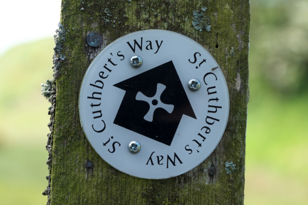
The St Cuthbert’s Way passes through Wooler. Credit: Vivienne Crow
Guidebooks
There isn’t a massive range of up-to-date walking guidebooks covering the Cheviot Hills, but if you’re looking for general inspiration and information on where to visit in the county, David Taylor’s 111 Places in Northumberland That You Shouldn’t Miss (Emons Verlag, £13.99) is a good starting point. David Wilson’s Day Walks in Northumberland (Vertebrate, £14.95) covers 20 hill and coastal routes of between 7.6 and 14.5 miles. And then there’s my own book, Walking in Northumberland (Cicerone, £14.95) which contains 36 walks of various lengths throughout the county, including several in the Wooler area. Cicerone also publishes Rudolf Abraham’s Walking St Cuthbert’s Way (£16.95).
Getting to Wooler
The easiest option by public transport is to get a bus from Berwick-upon-Tweed, which has direct rail links with Edinburgh, Newcastle, York, London and other stations on the East Coast Main Line. Buses from Berwick include the 464 and 267 run by Border Buses, Mon-Sat only. The journey takes less than an hour.
Discover more of the UK adventure towns and villages that make great weekend bases from which to explore the hills.