

Main image: A beautiful autumn pass on the Pamir Trail near lake Sares | Credit: Michaela Hrdá & Martina Merisi
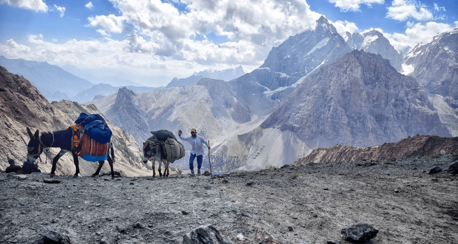
A battered old Mercedes jostled us along a dusty, rocky road. Squeezed between three jolly, large men, we both wrestled with stomach sickness. Despite the bumpy ride and the nausea, we swapped looks of bemusement, excitement, nerves! Can we manage to complete a trail no one has hiked before? In the hours, days and weeks that follow, ‘focus on small steps, celebrate little milestones, and take it one step at a time’ became our mantra.
Planning is (almost) everything
The Pamir Trail was not our first long distance adventure by any means, but while much of the route had been explored, some of it had not – and a full traverse had never been attempted. We knew it would not be easy. We weren’t just nervous and excited – to be honest, we were both a little scared too. So, we kept busy.
Planning for something like this is an expedition in itself. In the months before, we approached sponsors, carefully selected gear and coordinated logistics. It became all-consuming. We lost ourselves to maps, daily mileage and food calculations. Remote mountain villages have limited supplies, so finding a way to safely deliver food packages was a must – and a significant challenge, given there is no postal service or public transportation in Tajikistan. We planned to ship 45kg of dry meals from Czechia, buy more once we arrived, and would then rely on local taxi drivers to distribute 65 kilograms of food for us across our planned route.
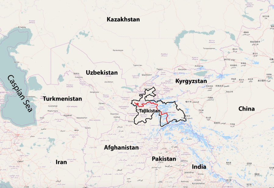
We also connected with Jan Bakker (whose book is mentioned in the footnotes for this feature), the crazy dreamer who has conjured the idea for a national trail in Tajikistan. The trail, still in its infancy, links ancient shepherd routes and trade passes with extensive off-piste travel to provide a means to explore the Pamirs, a region known in the west since the Victorian era as ‘the roof of the world’.
The Pamirs sit at the junction of many of Asia’s (and the world’s) highest ranges – the Hindu Kush in Afghanistan and Pakistan, Kyrgyzstan’s Tian Shan mountains and the neighbouring Kunlun in China. It’s a vast region of snaggle toothed peaks, high plateaus and wide, verdant valleys carved by immense glaciers, ventured into by legendary figures like Marco Polo and Frances Younghusband, squabbled over by Russia and China, a multicultural meeting point and melting pot for Tajik, Pashto, Urdu and Uyghu speakers.
A civil war in the late 90’s devastated the country, which is now very slowly recovering. Jan is working with both exploratory hikers and local communities to make the trail a reality that benefits the country and the people, sometimes coming up against local political and tribal unrest and reckoning with an almost complete lack of formal trail infrastructure… the last of which, for us, was a large part of the attraction. We gathered information on the known details for each stage of the route so far. He explained he hadn’t expected anyone to give the full route a try so soon – there were still one or two nagging gaps in his itinerary.
The enchanted Fann
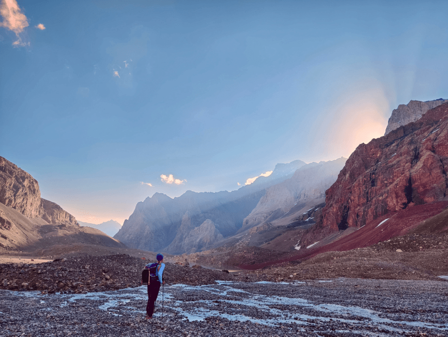
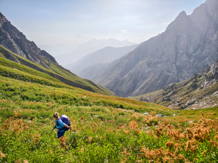
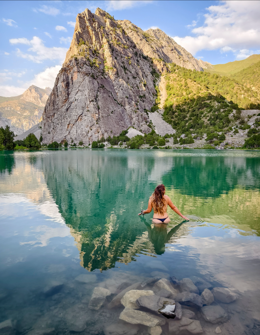
After our bumpy Mercedes ride, we were deposited at the start of the route. We carried supplies for only four days but felt like a pair of workhorses. “The beauty of the Fann Mountains will take our minds off this,” said Martina, and she was right. We were quickly immersed in a fairy-tale world of turquoise lakes, towering peaks and blooming meadows. We bathed in crystal clear rivers and feasted on nature’s bounty – mulberries one day, apricots the next.
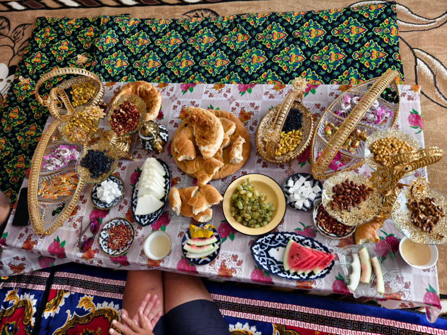
Villages where time seemed to have stopped and electricity had yet to arrive welcomed us with open arms and freshly baked bread – a blessing, since our first supply parcel had been mislaid in transit. The village store offered only instant ramen, condensed milk and ice cream, so we were thrown onto the generosity of local people for a week. They weren’t the only ones helping out – by regional standards, the Fann Mountains are popular among backpackers, and they too shared their food with us.
Our bodies slowly adapted to heavy rucksacks, hours of walking and high altitude, and we both seemed to manage the latter surprisingly well, literally dancing over the almost 5,000m Chimtarga Pass! After 150 km we felt in good shape, which led us to the very naive conclusion that the remaining 1100 km would be a piece of cake.
Reality check
From the relative civilisation and obvious paths of the Fanns, we were catapulted into a much wilder stage of the trail. Our progress became painfully slow as we negotiated steep snowfields, sharp descents and impenetrable thorny bushes that made us swear like old sailors. “We should have packed machetes instead of ice axes”, Martina joked.
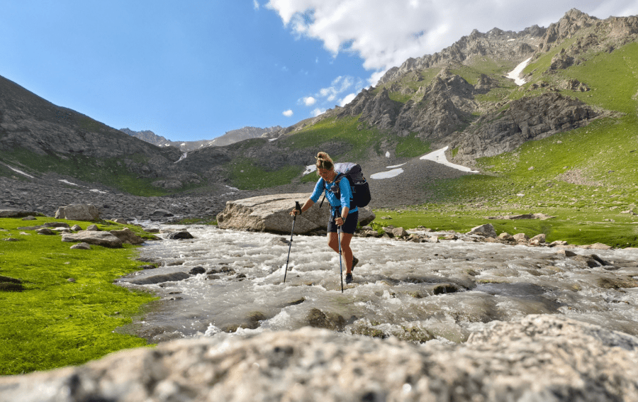
Our legs were soon covered with scratches and rashes. We contracted fungal infections from the near constant river crossings. And the elevation profile ramped up wildly – in some cases, one kilometer vertical for two kilometers horizontal. More worrying still, landslides became a daily feature, making each step a test of willpower.
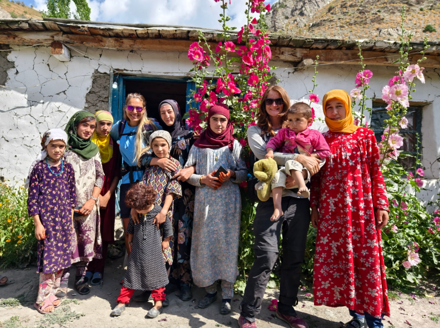
After three weeks and 400 km of the most diverse backpacking either of us had ever experienced, it felt as if we’d traversed the Alps, Dolomites, Pyrenees, Highland Scotland and the Moroccan Atlas in a single journey. Thankfully, the terrain then began to ease a little, rewarding us with little moments of meditative harmony as we hit flow state and fell deeply in love with the simplicity and beauty of the Pamirs. We both missed our loved ones and a few modern conveniences, but the warmth and hospitality of the Tajik people en route kept our spirits high.
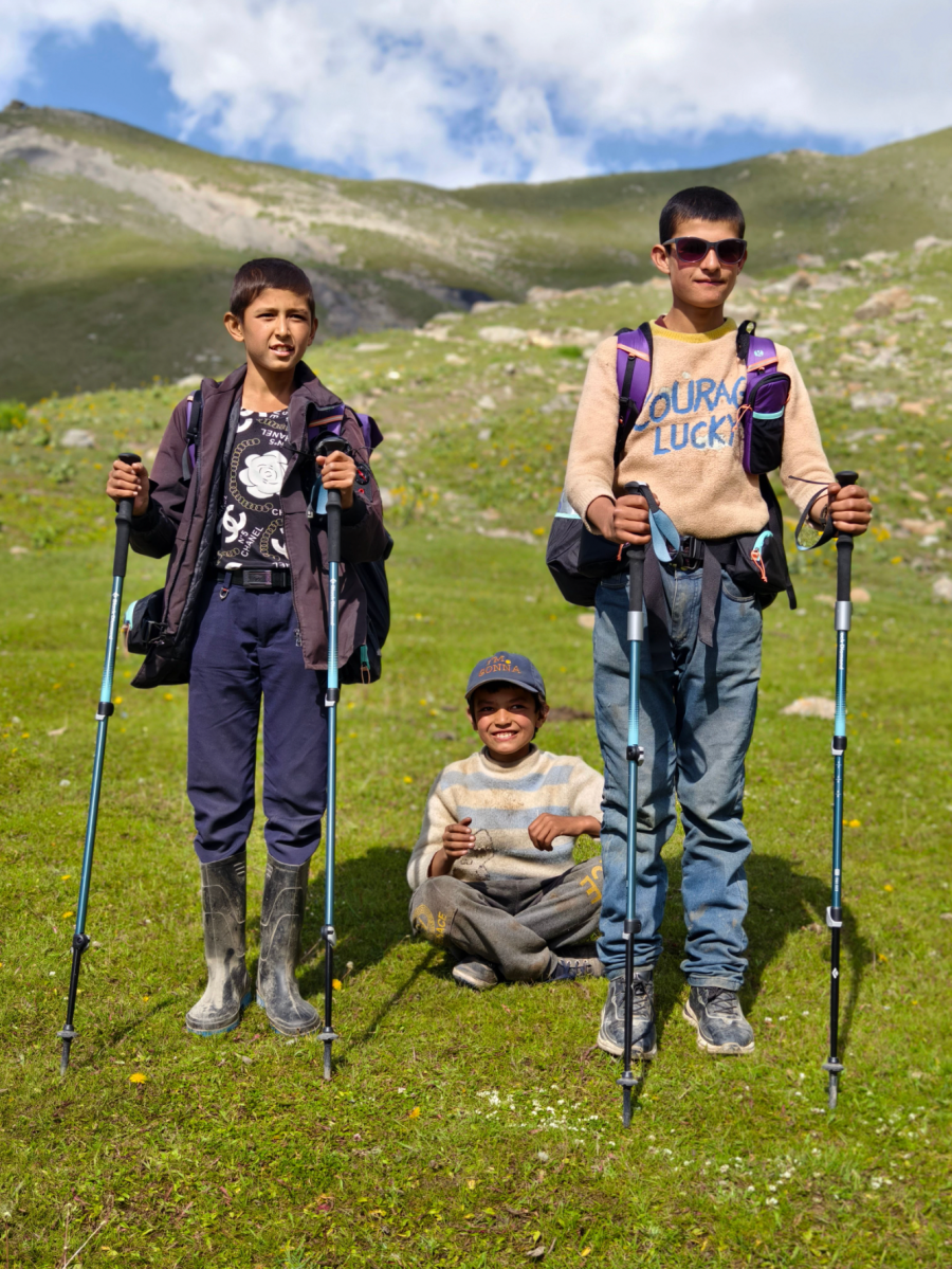
Almost without fail, we were treated as if we were family; taken fishing, offered fresh honey, a gentle dance, or a story. As time passed, this growing sense of human connection became deeply significant to us both. Despite the obvious language barriers – people in remote villages do not always speak Russian – we seemed to get by. Even through the exchange of simple gestures, plain kindness shone through.
Halfway through the trail, we returned to Uzbekistan to extend our visas. Tajik bureaucracy was as unpredictable as spring weather, but our earlier preparation in collecting contacts and saving dollars stood us in good stead for this new adventure in paperwork, and our mission was successful.
We then spent two days in Dushanbe, the architectural gem and capital of Tajikistan. One might expect that finding replacements for worn out outdoor gear would be easy here, but there is only a single outdoor store. Tracking down a new water filter was a headache, luckily resolved when we met fellow Czech hikers, who donated theirs to us. Getting new footwear was similarly fraught, with our choices limited to city sneakers or football boots. Finally, a second-hand bazaar came to our rescue for new trail runners and trekking poles. We took advantage of the internet, hot showers, and the friendly atmosphere of the Green House Hostel to plan our next stages, but the sweltering heat and the bustling city was overwhelming.
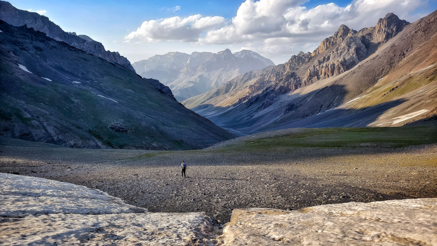
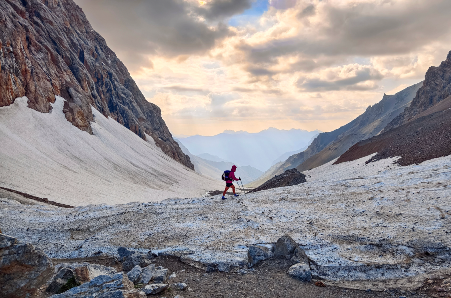
The second half of the route would take us into the Pamir itself – the world’s third highest mountain range. We would remain almost entirely between 4,000 and 5,000 meters altitude. The rivers here are larger and more dangerous, settlements even scarcer than in northern Tajikistan, and of course, there is no phone signal. We knew we were due to cross some glaciers with potentially tricky crevasses, but a complete unknown also awaited – a 150kilometer stretch, yet to be mapped.
The Wild Pamir
Looking back – even after just a few months – the tale of the Pamir Trail now becomes a kaleidoscope of memories, colour, sensations and occasions.
“Sweet young ladies, where have you come from?” gasps a shepherd as he rushes to greet us.
“From over there,” we point at the steep rocky pass.
“That’s impossible,” he shakes his head. “I’ve lived here for 48 years, and you’re the first ones to come here on foot,” he laughs. For once, we see a smile unmarred by gold or missing teeth. At that point, we realised just how much of a curiosity we were – western women passing through high places inhabited solely by shepherds and their animals. We pointed out on the map where we had camped the night before.
“Two days ago, a bear ate four of my cows there,” he nods, indicating he knows the spot. We regularly heard stories about bears and wolves on the trail, but attacks on people are so rare as to be statistically insignificant. Still, a real sense of vulnerability sent a chill down the spine and kept us on our toes!
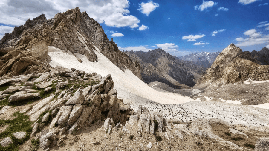
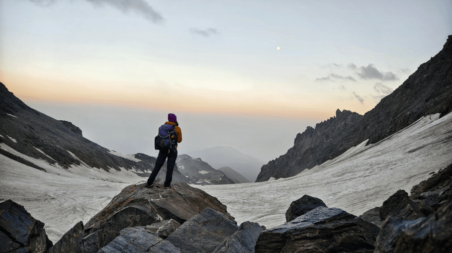
Later at camp, we see a breathtaking, yet terrifying view of mountains dressed in white for the first time. So many unknowns lay in our way. How much snow had fallen up there? Would we be able to see the crevasses once on the glaciers? And later still, we tried to cross a river in spate after a huge detour, only just managing to jump clear of a 2-metre chasm of rushing water.
That experience marked a literal turning point in our journey. To avoid the hazards of the highest, uncharted peaks, we switch direction, but our new lower route is no pushover. We spend hours tiptoeing across landslides and bushwhacking, before another close encounter, this time with a bear of our own. Later still, crossing a mobile riverbed, Martina suddenly began to ‘glide’ as the ground crumbled beneath her. Destined for certain injury or worse, she thankfully grabbed for and held on to a solitary pine after a 15m fall.
Heart of the Mountains
Due to our so-called safety detour, we needed to rejoin the next stage… via the Pamir Highway! We were both curious to see this historic road up close and managed to hitch a ride on a truck, but after an hour of dull scenery, our excitement faded. Progress was excruciatingly slow – sometimes a bulldozer cleared a landslide, sometimes a bridge or tunnel was under construction. A hundred kilometers took an entire day. Our final stretch was completed at night in a military commander’s vehicle. It was a very different experience to what had gone before, and to what awaited next.
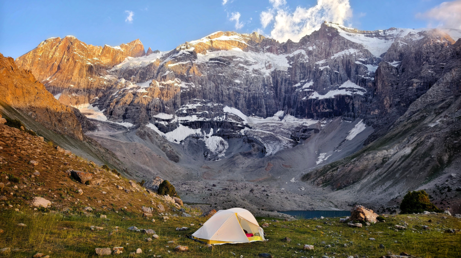
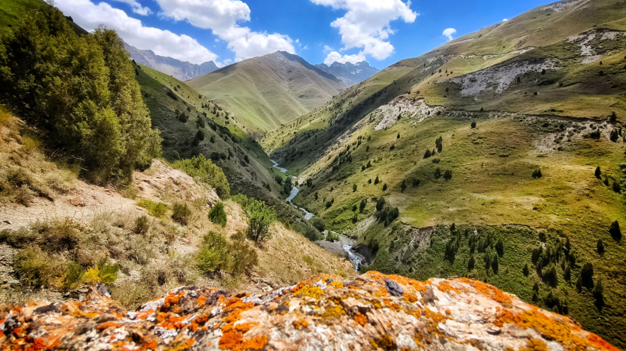
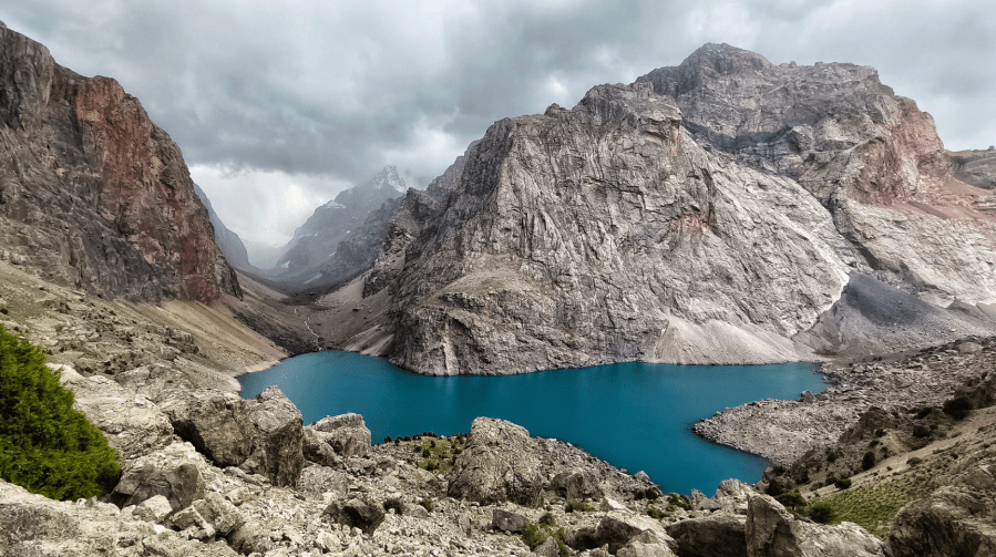
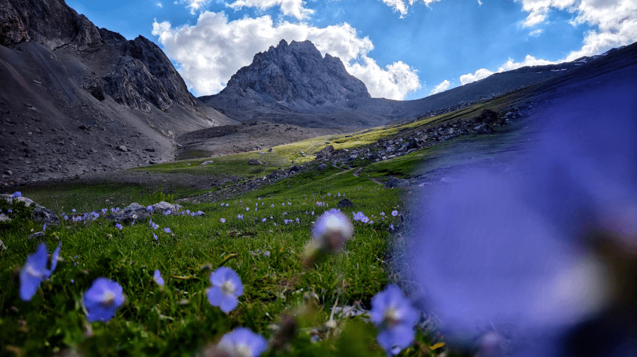
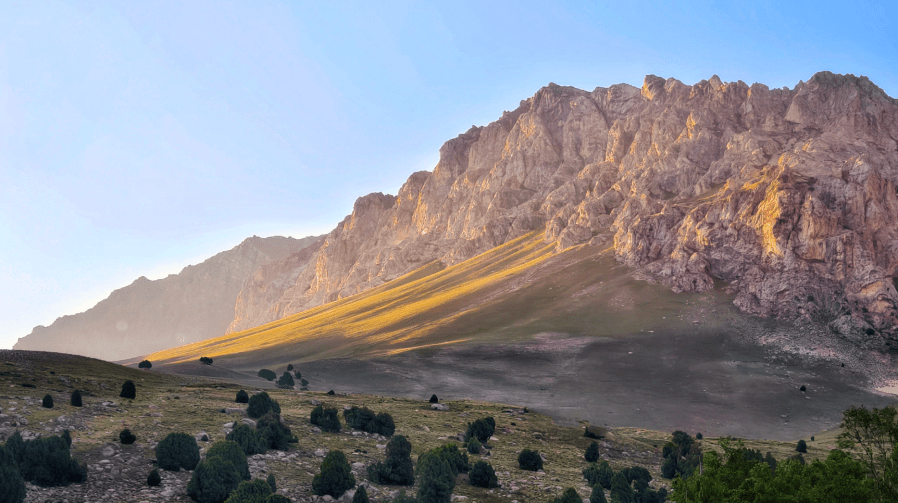
The last two sections of the Trail are in the very heart of the Pamir and this area, alongside the Fann, is perhaps the crown jewels of Tajikistan. The region is dotted with turquoise lakes poised between jagged glacial peaks, its gentle meadows providing good walking and fantastic camping. It is now September and autumn has taken hold. Everything is awash with colour.
We planned to cross the lake by boat to avoid a landslide that has destroyed the original path, but a stern officer barked back at us as we asked about the crossing: “There’s no boat, no fuel – you’ll have to walk!” The combination of hostility and bad news moved Martina to tears. Her response moved this macho man to tears, and his unexpected sensitivity then made me cry. We are all in tears together!
As he accompanied us to the start of “a dangerous trail” above the lake, he looked guiltily as if he was leading lambs to slaughter. But after a thousand kilometers, our perception of risk has been changed forever. In the end, we rate the exposed section along the cliffside as one of our trail highlights – right up there with the sauna and hot shower at the meteorological station on the other side of the lake!
Reflection
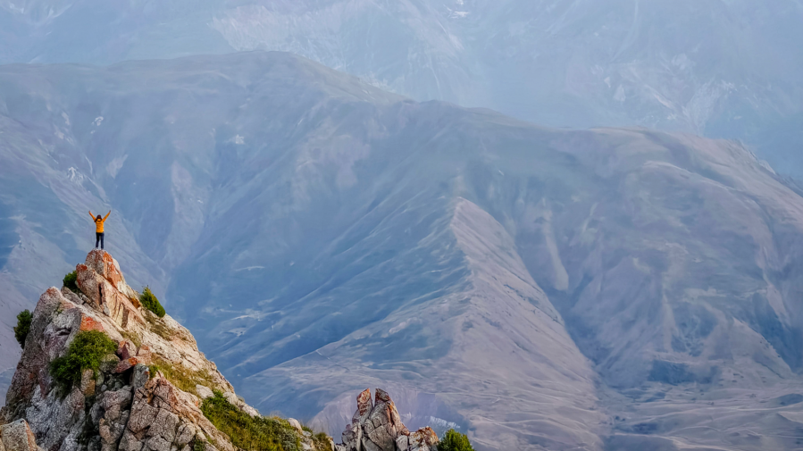
At our final camp, we were woken by the howling of wolves. We then spent our last day following their tracks like wolves ourselves, with our own prey in sight at last – the end of the Pamir Trail. Like all endings, it was bittersweet. My final hours of walking were laced with hundreds of unique memories from the previous 9 weeks on the trail – moments of pain, sadness, joy, humility, and gratitude.
Memories of towering peaks, cascading water, talus and landslides, meadow flowers and bright alpine light, of apricot-scented valleys and striking blue-green glacial lakes. Of our own friendship as fellow travelers, tempered and made stronger. And perhaps above all, a sense of community and cameraderie in this far-flung place that proves kindness and care is the universal human language.
We began with plentiful hope but few expectations, and we are both still amazed and delighted to be the first to make the dream of a trail through the Pamirs a reality. Over 69 days, we covered 1,330 kilometers and climbed 58,000 meters. We crossed 42 rivers, wore out four pairs of shoes, and ate eight kilograms of oats. But how many smiling faces? We lost count. The Pamir Trail may be unforgiving, but it is utterly disarming.
The Pamir Trail: at a glance
Trail start and finish: Shing to Vrang
Mileage: Approximately 1,330 km / 826 miles.
Ascent: Approximately 58,000 metres / 190,288 feet.
Time taken: 69 days including 5 zero (rest) days
Best time to travel: July – September
Bureaucracy: Passports with visa for 60 days – return from Jirgatol to Uzbekistan to activate the visa. A full traverse is around 70-80 days, and a refresh of an e-visa was required for Michaela and Martina to do the whole trip.
Staying healthy: Immunisation against diphtheria, tetanus and polio may need updating. Vaccinations against Hepatitus A and Rabies are recommended. Malaria is present in the south of the country but not a major issue in the high mountains. Visit your GP for advice in the first instance. It’s also worth a dental checkup before you go, as altitude can expose underlying issues due to the change in atmospheric pressure.
Transport: Local, shared taxis and hitchhiking, which sometimes worked better than taxis.
Equipment: Microspikes or crampons and ice axe essential. Lightweight camping kit suitable for 3-4 season conditions.
More essential preparation for the Pamir Trail
Regular hiking beforehand, and an acquaintance with winter hillwalking and scrambling, are essential. Logistics are the main challenge – organising mapping, gear, resupply points and food or transport for ‘post restante’ packages are very demanding as there is little or no hiking infrastructure.
Michaela said, “We started organising some of the packages in Samarkand, Uzbekistan. After crossing the border into Tajikistan, we stopped at the crossroads leading to the villages in the Fann mountains and gave local taxi drivers packages to drop off at the home stays. We learnt the hard way that you need to make these arrangements in the morning when the drivers pass through. Take their number plus the delivery numbers for each homestay. Greenhouse Hostel in Dushanbe was also very helpful. They organised some deliveries in the Pamirs with the help of tour guides and companies, for free! A huge thank you to them.”
Between them, the two women have hiked the Alta Vias, the Via Alpinas and the Tour de Mont Blanc in Europe, the John Muir Trail in North America, Te Araroa in New Zealand, and have crossed Iceland and Madeira.
Yet Michaela said: “It’s really not comparable with anything we have done before. The Pamir Trail will never be the Pacific Crest Trail – the terrain keeps changing every year. There are frequent landslides, and the trail is almost entirely unmarked, with only very occasional cairns and mostly off path. It’s extremely remote, with no real resupply. Any shops we did find stocked only ramen and sardines. The Fann mountains were the only place where we encountered other hikers. Otherwise, it’s only shepherds, so basic Russian comes in handy.”
The Pamir Trail: Further information
The complete Pamir Trail is still in development, with Michaela and Martina now regarded as its first complete thru-hikers.
The father of the Pamir Trail, Jan Bakker, put Michaela and Martina’s achievement into context: “With their detour, they opened an alternative section that I now consider the low option of the Pamir Trail. They bypassed the Starghee Pass and the Upper Vanj valley due to snowfall, then crossed the Psoda Pass that leads to Kaleikhum. The high ground at this point is risky, regardless of the time of year, and the trail does need a safer option. I have now begun inputting Michaela’s and Martina’s low route to the online trail guide. The low route does still need an extension from Kaleikhum (which is hard terrain). I absolutely consider their Pamir Trail trek as the first complete thru-hike. Purists may disagree, but it really is a small stretch (around 100km) they hitchhiked.”
Trekking in Tajikistan
Unsure about taking on something of this scale?! Luckily, Jan has co-written a book with Christine Oriol which covers 24-day walks, short treks, and 2 ‘link routes’ in Tajikistan, including comprehensive route descriptions and 1:100,000 mapping, and is filled with practical advice on trip preparation as well as insights into Tajikistan’s rich culture and history. Trekking in Tajikistan: The northern ranges, Pamirs and Afghanistan’s Wakhan Corridor is published by Cicerone (£22.95)


