
Jamie Smith takes a lessertrod route to Stanage Edge
HAVING WALKED SO much in the Dark Peak area, I’ve been fortunate enough to visit many a place, but on a number of occasions Stanage Edge has been the destination. This time, I decided to reach the lofty heights by means of a different approach. Sat poring over the Ordnance Survey map, a route was duly plotted, without even a hint of visiting Hathersage, as most routes to Stanage tend to start from this bustling village.
By pure chance, after heading out on an afternoon’s photography excursion, I’d found my starting point, at the Redmires Reservoirs. I’d quickly decided a walk should be devised around these waters. My return found me leaving the car at the eastern end of the reservoirs, taking a route heading south, climbing steadily. The smell of manure greeted my arrival at Brown Edge Farm, quickly dispelling the thoughts of the city smog that hung over Sheffield, out to the east. Progress was swift, as my feet soon carried me over the Ringinglow Road, onto the edge of Burbage Moor, ready to go in search of the Ox Stones. With the manure gone, the freshness of pine now filled the air.
This would be my first visit to the landmark, so I was intrigued to see what would be found. I guess I wasn’t surprised to find a few rather large lumps of gritstone! I was alone, the view was extensive, mainly over the vast expanse and relative wilderness of Burbage Moor. It was hard to believe that while I gazed to the horizon, only a few miles away it would be completely different, as the crowds descended upon Stanage.
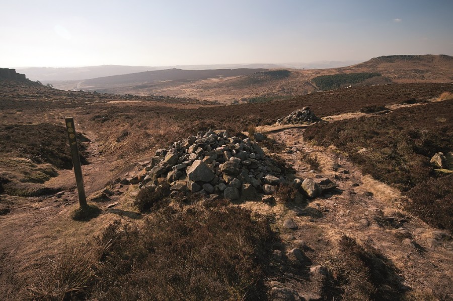
The Houndkirk Road followed, an old turnpike road that ran from Sheffield to Hathersage, then onto Chapel-en-le Frith. My route left the wide, dusty track behind, heading west for Carl Walk, reaching a prominent cairn. This required a decision: Should I take a left along the top of Burbage Edge and a circular route to the Iron Age Fort of Carl Walk, or drop into the valley? My decision became easy, as a group on navigation training appeared around the corner. Down into the valley it would be – after all, my aim was to avoid crowds at all cost. A steady ascent and a quick diversion to the summit of Carl Walk, taking time to admire the view over the escarpment of Burbage Edge, before heading north for Higger Tor and on to Upper Burbage Bridge.
Stanage Edge beckoned, bathed in glorious sunshine, and without a breath of wind, I took a leisurely walk, following the brim of the gritsone rock, occasionally stopping to admire the numerous climbers making the best of the weather. They almost resembled ants from a distance, as some made short work of the ascents. Unfortunately, I had to pull myself away, leaving the view for another day, my destination Stanedge Pole. This itself is an excellent vantage point, while also a famous landmark on Hallam Moor. The pole is a waymarker on the medieval packhorse road, known as the Long Causeway and provides an excellent viewpoint. I stood surveying much of the day’s route.
The final leg of the journey was a descent back to the Redmires Reservoirs, named Upper, Middle and Lower dating from the mid 19th century. They were built to provide clean drinking water for the city of Sheffield after a cholera epidemic in 1832. On my approach the waters stood motionless, and with a setting sun, I lingered, capturing a few images of the mirror-like surface, before finally retreating to my car, reflecting upon a stunning day of long panoramic vistas, while also achieving my aim of reaching the summits from a less than obvious starting point.
ROUTE DESCRIPTION
- L out of car park along road, turn R onto Soughley Lane. On reaching corner in lane, turn R, cross stile, follow path, bear L to ascend, cross stile, continue on path to reach and cross a further stile on R, follow path, bear L along track, through gate to reach stile onto road.
- Turn R, S along Fulwood Lane, then E short distance, taking R turn along track to Brown Edge Farm. Through farm yard, take path through gate. Ascend to cross stile, follow path in southerly direction to reach and cross Ringinglow Road. Follow track SE, taking diversion on R for Ox Stones.
- Turn L passing trig point, follow path to regain track. Continue SE to Houndkirk Road. Turn R, SW to reach and go through wooden gate on R.
- Head W to pass through further gate and on to large cairn. Cross path and descend to reach and cross Burbage Brook. Ascend to crossroads, turn L to summit of Carl Wark.
- Retrace steps, and go N over Higger Tor, to Upper Burbage Bridge. Turn L onto road, follow, to take path on R for Stanage Edge. Head W, then NW along edge to reach and take R turn onto track.
- Head E to Stanedge Pole. Descend NE to Redmires Reservoirs. Turn L onto road and follow to start point.

Jamie Smith takes a lessertrod route to Stanage Edge
HAVING WALKED SO much in the Dark Peak area, I’ve been fortunate enough to visit many a place, but on a number of occasions Stanage Edge has been the destination. This time, I decided to reach the lofty heights by means of a different approach. Sat poring over the Ordnance Survey map, a route was duly plotted, without even a hint of visiting Hathersage, as most routes to Stanage tend to start from this bustling village.
By pure chance, after heading out on an afternoon’s photography excursion, I’d found my starting point, at the Redmires Reservoirs. I’d quickly decided a walk should be devised around these waters. My return found me leaving the car at the eastern end of the reservoirs, taking a route heading south, climbing steadily. The smell of manure greeted my arrival at Brown Edge Farm, quickly dispelling the thoughts of the city smog that hung over Sheffield, out to the east. Progress was swift, as my feet soon carried me over the Ringinglow Road, onto the edge of Burbage Moor, ready to go in search of the Ox Stones. With the manure gone, the freshness of pine now filled the air.
This would be my first visit to the landmark, so I was intrigued to see what would be found. I guess I wasn’t surprised to find a few rather large lumps of gritstone! I was alone, the view was extensive, mainly over the vast expanse and relative wilderness of Burbage Moor. It was hard to believe that while I gazed to the horizon, only a few miles away it would be completely different, as the crowds descended upon Stanage.
The Houndkirk Road followed, an old turnpike road that ran from Sheffield to Hathersage, then onto Chapel-en-le Frith. My route left the wide, dusty track behind, heading west for Carl Walk, reaching a prominent cairn. This required a decision: Should I take a left along the top of Burbage Edge and a circular route to the Iron Age Fort of Carl Walk, or drop into the valley? My decision became easy, as a group on navigation training appeared around the corner. Down into the valley it would be – after all, my aim was to avoid crowds at all cost. A steady ascent and a quick diversion to the summit of Carl Walk, taking time to admire the view over the escarpment of Burbage Edge, before heading north for Higger Tor and on to Upper Burbage Bridge.
Stanage Edge beckoned, bathed in glorious sunshine, and without a breath of wind, I took a leisurely walk, following the brim of the gritsone rock, occasionally stopping to admire the numerous climbers making the best of the weather. They almost resembled ants from a distance, as some made short work of the ascents. Unfortunately, I had to pull myself away, leaving the view for another day, my destination Stanedge Pole. This itself is an excellent vantage point, while also a famous landmark on Hallam Moor. The pole is a waymarker on the medieval packhorse road, known as the Long Causeway and provides an excellent viewpoint. I stood surveying much of the day’s route.
The final leg of the journey was a descent back to the Redmires Reservoirs, named Upper, Middle and Lower dating from the mid 19th century. They were built to provide clean drinking water for the city of Sheffield after a cholera epidemic in 1832. On my approach the waters stood motionless, and with a setting sun, I lingered, capturing a few images of the mirror-like surface, before finally retreating to my car, reflecting upon a stunning day of long panoramic vistas, while also achieving my aim of reaching the summits from a less than obvious starting point.
ROUTE DESCRIPTION
- L out of car park along road, turn R onto Soughley Lane. On reaching corner in lane, turn R, cross stile, follow path, bear L to ascend, cross stile, continue on path to reach and cross a further stile on R, follow path, bear L along track, through gate to reach stile onto road.
- Turn R, S along Fulwood Lane, then E short distance, taking R turn along track to Brown Edge Farm. Through farm yard, take path through gate. Ascend to cross stile, follow path in southerly direction to reach and cross Ringinglow Road. Follow track SE, taking diversion on R for Ox Stones.
- Turn L passing trig point, follow path to regain track. Continue SE to Houndkirk Road. Turn R, SW to reach and go through wooden gate on R.
- Head W to pass through further gate and on to large cairn. Cross path and descend to reach and cross Burbage Brook. Ascend to crossroads, turn L to summit of Carl Wark.
- Retrace steps, and go N over Higger Tor, to Upper Burbage Bridge. Turn L onto road, follow, to take path on R for Stanage Edge. Head W, then NW along edge to reach and take R turn onto track.
- Head E to Stanedge Pole. Descend NE to Redmires Reservoirs. Turn L onto road and follow to start point.


