
James Reader spends the day with Daniel Neilson on a Grasmere walk and lets his mind and his feet go for a wander
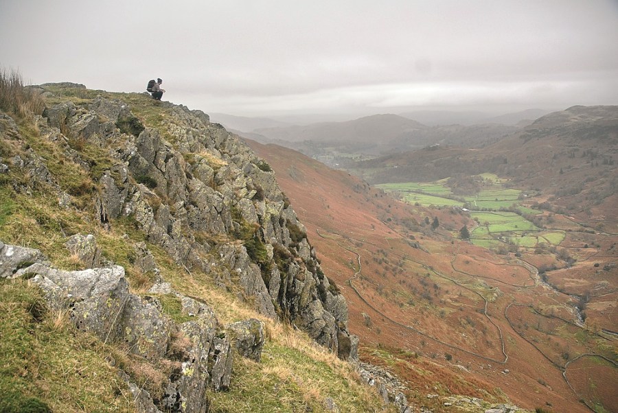
On this Grasmere walk, which is 14km/8.5 miles in length, involves 802m/2631ft of climbing, and takes about 5 hours to complete, Daniel Neilson and I explore some of the Lake District’s smaller hills. It was somewhere near Raw Pike, shortly after Daniel and I had begun our ascent from the quaint houses that populate Grasmere, that I started to think about one of the opening passages from Truman Capote’s first book, Other Voices, Other Rooms. It simply reads: “Often the only movement on the landscape is winter smoke winding out the chimney of some sorry-looking farmhouse, or a wing-stiffened bird, silent and arrow-eyed, circling over the black deserted pinewoods.”
Exploring the Lake District
Capote’s sentiments of remoteness reflected my feelings as we cut our progress further along Blea Rigg with those picturesque little houses slowly evaporating behind us, but my sentiments were defined more by a sense of relief than unsettled weariness. There were no pinewoods either, of course, but on this particular day the washed-out landscape was an almost blank canvas which allowed my mind to wander with my feet. It explains the obscure Capote quote, and it also explains why, even on a grey day in Grasmere, I was in the mood for exploring somewhere new.
Exploring? You’ll need to know how to read a map and use a compass. Check out our navigation skills guide to the basics of mountain navigation here.
Helm Crag
It was the walk over Ferngill Crag, Calf Crag, Gibson Knott and the dramatic rock formations that stand on the pinnacle of Helm Crag – like an enormous piece of jagged, black coral – where my senses started to truly awaken. The route rises and falls like the track of a thundering rollercoaster. Each time you think you’ve reached the end of this marvellous stretch of rugged crags, another seems to rear its gnarled head over the periphery. Even the steep descent, which winds confidently back down to Easedale and into Grasmere, leaves you feeling tingly with adrenaline. We soon caught the bus back into Kendal, and Daniel and I were both glad we came out for the ride.
ROUTE DESCRIPTION
- From the square and bus stop in Grasmere walk towards Allen Bank, the National Trust property, and follow the path in front of it and around its northern side. Follow the track W and then SW towards Lang How.
- Pass in front of Lang How and follow rough path NW staying high on the ridge up Blea Rigg. There’s not a clear path, but stay on high ground and you’ll be fine. There are steep crags to the north for part of it. Another unclear footpath at NY292083 descends steeply NE to a clear footpath to Codale Tarn.
- At Codale Tarn follow path roughly NNE to the col between Tarn Crag and Ferngill Crag. Follow the rough path W and then N to the head of Far Easdale Gill. It’s steep in parts on Ferngill Crag and rough going.
- From the head of Easedale, follow a clear path NE and then E and SE along the path along the ridge to Helm Crag.
- Descend along signposted path down Helm Crag to Grasmere.

James Reader spends the day with Daniel Neilson on a Grasmere walk and lets his mind and his feet go for a wander
On this Grasmere walk, which is 14km/8.5 miles in length, involves 802m/2631ft of climbing, and takes about 5 hours to complete, Daniel Neilson and I explore some of the Lake District’s smaller hills. It was somewhere near Raw Pike, shortly after Daniel and I had begun our ascent from the quaint houses that populate Grasmere, that I started to think about one of the opening passages from Truman Capote’s first book, Other Voices, Other Rooms. It simply reads: “Often the only movement on the landscape is winter smoke winding out the chimney of some sorry-looking farmhouse, or a wing-stiffened bird, silent and arrow-eyed, circling over the black deserted pinewoods.”
Exploring the Lake District
Capote’s sentiments of remoteness reflected my feelings as we cut our progress further along Blea Rigg with those picturesque little houses slowly evaporating behind us, but my sentiments were defined more by a sense of relief than unsettled weariness. There were no pinewoods either, of course, but on this particular day the washed-out landscape was an almost blank canvas which allowed my mind to wander with my feet. It explains the obscure Capote quote, and it also explains why, even on a grey day in Grasmere, I was in the mood for exploring somewhere new.
Exploring? You’ll need to know how to read a map and use a compass. Check out our navigation skills guide to the basics of mountain navigation here.
Helm Crag
It was the walk over Ferngill Crag, Calf Crag, Gibson Knott and the dramatic rock formations that stand on the pinnacle of Helm Crag – like an enormous piece of jagged, black coral – where my senses started to truly awaken. The route rises and falls like the track of a thundering rollercoaster. Each time you think you’ve reached the end of this marvellous stretch of rugged crags, another seems to rear its gnarled head over the periphery. Even the steep descent, which winds confidently back down to Easedale and into Grasmere, leaves you feeling tingly with adrenaline. We soon caught the bus back into Kendal, and Daniel and I were both glad we came out for the ride.
ROUTE DESCRIPTION
- From the square and bus stop in Grasmere walk towards Allen Bank, the National Trust property, and follow the path in front of it and around its northern side. Follow the track W and then SW towards Lang How.
- Pass in front of Lang How and follow rough path NW staying high on the ridge up Blea Rigg. There’s not a clear path, but stay on high ground and you’ll be fine. There are steep crags to the north for part of it. Another unclear footpath at NY292083 descends steeply NE to a clear footpath to Codale Tarn.
- At Codale Tarn follow path roughly NNE to the col between Tarn Crag and Ferngill Crag. Follow the rough path W and then N to the head of Far Easdale Gill. It’s steep in parts on Ferngill Crag and rough going.
- From the head of Easedale, follow a clear path NE and then E and SE along the path along the ridge to Helm Crag.
- Descend along signposted path down Helm Crag to Grasmere.


