
Vivienne Crow barely leaves Cumbria on her way to Yorkshire’s highest hill – Whernside from Dent.
Most walkers approach Whernside from the east, but this walk climbs to Yorkshire’s highest point from the west – from Dentdale in Cumbria; leaving Cumbria for only a few hundred metres, in fact. Ever since the local government reorganisation of 1974, a large proportion of Whernside, including its all-important trig pillar, has fallen outside of North Yorkshire’s borders.
Assuming you’re sticking with me – and you’re not a Yorkshire patriot offended by this shocking fact – this route uses old tracks to reach the base of Whernside. A moderately steep climb ensues before reaching the summit. Crossing into Yorkshire, we briefly share the ridge path with Three Peaks’ walkers before striking off over less frequented (Cumbrian) ground again. Now we visit moorland that is home to the Whernside Tarns, a breeding area for golden plovers later in the year. (This section is not on a right of way and crosses access land where there is a dog ban in force.) A green lane then drops into Dentdale, where riverside paths lead back to Dent’s cobbled streets and the George and Dragon pub.
Whernside from Dent: route description
START/FINISH: Pay-and-display car park in Dent, GR SD704870, 9km south-east of Sedbergh | MAPS: OS Explorer OL2 (1:25k), OS Landranger 98 (1:50k); Harvey Maps’ Superwalker XT25 Yorkshire Dales South West | DISTANCE: 19.2km/11.9 miles | ASCENT: 698m/2260ft | DURATION: 5½-6 hours
1. SD704870: Leave the car park and cross the road diagonally left to head up Dragon Croft. Keep straight on at the far end of the green. Beyond the lane-end, a narrow, stony path continues uphill, later broadening as it enters the wooded ravine of Flinter Gill, home to the Wishing Tree. To make a wish come true, walk three times clockwise through the tunnel created by its twisted roots. Beyond the trees, continue climbing.
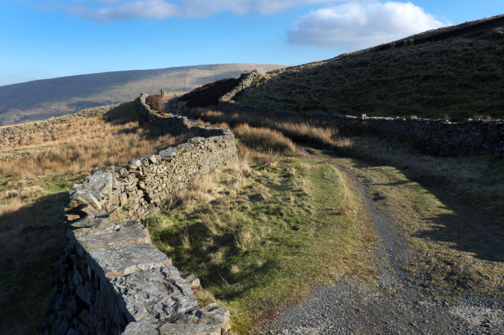
Turn left at waypoint 2, following a walled track above Dentdale. Credit: Vivienne Crow
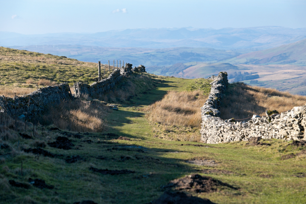
2. SD698859: Turn left on reaching a T-junction. This walled track, known as Occupation Road, curves around the northern and eastern flanks of Great Coum, the northern tip of a ridge that is also home to Lancashire’s highest point, Gragareth.
The view west, including Crag Hill, on the climb up Whernside. Credit: Vivienne Crow
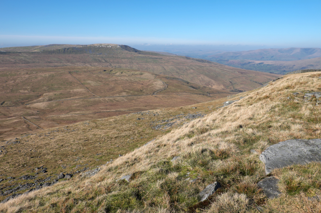
3. SD710846: Turn right at the next track junction. The steep, dark western slopes of Whernside dominate the landscape as you gain height. We’ll be heading up there before too long.
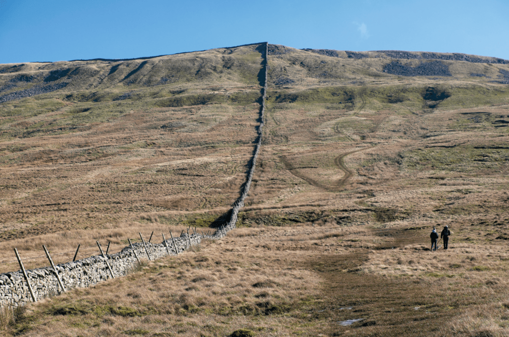
Climbing towards the wall corner at waypoint 5. Credit: Vivienne Crow
4. SD723822: Turn right along a minor road at High Moss for 400m and then cross the stile next to the gate on the left. A beck has to be forded before gaining the rough track heading uphill. Keep left at the top of this short rise, continuing the ascent beside the fence and then a wall. The wall corner is reached after a steep section near some shake holes and rock outcroppings.
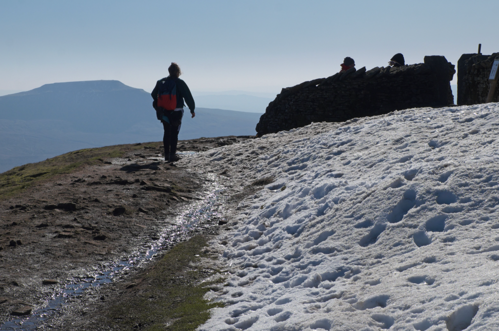
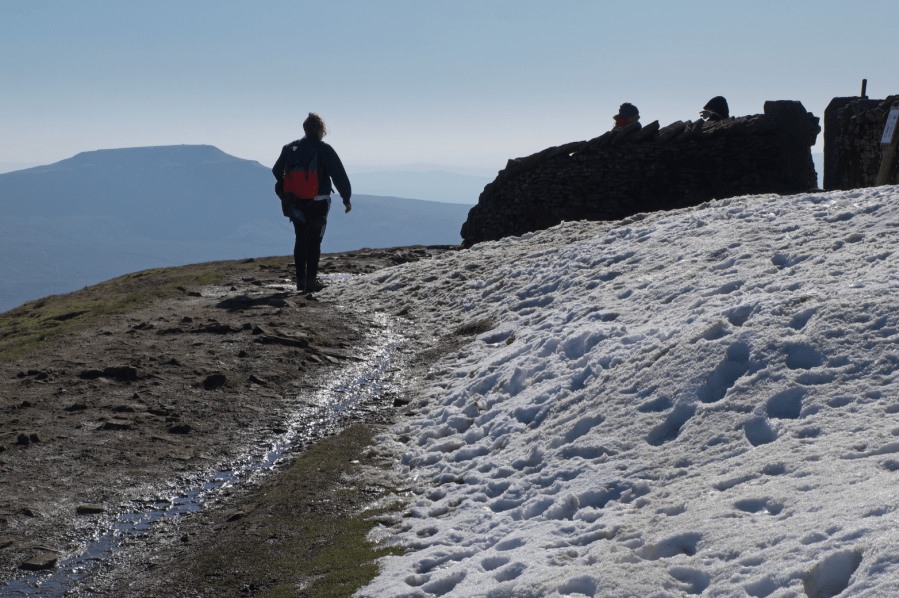
Walker nearing Whernside’s summit, with Ingleborough in the distance. Credit: Vivienne Crow
5. SD731816: Continue straight on for a few more strides and then fork right to skirt the top of a boulder-covered slope. The distinctive peak straight ahead is Ingleborough. About 130m beyond the wall corner, head east-south-east along a trail through peat hags and then up a steep, stony slope. This leads directly to Whernside’s trig pillar.
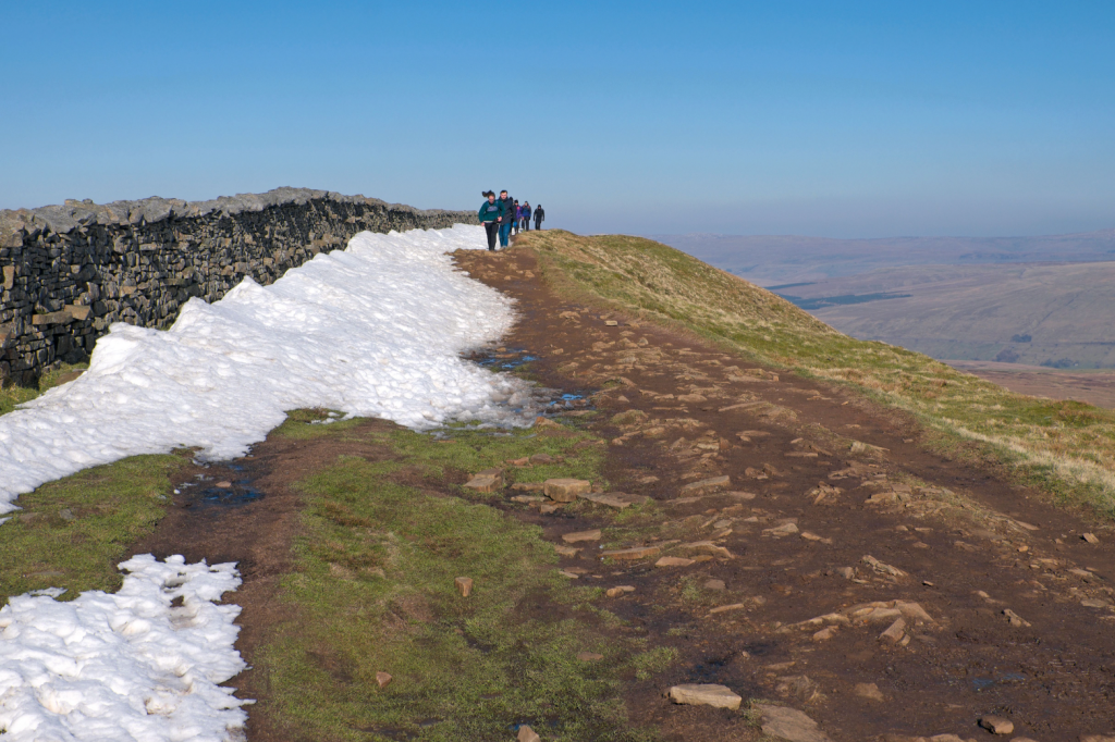
Turn left along the busy ridge path after waypoint 6. Credit: Vivienne Crow
6. SD738814: Squeeze through the wall stile to reach the main ridge path. Turn left along this. Part of the Yorkshire Three Peaks challenge route, this can be fairly busy at times, but the sudden appearance of the beautiful Dales landscape to the east is a welcome distraction from the sudden onslaught of fast-moving hikers.
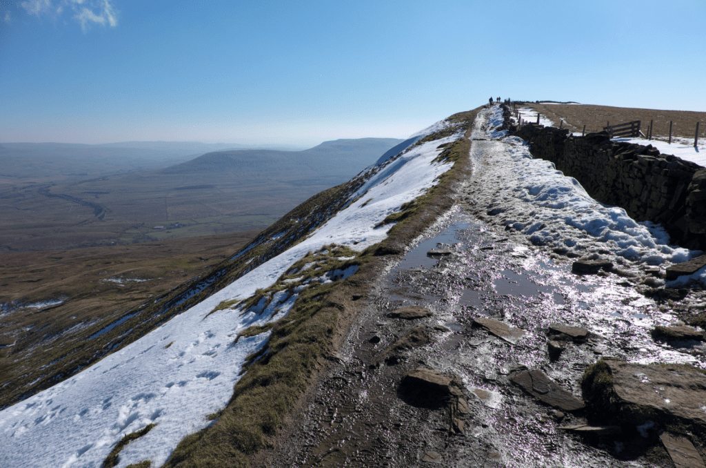
On Whernside’s summit ridge. Credit: Vivienne Crow
7. SD740823: Having walked the high ridge path for about 800m, cross a stile in a low fence up to the left. A grassy path heads out across the moorland towards the Whernside Tarns. Dodging the worst of the boggy ground, it follows a slightly convoluted route, but the general direction is slightly east of north. Pass to the right of the tarns and then veer north-east to descend gently. The path becomes less obvious when it reaches the corner of a wall/fence. Continue downhill with the wall and fence on your left.
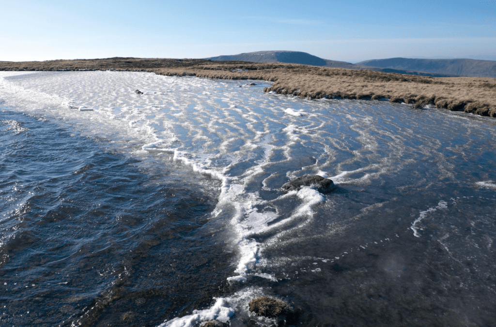
Sub-zero temperatures and the wind combine to create an unusual effect on one of the Whernside Tarns. Credit: Vivienne Crow
8. SD746845: Turn left when you reach a grassy track, soon enjoying distant views of the Lake District’s high fells as you descend. On dropping to a minor road, turn right and then, at a T-junction, go left.
The Lake District fells line the horizon on the descent back into Dentdale. Credit: Vivienne Crow
9. SD720860: Just after crossing Deepdale Beck, turn right along the Dales Way. Beyond a gate, the fenced path heads right and then left along the field edge. You’re accompanied by Deepdale Beck at first and then the River Dee.
10. SD710871: Having followed the beck and the river for about 1.8km, the path swings away from the Dee. After the bridge over Keld Beck, turn sharp right and follow the beckside path to Church Bridge. Turn left along the road and follow it through Dent. The village car park is on the right about 50m beyond the end of the cobbles.
Further information
PUBLIC TRANSPORT: Dent Station, on the Settle to Carlisle Railway, is 7km from the village
TOURIST INFORMATION: Sedbergh Information Centre, 72 Main Street (015396 20125, www.sedbergh.org.uk)


