
Andrew Galloway visits a landscape steeped in history – and a watering hole – on this route taking in Tal-y-fan from Tŷ Gwyn.
The Tŷ Gwyn Hotel in the village of Rowen provides a refuge for walkers on the North Wales Pilgrim’s Way. Once suitably refreshed, would-be pilgrims find themselves heading northwards, through the woods of Parc Mawr, up onto the rugged hinterland above the village of Henryd. A narrow pathway, bounded on either side by high walls, leads to a stone church. The building dates from the twelfth century and is dedicated to Saint Celynnin, who established a Christian settlement here six hundred years earlier. On the open moorland above the church are the remains of a still earlier settlement. Caer Bach is an Iron Age fortified settlement occupying a dramatic viewpoint over River Conwy. West of the fort rises Tal-y-fan, an outlying peak of the Carneddau Mountains. At just 610m (2,001ft) it barely qualifies for mountain status. The col at Bwlch y Ddeufaen truncates Tal-y-fan from its loftier cousins. From here the course of a Roman road leads to a field containing the remains of a neolithic burial chamber. Known as Maen y Bardd, these precariously balanced stones are believed to be five thousand years old.
Tal-y-fan from Tŷ Gwyn: route description
Start/Finish: Tŷ Gwyn Hotel, Rowen. Before parking at the pub please ask permission, otherwise there is ample parking and public toilets by the Memorial Hall. Tŷ Gwyn is a rural pub in a quiet village so please check opening hours on their website (GR: SH759719) | Distance: 13.5 km (8.4 miles) | Ascent: 660m (2,165ft) | Duration: 5 hours | Maps: Ordnance Survey 1:25,000 OL17 Yr Wyddfa/Snowdon & Conwy Valley
1. SH759719: The first 3km of the walk, to St Celynnin’s church, follows the North Wales Pilgrim’s Way. From the pub walk westwards through the village. After 150m turn to the right, taking the narrow road to the north towards the Cefn Cae campsite. Follow the track on the south side of the camping field for 100m. Through a gate, turn left and follow a path to a gravel track. Turn right and walk 100m along the track to a wooden stile by a Victorian grave dedicated to the memory of Wallace, “a fine hound and a faithful companion.” Cross the stile and walk northwards along the margin of the field for 100m towards a coppice of trees. Look for the “Hi Tiddle” marker nailed to a post and turn to the left. Follow the path westwards for 180m then pass through a metal gate onto a minor road. Turn to the right and follow the road for 160m, taking the rough track branching to the left. After 130m the track bends to the left. On the right is a tall ladder-stile. Climb the stile! Now head northwards across a field towards the woods. 50m short of the woods look for the North Wales Pilgrim’s Way marker on a post. Pass through the wooden gate and follow the wall towards the woods.
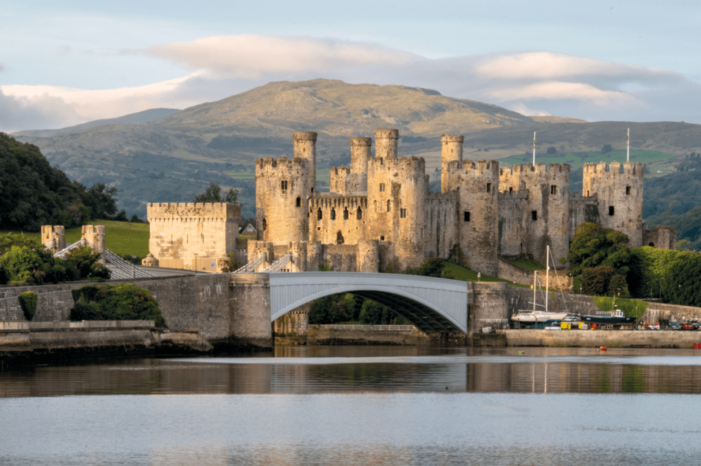
Conwy Castle with Tal-y-Fan in the distance. Credit: Andrew Galloway
2. SH756730: Pass over a metal stile, cross a small stream and continue 20m, looking for the welcome sign for the Parc Mawr woods. Now follow the path along the lower edge of the woods. After 300m paths cross. Take the path to the left, climbing steeply through the woods for 300m to where the path crosses a forestry track. Cross the track and continue westwards along the path for 100m and pass through a metal gate. Continue along the path, with high walls and thick vegetation on either side, for 640m to St Celynnin’s church.
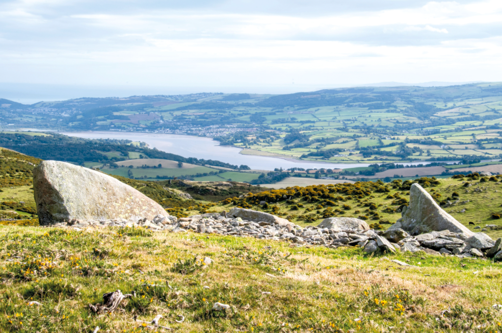
The Conwy Valley from Caer Bach. Credit: Andrew Galloway
3. SH751736: From the church continue westwards along the North Wales Pilgrim’s Way onto open moorland. After 560m the path divides into two. Take the path to the left heading southwards, passing Craig Celynin (sic) on the left. After 740m arrive at the fortified settlement of Caer Bach.
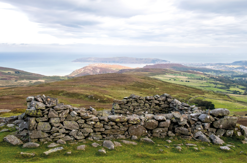
Ruined quarry building Tal-y-Fan. Credit: Andrew Galloway
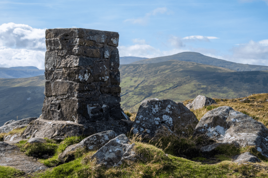
4. SH744729: From Caer Bach take the path to the northwest for 1km to a disused quarry. Locate the ruined building to the south of the quarry. Climb towards the southwest for 500m to reach a prominent stone wall. Keeping to the north of the wall, follow it along a broad ridge to a ladder stile on the summit of Tal-y-Fan (610m). Cross the stile to reach the triangulation pillar.
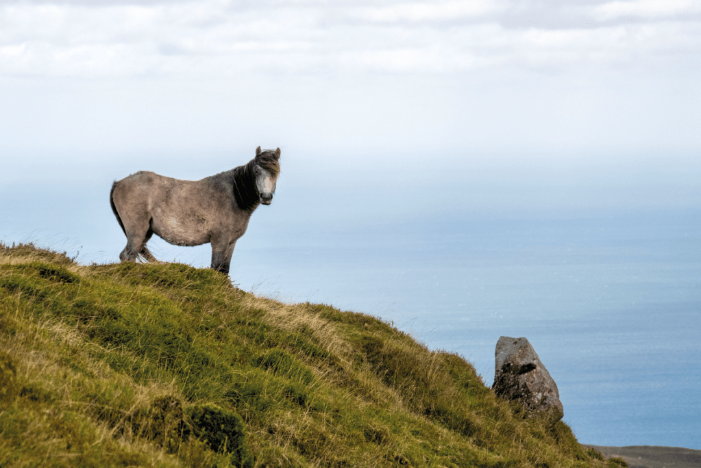
Requisite pony pic. Credit: Andrew Galloway
5. SH729726: From the summit follow the route of the Cambrian Way to the west, keeping to the north of the wall for 360m to a col where paths cross. Continue to the west for 1.8km, descending to Bwlch y Ddeufaen, where the path intersects the route of a Roman road.
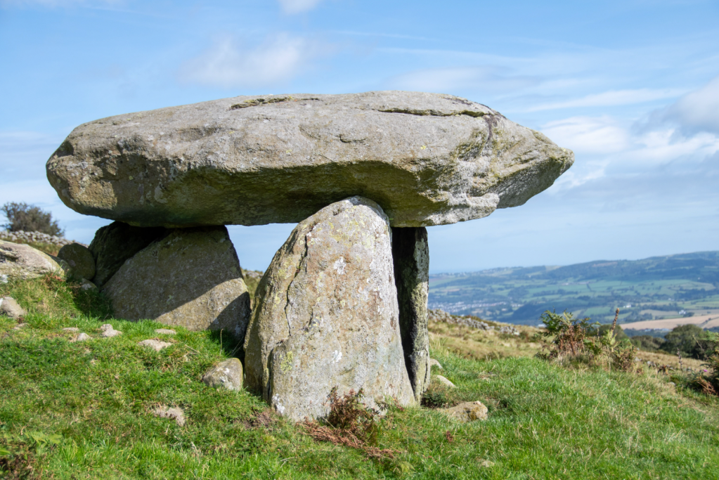
Maen y Bardd neolithic burial chamber. Credit: Andrew Galloway
6. SH712718: Pass through an iron gate and follow the route of the Roman road to the southeast. Here there are two prominent pre-historic monoliths, one on either side of the road. The stones provide this ancient mountain pass with its name, Bwlch y Ddaufaen, which translates into English as ‘the pass of the two stones.’ After 1km pass through a gate to a parking area where the trackway becomes a minor road (surfaced). Continue along the road for 1.2km to where it branches into two. Take the gravel track to the left for 1km. In the field to the north of the track stands the neolithic burial chamber known as Maen y Bardd, the poet’s stone.
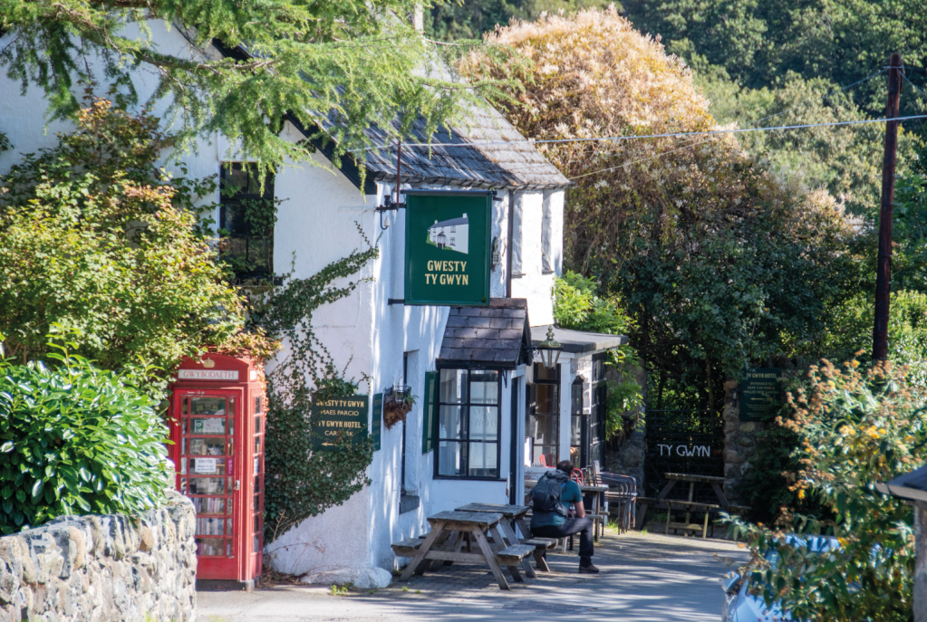
Ty Gwyn Hotel, Rowen. Credit: Andrew Galloway
7. SH741718: Return to the track and continue to the northeast for 600m to a hostel. From here the road is once again surfaced. Follow the road for 1.3km, turning left into the village to return to the Tŷ Gwyn pub.
Further information
Public Transport: Llew Jones operate the number 19 bus with regular services from Conwy to Rowen. Check timetables here: https://llewjones.com/bus-timetables/
Information: www.visitconwy.org.uk


