
James Forrest stops by a little-known and seldom-visited fall – and four Wainwrights – on this walk to Spout Force via Lord’s Seat.
Encircled by the Lorton Fells, hidden within Whinlatter Forest, Spout Force waterfall is a bit of an enigma. It has a secretive aura, as if shying away from the limelight, and its wonders are well-guarded by a steep-sided, dramatic gorge. A path leads to a viewing platform, but tall trees and thick vegetation block much of the view. So instead – if you’re sure-footed, brave and not averse to getting wet – you can ghyll scramble up a stream and along the ravine to the base of the 30ft plunging waterfall. It’s a wonderful outing with a childlike sense of exploration.
Spout Force is located only a short walk from Scawgill Bridge, on the B5292 Whinlatter Pass. But to make a day of it, you can combine a visit to the waterfall with a peak-bagging round of four Wainwrights. The Lord’s Seat group of fells, which lie between Bassenthwaite Lake and the Vale of Lorton, are the rounded, grassy hills that rise above Thornthwaite Forest. They aren’t rugged, rocky or majestic – but they offer peaceful, enjoyable hiking away from the hustle and bustle ticking off Barf, Lord’s Seat, Broom Fell and Graystones.
Spout Force via Lord’s Seat: route descritiption
START/FINISH: Spout Force car park, Whinlatter Pass (B5292), CA12 5TW (NY181255) | MAPS: OS Explorer OL4 (1:25k), OS Landranger 90 (1:50k), Harvey British Mountain Map Lake District (1:40k) | DISTANCE: 11.4km / 7.1 miles | ASCENT: 650m / 2,132ft | DURATION: 4.5 hours
1. NY181255: From car park, head north and north-east on wide forestry road. Pass to left of Darling How farm, going through vehicle barrier, and continue into Aiken Valley. Ignore turn-off to left at fingerpost sign and instead stick to forestry road heading east. At three-way junction, go straight ahead on middle road, and loop south around Brown How’s flanks, before looping east again to cross Willybrag Gill and Aiken Beck. Ascend north-east and – just before road loops sharply right to west of Ullister Hill – veer left on another forestry track bulldozed by heavy plant machinery.
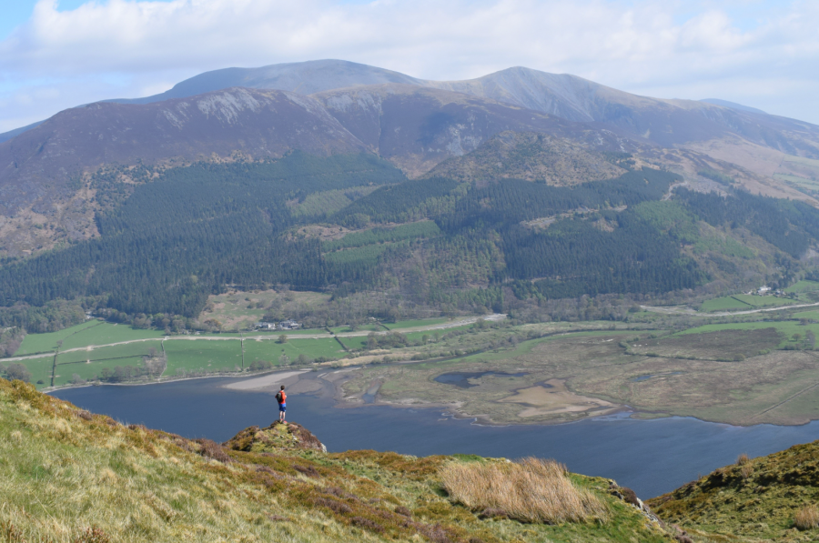
Bassenthwaite Lake from Barf. Credit: James Forrest
2. NY205259: Head north-north-east over rough terrain and eventually emerge beyond trees, negotiating short boggy section. Continue briefly and arrive at path junction. Turn left on good, stony path very briefly, before quickly turning right onto muddy trod over heather-covered slopes. This trod bypasses Lord’s Seat’s summit and heads north to col between Lord’s Seat and Barf. Cross stile over metal-wire fence and continue north to join main stony path for Dodd. Turn right, head east into dip and climb easily to Barf’s summit.
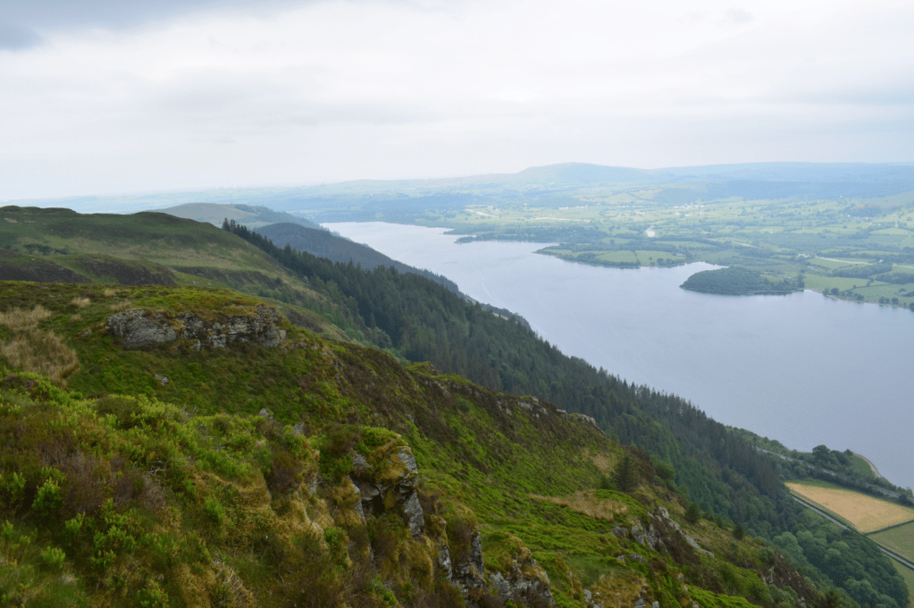
Hiking towards Lord’s Seat from Barf. Credit: James Forrest
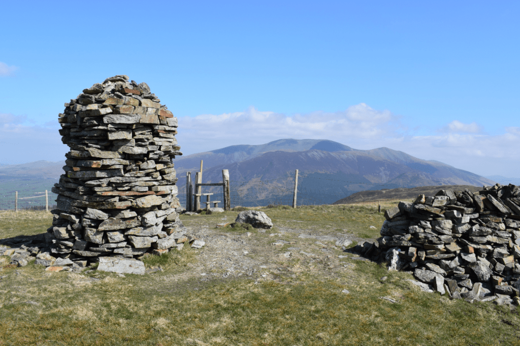
3. NY214267: Re-trace your steps along wide, stony path, heading west towards Lord’s Seat. As terrain steepens, stony path becomes more eroded and loose. Climb through heather-clad slopes and emerge beyond stony path to grassy trod. Continue south-west to Lord’s Seat’s summit.
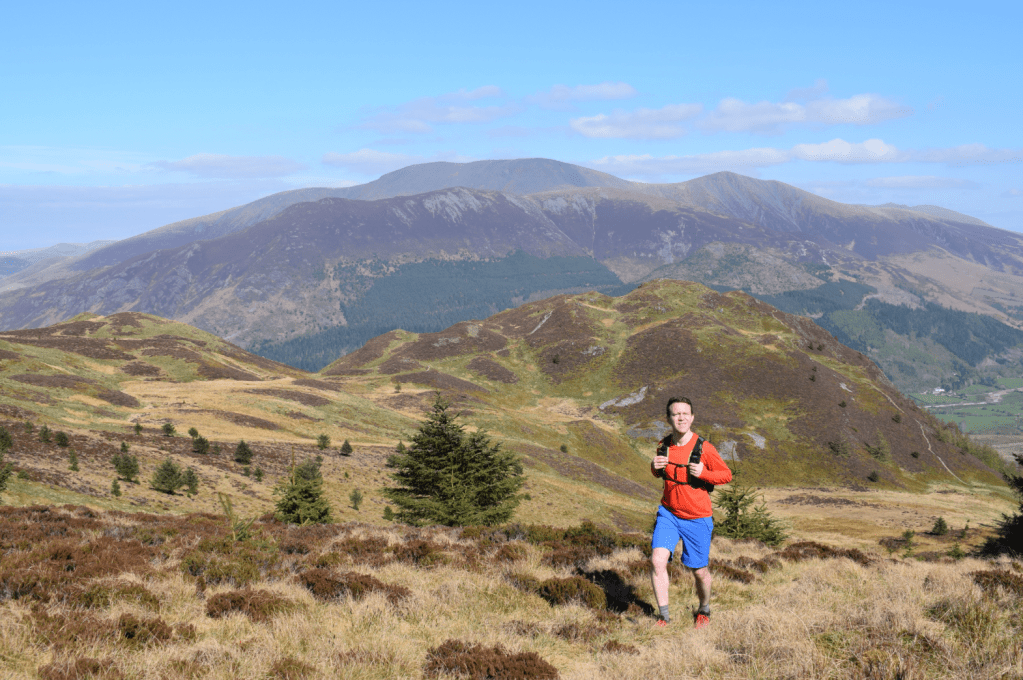
Lord’s Seat summit. Credit: James Forrest
4. NY204265: Turn right and take grassy ridge heading north-west. At lowest point of ridge cross fence at gate and ascend north-west and west on wide, grassy path. Cross stile and arrive at Broom Fell’s summit. Initially descend west on grassy trod, and then contour left over flatter section with brief climb to 467m subsidiary top.
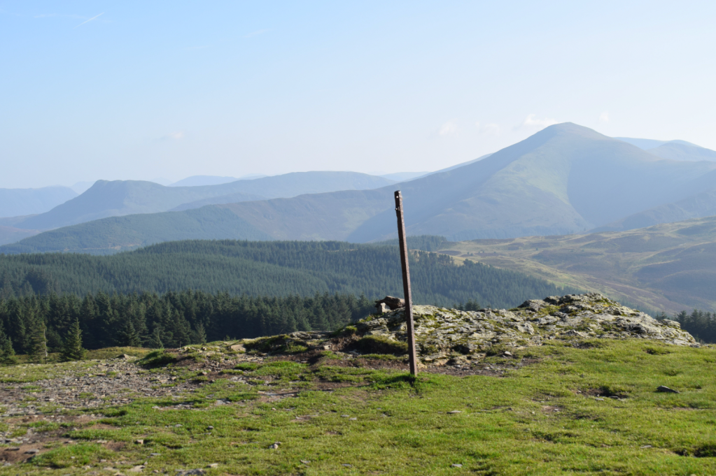
Broom Fell summit. Credit: James Forrest
Next drop steeply south-west to edge of deforested land at Widow Hause. Pass between derelict wall and new stile, and continue west to right of fence. Beyond col, after short climb, arrive at base of Graystones. Cross another collapsed wall, turn left over stile and climb steeply south-west, now to left of fence. Veer left off main path, and away from fence, and take grassy trod south-south-west, climbing over undulating terrain to Graystones.
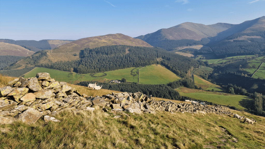
On the descent of Graystones. Credit: James Forrest
5. NY177264: Head south-south-west to cross old wall and turn left to descend very steeply south following wall. A narrow trod leads you over small section of craggy ground before continuing very steeply downhill over grassier terrain. As you near beck, path veers slightly right across scree slopes of slate to arrive at footpath next to Scawgill Bridge. Turn left and head east-north-east alongside beck. Go through gate, pass wooden bench and continue along path to reach footbridge. Don’t cross it yet and instead head north-east on path to left of beck, which has shallow pools if you want to take a dip. Climb steep path, which includes stepped sections, to viewing platform in front of Spout Force. Sadly vegetation blocks some of view, but it’s still a sight to behold. Alternatively, if you’re sure-footed, confident, don’t mind getting your feet and the conditions aren’t in spate, you can return to valley and ghyll scramble up stream for closer look at base of waterfall.
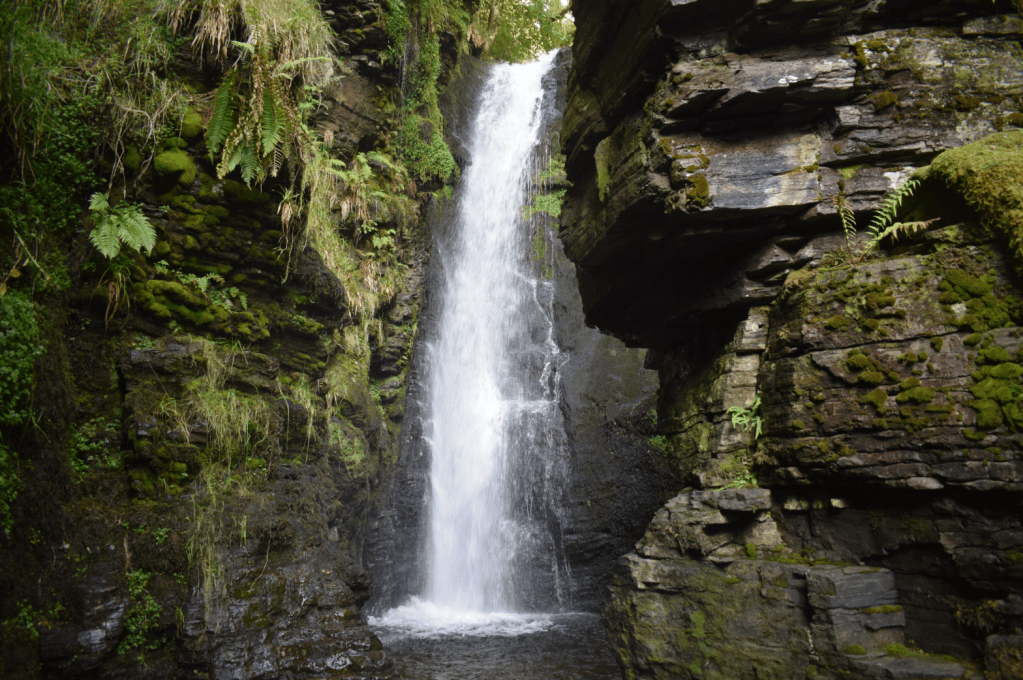
Views from the base of Spout Force waterfall. Credit: James Forrest
6. NY181260: Retrace your footsteps back to footbridge. Cross it and turn right over second footbridge fording tributary. Climb south on narrow, winding path with stepped sections. Cross stile into a field and turn left. Follow fence and wall east and then south. Veer left over stile, head south and emerge back at car park.
Further information
PUBLIC TRANSPORT: Take Stagecoach’s 77A bus from Keswick to Whinlatter Visitor Centre (1.9miles from walk start)
TOURIST INFORMATION: www.visitlakedistrict.com
More to explore: mapped walking routes in the Lake District


