
Vivienne Crow visits hidden falls on an off-piste outing to Sca Fell via Cam Spout.
Heading into Upper Eskdale never disappoints. This remote dale head, enclosed by rocky bulwarks of crag, scree and boulders, is unlike anything else in the Lakes – its grey scars forming seemingly insurmountable barriers. Just reaching the Great Moss, the soggy floor of this vast amphitheatre, requires commitment; then, from there, any attempt to climb England’s highest mountains involves storming those rugged walls.
Beyond the Great Moss, this assault on Sca Fell clambers up the side of Cam Spout waterfall before venturing on to pathless terrain just north-west of Cam Spout Crag. It’s painstakingly slow-going for the next few hundred metres, but the confines of this isolated bowl are eventually replaced by a sighting of the sea as you emerge on the high ridge.
Scafell Pike, just a short distance away across Mickledore, is inevitably crawling with people, but Sca Fell is much quieter. There’s even a possibility you’ll have it to yourself as you carefully peer down on the buttresses and gullies that make up the mountain’s north face before beginning the long ridge descent via Slight Side.
Sca Fell via Cam Spout: route description
START/FINISH: National Trust’s Wha House car park, GR NY200009, about 1km east of Boot Inn, Eskdale | MAPS: OS Explorer OL6 (1:25k), OS Landranger 89 (1:50k), Harvey 1:25,000 Superwalker Lake District West | DISTANCE: 15.6km/9.7 miles | ASCENT: 1037m/3400ft | DURATION: 5-6 hours
1. NY200009: Walk east along the road for 130m and take the first track turning on the left, later passing Taw House Farm. Almost 2km beyond the road, the track leads to a gate and ends. Once through the gate, climb to a ladder stile in the top wall. Cross this and walk north-north-east, soon joining a track to the left of a wall.
The path swings north along the edge of a boggy hollow between wp2 and wp3. Credit: Vivienne Crow
2. NY214024: A clear fork is reached about 80m beyond the Scale Gill Falls bridge. Take the left-hand option here, soon swinging west-north-west to begin zig-zagging up the fellside. There’s a glimpse of the high fells ahead as the path initially swings north along the edge of a boggy hollow. The route, generally north-east, disappears from time to time on the wet ground. It then becomes even less distinct as it swings north-north-west above the River Esk. Pass through old sheepfolds before reaching Samson’s Stones, a group of massive chunks of volcanic rock that are said to provide some of the best bouldering in the Lakes.
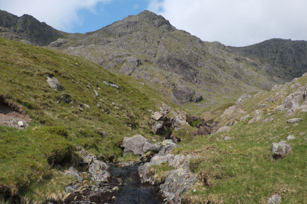
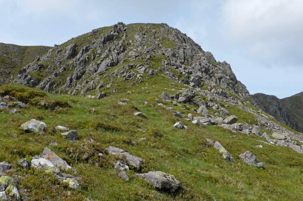
The route heads up the bare rock to the north of Cam Spout. Credit: Vivienne Crow
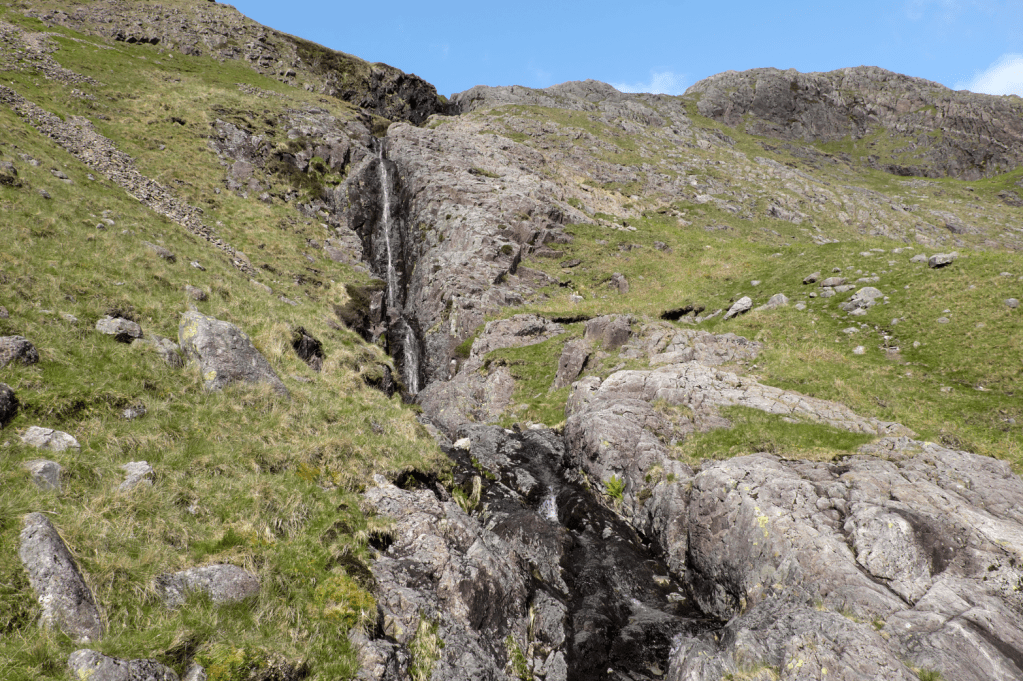
3. NY218056: About 250m beyond the boulders, swing left towards the base of Cam Spout – a slender waterfall that would probably attract more visitors if it were more accessible. After crossing the stream issuing from it, clamber up its north side. The bare rock might require you to take hands from pockets, but it couldn’t really be classed as a scramble.
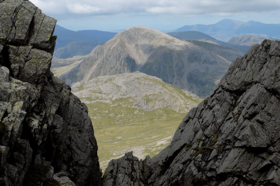
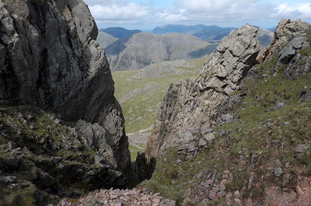
From wp4, looking up the gap between Sca Fell and Scafell Pike. Credit: Vivienne Crow
4. NY216059: Recross the beck as soon as possible after the gradient eases. The most difficult part of the route starts now – steep and pathless, over boulders and potentially ankle-twisting terrain. Head generally south-west, avoiding crags and rock bands, and passing about 120m north-west of the top of Cam Spout Crag. A grassy ridge is reached after about 500m. Now climb west-north-west.
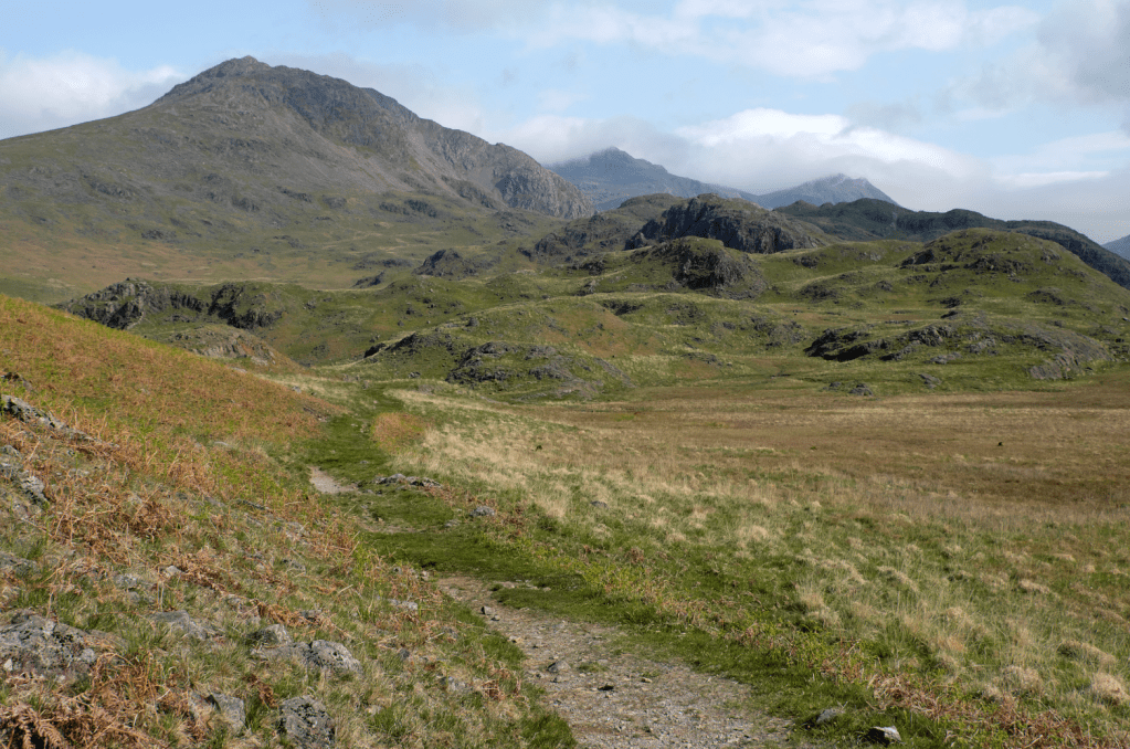
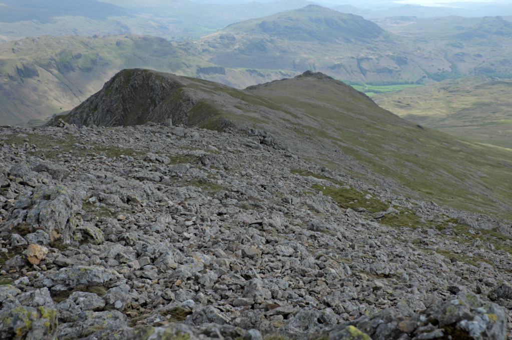
The ridge leading up to Long Green. Credit: Vivienne Crow
5. NY210056: Easier ground is reached on Long Green. Follow the ridge path north-north-west on to Sca Fell. Peak-baggers might be content with reaching the cairn and shelter amid the uninspiring sea of boulders at the summit, but it’s worth continuing north for another 300m for glimpses of the mountain’s impressive north face, particularly the dark chasm of Deep Gill.
The top of Deep Gill. Credit: Vivienne Crow
6. NY207067: From the northern edge, return to the summit cairn and then retrace your steps along the south ridge. Beyond Long Green, continue on to Slight Side. Keep to the eastern side of the high ground as you do so – there is a slightly less rocky path to the west, but the edge provides the more exciting prospect down into Upper Eskdale and of Bow Fell and Crinkle Crags on the opposite side. Slight Side’s true summit is reached via an easy clamber on rocks, but this can be bypassed.
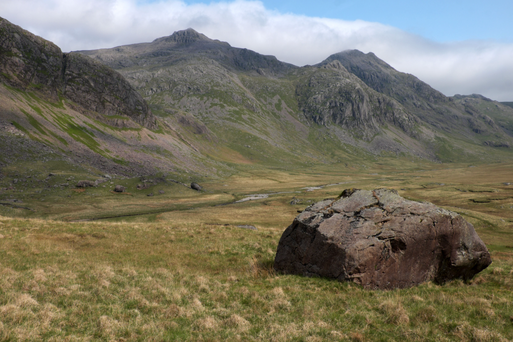
Scafell Pike stands proud over the Great Moss. Credit: Vivienne Crow
7. NY209050: From the top, descend south on a faint, cairned trail. This takes a winding, but straightforward route between the rocks before swinging south-west.
Descending to Slight Side. Credit: Vivienne Crow
8. NY207044: Watch for a tiny cairn almost 800m beyond Slight Side’s summit. This marks a faint fork where you should take the less obvious trail continuing south. Unclear when it hits boggy ground, this leads back to the car park 4km away. It heads roughly south for much of the way, but performs a few bends as it negotiates becks and bogs, and winds between knolls. Be alert to these twists and turns, some marked by cairns. You’ll eventually find you’re descending south-west with a wall on your left. This guiding wall is lost beyond some gated sheepfolds, but the car park is now less than 300m to the south-west.
Further information
PUBLIC TRANSPORT: None
TOURIST INFORMATION: www.lakedistrict.gov.uk, 0845 9010845
More to explore: mapped walking routes in the Lake District


