
If you’re looking for a two-week escape to a high place of big skies, overwhelmingly powerful falls and gentle wildflower meadows, why not walk The Roof of England? Allow Vivienne Crow to introduce you to this shiny, new long-distance circular.
Anyone who has ever walked parts of the Pennine Way will know that the sense of space on these expansive uplands brings an uplifting antidote to our crowded, busy lives – opening our senses, our lungs, even our minds. Through hikers will also know that that feeling of mental and physical restoration really begins to soar as the National Trail climbs into the North Pennines. So, imagine spending two weeks immersed in that landscape? This is the opportunity afforded by the new 301km Roof of England trail.
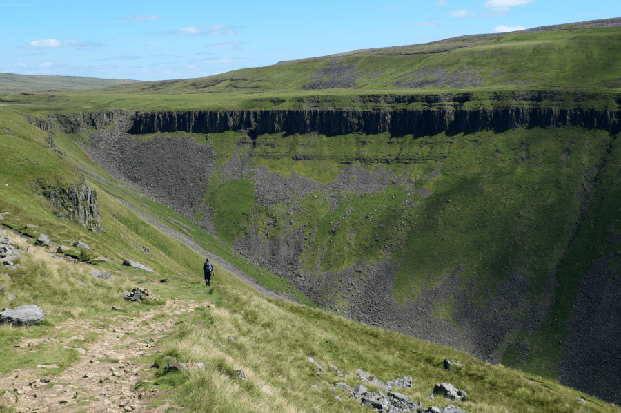
It links up stretches of existing long-distance routes including the Pennine Way, the Coast to Coast, A Pennine Journey, the Northern Saints Trail Way of Light and the Weardale Way. I’ve walked most of it over the years – some of it many times. When winter’s white coats its summits or spring brings life back to its moors, I must have a dose of the alluring horizons from Cross Fell, England’s highest point outside of the Lake District, or High Cup, the dolerite-rimmed canyon that never fails to stop me in my tracks. After heavy rain, I find the tumult of the River Tees crashing over High Force, England’s most powerful waterfall, almost totally overwhelming.
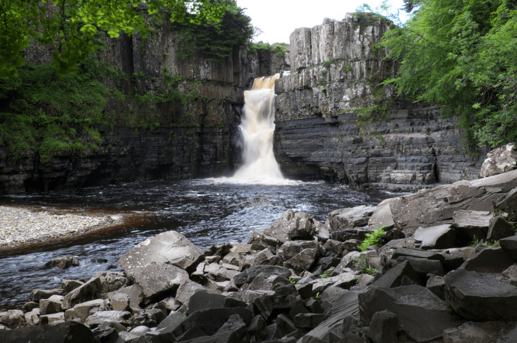
High Force. Credit: Vivienne Crow
The Roof of England isn’t just about the superlatives though; this varied trail has its gentler aspects too. It winds a meandering route through Tynedale, Allendale, the upper Derwent Valley, Weardale, Teesdale, Baldersdale, upper Swaledale and the Eden Valley. Flakebridge Wood near Appleby is home to one of my favourite bluebell displays while the broad-leaved trees of the Allen Banks gorge are at their colourful best in autumn. The hay meadows of Baldersdale are a summer highlight, hosting as many as 30 wildflower species in every square metre.
It is also in these valleys that walkers are able to interact with local people, staying in farmhouse B&Bs, stocking up at village shops and finding out about the history that shaped these communities, particularly the lead mines that once brought prosperity to the region. Each time the Roof of England crosses from one dale to another though, the remote, upland nature of this route makes itself felt again – and I’m reminded that the North Pennines is a place where England’s high population density dwindles to a low point and night skies aren’t sullied by the glow of nearby cities.
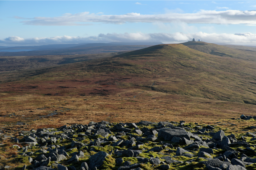
Looking back to Great Dun Fell on the climb to Cross Fell, the highest point in the Pennines. Credit: Vivienne Crow
Here’s The Great Outdoors‘ guide to the Roof of England, featuring helpful tips on the following:
- Route details
- When to go
- Myths and legends
- Transport
- Accommodation
- Resupply
- Essential gear
- Further resources
The Roof of England: at a glance
Start / Finish: Appleby-in-Westmorland | Distance: 188 miles / 301km | Ascent: 22,513ft / 6876m | Duration: 14 days | Maps: OS Landrangers 91 (Appleby-in-Westmorland), 87 (Hexham & Haltwhistle), 88 (Newcastle upon Tyne) and 92 (Barnard Castle & Richmond)
The Roof of England route
The idea of a long-distance trail through the North Pennines was dreamt up by Bob Pendlebury – the first chair of the North Pennines Area of Outstanding Natural Beauty, now the North Pennines National Landscape, when it was set up in 1988 – but it was more than 30 years before work began on identifying a possible route. The trail was finally launched by the National Landscape last autumn.
Unusually for a long-distance trail, the Roof of England is circular, beginning and ending in Appleby-in-Westmorland. It wastes no time on lengthy introductions, instead making directly for High Cup, one of the most recognisable geological phenomena in the entire Pennine chain – and one of the reasons behind the North Pennines’ designation as a UNESCO Global Geopark.
It joins the Pennine Way at High Cup Nick and sticks with it for several days, making use of the waymarking and established paths that have been maintained ever since the first National Trail was opened in 1965. Why reinvent the wheel? Down into Dufton – a pretty, red-sandstone village built by the Quaker-run London Lead Company – up and over windswept Cross Fell, down to the cobbled streets of Alston – one of England’s highest market towns – and north towards Haltwhistle.
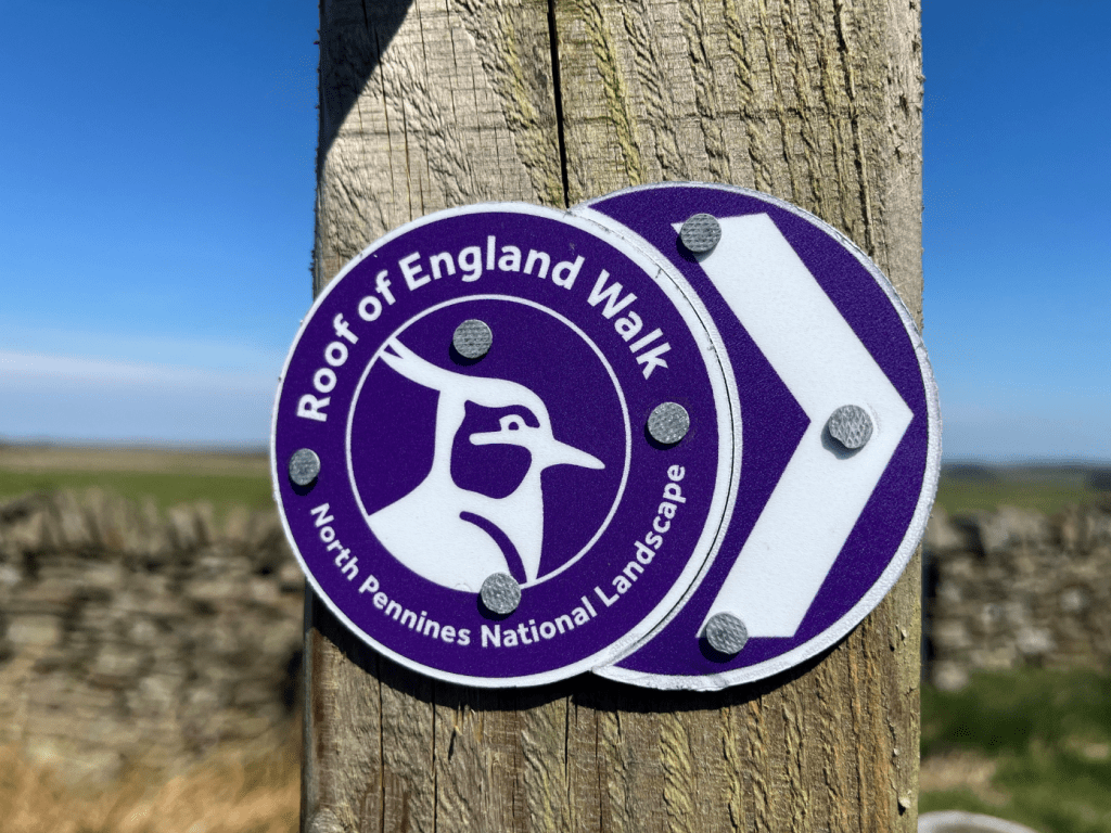
The Roof of England waymarkers guide the way. Credit: North Pennines National Landscape
The Roof of England bids farewell to the Pennine Way as the River South Tyne swings east. (But a happy reunion is on the cards. Watch this space!) A tributary of the Tyne, the River Allen, is then followed upstream to another former lead mining settlement, Allendale Town. We take to the moorland again on day five, enjoying the big skies of Hexhamshire Common and Blanchland Moor.
From the charming conservation village of Blanchland, where there’s the option of staying in a pub that was once the home of the local abbey’s prior, the route continues a brief dalliance with the upper Derwent Valley before heading into Weardale. Low moorland, woodland and riverside paths are encountered on the Weardale Way before the route heads up the Grasshill Causeway and back on to the high ground. Hearts leap as Cross Fell comes back into view and the Pennine Way is regained at Cauldron Snout.
The next few kilometres make up one of my favourite sections of the route: there’s scrambling and boulder hopping, powerful waterfalls and imposing crags, and the wildlife is fascinating. I’ve seen ring ouzels here as well as black grouse, two of the UK’s most elusive bird species; and an RSPB survey recently discovered there are dunlin breeding nearby. The River Tees makes for a lively, entertaining companion as it thunders downstream, over High Force and Low Force. It’s sad to part company with it at Middleton-in-Teesdale, but with three long, hard days ahead, there’s no time for tears.
Approaching the top of Cross Fell, the highest point in the Pennines. Credit: Vivienne Crow
Beyond the reservoirs and hay meadows of Lunedale and Baldersdale, the thing that stands out in my memory is the bog-trotting. Tan Hill Inn, the country’s highest pub, brings respite from the tough going but soggy peat continues to be a feature on the way into Keld. Here, the Roof of England baton is passed from the Pennine Way to the Coast to Coast as a newly flagstoned path leads across the moors. Dropping into the Walkers are Welcome town of Kirkby Stephen, that just leaves 26km through the bucolic Eden Valley, with the looming Pennine escarpment dominating the scene and already acting as a nostalgic reminder of two weeks well spent.
When to walk the Roof of England
It has to be spring! For me, spring in the North Pennines is all about the evocative call of the curlews as they return to their upland breeding grounds; the lapwings dipping and diving in their attempts to attract mates and to protect their ground nests; woods filled with the pungent aroma of ramsons; hay meadows bursting into magnificent bloom… It also benefits from being the driest time of year in England’s far north.
Bias aside though, from a practical point of view, the Roof of England is best completed between late March and early November. Some accommodation providers and other businesses close, or operate reduced hours, outside of these dates. And winter in the North Pennines? Well, the mid-winter sun shines a beautifully bleak light on the land at this latitude, especially after a decent dump of snow or during a period of high pressure, but the cold months obviously bring their own challenges.
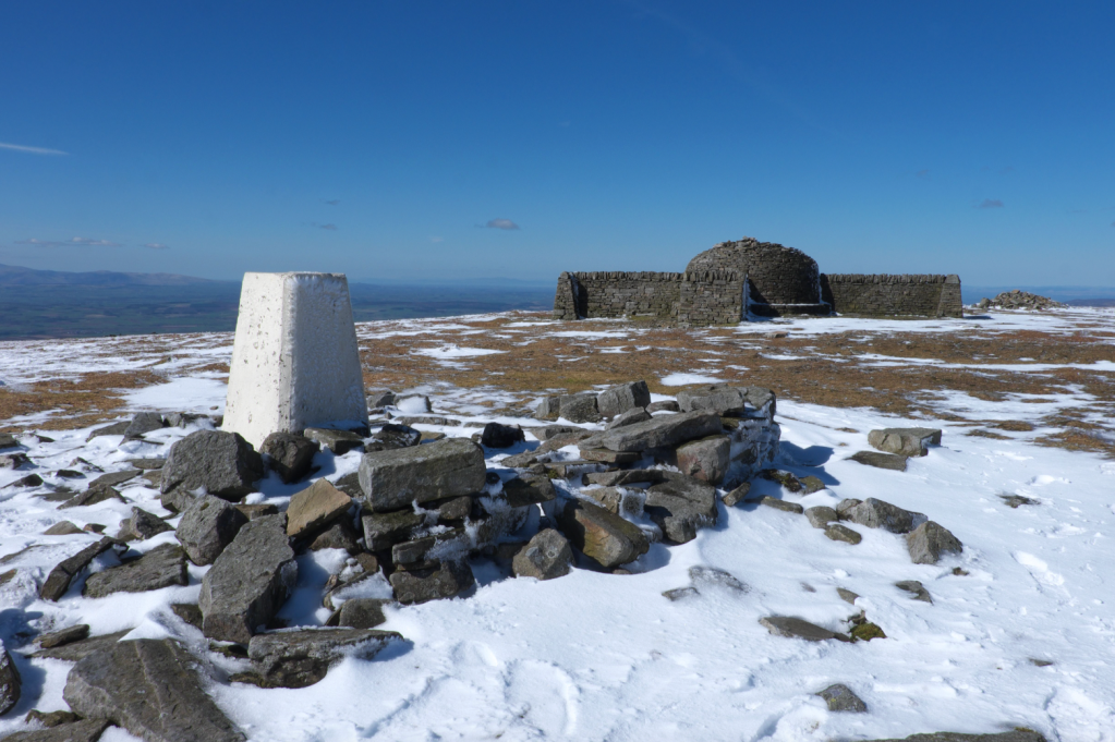
Summit of Cross Fell. Credit: Vivienne Crow
Transport
The Roof of England’s official start point is Appleby-in-Westmorland, but given its circular nature, walkers can start wherever they want. Appleby, however, benefits from being on a mainline railway – the Settle to Carlisle line. (An added bonus for those coming from the south is that they get to experience this scenic rail journey before even setting foot on the trail.)
The route also passes close to the Settle-to-Carlisle station at Kirkby Stephen as well as two stops – Haltwhistle and Bardon Mill – on the Tyne Valley Line linking Newcastle with Carlisle. Otherwise, you’re dependent on local buses, some of which operate just a few times a week. Blanchland, Edmundbyers, the Weardale towns and villages, Middleton-in-Teesdale, Alston and Keld can all be reached by bus.
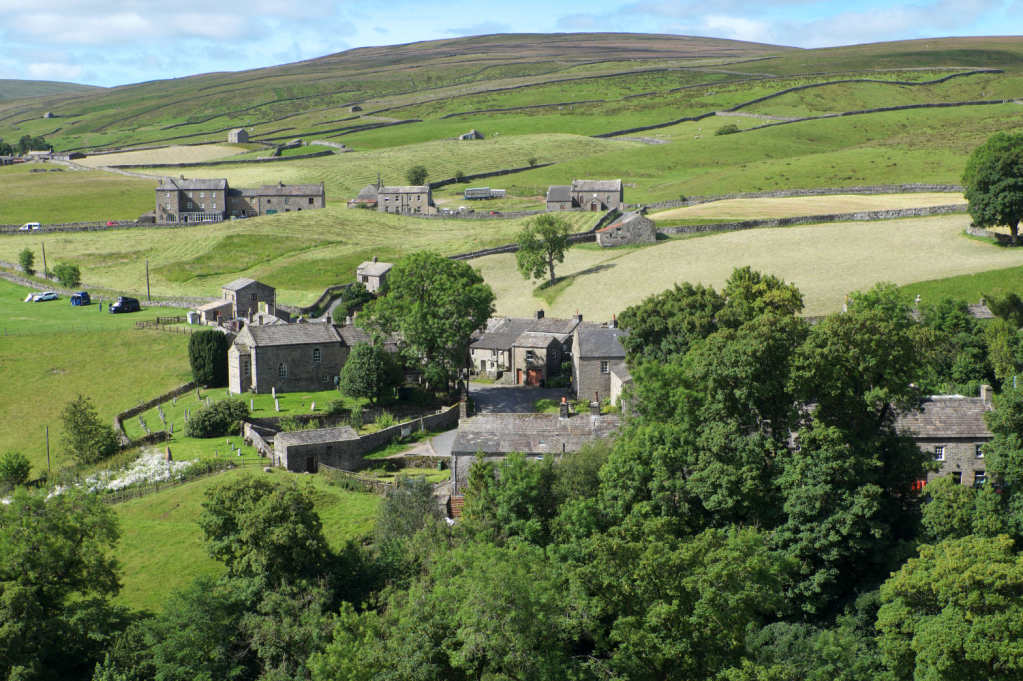
The Yorkshire Dales village of Keld. Credit: Vivienne Crow
Accommodation
What could be better after a long, hard day on the trail than rocking up at a welcoming inn, complete with roaring fire and cosy bedroom, knowing that dinner’s sorted for the night and breakfast is going to be cooked for you in the morning? With the route passing through several towns and villages, there are several pubs along the way as well as simpler B&Bs, guesthouses and campsites. YHA hostels still exist at Edmundbyers and at Langdon Beck in Upper Teesdale, and there are independent hostels and bunkhouses in places such as Alston, Kirkby Stephen, Garrigill and Wolsingham. For those carrying backpacking gear, the longest stretch between settlements – the 31km from Dufton to Alston – can also be broken at the MBA’s Greg’s Hut bothy on Cross Fell.
Some words of warning… If you’re following the National Landscape’s recommended 14-day itinerary, there’s limited accommodation near Saur Hill Bridge at the end of day 10. Opportunities are even more restricted at Tan Hill, where it’s the pub or nothing. Camping is allowed for a small fee though and there’s also a bunkhouse here. If you decide to break the journey at Keld, you’ll be competing with hikers on both the Coast to Coast and the Pennine Way for the few beds and camping pitches. If the camaraderie of long-distance walking is something you value though, book ahead; I’ve spent many happy evenings at Keld Lodge, swapping trail tales with other tired but enthusiastic hikers.
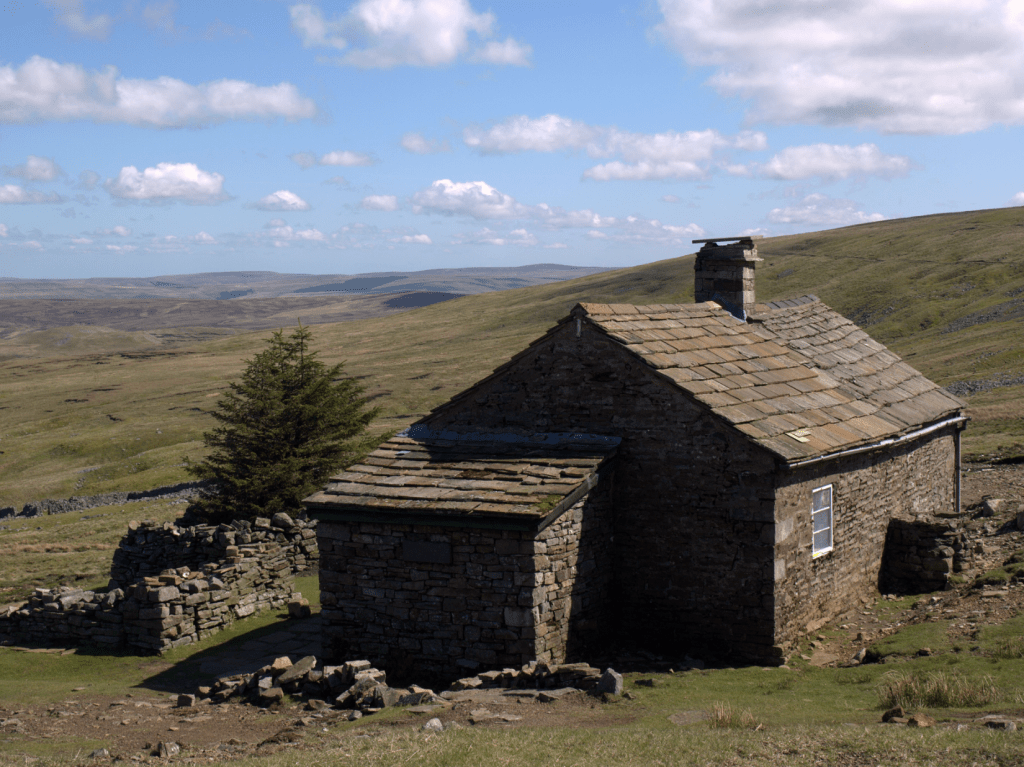
Greg’s Hut. Credit: Shutterstock
Resupply
The route passes through several towns and villages where backpackers can stock up on supplies, but this is remote country so don’t expect 24-hour supermarkets. Be prepared for limited stock and unusual opening hours; the tiny Village Store and Post Office in Blanchland, for example, shuts early afternoon.
The nearly 90km stretch between St John’s Chapel and Kirkby Stephen is particularly isolated and requires more forward thinking, with Middleton-in-Teesdale providing the only retail oasis on this section.
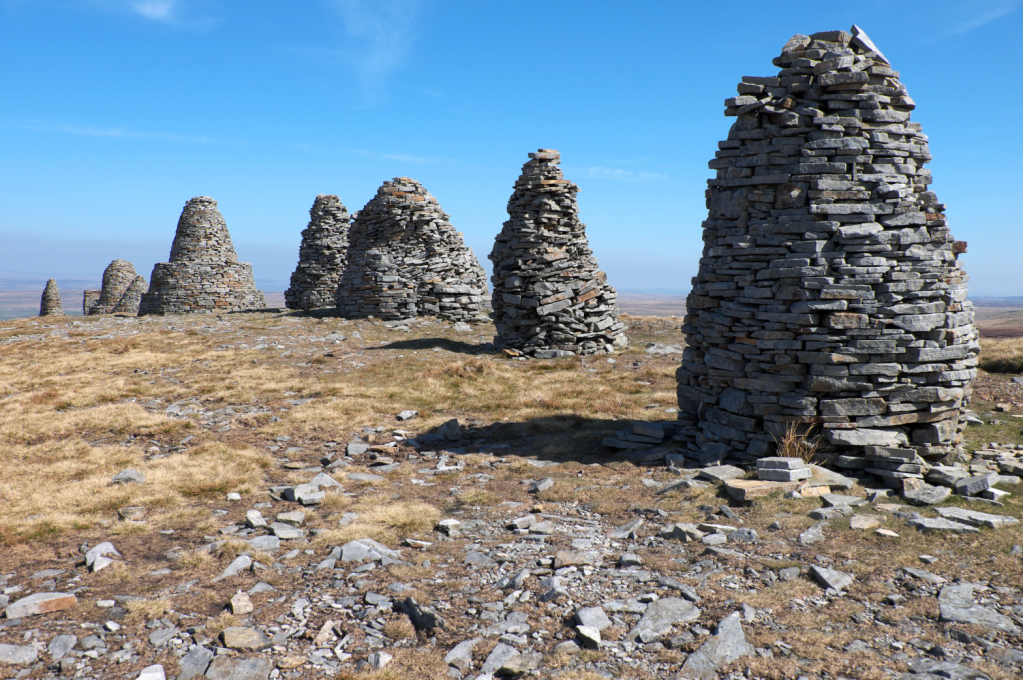
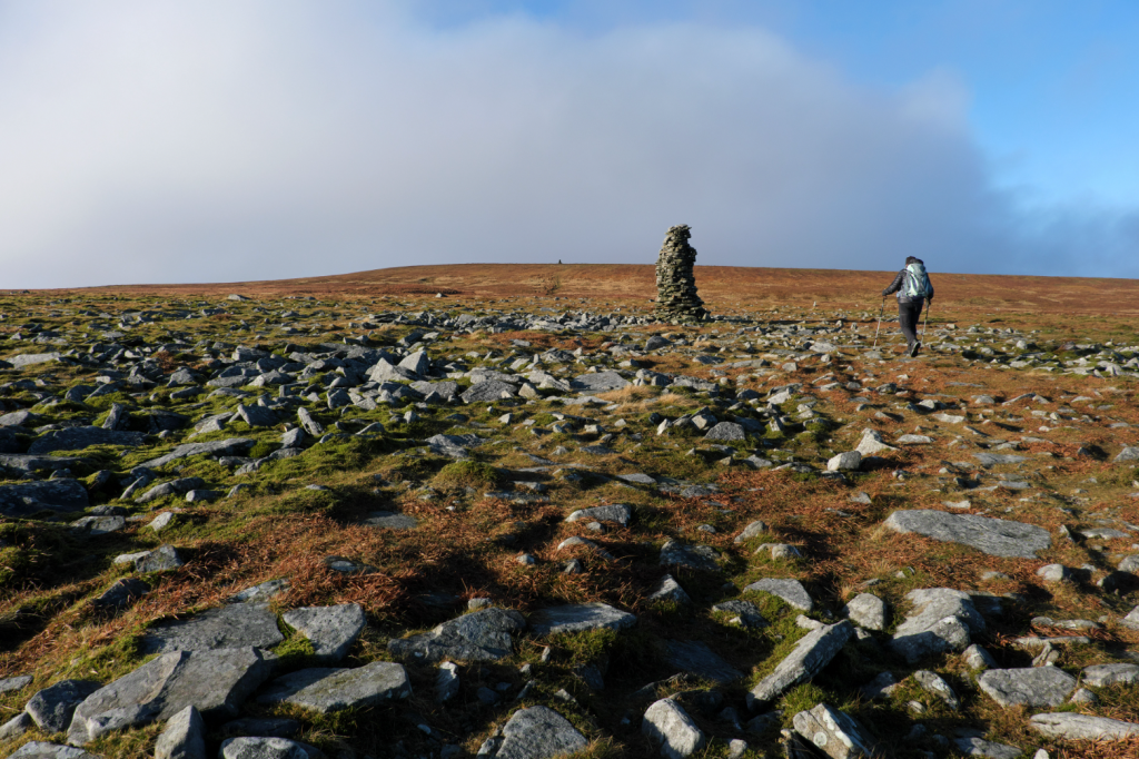
The Nine Standards above Kirkby Stephen. Credit: Vivienne Crow
Essential gear
Whether camping or staying under more solid roofs, you’ll need all the usual equipment for a multi-day hillwalking trip that takes you into remote areas often many hours from the nearest settlement. If you’re relying on your phone for navigation, take a power bank – and, better still, good old-fashioned paper maps as a back-up.
Whatever time of year you choose to complete the route, be prepared for potentially harsh weather – with waterproofs, boots and tent able to tolerate strong winds and wet conditions. Gaiters are highly recommended.
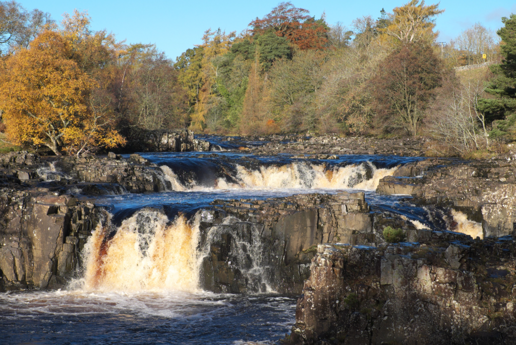
Low Force on the River Tees. Credit: Vivienne Crow
The Roof of England: Further resources
The North Pennines National Landscape’s new website – www.roofofenglandwalk.org.uk – is an excellent resource with practical information on planning as well as features on subjects as diverse as adders, hay meadows and historical features. Work on adding an accommodation section is currently underway.
To get you in the mood for full immersion in the North Pennines, pick up a copy of Alfred Wainwright’s A Pennine Journey, written after his solitary amble through the region on the eve of World War Two. For a more modern take, the 2021 book I Belong Here tells of Anita Sethi’s bid to reclaim the landscapes of the Pennines after becoming the victim of a race-hate crime.
Discover more long distance trails as mapped by our expert contributors.


