
Norman Hadley scrambles the East ridges of two underappreciated Lakeland pikes – Nethermost Pike and Dollywaggon Pike.
In hindsight, it was rather unwise of Nethermost and Dollywaggon Pikes to set up camp in Helvellyn’s shadow. So underappreciated are these two heights that, contouring just below their summits, you can trace the boot-tracks of thousands hurrying to the famous parent fell. But these are fine tops in their own right; Nethermost is Lakeland’s ninth highest, after all, and Dollywaggon ranks a respectable eighteenth. If the name Dollywaggon sounds faintly ridiculous to you, it probably helps to translate it via Old Norse into something like “raised fiend.” That should stir the blood of your inner Viking.
Both fells present tremendously craggy slopes to the east, each with its own sharp ridge. For this reason, they are best approached from the Grisedale side: the Thirlmere flanks may offer a rich salad to a hungry sheep but there is little on these slopes to tempt the mountaineer. Our route links the two eastern ridges, with intimate insight into the wild coves between. This makes a fine expedition on any day, but an especially beguiling one when Striding and Swirral Edges are adorned with silhouetted paper-chains of walkers.
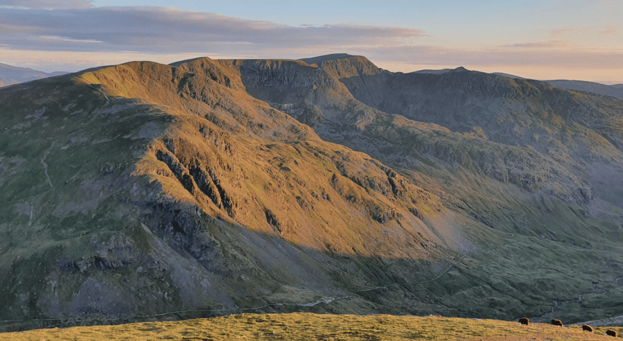
Main image: In this dawn view from Fairfield, the ridges of Dollywaggon and Nethermost Pikes show in profile | Credit: Norman Hadley
Nethermost Pike and Dollywaggon Pike: route description
START/FINISH: Grisedale Lane, Patterdale (GR: NY390161) | MAPS: OS Explorer North-Eastern Lake District OL5 (1:25k), Harvey Ultra Map Lake District East (1:40k) | DISTANCE: 13.7 km / 8.5 miles | ASCENT: 935m / 3,060ft | DURATION: 4 hours
1. NY390161: The route is laid out it as an elongated figure-of-eight with Nethermost first because descending this ridge would be uncomfortably steep, with a potential plummet from Eagle Crag waiting at the bottom: not somewhere to step off without a 2-metre wingspan. We’ve also assumed the good track up the valley because you’ll be eager to get to the fells quickly, and with dry socks, but happy to take the return leg at a more leisurely pace. Set off up the lane from the old police station. Despite starting on tarmac, this is a lovely introduction, with the sound of the rushing waters rising up from the deep wooded dell on your right.
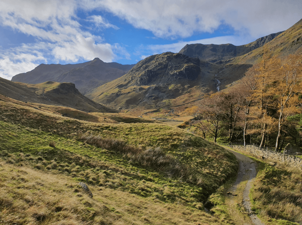
The snaking path that leads to adventure. Credit: Norman Hadley
2. NY383157: After a kilometre or so, ignore the right turn to Helvellyn. Make a mental note of this, though: you’ll be returning by this route. Pass a distinctively flat-topped boulder that serves well as a picnic table or photographic foreground, depending on your needs. In a similar vein, keep an eye out for the gable end of the barn just after Elmhow, and note how satisfyingly it echoes the pyramidal form of Dollywaggon Pike.
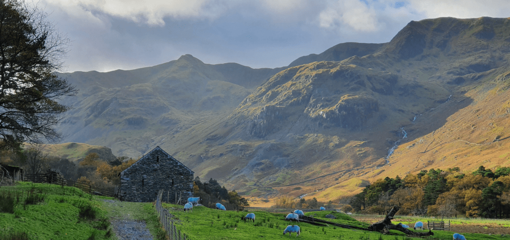
The Elmhow barn, echoing the profile of Dollywaggon Pike, with Nethermost on the right. Credit: Norman Hadley
3. NY364144: Three-and-a-half kilometres from the start, veer from the bridleway, taking the right fork across the valley floor, via a footbridge, towards the colossal hanging valley of Nethermost Cove, with its tumbling cascades. You’re in luck: you’re headed that way.
4. NY361144: Cross the smaller track traversing the north side of the valley (this track is your route back) and head steeply up into the cove. It’s easier on the left side of the wall. At this stage, any vestigial trods you can find should be considered a bonus: you’ve only just left a well-known bridleway, but the cove has a properly wild feel. Not long after the waterfalls (around the 500m contour) swing left onto the ridge proper, above the craggiest section. At first the ridge is broad-based, but it gradually gains definition, finishing with a visually-arresting arete that is nonetheless straightforward. Follow this steeply up to the summit, which proves to be a stark change of terrain from acute ridge to bowling-green plateau.
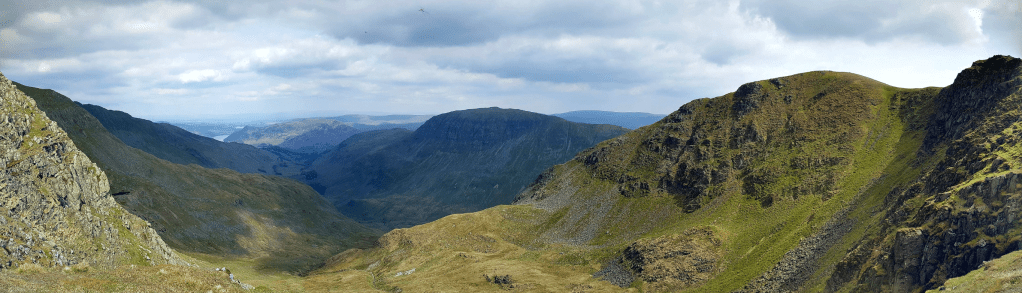
Looking down into Ruthwaite Cove, with the east ridge of Dollywaggon on the right. Credit: Norman Hadley
5. NY344141: Follow the escarpment south, over the subsidiary summit of High Crag. This is an even more overlooked summit than the two Pikes, being 910 metres high but missing out on Wainwright status and so receiving scant attention. The views from here, with the ground falling away from your toes to the pastures of Grisedale, are tremendous. Keep skirting the precipitous edge of Ruthwaite Cove, all the way to Dollywaggon Pike. A point of interest here is that Dollywaggon scatters its waters as far as any Lakeland fell: to Newby Bridge via Grasmere, to Carlisle via Ullswater and, thanks to the altered watershed around Dunmail Raise, to Workington via Thirlmere.
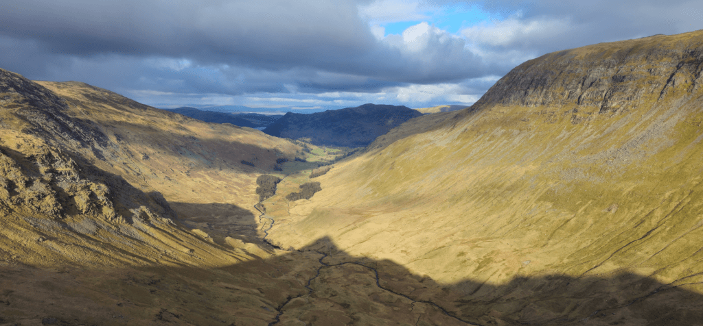
Looking down Grisedale from Dollywaggon Pike, its shadow laid at its feet.. Credit: Norman Hadley
6. NY346131: Drop down the sharp nose of the eastern ridge, marked “The Tongue” on Ordnance Survey maps. As with Nethermost, this is visually impressive but not difficult, and it soon broadens. The way is steep, rough and paths are sketchy, but it’s not perilous, so long as you give Spout Crag a wide berth at the bottom, veering to your left.
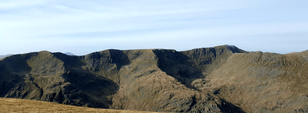
The eastern ridges seen from St Sunday Crag. Helvellyn and Strifding edge are seen to the right. Credit: Norman Hadley
7. NY360143: At the climbing hut of Ruthwaite Lodge, close to where you began the serious ascent at point (4), pick up the northern valley path and head back down the dale, crossing your footprints from earlier. This track leads charmingly down the northern edge of the flood-plain.
8. NY382160: Take a right by the small wood of Brownend Plantation, where the Striding Edge path comes slanting down from Helvellyn. Drop to the little bridge across Grisedale Beck to point (2) and retrace your steps down the tarmac lane.
Further information
PUBLIC TRANSPORT: Stagecoach bus 508 or, for extra panache, arrive by steamer from Pooley Bridge (with a short walk from Glenridding to Patterdale)
TOURIST INFORMATION: www.visitlakedistrict.com, 01539 822222
More to explore: mapped walking routes in the Lake District


