
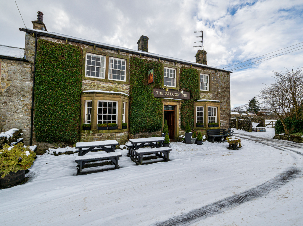
Ian Battersby finds a warm welcome after a nippy march in the tracks of monks and military machines on this route of Mastiles from The Falcon Inn, Arncliffe, Yorkshire Dales.
The Falcon Inn is set on the alluring village green of Arncliffe, an inviting Yorkshire Dales village in little Littondale, where the lovely River Skirfare trundles past to meet the wider Wharfe. In summer the green is the place to chill, but in winter the pub lures lovers of the cooler dales into a warm embrace. The pub is surrounded by hills packed with geological riches and remarkable history, and die hard Emmerdale fans will be cheered to know that this comforting retreat was also the soap’s original inn.
This route begins by climbing Yew Cogar Scar using the “Monk’s Road” path. The monks to and from a distant Fountain’s Abbey near Ripon when the monastery owned vast territories employed in sheep farming and warming wool production. There are no true mountains just here, but these heights surge from the southern reaches of the Dales, and the views range beyond immediately delightful dales into a far reaching southern panorama. Mastiles Lane (track) is an old Roman marching route, slinking past an old camp before sinking into Kilnsey whose crag leans over Wharfedale in a limestone frown that must reflect the furrowed brows of those who dare to climb here.
Mastiles from The Falcon Inn: route description
START/FINISH: Falcon Inn Arncliffe; SD931718 | MAPS: OS Explorer OL2 (1:25k), OS Landranger 98 (1:50k) | DISTANCE: 22.4km / 13.9 miles | ASCENT: 500m / 1640ft | DURATION: 7 hours
1. SD931718: Take the track to the right of the Falcon Inn heading S but turning W to a bend. Follow the bend SW to the next turn where the track swings SSE. Go round the bend, but take the Monk’s Road path SSW and climbing to 250m, where the ground rises sharply. The path veers SW, taking the climb at a diagonal, and rises above Cowside Beck and Yew Cogar Scar.
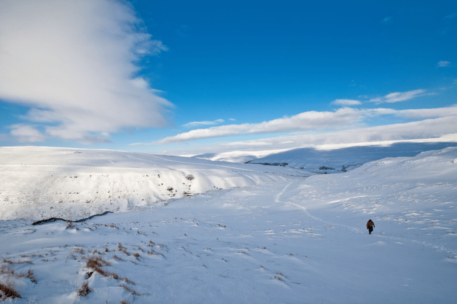
Old Cote Moor Top from Yew Cogar Scar. Credit: Ian Battersby
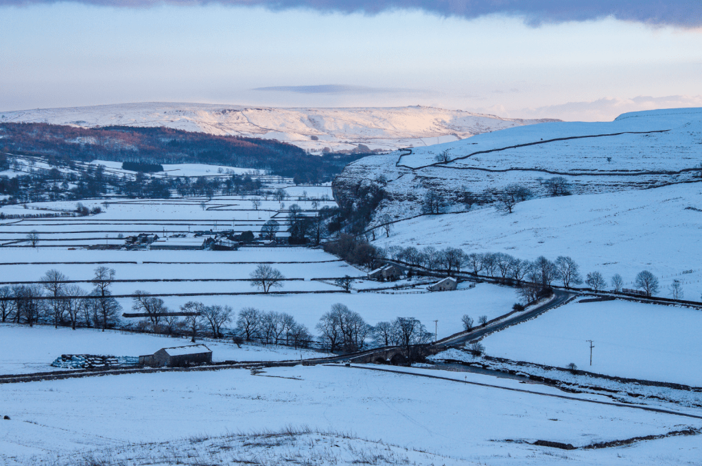
The views into this chasm and the upper reaches of Littondale are difficult to beat, especially when the land is snowbound and lit by glancing winter sun. Continue to climb past Falcon’s Cave (do keep a look out for peregrines) and Dew Bottoms, where the climbing lessens as the path turns into bridleway and veers S through limestone outcrops to reach Middle House at High Midge Hill.
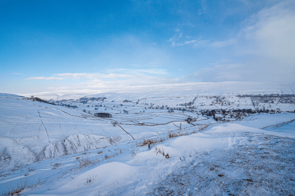
Old Cote Moor Top from Dew Bottoms. Credit: Ian Battersby
2. SD907681: Pass to the right of Middle House, veering SW to a track T-junction. Turn left, keeping to the bridleway, which bends S after 100m to pass Middle House Farm on the left, and joining a good track that serves the farm. Follow this S for 800m, where it swings SW alongside and past Cow Close Hill to reach a stand of trees where the track forks. Take the right, more obvious, fork S to meet the end of a road at Street Gate and the start of Mastiles Lane.
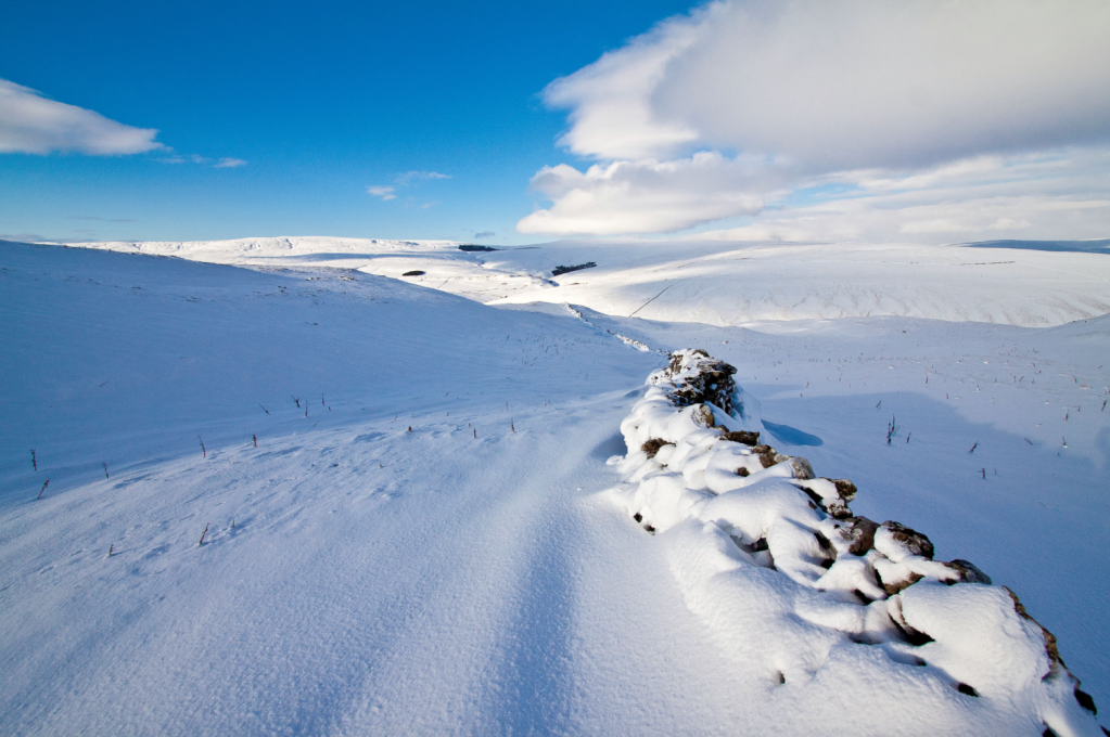
Wall in a snow drift at Out Pasture. Credit: Ian Battersby
3. SD905656: Mastiles Lane track heads E on bridleway, crossing Gordale Beck, and passes through the ramparts of an old Roman Camp after 1km. After another 1.5km the track veers ENE at a junction with another track joining from the S. Continue ENE to a fork in the bridleway. Take the left fork for Kilnsey, heading NE across Kilnsey Moor and climbing slightly to 423m, where Mastiles Lane begins a long descent. Drop generally NE for 2.5km to reach Kilnsey and head past houses for the B6160.
Kilnsey Crag and Wharfedale. Credit: Ian Battersby
4. SD975678: Head N along the B6160 with the iconic Kilnsey Crag towering up on the left. Staring up at the immense overhang it’s easy to imagine the glacier that filled the dale, scraping past and undercutting the cliff, and carrying its boulders far away, downstream. After 1km the road bends right at a junction and crosses Skirfare Bridge to a second side road. Either take this side road left or continue to a bridleway on the left just a little further up the rise.
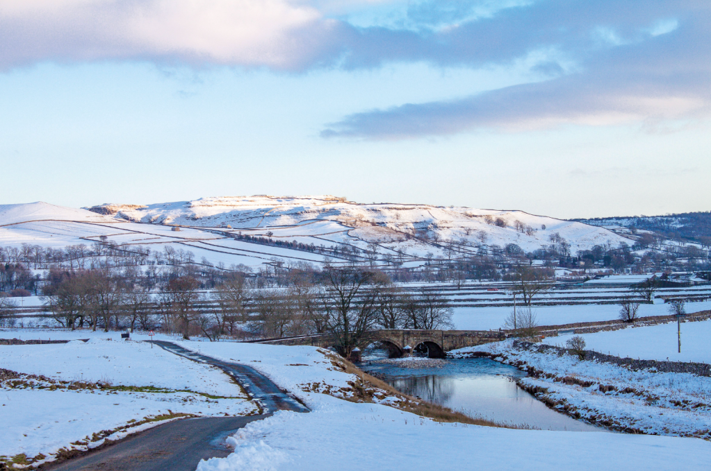
Skirfare Bridge, Wharfedale. Credit: Ian Battersby
5. SD973694: The bridleway heads NW to join the lane, but its higher position enjoys superior views down Wharfedale past the overhanging Kilnsey Crag. It’s worth climbing further up High Windy Bank on the right to improve this view even further. Continue NW along the lane, passing between two small tree plantations, with the River Skirfare down on the left. The lane soon reaches the tiny hamlet of Hawkswick. Ignore the side road here, and continue straight on past the cottages to a footpath bridge on the left.
Take the track right of the Falcon Inn. Credit: Ian Battersby
6. SD952707: Cross the bridge and follow the path right, heading NW through fields to re-join the Skirfare at a prominent loop in the river. Continue NW as the river bends away again, but re-join it after passing a stand of trees on the right. Now the path follows the river upstream, veering left as it approaches Arncliffe. Follow the path between houses and past the church to reach the road in the village. Turn left, following the lane S to a T-junction at the village greens. Turn right for a deserved knees-up and rosy smiles in the pub
Further information
PUBLIC TRANSPORT: None to start
TOURIST INFORMATION: Skipton, 01756 706397


