
Fiona Barltrop recommends a trip across the Solent to Limerstone Down and Hanover Point for some invigorating sea air and exhilarating walking by ferry then bus.
Regular viewers of Ben Fogle’s New Lives in the Wild might have raised an eyebrow earlier this year when instead of the usual far-flung destinations it was the Isle of Wight that was the location for one particular episode. In it, Ben met a couple and their son who had ‘carved out their own slice of wilderness on a cliff side’. Coastal erosion caused by landslips and weathering is a fact of life here, causing the island to shrink a little every day, and their home (on the southern tip) remains at risk…
This walk combines an outward leg along the top of the Downs following a stretch of the Tennyson Trail with a return along the Coastal Path. The Isle of Wight couldn’t be easier to get to with over 200 car ferry crossings a day from Portsmouth, Southampton and Lymington, all of which have train stations. There’s also a passenger catamaran from Portsmouth to Ryde and a hovercraft service. And it’s easy to get around without a car with both an excellent bus service, and a train service, too.
Limerstone Down, Isle of Wight: route description
START: Warnes Lane car park, Brighstone GR: SZ427827 or Brighstone bus stop | MAPS: OS Explorer OL29 (Isle of Wight); Landranger 196 | DISTANCE: 23km/14¼ miles | DURATION: 7 hours | ASCENT: 515m/1690ft
1. SZ427827: From car park walk back up lane to main road (B3399) – on the right is the Three Bishops pub, so named because three of Brighstone’s past rectors later became bishops. Turn left and then right along North Street. The picturesque thatched cottages include a free museum, worth a look inside when it’s open. At the T-junction you could cross and go straight on up the bridleway but for better ascent views turn right along the lane to the B3399. Just before it turn left at a footpath signed for Brighstone Forest heading up a concrete track and continuing up the right-hand side of the field to a stile and gate. Carry on up the grassy track which heads diagonally left uphill, joining a bridleway and turning right up to a gate in the top right-hand corner.

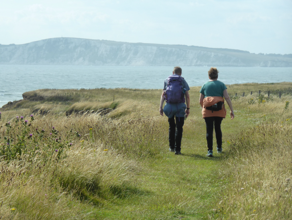
View back over Freshwater Bay heading up Afton Down nr start. Credit: Fiona Barltrop
2. SZ433832: Go through and turn left along the enclosed bridleway. Keep ahead, going through a gate and on up the open downland slopes to the top of the chalk ridge.
3. SZ434840: Although the main route turns left along the ridge-top track here, it’s worth a short detour to the right to the Limerstone Down viewpoint (toposcope), over to the right of the track. Continuing westwards, before long the Tennyson Trail joins from the right. It takes its name from the Poet Laureate, Alfred Lord Tennyson, who lived in Freshwater Bay for many years. Carry on down beside Brighstone Forest to the road. Turn right, then left through a car park and on up Mottistone Down, part of the National Trust’s Mottistone estate. There are excellent views from on top, the chalk cliffs of Tennyson Down in the distance. Note, too, the Bronze Age barrows (burial mounds). From them continue downhill to another road.
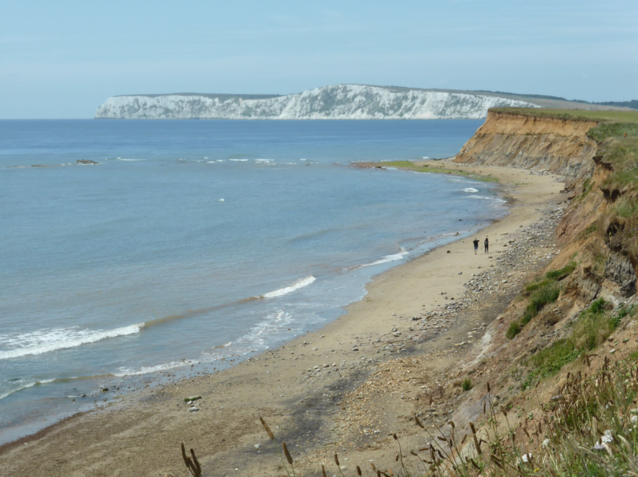
Walkers on the Coastal Path, Tennyson Down in the distance. Credit: Fiona Barltrop
4. SZ396851: Once again turn right, then almost immediately left and head on uphill again, still following the Tennyson Trail, but bear right to head directly up to the trig point and view atop the Five Barrows. The group of barrows is marked as five on the OS map, although there are a few more, with at least six obvious mounds. The fine view from up here takes in both the north and south coasts of the Island. Rejoin the Tennyson Trail and maintain direction over Brook and Compton Downs. Watch out for golf balls as you cross the Freshwater Bay Golf Club course. At a fork on Afton Down bear left down to the main road and either cross and pick up the Coastal Path down to Freshwater Bay or walk down beside road (verge, then pavement).

Chalk stack & cliffs, Freshwater Bay. Credit: Fiona Barltrop
5. SZ346857: Follow the Coastal Path* from Freshwater Bay E/SE via Compton and Brook Bays to Chilton Chine, a small coastal gully, a feature along the Isle of Wight’s coastline. The large white building on the other side is the Isle of Wight Pearl Centre, a tourist attraction (formerly the Chilton Chine Holiday Camp). There’s a café here, too, with views out over the sea.
6. SZ409822: Steps lead down to the beach, but the Coastal Path turns inland to a small car park and the main road. Cross and follow the track opposite to Chilton Green. On joining the lane, keep ahead past Chilton Farm on the right. Take the next bridleway on the right (also signed Coastal Path – an inland detour due to coastal erosion). Cross the next lane, and at the following road, turn briefly right, then left past the Methodist Church back to the car park.
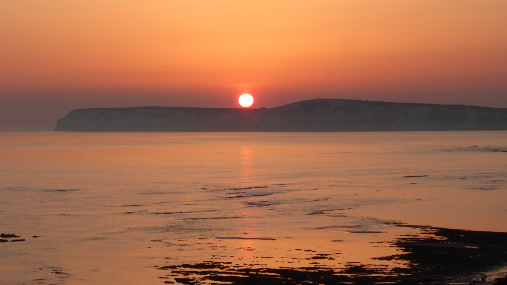
Sunset over Tennyson Down from the Coastal Path. Credit: Fiona Barltrop
* A short stretch of this over Freshwater Cliff is currently officially closed (alternative signed option) but it is possible to avoid it by walking with care along the verge of the Military Road.
Further information
PUBLIC TRANSPORT: Wightlink car ferries between Portsmouth & Fishbourne and Lymington & Yarmouth; passenger catamaran from Portsmouth to Ryde, 0333 999 7333, www.wightlink.co.uk . Bus services: islandbuses.info/services.
TOURIST INFORMATION: Brighstone Tourist Information Point (01983 740843), visitisleofwight.co.uk
Walk more routes in South England, as mapped by our experts.


