
Stefan Durkacz finds the familiar hills of White Coomb around Loch Skeen transformed by the icy grip of winter.
If you need a quick hill fix in easy reach of Scotland’s central belt, especially in winter when daylight hours are short, the Moffat hills are an obvious destination. This is excellent tramping country at any time of year. Although mostly lacking the raw grandeur of the Highlands there’s a great sense of space and it’s possible to cover long distances on those easy, rolling crests. It’s in winter, however, when snow and freezing winds strafe the tops, that these hills start to feel like mountains. This short route incorporates bracing high-level walking over the Corbett of White Coomb and its neighbouring tops with a visit to Loch Skeen, set in a fine, craggy amphitheatre that wouldn’t look out of place in the Cairngorms.
There’s also the steep approach by the famous Grey Mare’s Tail waterfall, feeding its waters into the upper reaches of magnificent Moffat Dale, rounding out the walk with more drama and variety. When the Highlands are out of reach, this is a more than satisfying alternative – and you’ll be home in time for tea.
White Coomb and Loch Skeen: route description
Start/Finish: National Trust for Scotland car park for Grey Mare’s Tail, A708 (GR: NT186145) |Maps: OS 1:50,000 Landranger sheet 79 (Hawick & Eskdale); OS 1:25,000 Explorer sheet 330 (Moffat & St Mary’s Loch) | Distance: 11km/7 miles | Ascent: 740m/2428ft | Duration: 5-6 hours
1. NT186 145: From the car park, take the well-made path that crosses the Tail Burn and climbs the hillside to the R above the Grey Mare’s Tail waterfall. This initial section is steep but the path is distinct, well-drained and rarely muddy so progress is straightforward. The ground falls away steeply to the left towards the deep cauldron at the foot of the falls. It’s best to keep firmly on the path with dogs on the lead especially in wet or wintry conditions as the steep ground off-path can be slippery.
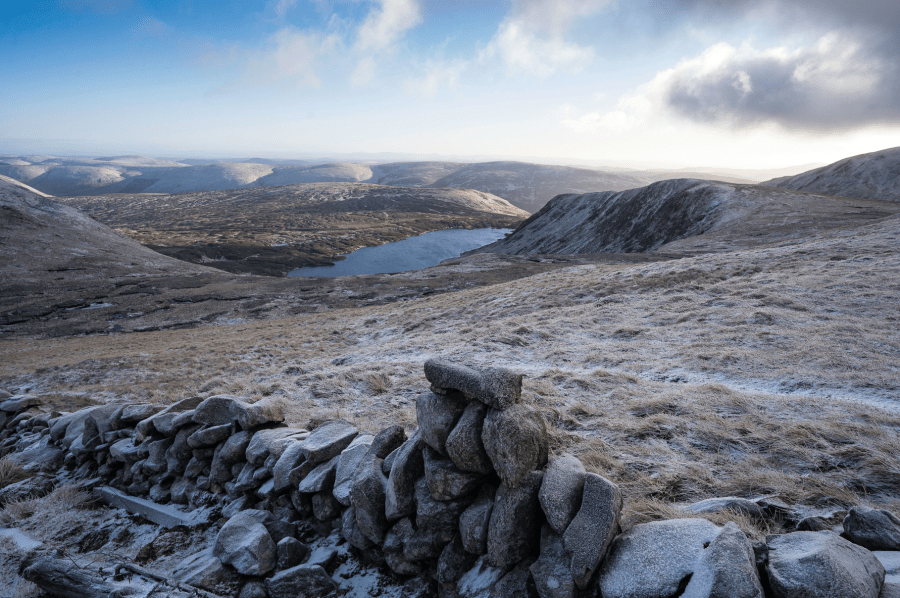
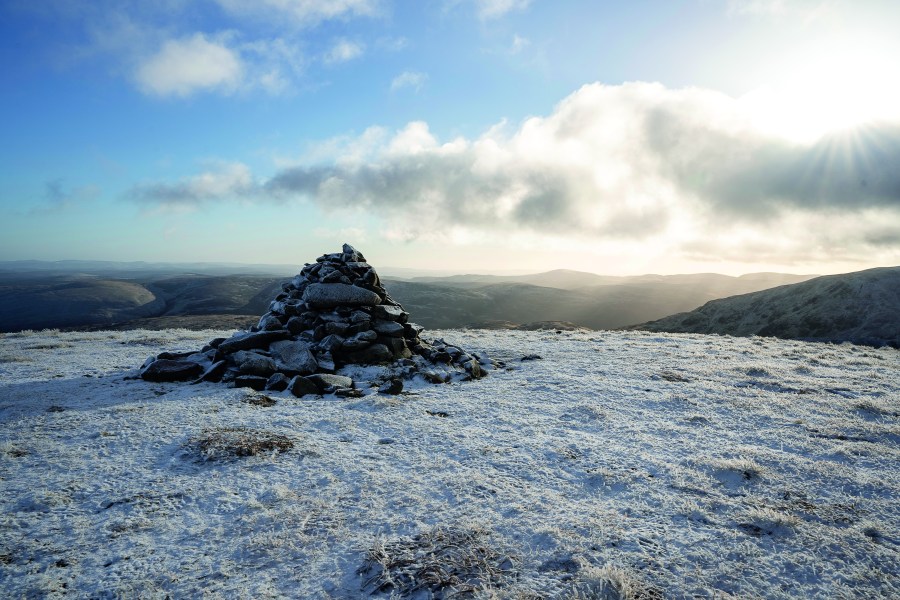
Approaching White Coomb from the east.
Credit: Stefan Durkacz
2. NT180 152: Above the uppermost waterfall, the gradient eases and the path levels out by the Tail Burn flowing out of Loch Skeen. Turn L off the path to ford the burn – please note this crossing can be tricky when the burn is running high. Once across, follow an old tumbledown wall to Upper Tarnberry (546m), then up steeper, craggy ground by Rough Craigs. A little bit of zig-zagging is needed on the climb to turn some of the outcrops, but hands should not be needed. Once on easier terrain above, follow the broad crest to the summit cairn of White Coomb (821m).
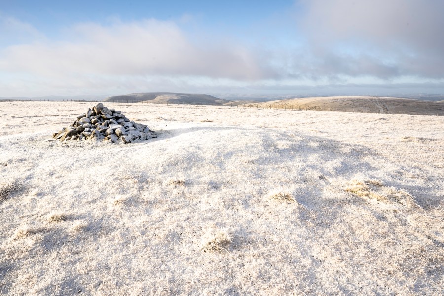
The freezing summit of White Coomb.
Credit: Stefan Durkacz
3. NT163151: In true Southern Uplands fashion, the route now largely shadows fences and ruined walls along the broad, grassy ridgelines. From the summit cairn of White Coomb bear NW, cross a fence and pick up another fence heading WNW across a shallow col then gently up to Firthhope Rig (800m). At a junction of fences just north of the top, turn right, following the fence line NNE passing just east of Donald’s Cleuch Head (776m) then over Firthybrig Head (766m) to another junction of fences. Loch Skeen is now in view on the right in its deep hollow.
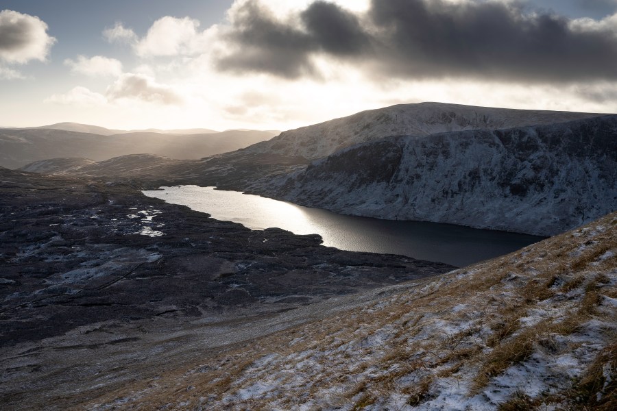
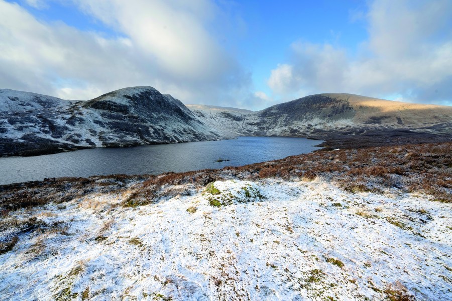
Loch Skeen catches the sun on the descent from Lochcraig Head.
Credit: Stefan Durkacz
4. NT159172: Follow the fence that bears right and head steeply downhill to the col of Talla Nick. Keep with the fence up the steep hillside opposite. As the slope levels out bear slightly left away from the fence to find the summit cairn of Lochcraig Head (801m). Enjoy the fines views east towards the billowing sea of hills around St Mary’s Loch.
Lochcraig Head summit cairn.
Credit: Stefan Durkacz
5. NT167176: Continue SE to pick up a fence and tumbledown old drystone wall that run side by side. Don’t try to descend south immediately from the summit of Lochcraig Head as there are dangerously steep crags above the head of Loch Skeen. Instead, follow the fence and wall as they more gradually bend south and down a steep, grassy slope safely to the east of the crags.
Loch Skeen, Mid Craig and Lochcraig Head.
Credit: Stefan Durkacz
Loch Skeen emerges below on the right from its deep hollow in the hills. At the foot of the slope continue along a rough boggy path by the wall, working your way down to the outflow of Loch Skeen. Here, pick up the well-made tourist path by the Tail Burn and follow it back to the starting point at the National Trust car park.
Further information
Public transport: None to start
Tourist information: Edinburgh VisitScotland iCentre (Tel: 0131 473 3820)
Explore more walks in Scotland, as mapped by The Great Outdoors’ expert contributors.


