
Ian Battersby spends time with Bowscale Tarn on and is gifted a novel approach to the fells – Bowscale Fell and Bannerdale Crags – above.
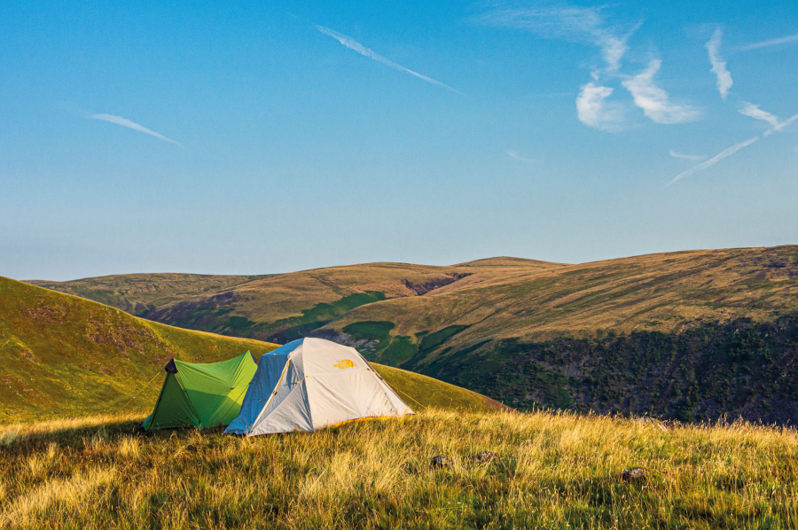
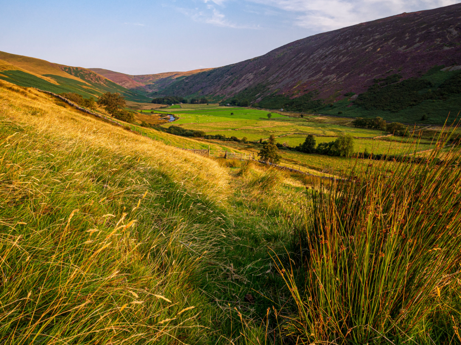
The River Caldew runs through level, verdant pastures beneath contrasting fell-sides, and the valley faces dawn sunlight that warms its attendant golden grasses and fragrant ferns. Carrock Fell opposite is steep and scarred, with dark heather holding sway in sketchy niches. Our path traverses the milder southern slopes, culminating in unexpected rewards. Bowscale Tarn’s tranquil waters reside in a hollow beneath sudden, verdant crags, all hidden by a sizeable ramp, the top of which gifts flat ground for wild campers with an open view of hill, dale and tarn.
Lingering here reveals an uncertain path along a natural green shelf, camouflaged among Tarn Crags, making an audacious route to Bowscale Fell. From the summit, Skiddaw’s gentle giant gradients contrast with thrilling crags that make Blencathra stab into southern sky. Bannerdale Crags lie within easy reach and its north-east ridge brings another moderate scramble for the final descent.
Bowscale Tarn and Bannerdale Crags: route description
START/FINISH: Layby just south of Bowscale; NY359316 | MAPS: OS Landranger 90 (1:50k), Harvey Superwalker XT25 (1:25k) | DISTANCE: 11km / 6.8 miles | ASCENT: 550m / 1,805ft | DURATION: 4 hours
1. NY359316: Follow the road north-west past the first houses of Bowscale to a junction with an unsealed track where the road bends to the right. Continue north-west along this track and bridleway, exiting the hamlet, and continuing west, climbing very gently above the valley, with streams gurgling across the path. The track veers south-west to cross Drycomb Beck, then turns west-north-west for another 500m. Here the bridleway forks left, climbing steeply to reach the stream at Tarn Sike, from where it climbs around a small grassy ridge to reach the outflow of Bowscale Tarn hidden just beyond the ridge. Lush purple heather adds opulent purple embellishments to the lush green banks of summer, and upon the mirror of sheltered water a reflection of the grassy wall of crags that rise up beyond might twinkle invitingly.
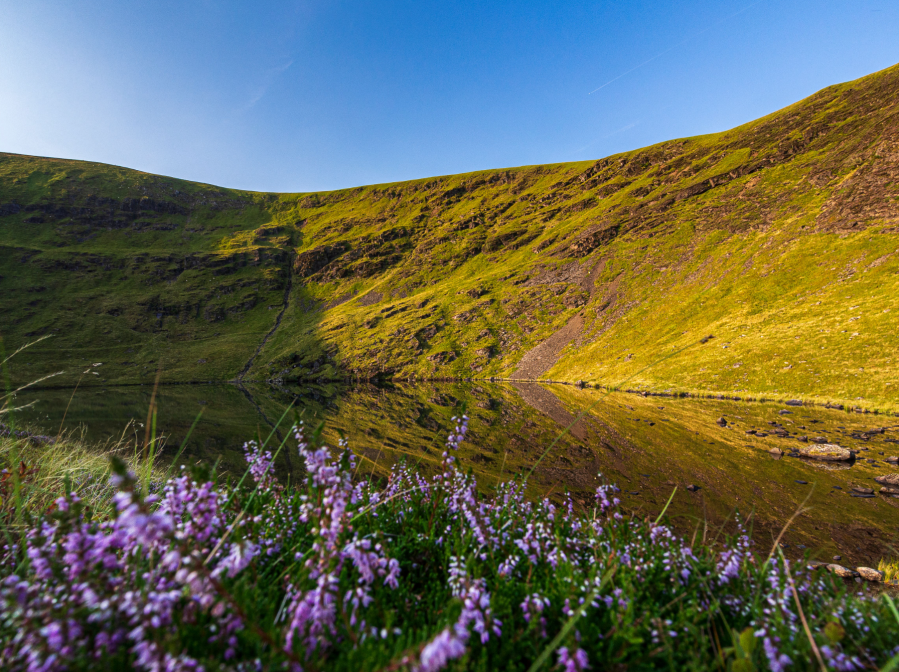
Bowscale Tarn and Tarn Crags.
Credit: Ian Battersby
2. NY336315: The usual route to Bowscale Fell heads north-west to crest the ridge that climbs south for the summit, but for spectacular bird’s eye views over the tarn head south-east along the water’s northern edge, passing lichen crusted rocks and flat grassy areas desirable for camping either sheltered low down by the tarn or catching a breeze on the elevated bank on the left. Veer south around the tarn, then veer away from the path hugging the water’s edge, and follow a less obvious path that climbs away from Bowscale Tarn into Tarn Crags, slowly veering west and traversing the steep slopes and drops along a grassy shelf that leans towards the tarn. Most of this diminutive path is straightforward, but there are occasions when care should be taken above dicey drops into the drink, best avoided in wet or windy conditions. As the path passes the tarn it becomes even less obvious. Climb more steeply west to crest the north ridge of Bowscale Fell. Climb south along this ridge, then south-west, to reach the summit shelter of Bowscale Fell.
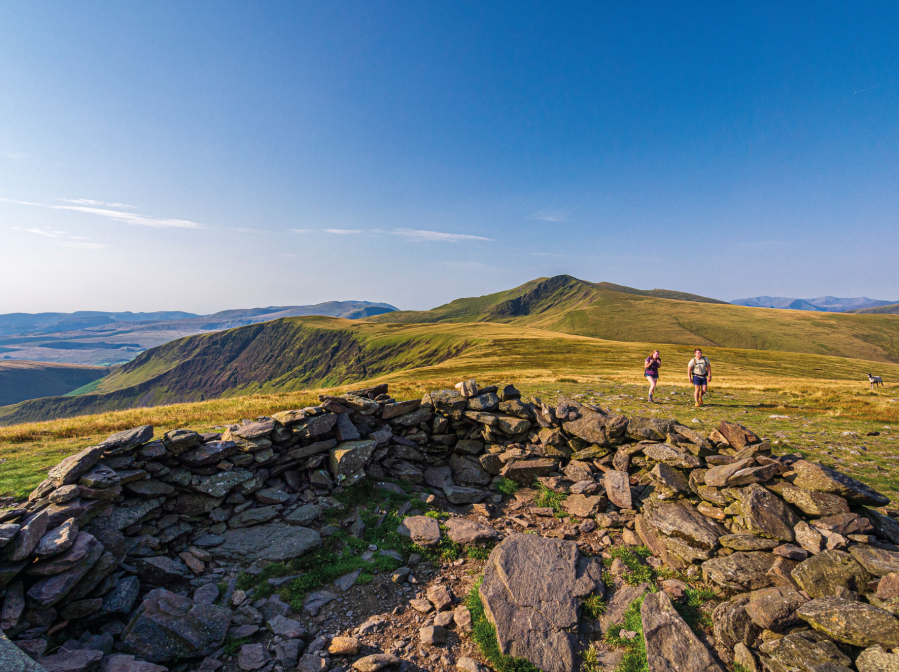
Blencathra from Bowscale Fell.
Credit: Ian Battersby
3. NY333305: Descend south-south-west down a broad grassy slope, veering south to reach the edge of Bannerdale Crags. Follow the path south, alongside the drop into the gaping valley of Bannerdale on the left, keeping to the edge and climbing south-east, veering right near the top for the summit, just a short distance from the edge. Head east for 100m to reach the top of the descent ridge, which appears to drop into the abyss from the edge. It’s nowhere near as bad as it looks, with little paths zig-zagging the steeper sections currently out of sight.
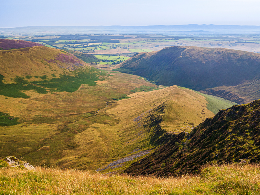
The ridge off Bannerdale Crags. Credit: Ian Battersby
4. NY336290: Follow the ridge east down to an altitude of 650m, where it turns east-north-east, becoming steep and scrambly in places down to around 550m where the gradient eases as the ridge drops to the meeting of Bannerdale Beck and the River Glenderamackin. Continue on the west bank of the river, following it north-east downstream, and negotiate a land slipped area, to reach a junction with the main track coming in from Bannerdale and Bullfell Beck. The path veers away from the river turning north-west, then north-east and south-east to cross a boggy area and returning to the river from where the track heads directly east to meet the road.
Swineside rises over the River Caldew.
Credit: Ian Battersby
5. NY362303: Follow the road east, then north through Mungrisdale, passing a chapel on the right to reach a forked junction. Keep left at the fork, signposted to Mosedale, heading north to return to Bowscale which is 1km of tarmac away, and enjoy the views of the edge of the Lakeland hills on the left and distant Pennines across the vast plain on the right.
Further information
PUBLIC TRANSPORT: None to start
TOURIST INFORMATION: Keswick TIC, 0845 9010845
NEAREST YHA: YHA Skiddaw Bunkhouse
Discover more walks in the Lake District as mapped by The Great Outdoors’ expert contributors.


