
Fiona Barltrop gets high on the lofty Noth Devonian cliffs on this Exmoorian route from Lynmouth to Combe Martin via Great Hangman and the Valley of Rocks.
Exmoor’s most spectacular scenery is to be found along the coast, nowhere more so than the westernmost stretch between Lynmouth and Combe Martin. It’s a superb, albeit strenuous, day’s walk taking in the dramatic Valley of Rocks, steep-sided Heddon Valley, its slopes carpeted with bluebells in spring, and the highest point on the South West Coast Path, Great Hangman. You’ll need plenty of stamina since the overall ascent is considerable. During the spring and summer months the open-top Exmoor Coaster bus runs between the two ends, but at other times of the year there is no direct bus service.
The attractively situated village of Lynmouth lies at the mouth of the East Lyn and West Lyn rivers, sheltered by high cliffs on either side. In the past it was a favourite resort for aristocratic and intellectual visitors, followed by middle-class Victorian holidaymakers. Its sister village, Lynton, lies above up a steep hill, a water-operated cliff railway connecting the two. The Victorians dubbed the area “Little Switzerland”.
Great Hangman and Valley of Rocks: route description
START: Lynmouth, Lyndale Cross or Lower and Upper Lyndale car park, GR: SS724494. Alternatively, Esplanade car park | FINISH: Combe Martin, GR: SS577473 MAPS: OS Explorer OL9: Landranger 180 | DISTANCE: 21.2km/13.2 miles | DURATION: 8 hours | ASCENT: 1232m/4043ft
Logistics: if there is no direct bus service running, you could base yourself at Barnstaple, take the bus out to Lynmouth and another back from Combe Martin at the end. Other options are two cars or a taxi all the way, but another solution is to park at the Blackmoor Gate car park (at the intersection of the A39 and A399) and catch the bus, which comes from Barnstaple and stops here, to Lynton. At the end of the walk, it’s only a few miles from Combe Martin by taxi back to Blackmoor Gate.
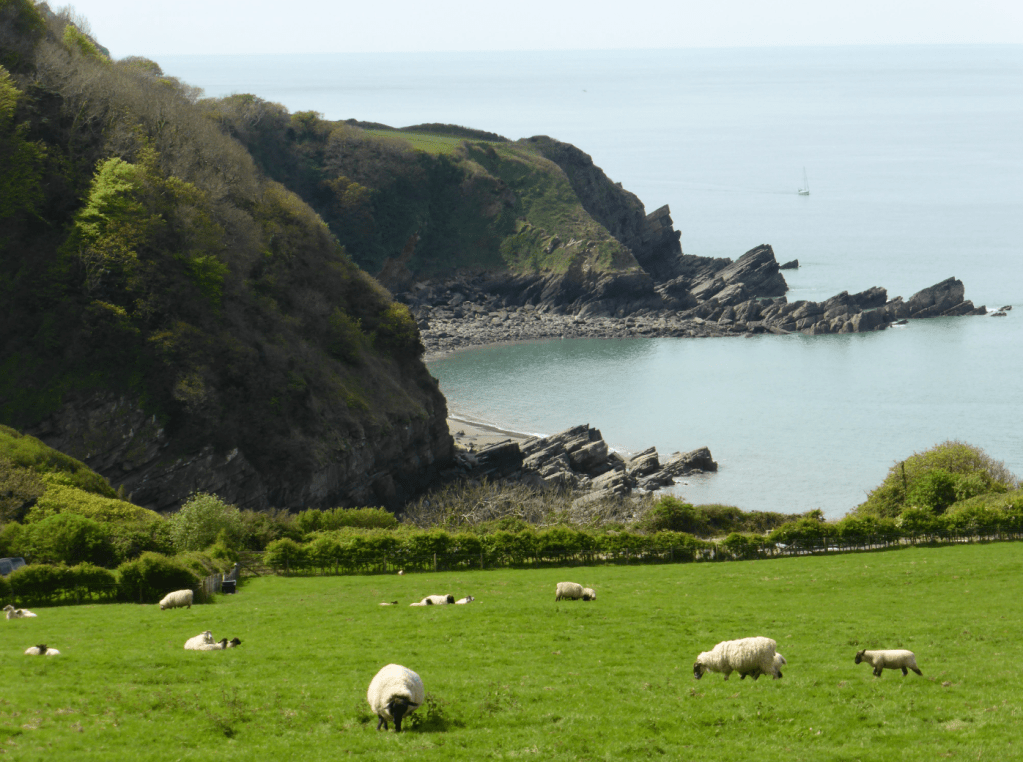
Lee Bay from nr Lee Abbey. Credit: Fiona Barltrop
1. SS724494: Leave the car park with the river on your right. Cross the main road and continue along Riverside Road. Just after Lynmouth Road joins from the left you’ll pass the Lynmouth Flood Memorial Hall on your left, opposite Lynmouth Harbour. The most dramatic event in Lynmouth’s history was the flood disaster in August 1952 when exceptionally heavy rain on Exmoor turned the waters of the East and West Lyn into enormous torrents which surged through their narrow valleys, causing devastation in their wake. Buildings were destroyed and over 30 lives lost. There is a display of photographs and other memorabilia in the Hall.
Continue to the end of Riverside Road, turning left along The Esplanade. Soon turn left up steps just before the cliff railway (which can be taken, if wished, avoiding the initial climb to Lynton). Now following the well-signed South West Coast Path (CP) the route is straightforward enough, the CP zigzagging uphill to join North Walk at the top, bearing right.
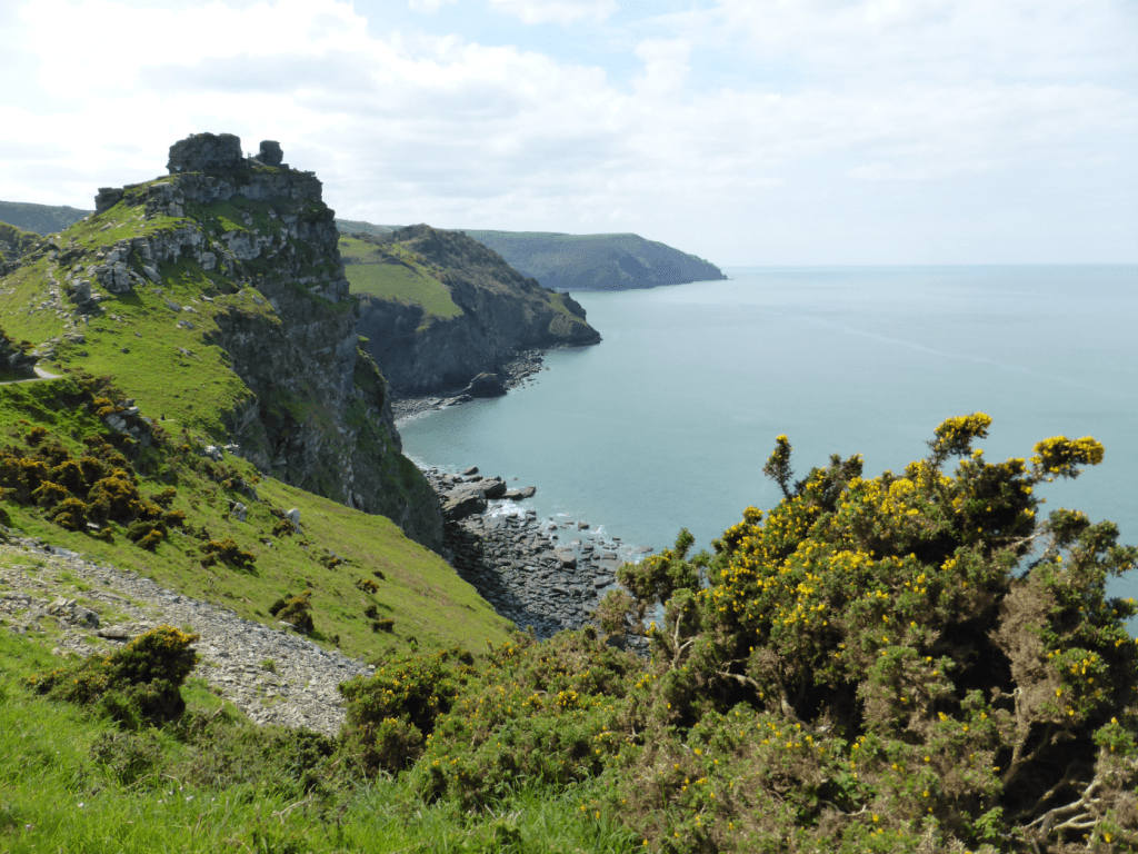
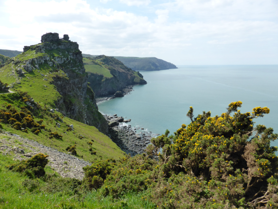
Castle Rock & coastline beyond, Valley of the Rocks. Credit: Fiona Barltrop
If starting from Lynton, with your back to the town hall, head left along the road, then left in front of the church down North Walk Hill which becomes North Walk. Follow North Walk to its end continuing on a paved path that leads to the Valley of the Rocks, one of the classic Exmoor sights. The view of Castle Rock and the coastline beyond is especially striking. Look out for feral goats around here.
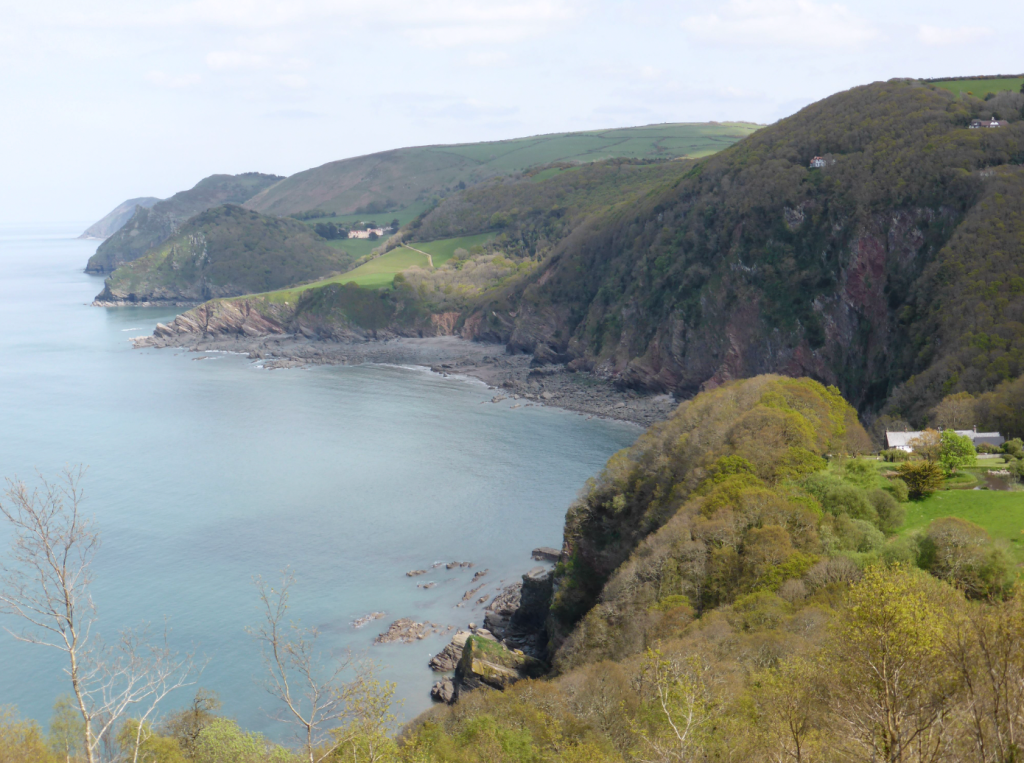
View over Woody Bay. Credit: Fiona Barltrop
2. SS705497: Continue along the CP (also the route of the King Charles III England Coast Path) which runs parallel to the road, then joins it taking you past Lee Abbey, a Christian community. Leave the road to follow the path round Crock Point, rejoining the road again along the wooded cliffs high above Woody Bay. Again leave the road, as signed, before long joining another stretch of road for a short distance. When the road bends left, keep ahead on the path through the woods.
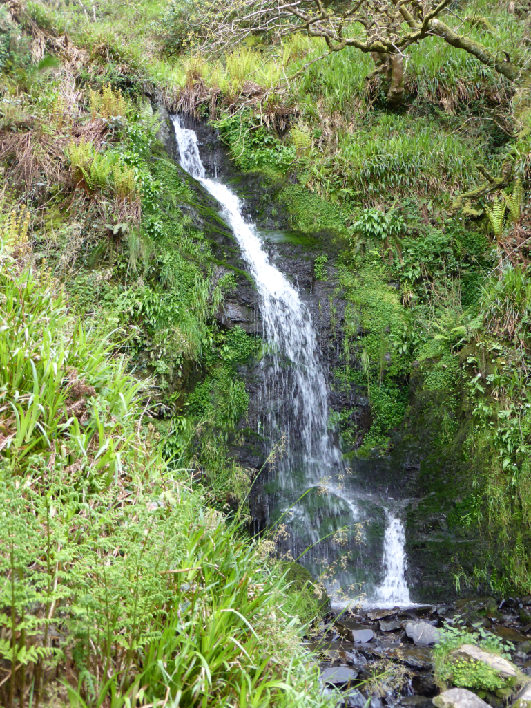
Hollow Brook waterfall. Credit: Fiona Barltrop
Emerging from the trees, you soon pass the Hollow Brook waterfall, one of the highest coastal waterfalls in the country. Thereafter you come to the deep, narrow, wooded Heddon Valley, and follow the path down to it, turning left at the bottom and right at the bridge (for Hunter’s Inn keep ahead for ½ mile and return same way).
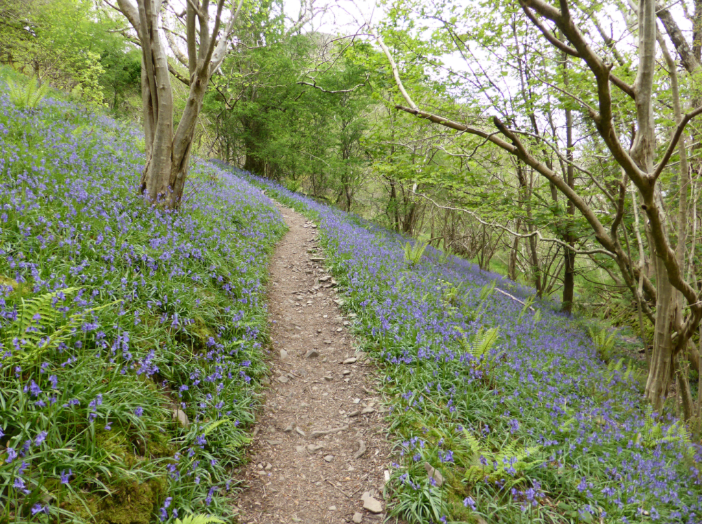
Bluebell-carpeted slopes on W side of Heddon Valley. Credit: Fiona Barltrop
3. SS655488: On the other side of the bridge turn left, and thereafter sharp right to head back uphill, bearing right when the path levels off. Now high above the valley, the path follows the contours round to meet a wall and carries on south-westwards along aptly named High Cliff, then over the open heathland of Holdstone Down, and down to Sherrycombe Valley. One final big ascent gets you to the top of Great Hangman (318m/1043ft).
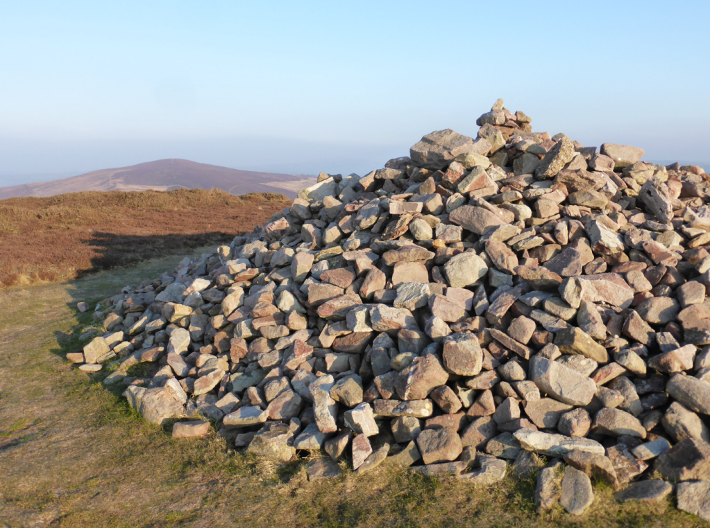
Great Hangman summit cairn. Credit: Fiona Barltrop
4. SS601481: From here it’s downhill to Combe Martin, but with a few extra feet of ascent you’ll surely want to bag Little Hangman on the way down, too. PS Look out for the Pack o’ Cards Inn up the High Street.
Further information
PUBLIC TRANSPORT: Exmoor Coaster between Combe Martin and Lynmouth runs in spring and summer only (firstbus.co.uk). Stagecoach bus 309/310 between Barnstaple and Lynton/Lynmouth and Stagecoach bus 301 between Combe Martin and Barnstaple (stagecoachbus.com). Railway station at Barnstaple.
TOURIST INFORMATION: Exmoor National Park Centre, Lynmouth (01598 752509), visitlyntonandlynmouth.com