
Ian Battersby uses a dry spell to scramble Gordale Scar up to Malham Cove, a jewel in Yorkshire’s geographical crown.
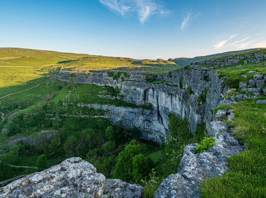
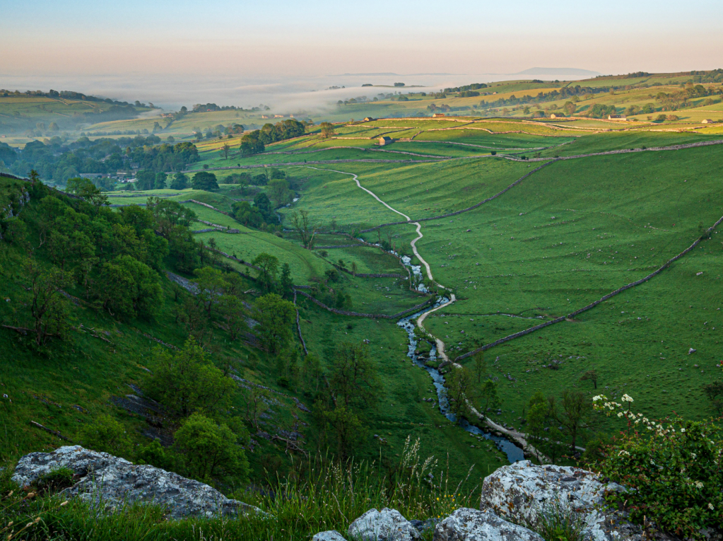
The classic way to experience Malham Cove’s colossal crescent of crag is to approach its foundation from Malham village, and marvel up at the enveloping limestone enclosure from the base. But this renders its manifestation by degrees. Our way offers no such consideration, unless sauntering down Watlowes dry valley, scarred with cliffs and cave, can coach for a world beheld from the brink of phenomenal limestone pavement perched 80m over Malhamdale. It is rightly held in the highest esteem.
There is only one way to escape its compelling spell; to want for more, but that isn’t a problem in this land of limestone lures. Janet’s Foss is an impressive cascade coupled with enchanting pool, behind which Janet, the fairy queen, resided, just downstream from arguably the national park’s most impressive gorge. Gordale Scar draws visitors into its looming jaws, and after the sky is all but gone there is only one onward way if the torrent allows: a stimulating scramble up secure holds in rock bulging between the lower falls (experience preferred).
Gordale Scar and Malham Cove: route description
START/FINISH: Water Sinks car park south of Malham Tarn; SD894658 | MAPS: OS Explorer OL02 (1:25k), OS Landranger 98 (1:50k) | DISTANCE: 15.1km / 9.4 miles | ASCENT: 400m / 1,312ft | DURATION: 5 hours
1. SD894658: Head W 100m along the lane to a footpath sign on the left. Through the gate head S, then fork SSE along Pennine Way signed Malham Cove, meeting a wall and following it SW. After 300m the path turns S into a dry valley, passing between crags and cave to reach a viewpoint for Watlowes dry valley. Veer WNW, contouring to a stile signposted Malham Cove. Drop SE down steps into Watlowes to a stile. Continue SE passing Inga and Raven Scars arriving at a stone stile. Cross and turn right on minor path aiming WSW then SSW to reach the western end of Malham Cove. Pick any route along the limestone pavement (slippery when wet) to reach a walker’s gate half way along the cove.
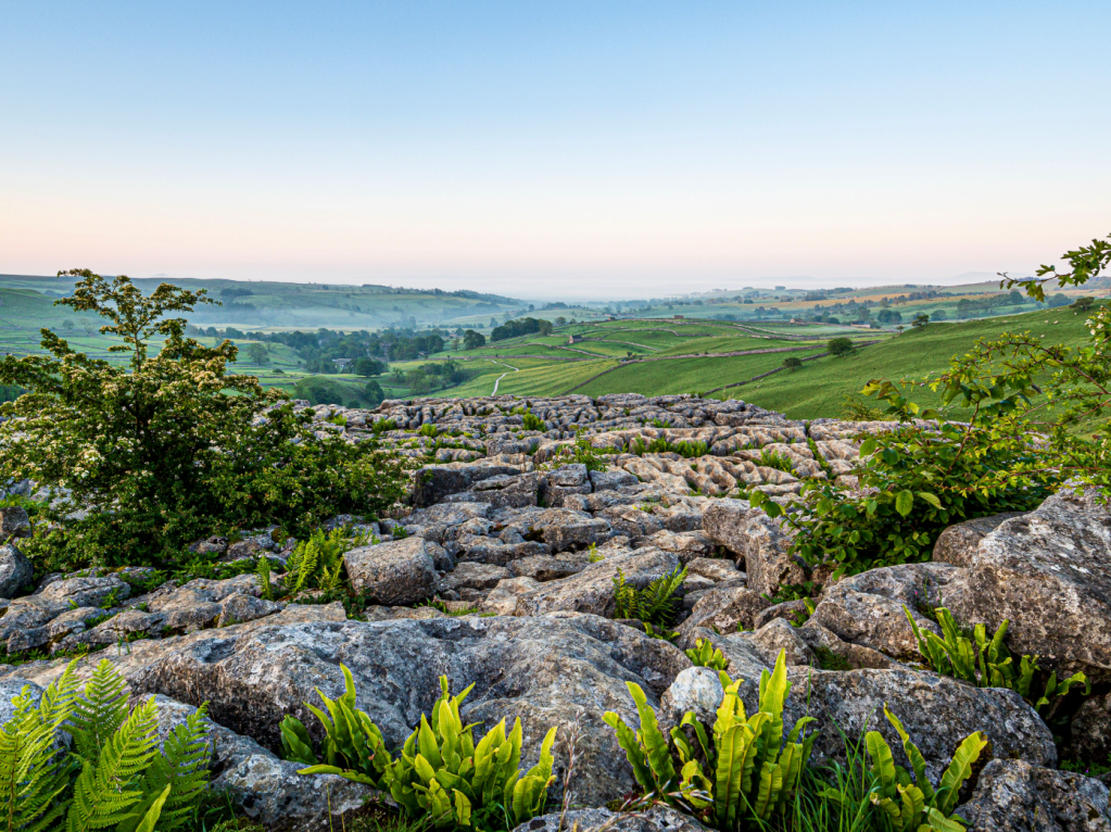
Malham Cove limestone pavement. Credit: Ian Battersby
2. SD897642: Through the gate, signed Gordale Scar, continue SE along the edge until fence and wall block progress. Head NE by the wall to join the Gordale path. This follows the wall SE at first, continuing SE down to a ladder stile. Cross the road entering the gate opposite following the Dales High Way SE on good track to a barn, then ENE to a gate. Continue contouring on track SE then E. After a small rise follow the Gordale sign right down grassy track ESE through a gate to Gordale Bridge. Turn right for 100m down the road and take the Janet’s Foss path left to this strikingly beautiful cascade.
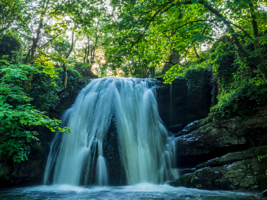
Janet’s Foss. Credit: Ian Battersby
3. SD911633: Return to Gordale Bridge, and continue NE to a bend. Take the path NE through the campsite, heading N alongside Gordale Beck, turning E into the imposing jaws of Gordale Scar.
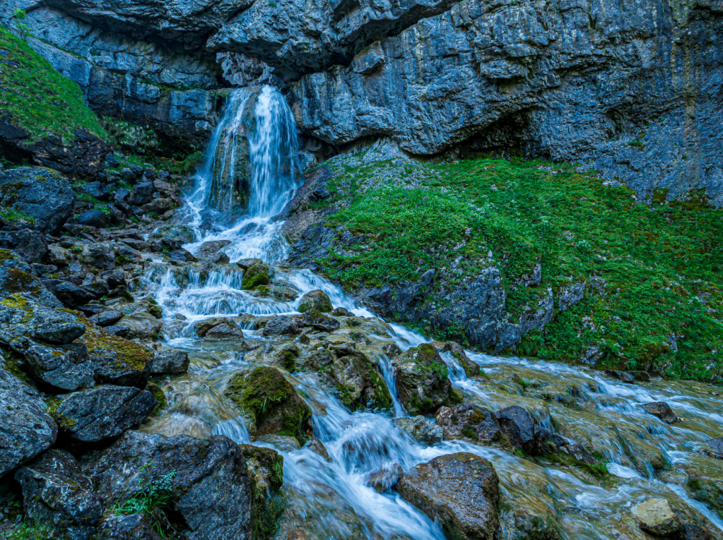
Gordale Scar. Credit: Ian Battersby
4. SD915641: Pick a route over the stream, which shallows as it fans out here. Beware slippery rock though, then scramble up the bulging limestone between the falls using plenty of good hand and foot holds to help you over the outcrop. Above the falls the stream is deeper so take care crossing to the left bank. Climb NW past the upper falls which spurt from a hole in the rock, and continue climbing steps at first, to a stile at the top. The path then levels, aiming NW for a wall and stile (which is ignored) at a road. Keep right of the wall, heading NNW to a stile at Street Gate.
Malhamdale from the top of Malham Cove. Credit: Ian Battersby
5. SD905656: Cross the stile and follow the bridleway track N through a cattle grid at Great Close Plantation. Leave the paths after the trees and make your own way up through scant crags to gain Great Close Hill NW of this position, or climb and contour at 430m above more dramatic crags along its southwestern flank, or combine the two, enjoying sweeping views over Malham Tarn. Drop NW off the hill and re-join the Pennine Way heading NW through woods to the Field Centre. Continue WSW on tarmac past the bird hide, turning NW to reach two cottages and the boardwalk sign on the left.
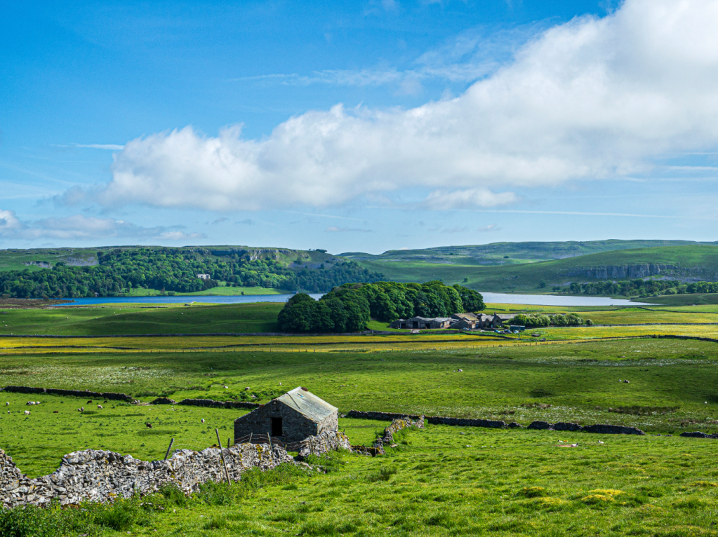
Malham Tarn from New Laithe. Credit: Ian Battersby
6. SD889673: Follow the boardwalk S to a sharp right hander. Continue W through trees to a junction. Turn left over a bridge heading SW to another bend. Head N to exit through a gate onto track. Turn left to the road, continuing SW to a junction. Fork left, heading SSW then S to Streets crossroads and a stile. Head SE to the chimney. Continue S, following posts, veering SSE over a stile after New Laithe. Drop SE following the posts to a bridleway junction at a gateway. Follow the bridleway NE then N to return to Water Sinks.
Further information
PUBLIC TRANSPORT: None to start
TOURIST INFORMATION: National Park Visitor Centre – Malham, www.yorkshiredales.org.uk, 01729 833200


