
Fiona Barltrop recommends a pub and peak, both with great views, on this route of Golden Cap & The Anchor Inn.
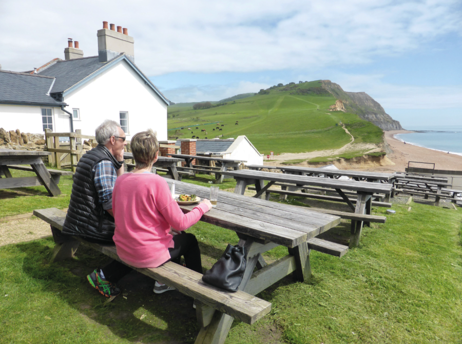
For a ‘pub to peak’ walk in the south of England, you can’t do much better than the Anchor Inn at Seatown, from where you can climb straight up to the highest point along the southern coastline of Britain, the 191m/627ft flat-topped summit of Golden Cap. From here there are stunning views along the coast in both directions.
The multi-award-winning pub is situated in a beautiful location above the beach tucked away at the end of a no-through lane. There is excellent walking along in the Coast Path in either direction, with far-reaching views from Thorncombe Beacon to the east as well as Golden Cap to the west.
The Jurassic Coast is world famous for its geology and fossils, which can be found at many locations along the Dorset coast, including Seatown and nearby Charmouth. A voluntary code of conduct operates: collecting from the beach is acceptable practice but digging in the cliffs is not. The Charmouth Heritage Centre is a good place to learn more about the fossils to look out for.
Golden Cap & The Anchor Inn: route guide
START: Beach car park, Seatown, GR: SY420917 | MAPS: OS Explorer OL10; Landranger 197 | DISTANCE: 14.25km/9 miles. If short of time, out-and-back extension to Charmouth could be omitted | DURATION: 5 hours | ASCENT: 662m/2172ft
1. SY420917: Turn right along the lane from the car park and continue to the Coast Path (CP) turn on the left. The route to Golden Cap is well waymarked. The terrain is part of the National Trust’s Golden Cap estate, which encompasses a variety of terrain – hills, fields, valleys and coastline – with over 25 miles of footpaths and bridleways. The patchwork pattern of fields has been preserved and traditional methods of farming have encouraged a wealth of wildlife.
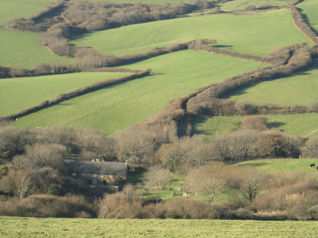
NT Golden Cap Estate – patchwork pattern of fields & St Gabriel’s. Credit: Fiona Barltrop
A long steady ascent up grass with some steps to finish with leads you to the trig point on the summit plateau – Golden Cap itself takes its name from the honey-coloured sandstone that crowns it. On a clear day the views extend from Portland in the east to Start Point in the west. Also on the summit is a memorial to the Earl of Antrim, chairman of the NT in 1960s and 1970s. He spearheaded the fundraising campaign, named Enterprise Neptune, to purchase stretches of unspoiled coastline, thereby saving them from development. The Golden Cap Estate was part of this, parcels of land being added in stages over the years. 780 miles of coastline are now in the care of the National Trust.
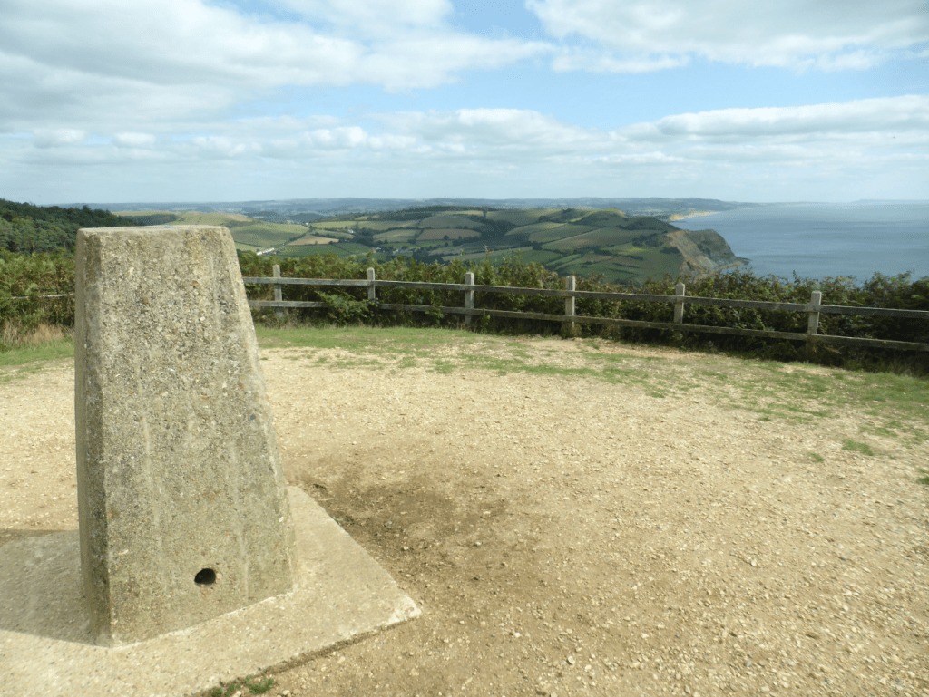
Trig point atop Golden Cap. Credit: Fiona Barltrop
2. SY407922: Walk to the far end of the summit plateau and head down the zigzagging path to a kissing gate and junction, continuing on the CP down grassy slopes. The path descends through vegetation to cross a footbridge over a stream above St Gabriel’s Mouth, and thereafter two more footbridges are crossed. Further on climb a flight of steps. Bear left at the top to the grassy cliff-top plateau – Cain’s Folly viewpoint, Lyme Regis in view across the bay.
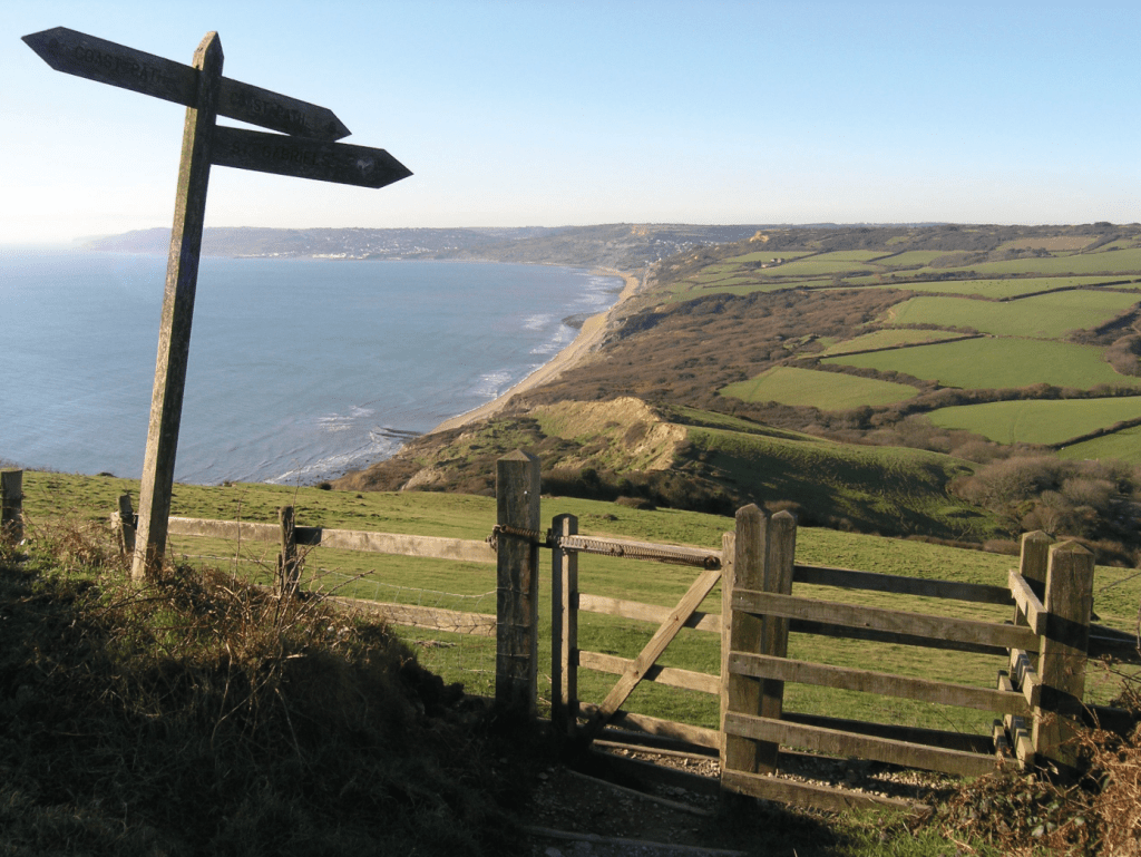
View over Lyme Bay from Golden Cap. Credit: Fiona Barltrop
3. SY379931: Keep ahead at a signpost (car park signed to the right) to go through a kissing gate, and follow the CP downhill, crossing a bridge at the bottom to the car park, the Heritage Centre beyond. (Note: the western end of Dorset is particularly prone to landslips, which have resulted in a number of Coast Path diversions over the years, notably east of Charmouth – follow diversion signs, if need be.)
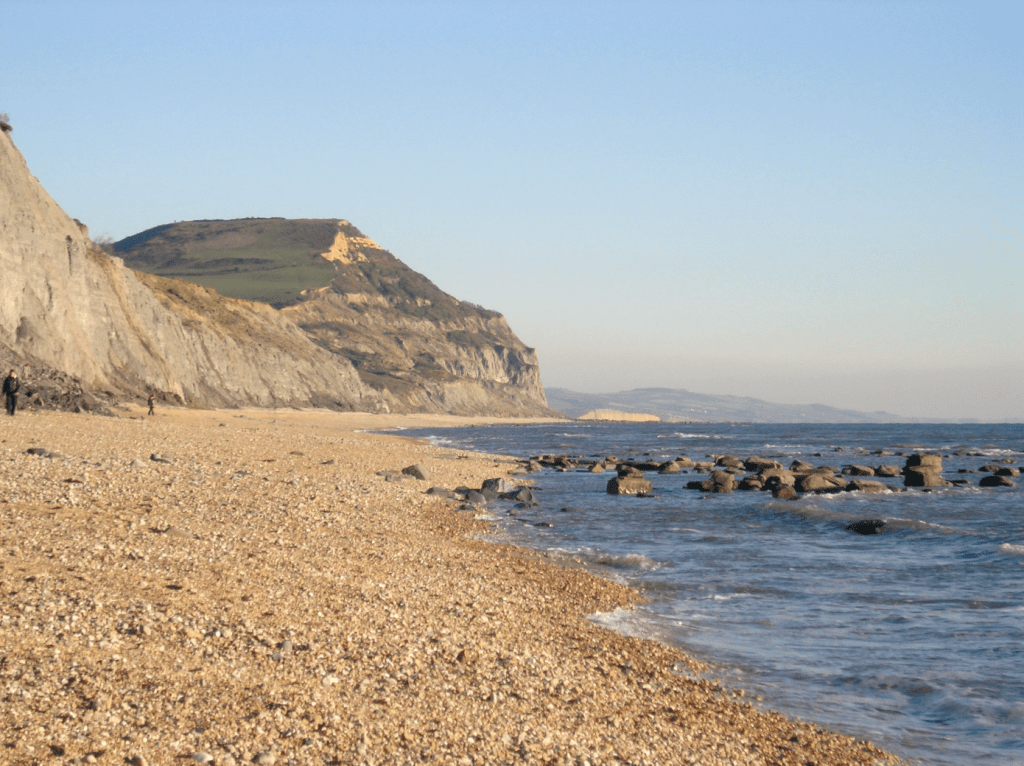
Golden Cap from beach nr Charmouth. Credit: Fiona Barltrop
4. SY364930: Retrace steps back uphill. Turn left along the grassy path to Stonebarrow Hill car park, turning right there along a track passing the Old Radar Station (now NT holiday let) to the car park at the far end.
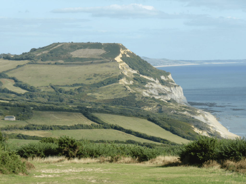
Golden Cap from Stonebarrow Hill. Credit: Fiona Barltrop
5. SY390935: Turn right through a gate and fork right down the grass (signed St Gabriel’s & Golden Cap) – Golden Cap ahead of you – soon on a defined track. Carry on downhill to Upcot Farm, turning left at the farm buildings, and continue along the track to a signposted junction, Pickaxe Cross.
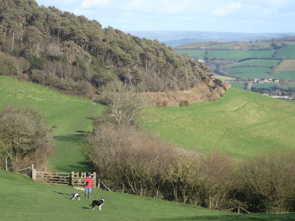
Wooded Langdon Hill. Credit: Fiona Barltrop
6. SY399930: Turn right and continue down the access road to St Gabriel’s. The large thatched house, an 18th century manor house, is now divided into NT holiday cottages. This is the location of the former hamlet of Stanton St Gabriel, once a thriving settlement dating back to 11th century.
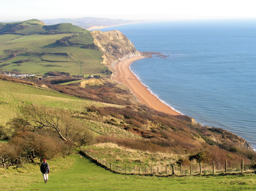
View back over Seatown on climb to Golden Cap. Credit: Fiona Barltrop
7. SY401924: Continue on the bridleway past the ruins of 13th century St Gabriel’s Chapel. Keep ahead where a footpath forks right. A little further on the bridleway turns right up the northern slopes of Golden Cap, and then left, signed for Langdon Wood. At the next junction bear right along the bridleway signed for Langdon Hill. Continue on the bridleway along the southern edge of Langdon Hill woodland. At the next fork bear right, signed Seatown, To Coast Path, heading downhill, fence on left, to rejoin the outward route. Retrace initial steps to the start.
Further information
PUBLIC TRANSPORT: X51 from Dorchester to Axminster and X53 from Weymouth to Axminster, both stop at Chideock, ¾ mile from Seatown, and Charmouth.
TOURIST INFORMATION: Bridport TIC (01308 424901), visit-dorset.com