
Ian Battersby finds size doesn’t matter when you take a step back on Cùl Mòr in the Northwest Highlands.
By Scottish standards Cùl Mòr is but a bairn. Compared with its neighbours, however, 849m makes it a big lad. But these statistics are meaningless. They hide the frank reality. The mountain sits in the Assynt-Coigach National Scenic Area (another understatement). It is home of the inselbergs; isolated island mountains.
The land is predominantly low, its softer rocks generally lost to the last ice cap. Where there are hollows, there is water for bogs and lochs of all dimensions. Here and there, Lewisian Gneiss rises to make a plinth of more resilient material, able to deflect a glacier, and leave a mountain stacked on top. These diminutive sturdy summits should be, and are, deeply revered.
Of all these isolated rebels, Cùl Mòr is one of the loneliest, but don’t let that get you down. The distant neighbours are fetching companions, and spatial separation bequeaths a satisfying stand-back-and-admire effect. The panorama from the top of its corries and crags is besieged by water, out of which inselbergs rise to toy with clouds.
Cùl Mòr, Assynt: route description
START/FINISH: Small parking area on A835 by Knockan Crag; NC189094 | MAPS: OS Explorer 439 (1:25k), OS Landranger 15 (1:50k) | DISTANCE: 13.2km / 8.2 miles | ASCENT: 822m / 2697ft | DURATION: 5 hours
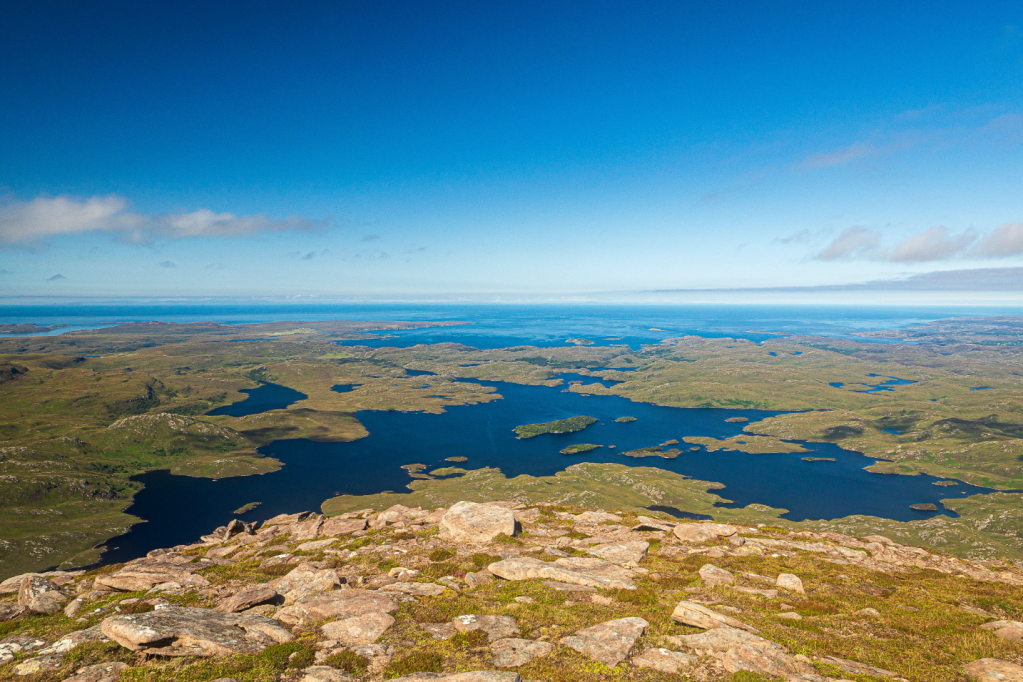
1. NC189094: Go through the gap in the fence and follow a good, stony path wriggling N, soon reaching a gap in an old deer fence in disrepair. The path continues N, contouring and passing Lochan Fhionnlaidh on the right. Past the lochan the path climbs gently and soon turns W to reach a cairn at 340m where the path turns to peat and becomes less distinct as it crosses a wetter area, heading NW through heather and grass moorland. The path climbs more steeply, leaving the dampness behind for a drier, stone strewn landscape after the 500m contour. Here the path becomes more obvious, slowly turning W, with the twin pyramids of Cùl Mòr coming into view over the rounded horizon of Meallan Dìomhain ahead, where there is a cairn marking its high point at 609m. Take a peak over the south western edge for a dramatic view over to the craggy face of An Laogh and Cùl Beag beyond.
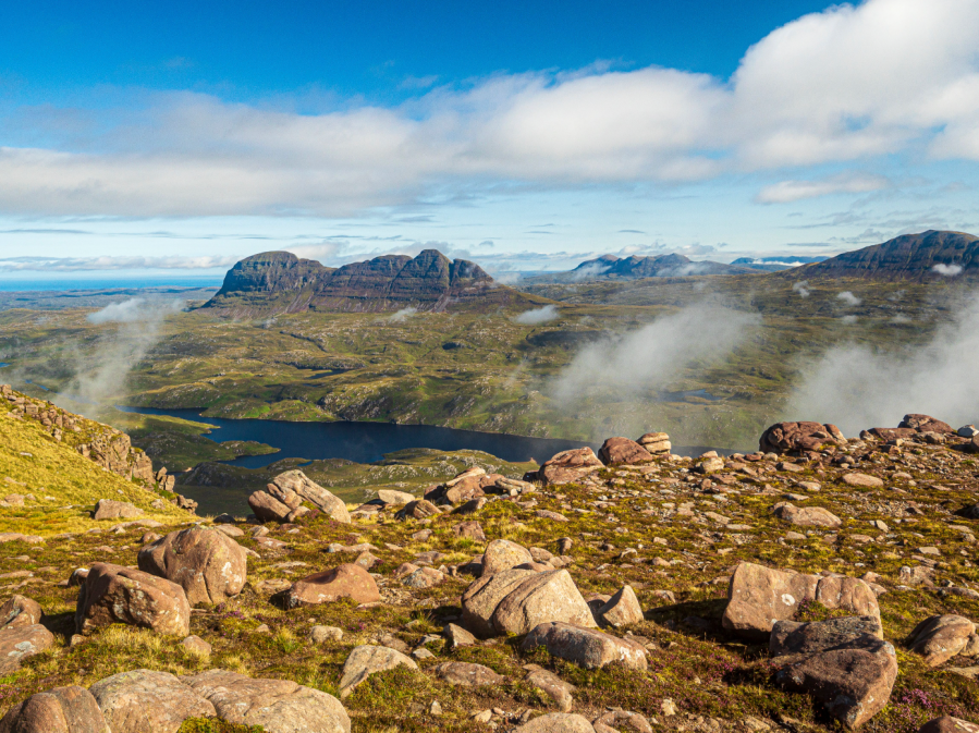
Cùl Beag and Coigach from Cùl Mòr. Credit: Ian Battersby
2. NC171116: Head NNW across the broad saddle of Fluich-Choire. The eastern edge holds the best views of Canisp and sneak previews of Suilven ahead, even though small cairns lead across to the western edge. The path is lost among scattered rock and exposed slabs, but re-forms as it passes an unnamed pool and climbs NW above Cadha nan Each, from where the land sweeps down and across Loch Veyatie to meet the southern flank of Suilven head on.
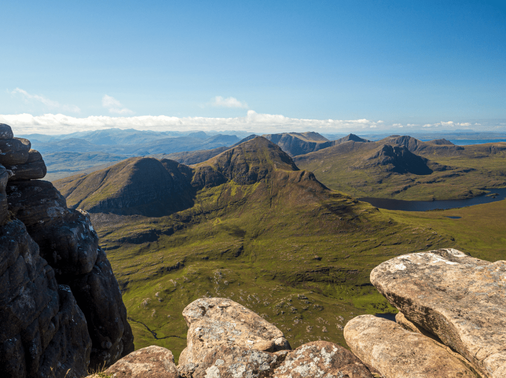
Suilven from Cùl Mòr. Credit: Ian Battersby
The path climbs 30m to the W where the ridge narrows considerably, climbing SW towards the summit. The path gets lost in a boulder field before the top, although small cairns help guide the way. Beyond the boulders turn right for the trig point (849m).
Cùl Mòr summit. Credit: Ian Battersby
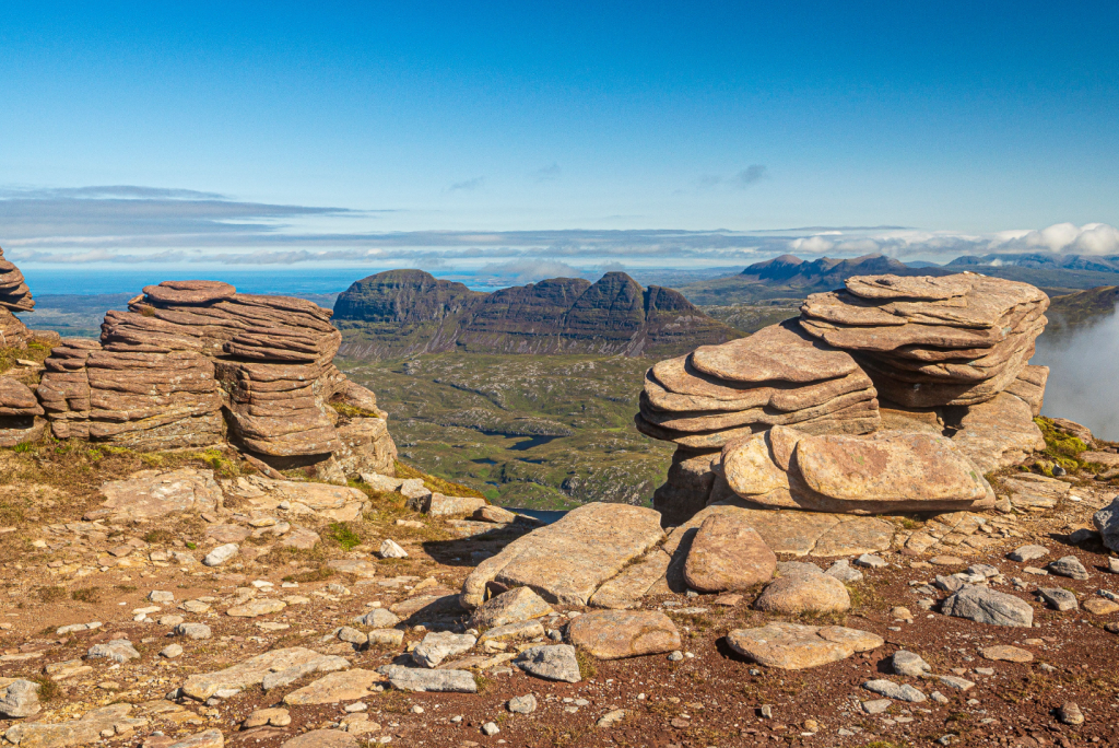
3. NC162119: Follow the northern edge of the ridge which drops gently W passing impressive stacks of red sandstone plates that teeter over the abyss. From altitude 800m the mountain sends out a ridge, which noses NW with the promise of an ocean view. Follow vague paths along the undulations of the plummeting northern edge. Sròn Gharbh rises to 758m, a natural end to this exploration, but continue W down to 740m for a jaw dropping spectacle across Loch Sionasgaig to the Atlantic beyond.

Coigach and Stac Pollaidh from Sròn Gharbh. Credit: ian Battersby
4. NC152124: Return SW along Sròn Gharbh, climbing back to 780m where a defined path leads SE along the edge and drops into a pathless, stony col. Beyond this the ridge narrows and a path climbs it S to the top of Cùl Mòr’s second summit at Creag nan Calman (828m). The views of Cùl Beag, the sharp peaks of Coigach and Stac Pollaidh are spectacular.
Loch Sionasgaig from Sròn Gharbh high point at 758m. Credit: Ian Battersby
5. NC159114: A broad and rocky ridge with a well-defined southern edge drops SE, soon turning E and dropping to around 630m. Paths are now ill defined, so pick your own route dropping ENE into a wide basin poised above Allt Lochan Dearg a’ Chùil Mhòir and cross the slightly boggy area around the streams. Continue along pathless terrain, dropping E to around 500m, then contour around to the N to meet our earlier outward-bound path, which is a grassy track around here.

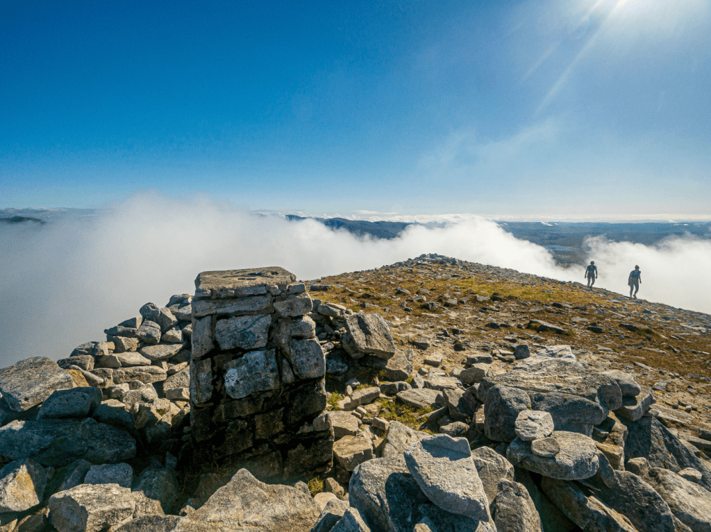
escent from Meallan Dìomhain. Credit: Ian Battersby
6. NC176116: Retrace steps down to the stony path which descends SE then S to return.
Further information
PUBLIC TRANSPORT: Infrequently bus 809 from Ullapool (traveline.info)
TOURIST INFORMATION: Ullapool, 01854 612486, visitscotland.com


