
Roger Butler enjoys a high escarpment and a plunging waterfall in the hills of Mid Wales on this route to Creigiau Pennant & Ffrwd Fawr.
Main image: Creigiau Pennant and Ffrwd Fawr | Credit: Mike Parker
The chunk of high ground between Machynlleth and Llanidloes remains largely off-the-beaten-track. Empty hills and panoramic skies are the order of the day and you’ll see plenty of these on the mountain road which links the two towns. And, halfway between them, the isolated former lead mining village of Dylife – once a place of toil and turmoil, but now hardly a hamlet – is the starting point for a great loop above and around the deep valley of Afon Twymyn.
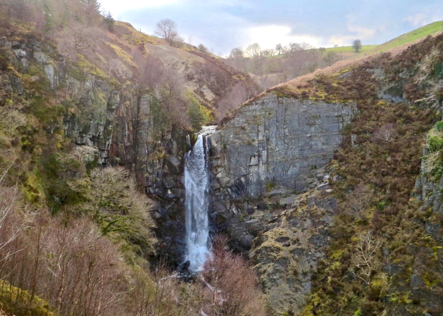
This unexpected chasm, forged by glacial meltwater, is hemmed by steep escarpments, from where swathes of grey scree tumble into classic clumps of oak woodland. The promontory below the windswept moors of Creigiau Pennant resembles the mighty prow of an ancient galleon and the scenery is equal to many better-known mountains just a few miles to the north. A romp above the western side of the valley is followed by a long rising bridleway which culminates in views of Ffrwd Fawr, a dramatic hidden waterfall with a single crashing 40-metre cascade.
Creigiau Pennant & Ffrwd Fawr: route description
Start/Finish: Dylife, grid ref SN861940 | Maps: OS Explorer, 1:25,000 – Sheet 215: Newtown & Machynlleth | Distance: 12km / 7½ miles | Total ascent: 505m / 1655 feet | Time: 5 hours
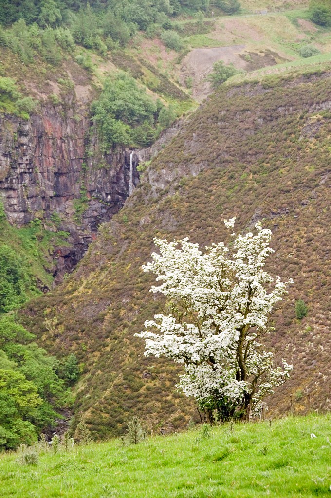
1. SN861940: From the north side of the road at Dylife walk up the lane, past the former Star Inn (now offering B&B accommodation, etc) and continue to last house. Go through a gate and walk over the field to a gap in the hedge. Join the track which dips into a valley and proceed down to pass through a gate. Cross the stream, leave the track and follow an indistinct path on L which zig-zags uphill and crosses breezy pasture to a stile set above the steep west side of the deep Afon Twymyn valley. The dramatic Creigiau Pennant escarpment stretches northwards for 2.5km and the slopes must rank amongst the steepest in Wales.
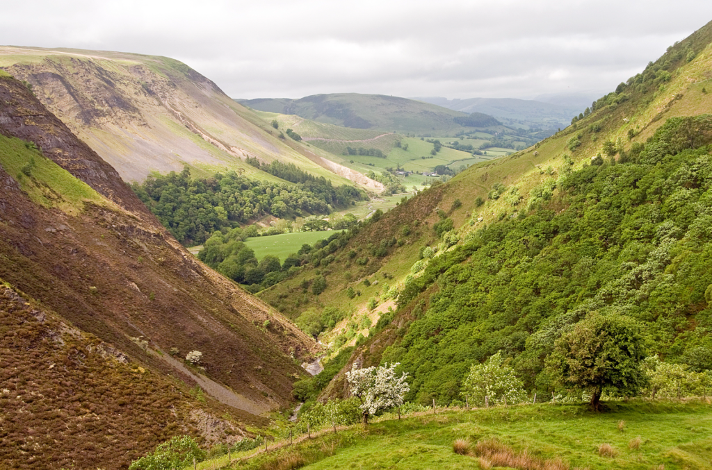
The eastern slopes of Creigiau Pennant rise steeply above Afon Twymyn with the gorge in the foreground. Credit: Roger Butler
2. SN866947: Cross the stile and enter Open Access land. Follow a narrow path heading north through bilberry and heather, with fence on L. Keep ahead until a fence runs across the top of a steep gully, where Nant Ddeiliog tumbles from a nearby small lake. Hop over the fence and bear L, downhill, to cross the stream and cascades – these soon vanish from sight as the slopes plummet away from the edge. Continue north and climb to the edge of escarpment. There’s no real path and the next 2km are pure wild walking. Promontories and incised streams drop towards woods in the valley, whilst open moors slope west to lonely valleys and the perky summit of Foel Fadian. Follow the edge until a prominent spur rises above forestry, just north of the farm at Cilcwm-fawr. Descend east-north-east on an indistinct path with some rocky patches – though the route down in obvious – to an acute fence corner.
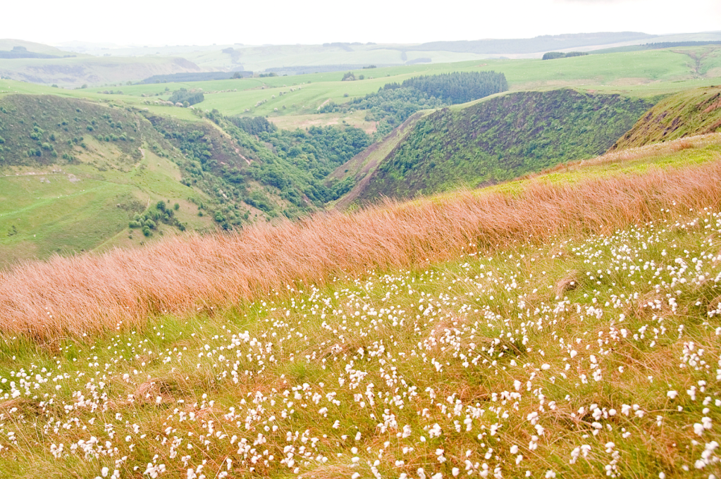
A blanket of cotton grass on Creigiau Pennant with views back to the head of the Twymyn gorge. Credit: Roger Butler
3. SN871970: Some forestry has been felled and replanted around and below the fence but there’s no need to enter the plantations. Turn sharp R and contour south around the steep bowl above the farm. Cross a stream and look for a sheep path to continue south, cross another stream and bear L, downhill, to a fence. Turn L alongside fence for 75m to valley floor and turn L (north) for 500m on right of way path to Cilcwm-fawr. Continue to junction with lane and turn R. Cross river, immediately fork L onto bridleway track and walk north-east to track near Cefn.
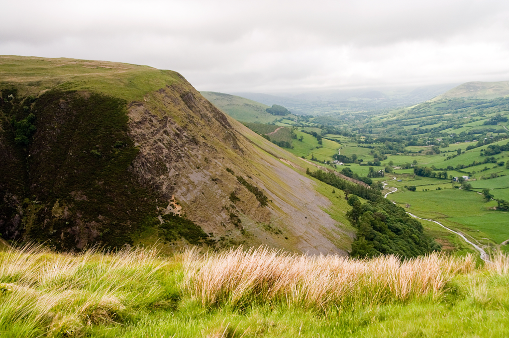
View of Creigiau Pennant from Craig y Maes with Afon Twymyn meandering through the valley below. Credit: Roger Butler
4. SN881969: Turn sharp R onto an unmade track through dense hedges. Go through three gates until track opens onto rough pasture, lined by a row of trees. Keep ahead, uphill, through a couple more gates and past craggy hawthorn to merge onto a stony track, followed by two more gates, leading to a steep escarpment edge by Pen y Waun-fawr as the head of the valley now begins to close in. Continue south when track bends sharp L, go through gate at top of wooded ravine and look across the gorge for sudden views of the waterfall cutting through the cliffs at the south end of the Craig y Maes escarpment. Follow grass track to gate at road.
Ffrwd Fawr, a dramatic 40-metre waterfall, is best viewed from the track near Pen y Waun-fawr. Credit: Roger Butler
5. SN977939: Now turn R for 1.75km to return to Dylife, where there are still plenty of remnants from the days of lead mining, including a large water wheel pit. But it’s hard to imagine this was once a thriving community of more than 1,000 people with four pubs, several chapels, a church and a school.
Further information
Public Transport: Nearest stations Machynlleth and Caersws – but no bus connections to Dylife
Tourist Information: www.visitmidwales.co.uk


