“I soon reached another cairn. A moment of shock and disbelief. Yes, I had been here before!”
This is part of our series of reader submissions on getting lost and lessons learned the hard way. To read more entries, and to find out how to submit your own, see this page.
Read the full story, including more photos and context, here on Colin’s blog.
Although the route on the map appeared straightforward a conversation earlier at the campsite indicated the ridge required careful navigation at one or two points.
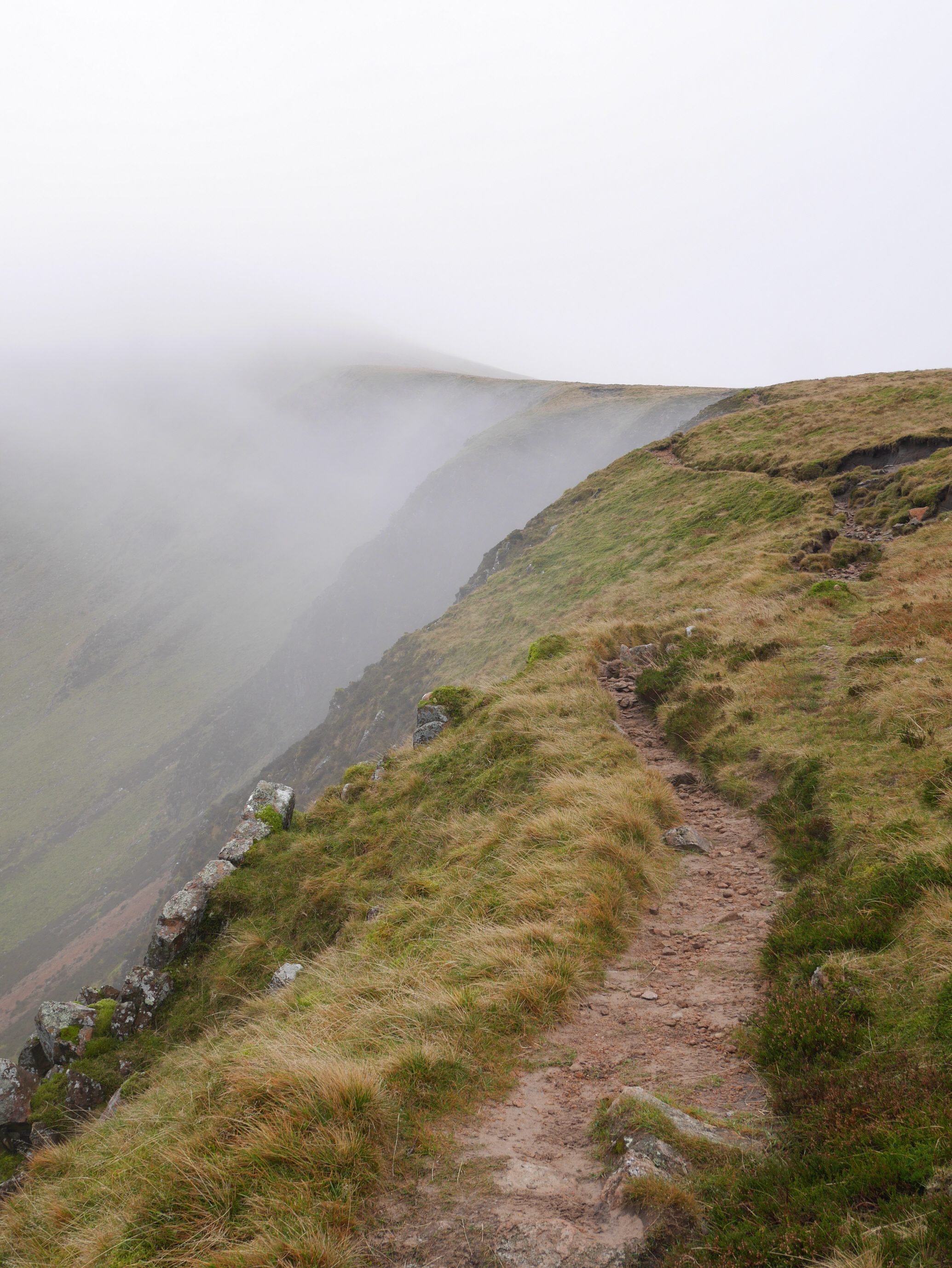
Image © Colin Marsh
Forewarned I began following the map and compass carefully. The path to the summit of Red Pike at 755 metres was straightforward. I turned south and south east before a steep climb to High Stile, the highest point of the ridge at 806 metres. I am not sure what happened next. Was it complacency or incompetence?
My first mistake was to keep the ridge on my left. When I began descending too soon I adjusted by turning back to the summit area. I then took a compass bearing and walked purposefully in a south-east direction, carefully following the map.
“So much for my purposeful walking and close scrutiny of the map. I felt disorientated. I couldn’t remember which cairn this was”
The summit area was broader than I anticipated. I was finding it difficult to judge my exact location. Although I had the option of using the GPS on my phone I felt confident with my progress.
There were a couple of moments of uncertainty and rechecking the map.
After finding again a line of old rusty metal fence posts I met a walker coming towards me. After a brief exchange as we parted he added, “don’t forget if you follow the fence posts you can’t go wrong”.
I soon reached another cairn.
A moment of shock and disbelief.
Yes, I had been here before!
Yes I had gone wrong!
So much for my purposeful walking and close scrutiny of the map.
I felt disorientated. I couldn’t remember which cairn this was.
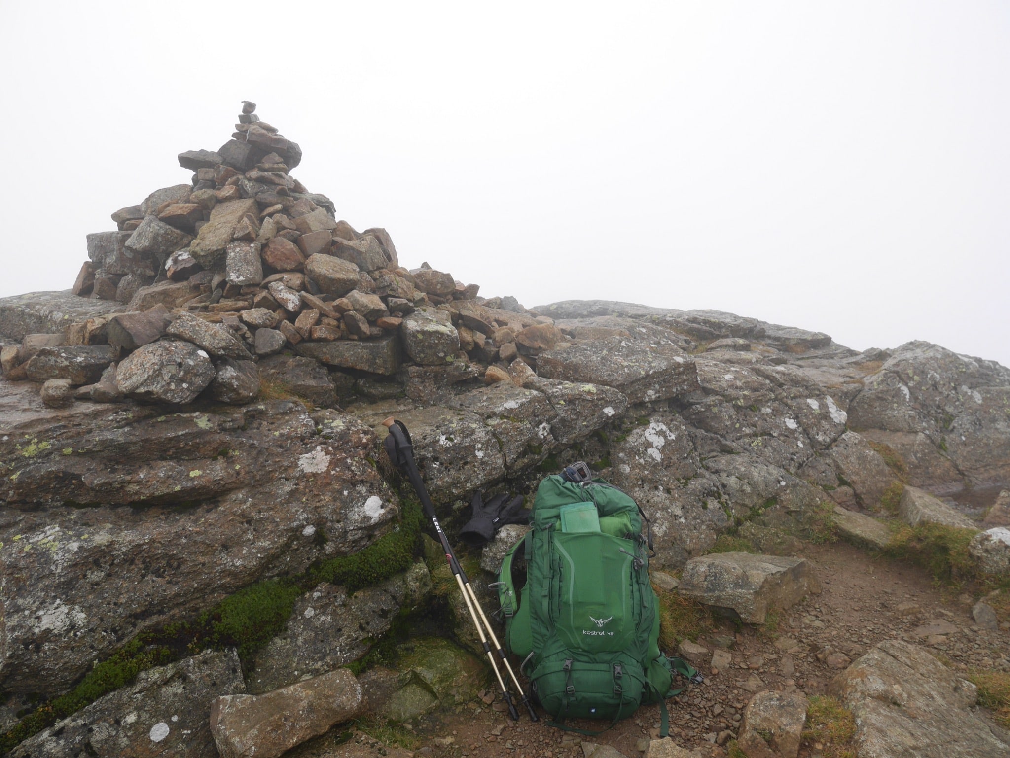
Image © Colin Marsh
It was not a moment to mess around and pontificate on my mistake. I needed to know my exact location so I turned on my phone to use its GPS and OS map. Yes I was on High Stile. I took another compass bearing and left the cairn following the posts.
“I quickly realised the print surrounding the detail of High Stile was smudged and contour information obscure”
Soon my compass bearing pointed east of the post line, it looked familiar from earlier on. This time I decided to take the word of the walker and followed the posts even though they appeared to take me too far south. In a short distance, the line turned left and eastwards to reach the next part of the ridge and a clear path.
My confidence bruised but intact I continued over High Crag and down to Scarth Gap Pass. Coming out below the mist I could see the road from Honister pass and also Buttermere (please note that ‘mere’ means lake).
At Scarth Gap I joined a path leading into Ennerdale, where I found a place near the river to camp. After I cooked a meal and settled for the evening I began to question what happened over High Stile.
I pored over my OS map. I quickly realised the print surrounding the detail of High Stile was smudged and contour information obscure. I compared it with the map on my phone.
On close examination I realised the details showed two separate peaks, the first above the ‘H’ and a second above the ‘h’ extending north/northeast across a small plateau to a higher point of 807 metres.
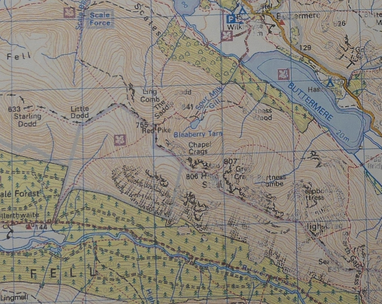
The slope south was gradual and alongside the word ‘High Stile’ the fence was marked as a boundary with a dashed black line.
I’d taken about an hour to find my way off the summit. Fortunately I had plenty of time and the mist had not been accompanied by either strong wind or rain. Throughout I knew I could use my phone at any moment to pinpoint my location on the OS map.
Over the three weeks since this happened I’ve come to the conclusion that at some point I held the compass upside down and retraced my steps, perhaps due to the magnet in my phone.
Read more in our reader series ‘Getting lost: lessons learned the hard way’