
Ian Battersby finds a relaxed approach to Clennoch Bothy and Moorbrock Hill wins the day.
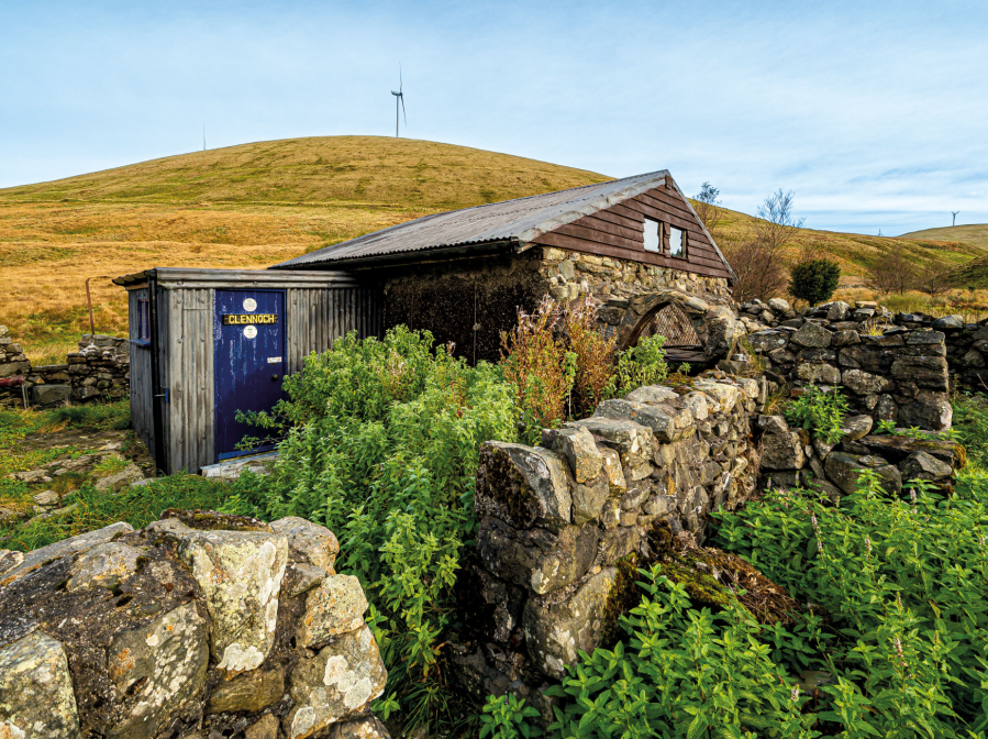
Most careful plans work well, but changes on the ground can sometimes thwart no matter how cunning and creative we may become. Climbing Cairnsmore of Carsphairn from Craigengillan demonstrates the point. There are good tracks through the Moorbrock estate and associated pine plantations, but miles of new deer fencing now block access from them to the mountains. Walking some of the fence line and scanning with binoculars fail to find a way, but finally Clennoch Bothy can lift the spirits of the disheartened.
First break through a flutter of birds attracted by well-placed feeders and open a cheery light blue door. Through the porch a bright, well maintained dwelling with sleeping platforms for four awaits. There are chairs and a worktop for making a brew or more. Information posted on walls tells a history of this old shepherd’s abode. Lacking a fire place it may best be used as a cosy shelter in colder months in which to concoct plan B, and returning via Moorbrock Hill provides an answer. Outside a nearby pond and coiling stream make nice focal points, and with improving luck roe deer or a fox may pass nearby.
Clennoch Bothy and Moorbrock Hill: route description
START/FINISH: Verge parking near Craigengillan Bridge; NX638948 | MAPS: OS Explorer OL328 (1:25k), OS Landranger 77 (1:50k) | DISTANCE: 19.3km / 12 miles | ASCENT: 676m / 2,218ft | DURATION: 6 hours plus bothy time
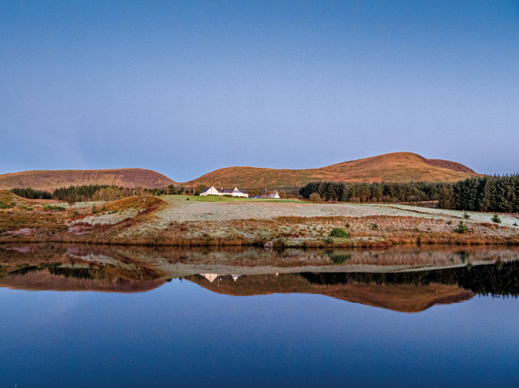
1. NX638948: Take a good forest track heading NNW past two cottages following the edge of evergreen woods with Prolifferie burn on the right and the forested Craigengillan Hill on the left. After almost a mile this track bends left under electricity cables into the woods. Instead leave this track and take a path continuing NNW over a bridge spanning Poldores Burn, then turning to green track and climbing to meet a junction at the Moorbrock Estate buildings by a prominent stag sculpture. Red arrows for a new permissive path show the way around the estate with track heading NE by a pond, then turning NW and W by pines to a junction of tracks.
Beninner rises above the pines. Credit: Ian Battersby
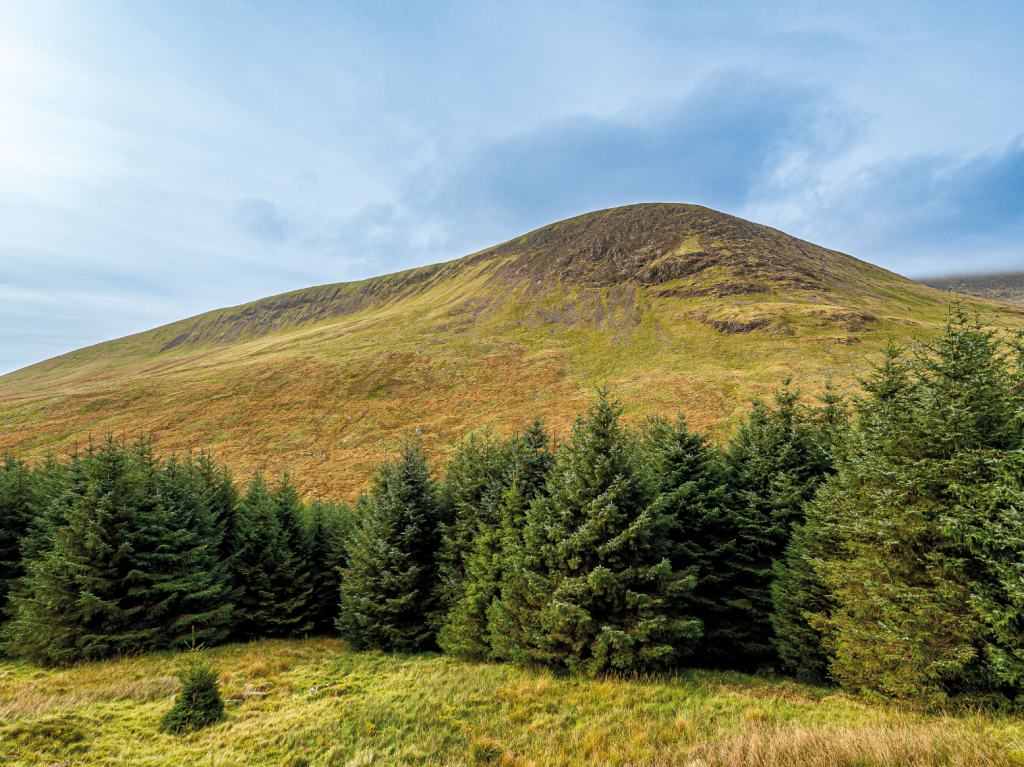
2. NX630967: Follow the red arrows left then immediately right, away from the buildings, climbing NW up a track between woods and past occasional green wooden hides with Poltie Burn on the left. At 410m the track turns left, climbing much more gently around Green Hill towards Beninner, with a fabulous view out over trees into the rolling southwest. The track heads N, passing Beninner to arrive at a fork junction. Ignore the minor track forking right. This will be part of the return route.
Beninner and Cairnsmore of Carsphairn. Credit: Ian Battersby
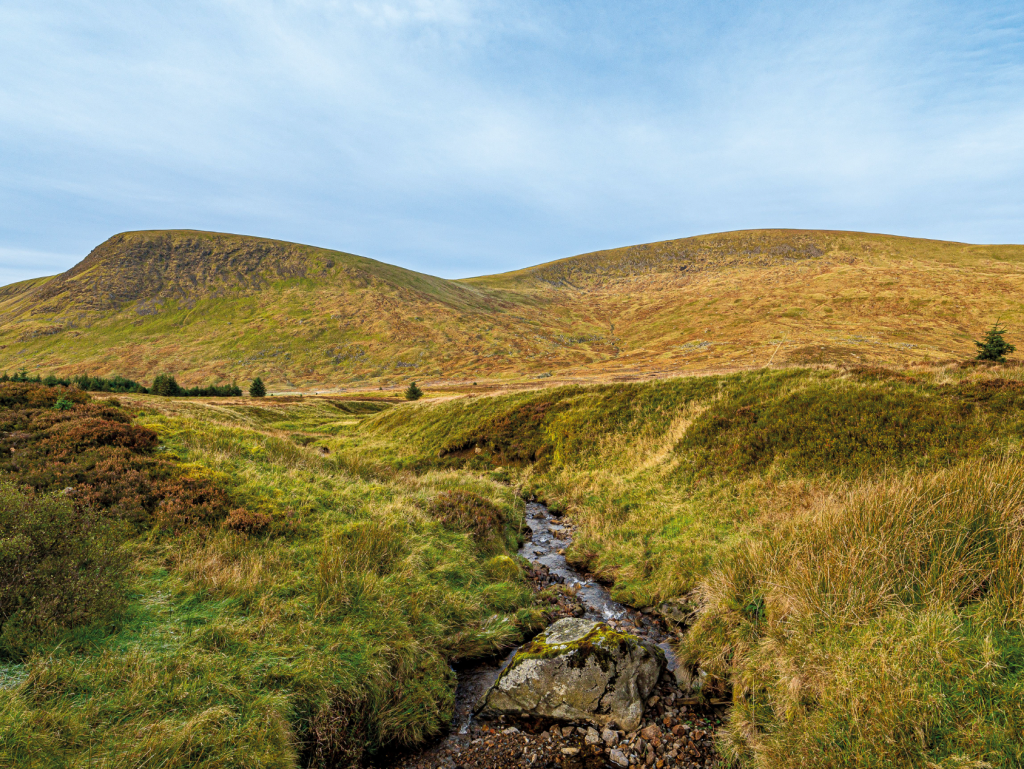
3. NX614975: Take the left fork heading N away from the conifers, crossing Black Burn between Beninner and Moorbrock Hill with Cairnsmore of Carsphairn now rising up alongside Beninner on the left. This soon turns NNW away from Moorbrock Hill, entering another small plantation. The track turns N after exiting the trees, reaching a junction where the main track swings E. Take the lesser track N, dropping down to Hog Hill Burn, climbing a little, then turning W and dropping to ford Clennoch Burn with the bothy straight ahead.

Inside Clennoch Bothy. Credit: Ian Battersby
There is a pond nearby and the banks of Bow Burn to explore, as well as birch, rowan and willow trees, which, along with feeders, bring in the birds. Keep a low profile and you may see roe deer or fox, and there are plenty of red deer among the conifers.
4. NS603002: Head E back along the track, turning S across Hog Hill Burn and climbing to the main track. Continue S then SSE through the next plantation to open country with Moorbrock Hill rising steeply on the left.
Moorbrock Hill and Beninner from Moorbrock. Credit: Ian Battersby
5. NX611988: There are no paths up Moorbrock Hill from here so use the main track to climb a further 20m up to 500m, then leave it, climbing ENE over steep grassy ground. The gradient eases after 100m of lung busting ascent, and grass tussocks lessen until you arrive at the subsidiary summit at 641m, with the wind turbines of Keoch Rig and Windy Standard filling the view to the north. Continue SE following a minor path along the ridge to reach the summit (650m) with its view of Cairnsmore and Beninner, as well as over Prolifferie Burn to Alhang, Dodd Hill and beyond.

Green Hill and Benniner from Moorbrock Hill. Credit: Ian Battersby
6. NX621984: The path has now turned to grassy track which heads S along the ridge, soon turning and dropping SW to meet a more definite track dropping to the col before Green Hill, with a fabulous profile of the Beninner scars ahead, and lesser hills dwindling into distant Irish Sea. This track meets the main track at waypoint 3 of the outward bound route (500m). Retrace steps S then ENE around Green Hill and dropping SE to Moorbrock, following the red arrows around the estate to pick up the track SSE to Craigengillan
Further information
PUBLIC TRANSPORT: None to start
TOURIST INFORMATION: Dumfries iCentre, 01387 253862


