
Roger Butler crosses one of Lakeland’s outlying fells – Black Combe – and ends up with his feet in the sea on this station-to-station route.
The great whaleback of Black Combe forms a backdrop on many Lakeland outings and it’s always worth heading west to wander across this sprawling fell which almost dips its toes in the Irish Sea. A long linear walk across the rolling ridge can be combined with a rattling train ride back to Broughton-in-Furness.
An old proverb recalls the Viking raiders who used to sweep down the west coast of Cumbria: ‘Nowt good comes round Black Combe’. But that’s all in the past now and excellent routes lead over this broad dome-shaped massif on the north side of the Duddon Estuary. The views are quite special – half sea, half Lakeland – and, on a crisp winter’s day you might even spot Snowdon!
Much of the walk covers rough but easy-going hillsides. One or two sections have no established path but there’s a popular well-used route which descends from the summit to the station by the expansive sands at Silecroft. After a quick paddle, the views from the train make a fine end to the day.
Black Combe: route description
Start: Broughton-in-Furness – grid ref SD212875 | Finish: Silecroft – grid ref SD130819 | Maps: OS Explorer 1:25,000 Sheet OL6 (English Lakes – South Western Area); OS Landranger 1:50,000 Sheet 96 (Barrow-in-Furness & South Lakeland); Harvey 1:40,000 Ultramap XT40 – Lake District West | Distance: 17.5km / 11 miles | Total ascent: 675m / 2215 feet | Time: 7 hours
1. SD212875: From the square in Broughton-in-Furness take the road leading west to the junction at High Cross. There’s a bit of tarmac to begin with – go straight over and continue downhill to cross the road bridge over the River Duddon. Turn R (signed Corney Fell Road) and then L through a gate after 150m, with an impressive former iron-making furnace on the right – free admission and well worth half an hour if you feel you can spare the time.
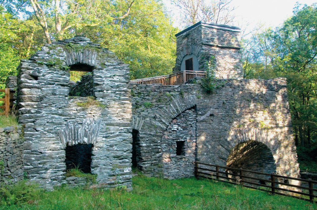
The impressive 18th century iron furnace by Duddon Bridge, near the start of the walk. Credit: Roger Butler
2. SD197883: Follow bridleway uphill through woods, fork R and continue to gate in wall. Keep ahead to another gate, now on the open fell, and pass through a gate in a high wall after 350m. Turn L and follow the wall above the farm at Thwaite Yeat. Continue to an open lane, go R and fork L on a farm track towards the farm at Fenwick.
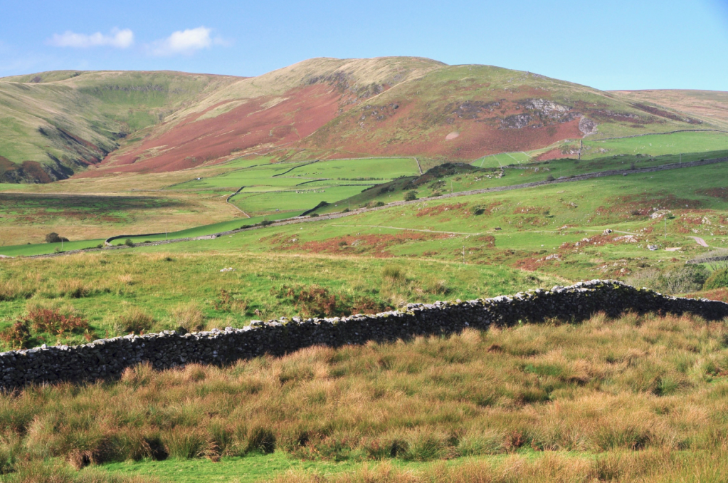
View looking west to Swinside Hill from near Thwaite Yeat. Credit: Roger Butler
3. SD168892: Near the farm, take a permitted path to L of the buildings and go L after the first barn. Cross the field to cross a stone stile and continue ahead for 350m to the open road. Turn L for 1.5km to the crest of the hill and a small rough parking area.
4. SD149896: Leave the road on L and turn south-west for 550m to the rocky outcrops on Stoneside Pike. Keep the fence on R, descend to pass an isolated conifer plantation and then cross a stile by a junction of fences – it can be rather boggy here. Keep fence on R and walk south-south-east over Swinside Fell for 1km.
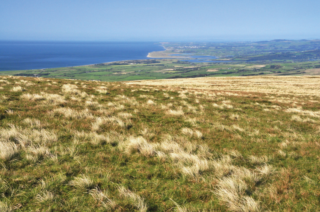
Panorama looking north along the Cumbrian coast to the estuary at Ravenglass. Credit: Roger Butler
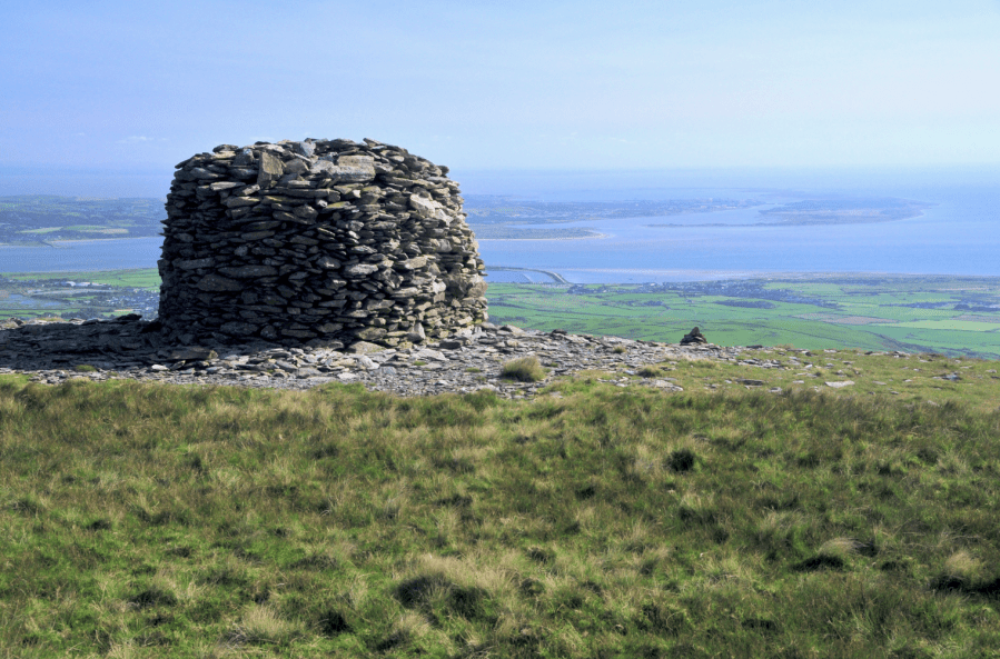
5. SD153878: Follow fence for another 400m; then keep ahead over level ground by the top of Whitecombe Screes. Continue over Hentoe Hill to the top of Blackcombe Screes – walk to the edge for views into the rocky bowl with the fairy tale name of Eller Peatpot – and reach the stone shelter and trig pillar on the summit of Black Combe after another 500m.
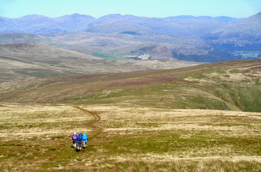
Walkers head north from the broad plateau of Black Combe. Credit: Roger Butler
6. SD135854: Walk south to a small tarn and prominent cairn on the south summit. Continue south-south-west (no path) for 700m to meet the broad path which descends south to Townend Knotts and the steep valley of Moorgill Beck. Walk downhill to a gate, leading onto a track.

The western slopes of Black Combe dip down towards the Irish Sea at Silecroft. Credit: Roger Butler
7. SD130828: Go L, around a bend and take gate on R. Cross a couple of fields to the A595, take small gate next to cottages after 100m and bear R over the field towards a pylon and gate by A5093. Turn L for 100m and go R on the lane to the railway station in Silecroft – or carry on for ten minutes if you want to visit the beach, where there are miles of sand when the tide is out. Catch the train to Foxfield – three stops down the line – and enjoy the views back to Black Combe.

At the end of the walk, the train ride from Silecroft provides fine views back to Black Combe. Credit: Roger Butler
8. SD208854: Turn L out of the station on the A595 – fork R after 1km to follow the lane back into Broughton-in-Furness.
Further information
Public transport: Stations at Foxfield and Silecroft – the walk could start at either end of the route
Tourist Information: Broughton-in-Furness TIC – 01229 716115; open Thursday to Saturday
Walk more routes in Cumbria mapped by our experts.


