

Alex Roddie jumps on the train to explore a Corbett – Beinn Mheadhonach via Glen Tilt – above Blair Atholl.
One of the pleasures of getting to know a single area intimately over many years is that it soon stops being about the big attractions and starts being about the subtler charms. For me, the Blair Atholl area is a bit like that. I’ve been visiting regularly for more than a decade and still feel as if I’ve only just scratched the surface.
One of the reasons why I visit so often is that it’s very accessible by public transport – both train and bus. This made it a feasible base even when I lived down south in England. Now, based near the Angus Glens, I can easily head there for a day (or overnighter) by public transport.
Beinn Mheadhonach is a Corbett at 901m in height, tucked away between the Munros of Carn a’ Chlamain and Beinn Dearg. Approached through the delightful Glen Tilt, this is a straightforward hillwalk with good views and plenty of historical interest. Paths are generally good, although occasionally rough and heathery on the mid slopes.
Beinn Mheadhonach via Glen Tilt: route guide
START/FINISH: NN874663, Old Bridge of Tilt car park | MAPS: OS 1:25,000 Explorer sheet OL51 (Atholl), OS 1:50,000 Landranger sheet 43 (Braemar & Blair Atholl), Harvey 1:25,000 Superwalker XT25 (Loch Tummel & Blair Atholl) | DISTANCE: 22.1km / 13.7 miles | ASCENT: 974m / 3,196ft | DURATION: 7 to 8 hours
1. NN874663: Start at the car park at Old Bridge of Tilt (which is a short walk through the woods from Blair Atholl). On the other side of the road, a track heads uphill through trees beside East Lodge. The track soon exits the trees and continues to gently climb with open pasture to your left. After about 1.6km, take the right-hand fork in the track and continue through woodland, soon descending to Cumhann-leum Bridge across the River Tilt.
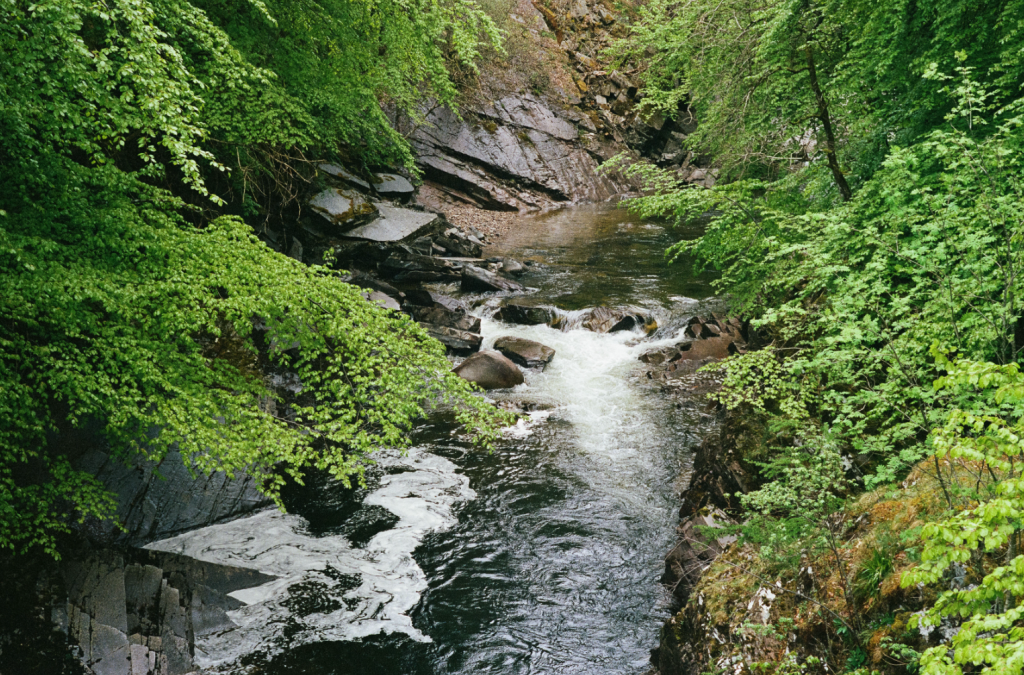
The River Tilt. Credit: Alex Roddie
2. NN881685: Cross Cumhann-leum Bridge and keep going N (ignore a path coming in from your right soon after the bridge). Now on the E bank of the river, views begin to open up along the glen. Soon enter more woodland (Dalginross Wood) and descend to a second bridge (Gilberts Bridge).
The Ach-mhairc Bridge. Credit: Alex Roddie
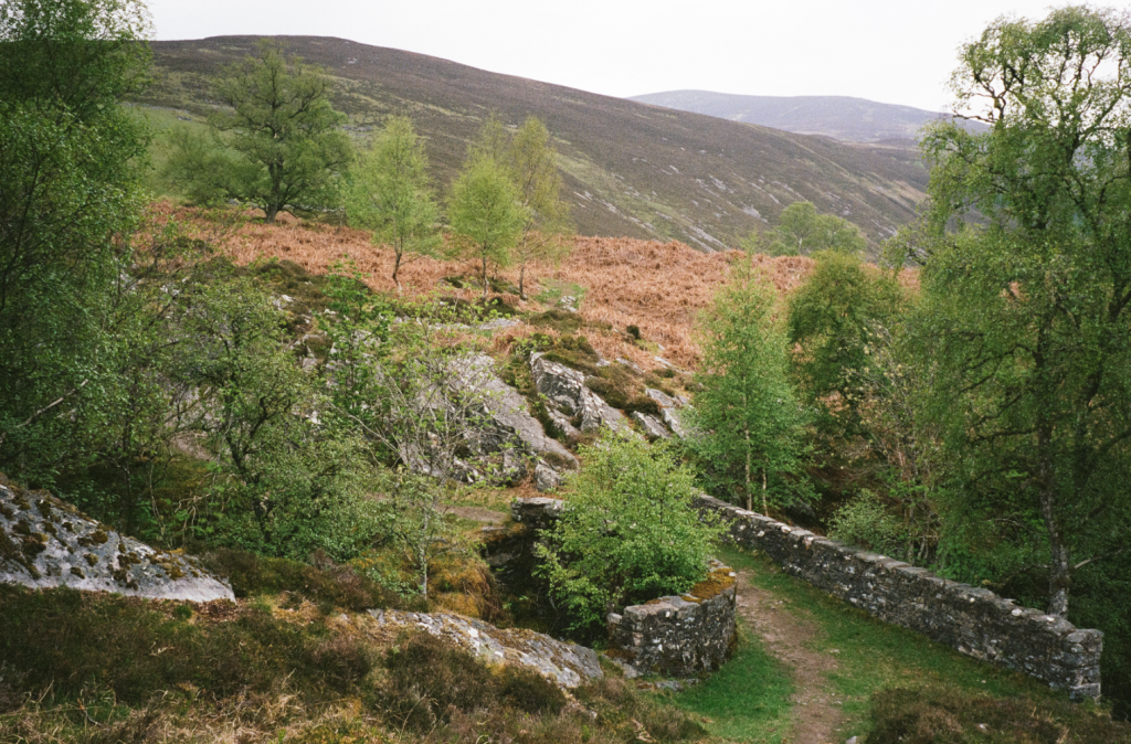
3. NN881701: Cross Gilberts Bridge back to the W side of the river, turn right, and continue N. The track passes through an area with several ruins before entering delightful open wooded pasture with mature birch trees dotted around. This is Sean-bhaile Wood, named after the cleared township of Sean-bhaile (not visible from the path). The track, fainter here, soon reaches Ach-mhairc Bridge – a far smaller, older, and more picturesque bridge than the others, straddling an energetic waterfall. Cross the bridge to arrive in the ruined township of Ach Mhairc Mhoir.

The cleared township of Ach Mhairc Mhoir. Credit: Alex Roddie
4. NN888714: Extensive ruins can be explored on a slightly raised area above the main path. It’s thought there were originally up to 27 buildings; the community was cleared from around 1850. Take a left turn on a faint path next to a tumbledown stone wall. Continue on this path NW into Gleann Mhairc, climbing steadily uphill. The rounded, heathery bulk of Beinn Mheadhonach can be seen rising directly ahead. The path follows the gorge for just over 1km before roughly descending to the E branch of the river, where a fourth bridge (New Bridge) provides a way across.
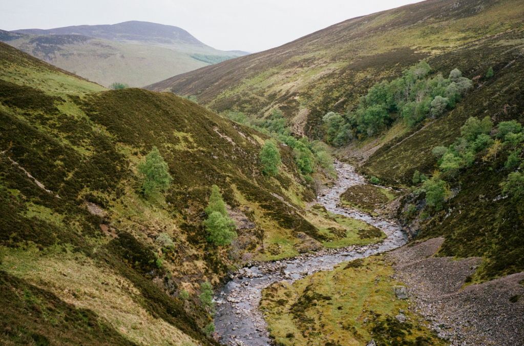
Upper Gleann Mhairc. Credit: Alex Roddie
5. NN884725: New Bridge is another picturesque grass-covered span, probably dating to the early 19th century or earlier. After crossing it, the path becomes vague. A faint path zigzags NW, but is easily lost. Continue climbing NW through heather; after about 100m of elevation gain the heather is less dense and a clearer path can be found. Aim for the crest of the broad spur and climb steadily. It’s about 3.5km with 570m of gradual ascent from the bridge to the summit. The heather fades back after about 2km, leaving open mossy and grassy slopes; despite a few minor boggy and rocky areas, the route is generally clear and easy. Landmarks include the remains of a deer watcher’s shelter, a low stone wall, and a minor false summit cairn.

On the way up Beinn Mheadhonach’s broad shoulder. Credit: Alex Roddie
6. NN880758: The true summit comes at the end of a long, broad plateau. Views are good back to Beinn a’ Ghlo and NW to Beinn Dearg’s rocky dome. After enjoying the views, retrace your steps back the way you came to New Bridge (5), and then Ach-mhairc Bridge (4) and Gilberts Bridge (3).
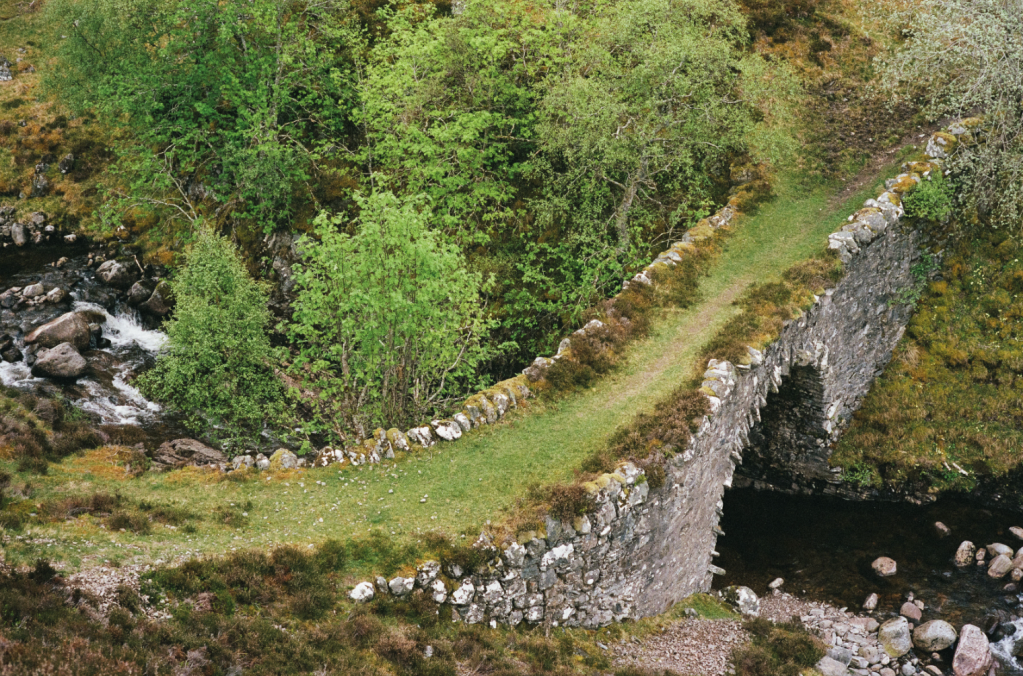
The top-down view of New Bridge on the way back. Credit: Alex Roddie
7. NN881701: Back at Gilberts Bridge, either retrace your steps all the way to Old Bridge of Tilt, or take a slight variation on the return. About 0.2km on the other side of the bridge, a track turns left into Dalginross Wood; take this to climb gradually through the woods to Croftmore. Follow the obvious track for 1.6km after Croftmore until reaching a road junction with views down into Blair Atholl.
8. NN883671: Take a right turn and follow the road through Fenderbridge back to Old Bridge of Tilt.
Further information
PUBLIC TRANSPORT: Regular trains to Blair Atholl. Bus service M91 stops at Blair Atholl between Edinburgh and Inverness.
TOURIST INFORMATION: Pitlochry iCentre, 01796 472215
Walk more routes in Scotland, as mapped by our experts.


