James Roddie takes on Aonach Eagach, a big route with a big rep in Glen Coe, Scotland – plus the obligatory Clachaig pub stop!
The Aonach Eagach is a big route with an even bigger reputation. This is as good as it gets in Scotland – a pinnacled, narrow ridge linking two Munros, with excellent scrambling and exceptional views. Unlike most of the scrambling on the Liathach and An Teallach ridge traverses, the main technical difficulties on the Aonach Eagach cannot be safely bypassed. It is a committing undertaking which should not be underestimated, involving exposed Grade 2/3 scrambling over a considerable distance.
Route-finding is largely straightforward, as following the crest of the ridge itself is usually the best option. If you have any doubts about your scrambling abilities or head for heights, hire a professional mountain guide. Leave it for a dry day if you can and enjoy it – days in the hills don’t get much better than this.
As a reward, Clachaig Inn provides a welcome stop for refreshments on the return walk. If you are lucky, you may be able to get a lift from other walkers driving from the Clachaig back towards the start of the route.
Aonach Eagach: route description
Start/finish: NN 1710 5688 – The Lost Valley carpark on the A82 | Ascent: 5729ft/1609m | Duration: 8-12 hours | Distance: 10.6 miles/17km | Maps: OS Explorer 384 – Glen Coe and Glen Etive
1. NN 1710 5688: Park in the Lost Valley carpark and walk 200m E along the A82, to a small carpark at the bottom of the path up Am Bodach. (This smaller carpark is often full). Head up the well-made path, which is now followed steeply all the way to the summit of Am Bodach. There are a few necessary clambers up rocky steps and slabs along the way.
The start of the route up Am Bodach. Credit: James Roddie
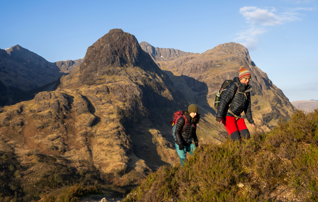
2. NN 1684 5799: The summit of Am Bodach provides a fine view of the ridge, but does not reveal its technical difficulties. Head NW from the cairn along an obvious path, to soon reach a steep downclimb. Once at the bottom you are committed, so turn around at the top if you have any doubts! A polished route zig-zags down the crag face, which some large drops on each side. An awkward step around a bulge at the bottom brings you to easier ground. This is followed by a further climb down a polished rocky ramp and some disjointed easy scrambling, after which a straightforward ascent brings you to Meall Dearg – the first Munro of the day at 953m.
Heading West from Meall Dearg. Credit: James Roddie
3. NN 1612 5835: Meall Dearg’s summit reveals the difficult nature of the ridge ahead. The majority of the route’s difficulties lie within the approximately 1km distance between Meall Dearg and Stob Coire Leith. Descend an easy path SW from Meall Dearg to reach much rockier ground. A narrow crest and steep descent bring you to a notch in the ridge, with the route ahead following up an obvious rocky gully. Continue over a number of short scrambles, and descend a narrow, polished chimney over a chockstone.

Two ways of approaching the rocky gully. Credit: James Roddie
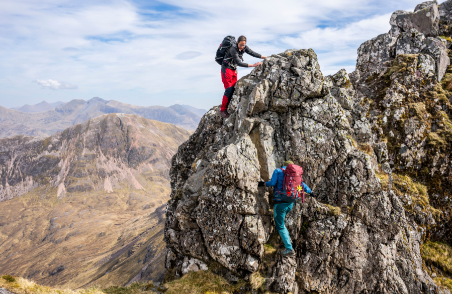
4. NN 1531 5828: Not long after the polished chimney descent, you will reach the start of the ‘crazy pinnacles’. This is arguably the crux of the route and some people might want the assurance of a rope here. It is very exposed section but the holds are plentiful. The best route generally passes over the pinnacles on their right side as you face them. Do not be tempted to try and bypass this section – the faint paths running below the pinnacles will lead you to dangerous ground.
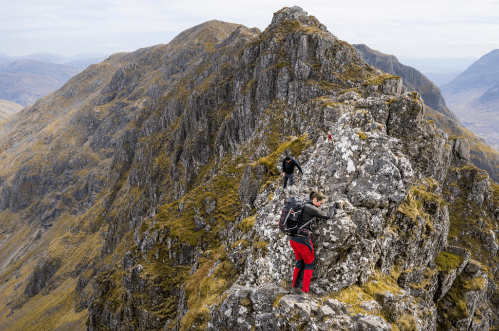
Coming over the crazy pinnacles. Credit: James Roddie
The pinnacles are followed by a series of steep descents and reascents over small rocky tops. One descent in particular is awkward and more technically difficult than the downclimb off Am Bodach, and may provide the crux of the entire route for people who find downclimbing their weakness.

A steep step down on the ridge. Credit: James Roddie
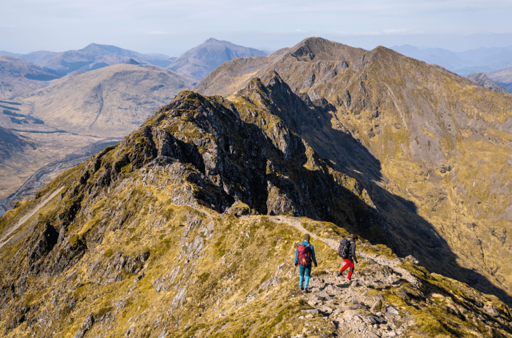
5. NN 1493 5849: The ascent to the summit of Stob Coire Leith marks the end of the technical difficulties. The view back along the ridge from here is excellent. Descend slightly to the SW and then reascend to the second Munro of the day – Sgorr nam Fiannaidh at 967m.
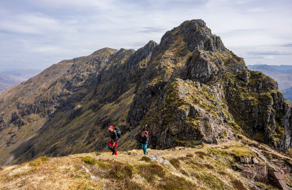
After the difficulties – approaching Stob Coire Leith. Credit: James Roddie
6. NN 1403 5830: From Sgorr nam Fiannaidh’s summit rock shelter, follow an obvious path W down loose ground and scree. Eventually this joins the highly eroded Pap of Glencoe path at a large cairn. Follow the path to the minor road from Glencoe village. Turn left along the road, passing the hostels and campsite.

On Sgorr nam Fiannaidh, looking back to the ridge. Credit: James Roddie
7. NN 1280 5673: Clachaig Inn provides a welcome stop for refreshments on the return to the car. From here you have a 5km walk back along both the road and a minor track just beside the A82 on its S side. If you are lucky however, you may be able to get a lift from other walkers driving from the Clachaig back towards the start of the route.
Further information
Public transport: Citylink bus (914/915/916) to Glencoe village.
Tourist information: Glencoe Visitor Centre, Glencoe, Ballachulish PH49 4HX