“I had descended a fair distance down the NE spur before I realised that I shouldn’t be on such blocky and steep ground.”
This is part of our series of reader submissions on getting lost and lessons learned the hard way. To read more entries, and to find out how to submit your own, see this page.
Allan Young is a hillwalker who occasionally indulges in mountaineering, rock climbing, ice climbing and snowboarding. He’s on Twitter at @MountainAllan and blogs at wainwrighteer.blogspot.com.
Although there are probably quite a lot of navigational errors I have made over the years, I can recall three that have somehow managed to lodge themselves in my long-term memory.
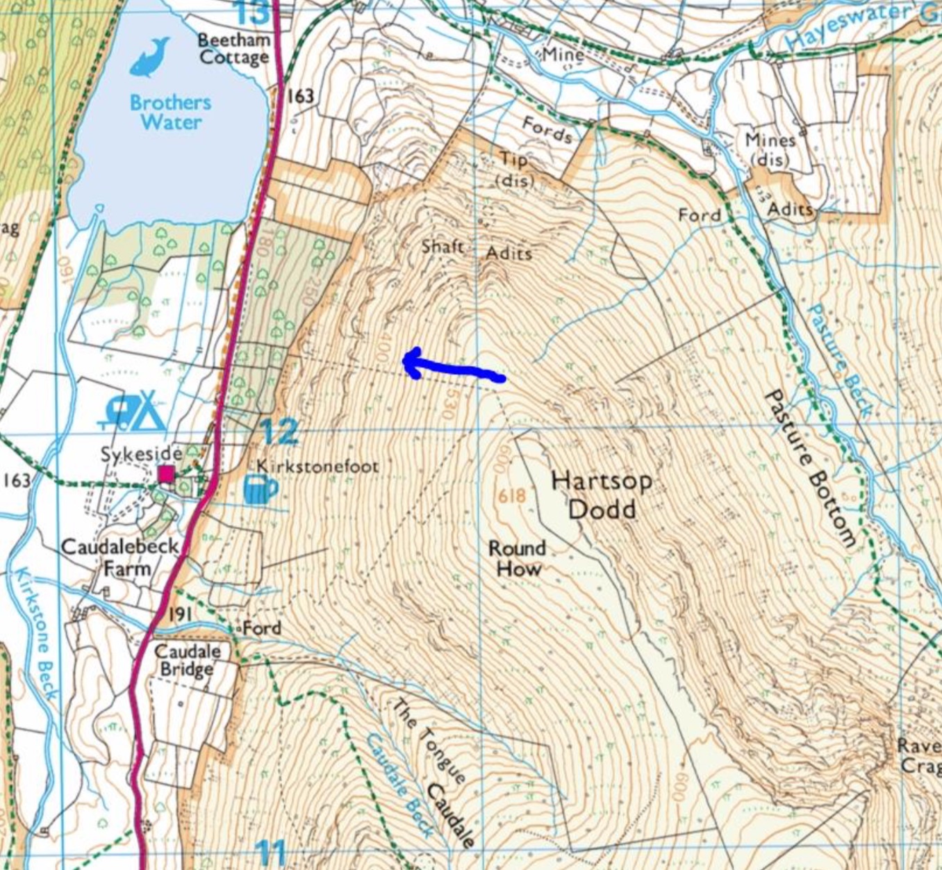
Firstly, the OS Explorer symbols for a ruined boundary and a footpath on the ground are the same (a dashed grey line). Heading west from just north of the summit of Hartsop Dodd is a ruined wire fence which I interpreted as a footpath off the fell. This happened at the end of a long day and I should have realised that footpaths tend not to follow such straight lines – my knees paid for that mistake!
The next two instances of error have a lot in common.
The Moel Siabod error was quickly recognised and with a closer look at the map I made the correction needed to get off the Daear Ddu and head for Capel Curig.

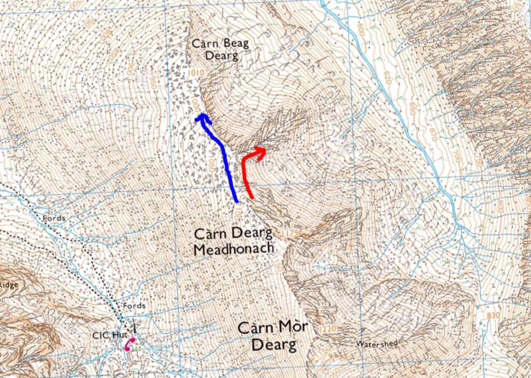
The CMD mistake took a little more time to realise. I had reached the main ridge a little way below the summit of Carn Dearg Meadhonach after a direct ascent from the CIC hut and was aiming for Carn Beag Dearg. I had descended a fair distance down the NE spur before I realised that I shouldn’t be on such blocky and steep ground. But the terrain was so entertaining that I intend going back and use the spur as an ascent route.
The things in common about these two mistakes are:
- poor visibility;
- not taking a bearing;
- aiming to descend easy terrain;
- using steep ground on the right as a handrail;
- descending a steeper subsidiary ridge.
Read more in our reader series ‘Getting lost: lessons learned the hard way’