Computer mapping for long walks
When I first did the TGO Challenge I used to lay out the OS sheets on the floor and trace a route on them in pencil. I’d then count all the grid squares crossed for an estimate of the mileage and laboriously add up the contour lines for an estimate of the amount of ascent. Now I sit at a desk and draw the route on a map on the computer screen. A couple of clicks then gives me the distance and ascent.
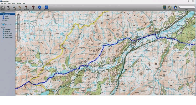
The software I’ve used for this for several years now is RouteBuddy, on which I have all the OS 1:50,000 mapping for the Scottish Highlands. This scale isn’t fixed with RouteBuddy though and I can easily reduce it to get a bigger picture of sections of the route or increase it if I want to see more detail.
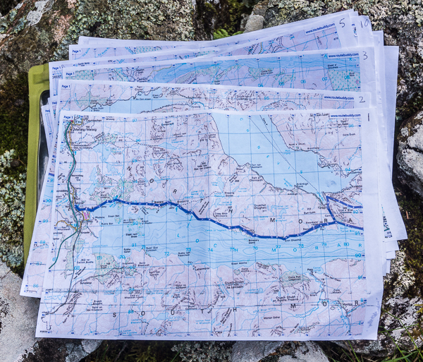
Route planning on Route Buddy is easy and fun. On the screen maps I draw intended routes and bad weather alternatives. If I want to make changes I can easily delete or alter routes. Once I’m happy with the result I print the maps out on A4 paper. This year the total was seventeen sheets that, with a SealLine waterproof case, weighed 185 grams. I carried them all the whole way. If I’d taken OS Landranger maps I’d have needed nine, with a total weight of 747 grams. Of course I wouldn’t have carried all of those. I’d have posted them in batches to post offices along the route, as I used to do in the past, and posted back ones I didn’t need anymore. Not having to reach post offices when they were open makes route planning easier and allows for more flexibility during the walk itself.
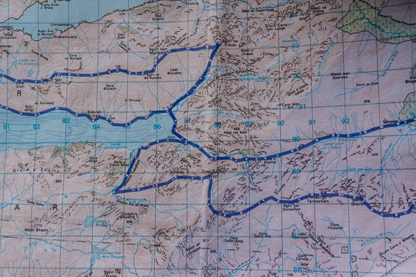
The RouteBuddy maps were printed on ordinary A4 paper with a very old inkjet printer. The colour and definition wasn’t as good as on OS maps or as good as print-outs in previous years. I think I need a new printer! In future I’ll print on better quality paper, perhaps waterproof, too. Not that I had any problems with the maps this year but having them a little sharper and glossier would be an advantage in poor light. To protect the maps against rain I carried the ones for each day in an Alosak bag weighing 33 grams – a bag I’d have used with OS maps too. In the Aloksak the thin maps could easily be folded and carried in a pocket.
Using A4 sheets has just one disadvantage. If you change your route it’s easy to walk off one unless you have all the surrounding areas, which rather defeats the point. In case of this I had mapping for the whole of the Highlands on my phone. Not from RouteBuddy as it’s not available for Android phones but from ViewRanger. Having this app also turned my phone into a GPS unit, a useful backup to paper map and compass that I used a few times in misty weather to confirm my position.
RouteBuddy makes planning so much easier and quicker than tracing routes on all those maps on the floor. I still love big maps but for long walks computer planning and A4 print-outs have great advantages.