Marching for nearly 270 miles through the ever-changing scenery of the Pennines, the Pennine Way is the first (and, some would say, still the best) of England’s long-distance paths. Becky Angell takes a detailed look at the route.
England’s original long-distance path, the Pennine Way has been guiding walkers from the Peak District to the Scottish Borders for sixty years. Despite treading a high route between some of northern England’s largest cities, this classic 268-mile trek is known for its remoteness – sometimes you can walk for miles without seeing another person. Walking from south to north, the adventure begins with a traverse over the peat moorland of the Kinder Plateau. You’ll wind onwards through the rolling hills and villages of the Yorkshire Dales, coming at last to the bleaker terrain of the North Pennines. The final stages cut through the Cheviot Hills, famous for their unpredictable weather and flagstone pathways.
Main image: Looking into Scotland from the hard-fought-for Pennine Way | Credit: Shutterstock
The Pennine Way isn’t short of scenic highlights. From Kinder’s gritstone outcrops to the waterfalls of High and Low Force and the spectacular U-shaped chasm of High Cup Nick, there’s plenty to feast the eye upon as you hike. But don’t under-estimate the demands of the route. Many of the days are long and physically tough, particularly the 20-mile stage taking in 893m Cross Fell. It’s traditional to celebrate the accomplishment of completing the route at the Border Hotel, which hands out a free certificate and beer. Don’t forget to leave a message in the Walkers Book.
Here’s The Great Outdoors‘ guide to the Pennine Way, featuring helpful tips on the following:
- Route details
- When to go
- Transport
- Accommodation
- Resupply
- Navigation
- Essential gear
- Further resources
The Pennine Way: at a glance
Distance: 431km/ 268 miles | Ascent: Approximately 11,700m/ 38,300ft | Start: Edale, Peak District | Finish: Kirk Yetholm, Scottish Borders | Duration: between 2-3 weeks
The Route
This iconic 268-mile trail begins from Edale and finishes in Kirk Yetholm. Allow two to three weeks to complete the full Way and don’t expect easy days – there’s nearly 12,000 metres of ascent to tackle! The first two stages* are tough, beginning with a demanding uphill via Jacob’s Ladder to Kinder Scout and continuing via Bleaklow to a second steep ascent up Black Hill (with bonus boggy obstacles!). Fortunately, the subsequent stages have fewer punishing climbs and feel easier.
The third stage often ends in Hebden Bridge (off route but the best overnight option). From here, the route proceeds over the moors. It passes Top Withins, an old farmhouse associated with Wuthering Heights, and comes to the little village of Cowling. Then it crosses the border into the Yorkshire Dales, passing through Gargrave and Malham. The sixth stage is a route highlight, but it’s mentally and physically challenging. Starting with the steep steps up Malham Cove, it traverses Fountains Fell and ends with 694m-high Pen-y-Ghent.
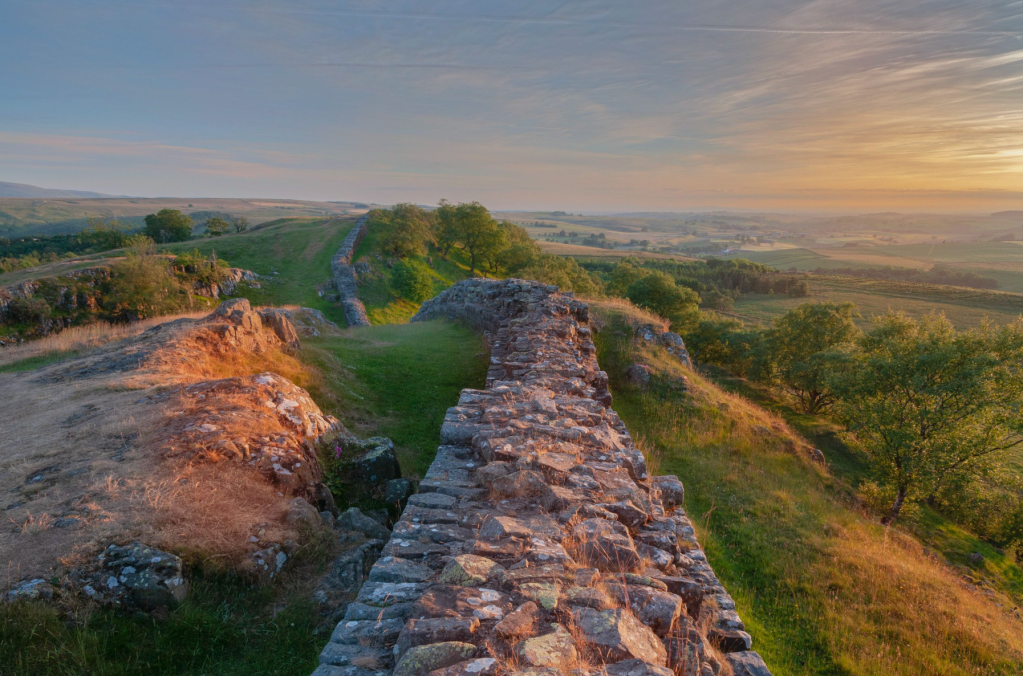
Where the Pennine Way crosses Hadrian’s Wall. Credit: Shutterstock
There’s more scenic beauty to come, with plentiful vistas of green rolling hills amongst limestone rocks as you tramp from Horton-in-Ribblesdale to Hawes. Then brace yourself for another energy-sapping climb up Great Shunner Fell, with the prospect of a pint at the Tan Hill Inn – Britain’s highest pub 528 m – to reward you at the end of the day. The official route of the Pennine Way continues via boggy Sleightholme Moor (where some choose a road detour) to God’s Bridge. Next comes the tough 20-mile hike between Middleton-in-Teesdale and Dufton, incorporating a challenging scramble alongside Cauldron Snout.
This is another highlight for many, thanks to the waterfalls of Low Force and High Force, and the breathtaking views of High Cup Nick. Hiking onwards over Cross Fell (893m), it’s easy to get disorientated in poor visibility. Luckily, Greg’s Hut (the highest bothy in England) offers a little shelter and respite. One of the least scenic stages comes next – Alston to Greenhead – but the Way soon joins Hadrian’s Wall Path and then turns north away from the crowds to reach Bellingham.
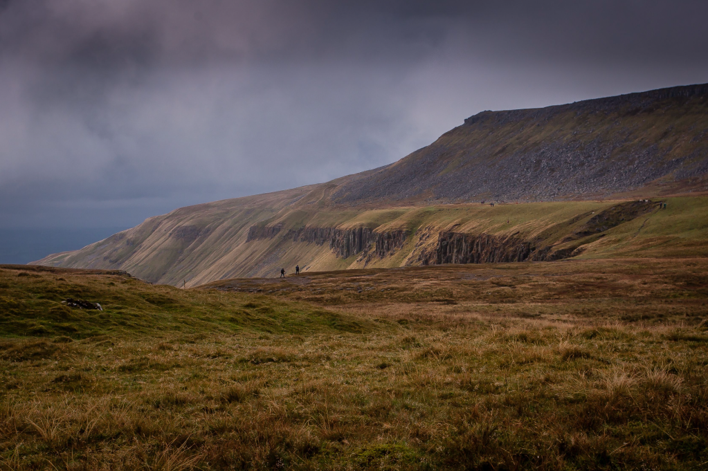
High Cup Nick. Credit: Shutterstock
The hike onto Byrness finishes with an everlasting forestry track. Then you can attempt to cross the Cheviots in one day or split this mammoth stage into a two-dayer by organising a pickup near Windy Gyle. There’s one more decision to be made on the final section. Do you take the high or the low route? More ascent versus downhill most of the way to the finish in Scotland. You decide.
*Becky’s stage-by-stage breakdown is based on one of the most popular itineraries among Pennine Way walkers.
When to Go
The weather is generally best between late spring and early autumn; but the Pennine Way is renowned for throwing curveballs, especially in the mountainous areas. Pack for all conditions! You’ll benefit from extra daylight hours around the spring equinox, but choose early September for fewer people on the trail.

Goat Scar Lane above Stainforth in Ribblesdale. Credit: Pete Stuart / Shutterstock
Transport
Edale is served by regular trains from Manchester and Sheffield. In Kirk Yetholm, the nearest station is Berwick-upon-Tweed. There are two options here: book a taxi or catch two buses, the 81/ 81A to Kelso and then the 67 to Berwick-upon-Tweed. Check the bus timetables in advance.
Accommodation
Some locations have plenty of accommodation options while others are limited. Camping allows you to keep your plans flexible, and many campsites offer a ‘walk in’ policy so they won’t turn you away. If the idea of carrying a heavier backpack doesn’t appeal, there are luggage transport options too. Alternatively, you can choose between guesthouses, hostels and B&Bs to suit most budgets. Book in advance to ensure you don’t struggle finding somewhere. The hotspots include Horton-in-Ribblesdale, Keld, Hadrian’s Wall and Byrness.
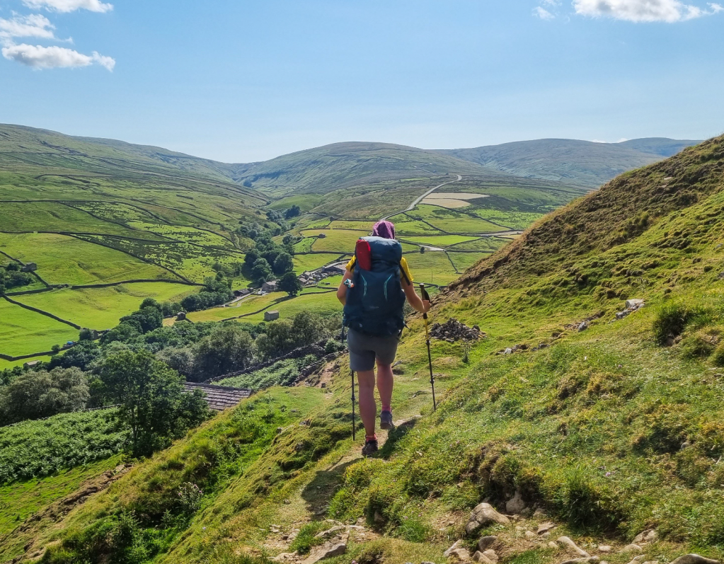
Walking the path above Swaledale. Credit: Becky Angell
Resupply
There are local and independent pubs, cafes and shops along the Pennine Way, although not always where you might want them. Gargrave, Hawes, Alston and Middleton-in-Teesdale are great places to resupply or replace items. Also, detour to May’s Farm Shop outside Hebden Bridge – it’s full of things you’ve forgotten or didn’t know you needed.
Navigation
Signposts are found regularly along the route, from wooden fingerposts to PW letters marked on stones; but you can’t solely rely on them for the entirety of the trail. The toughest, mountainous areas have fewer signs. In bad weather you can become disorientated by lack of features, so you’ll need good map reading skills.
Essential Gear
For expert advice on everything from hiking boots and waterproof jackets to tents and sleeping bags, check out The Great Outdoors‘ reviews, buying guides and recommended products.
Discover more long distance trails as mapped by our expert contributors.