Ditch the car and tick off six Wainwrights (plus the dinky-but-delightful Orrest Head) on this linear walk of the Kentmere Horseshoe from Windermere train station to Patterdale.
If you fancy ditching the car in favour of rail, there are two main access points to the Lake District by train – Windermere (via Oxenholme Lake District) and Penrith North Lakes. With a long weekend, you could even walk between to the two train stations on a three-day, wild camping expedition with a twist. But, if you only have a day spare, this 24km linear route is an excellent alternative.
Starting at Windermere train station, the route first climbs Orrest Head, the 238m hill where a young Alfred Wainwright first set eyes across Lakeland, sparking his lifelong passion for the landscape. After a linking section across farmland, next comes a delightful ridge walk over the Kentmere fells, including the rolling trio of Yoke, Ill Bell and Froswick, before picking up the ancient Roman Road path over Thornthwaite Crag, High Street and beyond to The Knott. The final stage descends via Angle Tarn and Boredale Hause to Patterdale, where the regular Stagecoach 508 bus will whisk you away to Penrith North Lakes train station to complete your rail journey home. Along the way you’ll tick off six Wainwrights – Yoke, Ill Bell, Froswick, Thornthwaite Crag, High Street and The Knott – but there is ample room to tick off more.
The Kentmere Horseshoe: route description
START/FINISH: Start at Windermere train station (SD414986, LA23 1AH), finish at Patterdale Hotel (NY395159, CA11 0NN) | MAPS: OS Explorer OL05 and OL07 (1:25k), OS Landranger 90 and 96 (1:50k), Harvey UltraMap XT40 Lake District East (1:40k) | DISTANCE: 24.1km / 15 miles | ASCENT: 1,196m / 3,924ft | DURATION: 9 hours
1. SD413986: Exit train station and turn left. Go past bus stops and Booths supermarket and turn right to cross road at zebra crossing. Turn right past bench and Windermere train station sign, and cross A591. Turn left, heading west. Fork right off main road and arrive at prominent white sign. Turn right and head north briefly before veering left at fingerpost sign. Head north-north-west on walled lane through woodland. Just before reaching building, turn right at next fingerpost sign. Continue north on winding path to reach right-hand turn in wall at Elleray Bank. Follow path as it bends rights, fork left almost immediately at next junction and climb steps heading east. Beyond gap in stone wall, continue east on wide gravel path. Ignore a turn-off left through gate and instead stick to wide path, which loops north-west and north to Orrest Head.
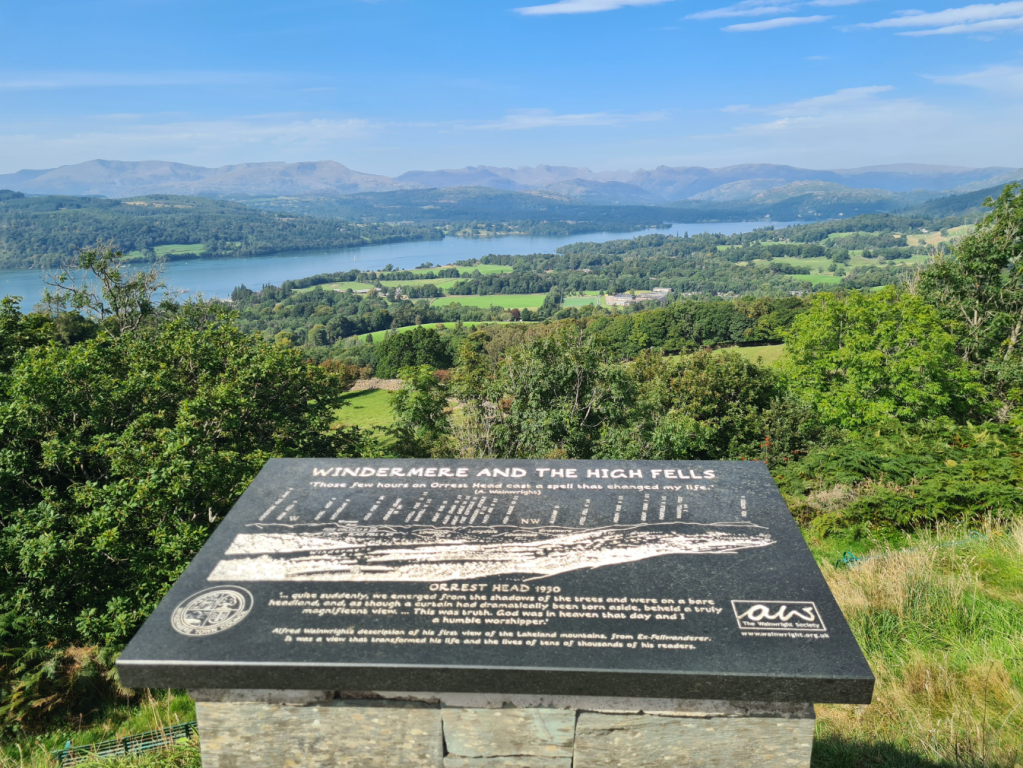
An infographic explaining the scenery from the summit of Orrest Head. Credit: James Forrest
2. SD414993: Pick up a grassy path descending north. Next to gate, turn right over stone stile and head north and north-north-east through fields. Cross little stone footbridge, climb stone stile and turn right on road. Head north-east and east past Near Orrest. At fingerpost sign to ‘Moor Howe’, turn left through gate and head north through farm fields. After multiple gates and stiles, turn right on Moorhowe Road and walk south-east to car park at Moor Howe. Turn left on Dubbs Road byway and head north to Dubbs Reservoir.
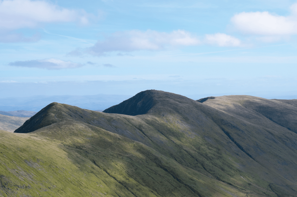
The trio of Froswick, Ill Bell and Yoke on the Kentmere Horseshoe ridge. Credit: James Forrest
3. NY422016: Walk along eastern shores of reservoir and continue north. Ahead the going is straight-forward, sticking to wide track. Continue north on wide Garburn Road track. Climb steadily as path veers north-east and, beyond the woodland at Garburn Nook, arrive at top of Garburn Pass.
4. NY434044: Turn left off Garburn Pass at cairn and ascend north on steep but easy-to-follow fell path. Veer right towards wall, go through kissing gate, and ascend steadily up stone-pitched path to Yoke.
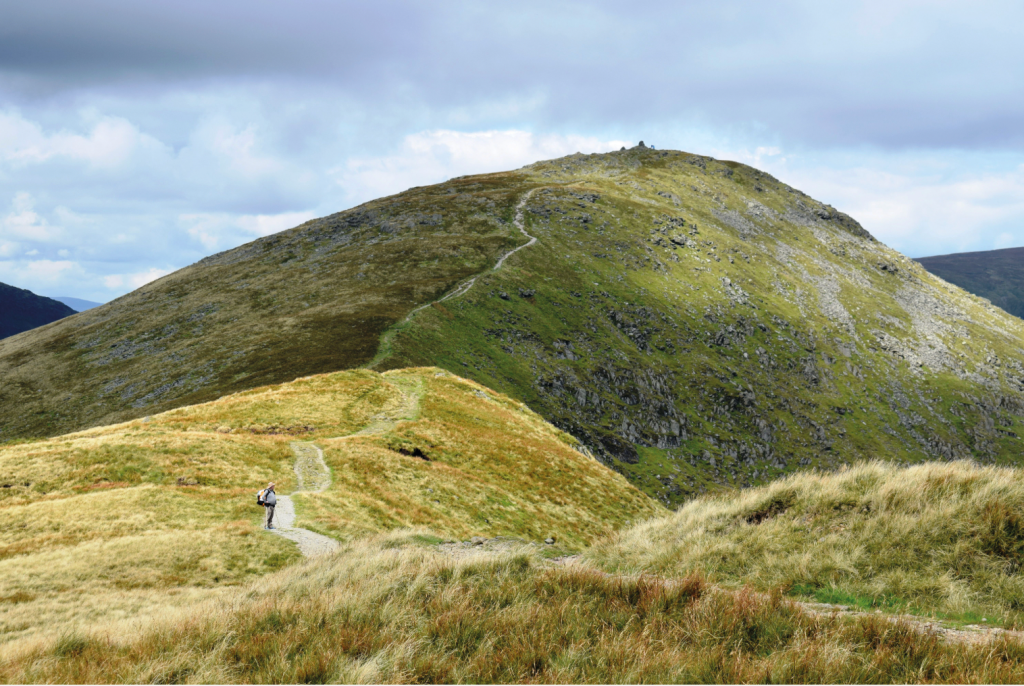
Views of Ill Bell from the Kentmere ridge. Credit: James Forrest
5. NY437067: Head north past small tarn on right, go through gate and descend to col between Yoke and Ill Bell. Climb steeply north over rockier terrain, keeping safely to left of Rainsborrow Cove, and arrive at twin cairns of Ill Bell. To north lie precipitous cliffs above Over Cove, so descend north-west on stony path to next col. Climb north over grassy slopes to Froswick and descend north-west to yet another col. Continue steadily north and veer left, away from Roman road to High Street, bearing north-west to Thornthwaite Crag.
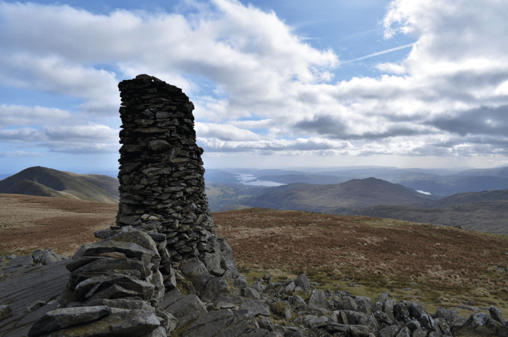
The huge columnar cairn atop Thornthwaite Crag. Credit: James Forrest
6. NY431100: Turn right and head east and north-east to join up with High Street Roman Road. As you cross gap in collapsed wall, fork right and join another wall. Follow this wall north-north-east to High Street’s trig. Several paths lead in same direction here, but we’d suggest turning left and heading north-west briefly on grassy cut-through. Rejoin Roman Road, turn right and head north down to col at Straits of Riggindale. Ascend north-north-west alongside wall. Continue climbing next to wall – following it as it bends sharply west – to Knott.
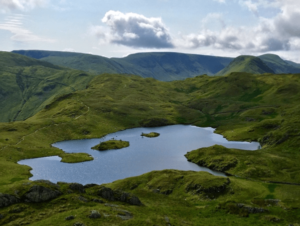
Angletarn from Angletarn Pikes.
7. NY437127: Descend north-west down to wide stony path. Turn left and descend briefly west before forking right to traverse below southern and western flanks of Rest Dodd, aiming towards Satura Crag. Cross Sulphury Gill and follow wall and fence north-west. After crossing two forks of Prison Gill, follow fence as it veers left and climb gently to broad ridgeline. Pass tiny tarns and descend north-west towards Angle Tarn, sticking to west of Buck Crag. Loop left around tarn’s northern shore, then right around Angletarn Pikes, and finally north to left of Stony Rigg down to Boredale Hause col. Cross Stonebarrow Gill, next to old sheepfold, and turn left. Fork right almost immediately to descend north-west. Beyond copse of pines, follow wall north-west, and turn left onto minor road beyond a footbridge and gate. Follow road south-west and over river to reach A592 in Patterdale. Turn right and head to bus stop at Patterdale Hotel.
Further information
PUBLIC TRANSPORT: Take a train to Windermere railway station, via Oxenholme Lake District. From Patterdale, take a Stagecoach 508 bus to Penrith North Lakes train station.
TOURIST INFORMATION: www.visitlakedistrict.com
Walk more routes in the Lake District, as mapped by our experts.