If you find the human history of the landscape as fascinating as the mountains, the Snowdonia Slate Trail – a multi-day wander through North Wales – could be right for you, says Alex Roddie.
Llwybr Llechi Eryri, or the Snowdonia Slate Trail, takes a route that may look ambling on the map, but this is an adventure with purpose. Today, Eryri (which you may know by its former name Snowdonia) is a mountain paradise for hillwalkers, climbers, runners, and cyclists. But it wasn’t always this way. Centuries ago, tourism had yet to develop – and the main industry of the entire region was slate. Welsh slate was renowned as the best in the world.
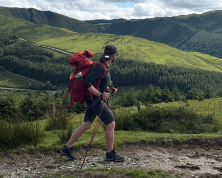
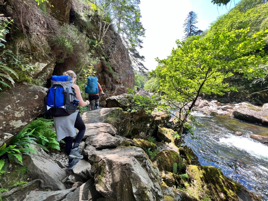
Main image: The locals on the Snowdonia Slate Trail in the shadow of Cnicht | Credit: Francesca Donovan
Observant visitors to Eryri can’t fail to notice the scars of this industrial past. They’re everywhere, from the grassed-over spoil tips high on remote mountainsides to entire landscapes that have been excavated and transformed. Mountains have been hollowed out. And many of the region’s towns and villages – such as Blaenau Ffestiniog – were entirely devoted to slate mining in their heyday. Today, dozens of abandoned quarries from tiny to vast dot the mountains – an important part of Eryri’s heritage with an austere beauty all of their own.
The Pass of Aberglaslyn – a dramatic wooded ravine. Credit: Alex Roddie
The Snowdonia Slate Trail aims to celebrate and explore this heritage. Taking a tour of the region, it wanders from town to town and valley to valley via moorland trails and tracks, although it does not climb into the high peaks. The highest point is at only 526m, and with a modest elevation gain over several days this is a moderate route – far less extreme than, for example, a round of the Welsh 3,000ers. But it can still feel like a strenuous trail, especially in bad weather. And what it might lack in big-name summits it makes up for in heritage and exploring areas away from the honeypots.
The Snowdonia Slate Trail: at a glance
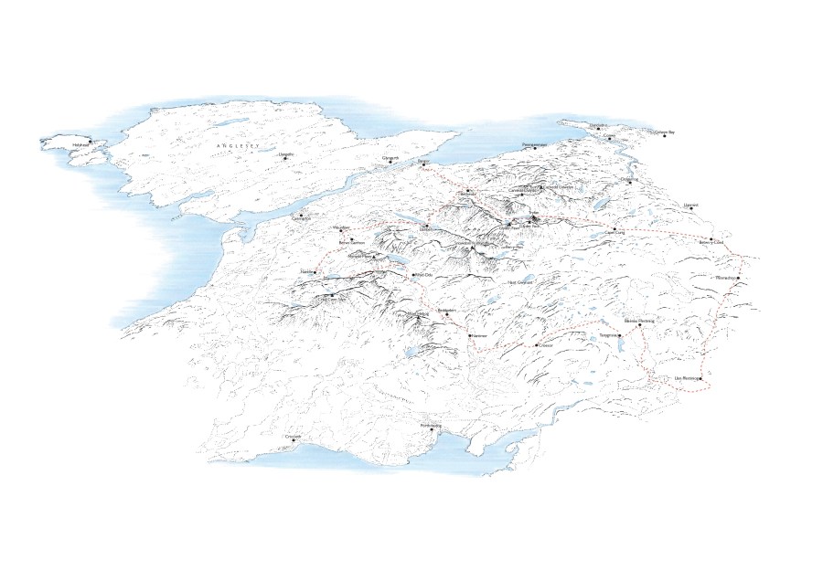
Start: Bangor, Gwynedd, Wales | Finish: Bethesda, Gwynedd, Wales | Distance: 133km / 83 miles | Ascent: 2,777m / 9,111ft | Duration: 4 to 6 days
The Route
After starting from Bangor at the coast, the Snowdonia Slate Trail begins by heading south towards Bethesda at the northwest corner of the national park. Although it passes a few smaller spoil tips before reaching Bethesda, you can’t fail to notice the Penrhyn Slate Quarry above the town – the first of the huge quarries this trail sets out to explore. Vast piles of excavated rock lie in terraces above the trees. The quarry is still in active use, although its workforce is far smaller now than it was at its peak in the 19th century.
The Slate Trail skirts the quarry to the west, then soon draws near to the Dinorwic Slate Quarry, which delves far into the flank of Elidir Fawr above Llanberis. After dropping down to Llanberis itself, the trail then climbs up out of the village. The section over to Waunfawr barely manages to escape the labyrinth of spoil tips, shafts, inclines, and abandoned levels. Waunfawr to Nantlle (both former mining villages) is another section riddled with these traces.
Rhydd-Ddu, the most common starting point for the Nantlle Ridge walk, is the next stop along the Slate Trail. The trail takes on a new and more mountainous character here, heading south along the Nant Colwyn towards Beddgelert where several valleys converge. After passing beneath the shapely peak of Cnicht, and exploring some of the more remote quarries in the hills nearby, it drops down into Blaenau Ffestiniog itself – former slate capital of the world.
The Slate Trail now takes a tour through the quieter end of Eryri. An amble through the hills between Llan Ffestiniog and Cwm Penmachno reveals plenty more abandoned slate mines before descending through woodland towards the Conwy Falls on Afon Conwy, a major river leading to Betws-y-Coed.
After a well-deserved town stop (train enthusiasts should check out the railway museum), the Slate Trail now beelines west through woodland to Capel Curig, one of Eryri’s main centres for hiking and climbing. The terrain is starting to look a lot more mountainous again – and the views on the final section to Bethesda are arguably some of the best on the trail. Although the route stays low level through the Ogwen Valley, there are still some fabulous views looking up into the various cwms in the Glyderau and Carneddau, as well as that view of Tryfan’s shark-fin profile.
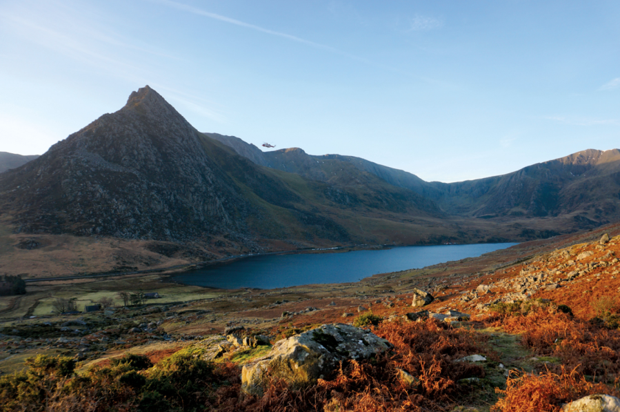
An Ogwen Mountain Rescue helicopter flies past Tryfan from Pen yr Ole Wen. Credit: Francesca Donovan
A final stroll along the east side of Penrhyn Slate Quarry leads back to Bethesda, where the trail comes to an end.
When to hike the Snowdonia Slate Trail
April to September are best, although July and August can feel excessively busy in the more popular parts of Eryri. This route is perhaps best enjoyed in a week of good weather in either May or September.
Working in the Slate Quarries
Quarry workers started as apprentices by the age of 14, and formed crews – often members of the same family. These crews worked together to extract the slate. Some crew members used explosives to blast their section of the quarry face (known as the “bargain”), and then the other workers would split, saw, and trim the slabs into finished slates using a variety of tools.
Although much of the work was conducted outdoors in all weather, dressing the slates took place in sawing sheds where the air was thick with stone dust. This dust contaminated clothing and skin, and often led to lifelong health problems such as eye irritation, respiratory complaints, silicosis, and lung cancer.

On the Snowdonia Slate Trail. Credit: Francesca Donovan
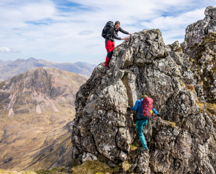
Climbing on Welsh Slate
The Welsh slate industry suffered from the First World War and the Great Depression, and the Second World War largely finished it off. Another factor was the rise of cheaper (but often lower-quality) alternatives such as roofing tiles.
As the quarries fell silent, climbers began exploring their vertical rock faces and labyrinthine warrens. Once a sport for rich (and male) adventurers, climbing began to open up to new classes in the 1950s and 60s. In 1971, only two years after Dinorwic Slate Quarry closed, legendary climber Joe Brown established the route Opening Gambit. Countless more routes have followed – many extremely technical.
Snowdonia Slate Trail hikers are well placed to watch climbers having a go at classic routes on these slabs and walls, as well as questing up unclimbed lines. Another connection between climbing and slate: some pioneering ice climbers, such as W.H. Murray, chose a modified slater’s hammer for cutting steps on technical ice climbs.
Transport
Bangor is on the rail network and can be reached from elsewhere in the UK by changing at Chester. Blaenau Ffestiniog and Betws-y-Coed are on a branch line from Conwy – useful for section hikers. Regular bus services link Bethesda at the end of the trail with Bangor.
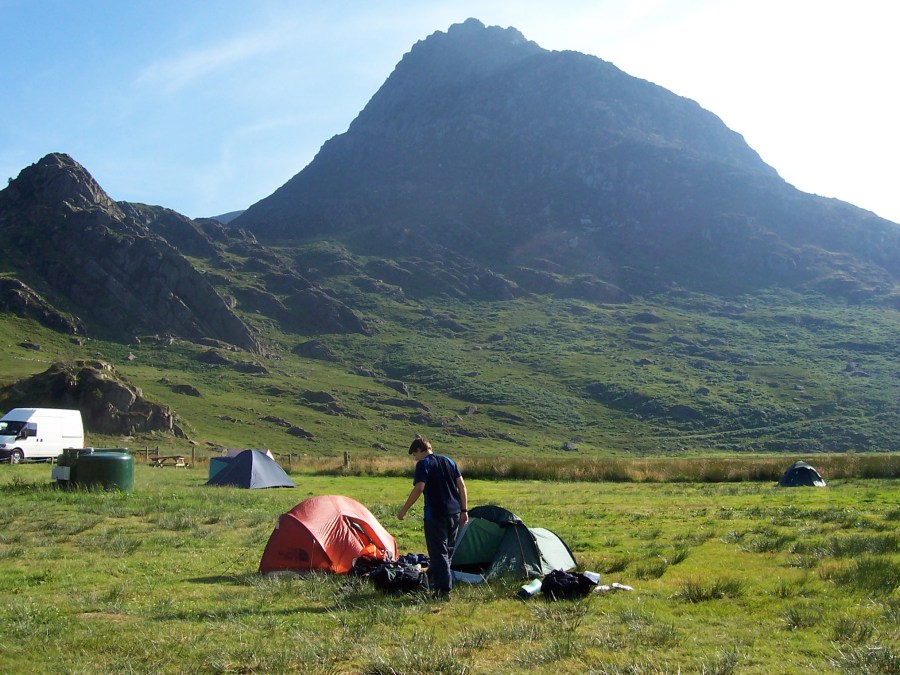
Camping at Gwern Gof Uchaf with Tryfan in the background. Credit: Alex Roddie
Accommodation on the Snowdonia Slate Trail
There are many hostels, hotels, B&Bs, and guest houses along this route, but booking ahead is essential, especially in summer. Valley campsites are usually walker-friendly and rarely require booking. The situation with wild camping is, as usual, to be discreet and courteous; try to camp in higher moorland areas, pitch late and leave early, and above all leave no trace.
Resupply
With frequent towns and villages, as well as numerous cafes and pubs, you will rarely need to carry supplies for more than a day or two.
Essential Gear
In addition to the usual full waterproofs and warm layer, it is worth carrying trekking poles on this trail. Although most of the terrain isn’t mountainous, there are still some steep climbs – and loose slate scree can be tiring.
The Snowdonia Slate Trail: Further Resources
The Snowdonia Slate Trail website has a wealth of information about the trail, including a downloadable GPX file for your GPS device or navigation app of choice (download your maps, as there is poor phone signal in some areas). Aled Owen’s guidebook, Snowdonia Slate Trail, is available from Rucksack Readers (£14.99, 2022).
Discover more long distance trails as mapped by our expert contributors.