

When roads close there are ways to wander on the outskirts of The Peak to the heights of Shutlingsloe, says Francesca Donovan.
After heavy snowfall, the boundary of the Peak District National Park is notoriously hard to breach from the west with the two main thoroughfares – Snake and Winnats Pass – turning perilous and facing closures in icy conditions. The Cat and Fiddle road, however, is often the first to be greeted by gritters, making Cheshire’s hilly outskirts of The Peak a good (and safe) option for a snow day. While forests and country parks may sound tame, head to Shutlingsloe – locally nicknamed the Cheshire Matterhorn – for some slightly loftier views and to bag a trig overlooking the Cheshire Plain at 506m.
The quickest approach is from Macclesfield Forest – look out for the resident red deer – or Wildboarclough but the vistas from Shutlingsloe’s westerly neighbour, Tegg’s Nose, which reach as far as to Eryri on a clear day are worth an extended circular. A popular sledging site, you may also be interested in the Bronze Age burial and the 16th century quarrying historical artefacts. The smattering of pubs and cafes on the return leg of the loop will offer warmth and respite making a snow day the prime time to wander through these otherwise populated woodlands.
Shutlingsloe & Tegg’s Nose: route description
Start/Finish: Bus stop at Walker Barn (GR: SJ 955 738) if arriving by public transport or the car park at Tegg’s Nose Country Park (GR: SJ 950 733) if by car | Distance: 16km / 10 miles | Ascent: 637m / 2,090ft | Duration: 5 to 6 hours | Maps: OS Explorer OL24: The Peak District – White Peak Area Buxton, Bakewell, Matlock & Dove Dale (1:25k)
1. SJ 955738: From the bus stop walk along Buxton New Road for 250m taking care where overhanging trees make visibility tricky. (There is and alternative footpath alongside Warrilow Head Farm but it is a a wind tunnel and is often impassable in deep snow.) Turn R onto Charity Lane when you reach the millstone marking your entrance to the Peak District.
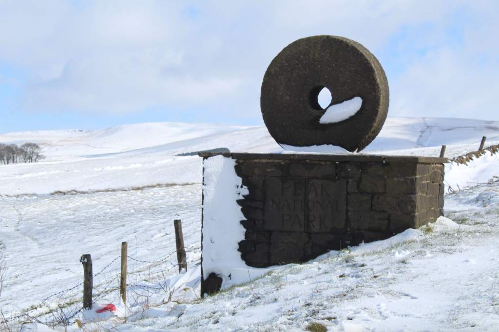
The millstone marks your entrance to the Peak District National Park. Credit: Francesca Donovan
This quiet lane ascends steeply with views behind towards the Manchester skyline. Walk 1km until you continue along the rocky bridleway in an SE direction. Watch out for bikers who favour the lower rocky path – stick to the higher hillwalkers’ option. Follow this until you reach Forest Chapel.
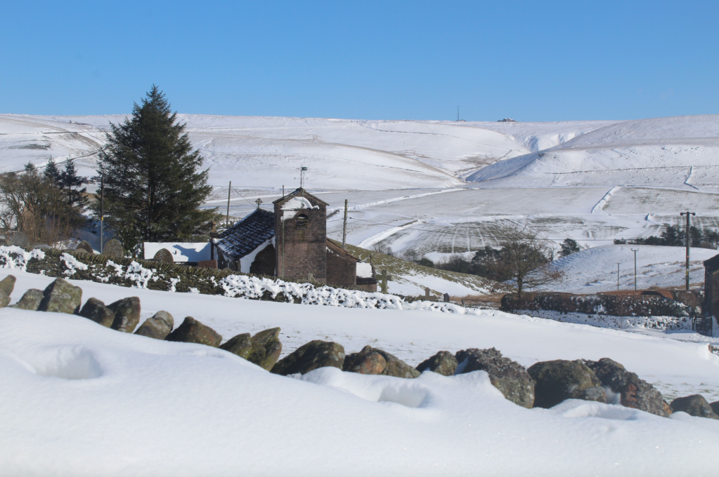
St Stephen’s Church serves the tiny community of Forest Chapel. Credit: Francesca Donovan
2. SJ 974721: Turn R and follow the single-track lane for 300m until you reach a gate into Macclesfield Forest. Follow the fingerpost and onto this woodland descent for 200m before veering off L in a NE direction onto the permissive footpath.
It winds through enchanting woodland (slightly quieter than Macclesfield Forest’s well-trodden, wider pathways) and over Bollin Brook until you reach Standing Stones. It’s a euphemistic name for a car park derived from the former Standing Stones of Macclesfield Forest, of which only one now remains in a field at Higher Ridgegate.
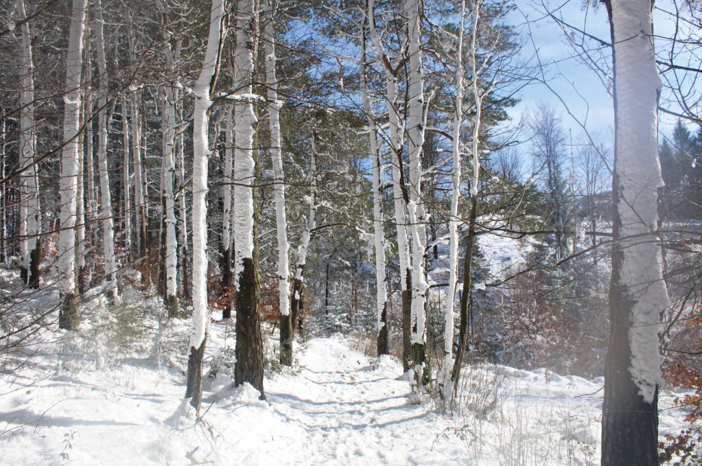
A winter wonderland just past Bollin Brook. Credit: Francesca Donovan
3. SJ 978 715: Turn R out of the car park, cross the road and go through the gate in front of you taking the wide permissive bridleway through the heights of the forest. Expect to meet cyclists, runners, dog walkers and riders as you walk through tall trees in the shadow of Buxtor’s Hill. Despite being a busy thoroughfare, you can spot the resident red deer here.
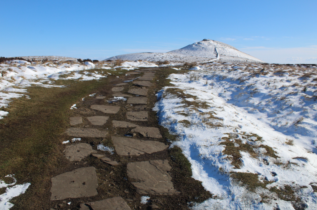
Snow melt on the paved path to Shutlingsloe. Credit: Francesca Donovan
In 3.5km, veer L off the bridleway past Terry’s Bench and through the gate to begin the ascent ‘proper’ to Shutlingsloe. This takes you up paved SE pathways before sending you through a kissing gate and S to the summit. It may look small but the last 50m of ascent will have your legs burning, briefly.
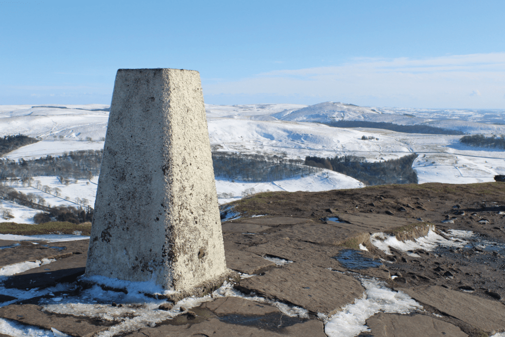
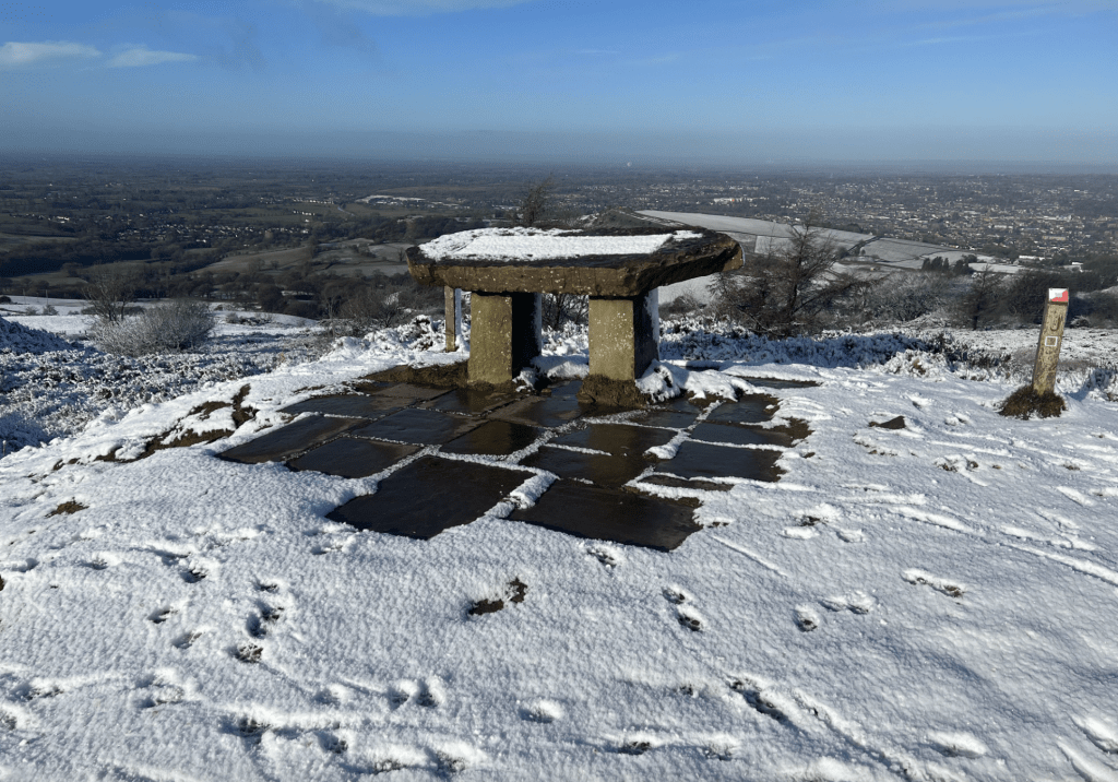
The trig point with views south to The Roaches. Credit: Francesca Donovan
4. SJ 976696: At the summit, pause to admire the views southwards towards The Roaches and northwards towards Shining Tor. Descend off Shutlingsloe the way you came until you return to the gate by Terry’s Bench.
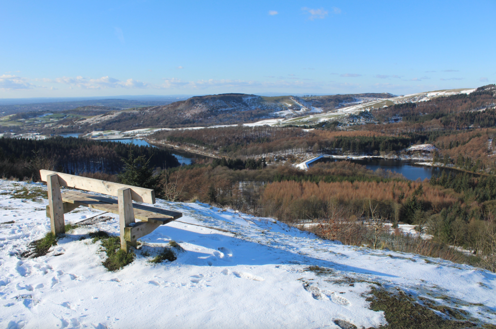
The view from Nessit Hill towards Tegg’s Nose. Credit: Francesca Donovan
5. SJ 971703: At the gate turn L and follow the clear path. This one will take you to Nessit Hill which offers fine views over the forest reservoirs and to the Jodrell Bank Observatory. Continue along the permissive footpath downhill in an NW direction for 1.5km until you reach a road around the lower levels of the forest. Here, turn L and walk for 300m. Turn R onto the footpath leading towards Ridgegate Reservoir and skirt the water.
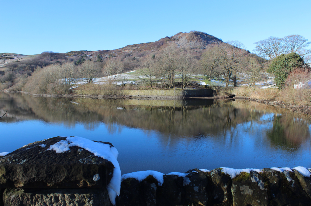
Tegg’s Nose sits above Bottoms Reservoir. Credit: Francesca Donovan
6. SJ 952713: Turn L off the paved track onto a descending woodland pathway, cross the footbridge and turn R onto the path alongside the stream. Follow it for 200m and turn L onto Clarke Lane, walking along Bottoms Reservoir’s southern end. Take a second to glance up at Tegg’s Nose and its reflection in the water. Come off Clarke Lane, following the path at the W bank of the water and continue N to skirt the lower end of Teggsnose Reservoir where you’ll walk through another car park to begin the woodland ascent of Tegg’s Nose.
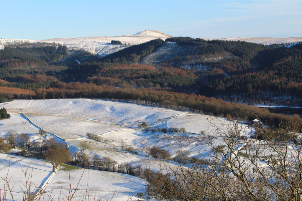
One of the numerous Tegg’s Nose viewpoints offers fine views to Macclesfield Forest and Shutlingsloe. Credit: Francesca Donovan
7. SJ 945718: Ascend Ward’s Knob following the woodland path with occasional steps to the S end of Tegg’s Nose and views to Shutlingsloe behind. The going is signposted and a choice of paths is yours. I recommend the high route along the mini-ridge and to the summit, marked by an information sign.
The summit of Tegg’s Nose. Credit: Francesca Donovan
8. SJ 948725: From here, on a clear day, you can see the summit of Moel Famau and the tops of Eryri in the distance. Descending N follow the path to the tea room and car park (an alternative start if you’re in the car). Continue 100m along Buxton Old Road.
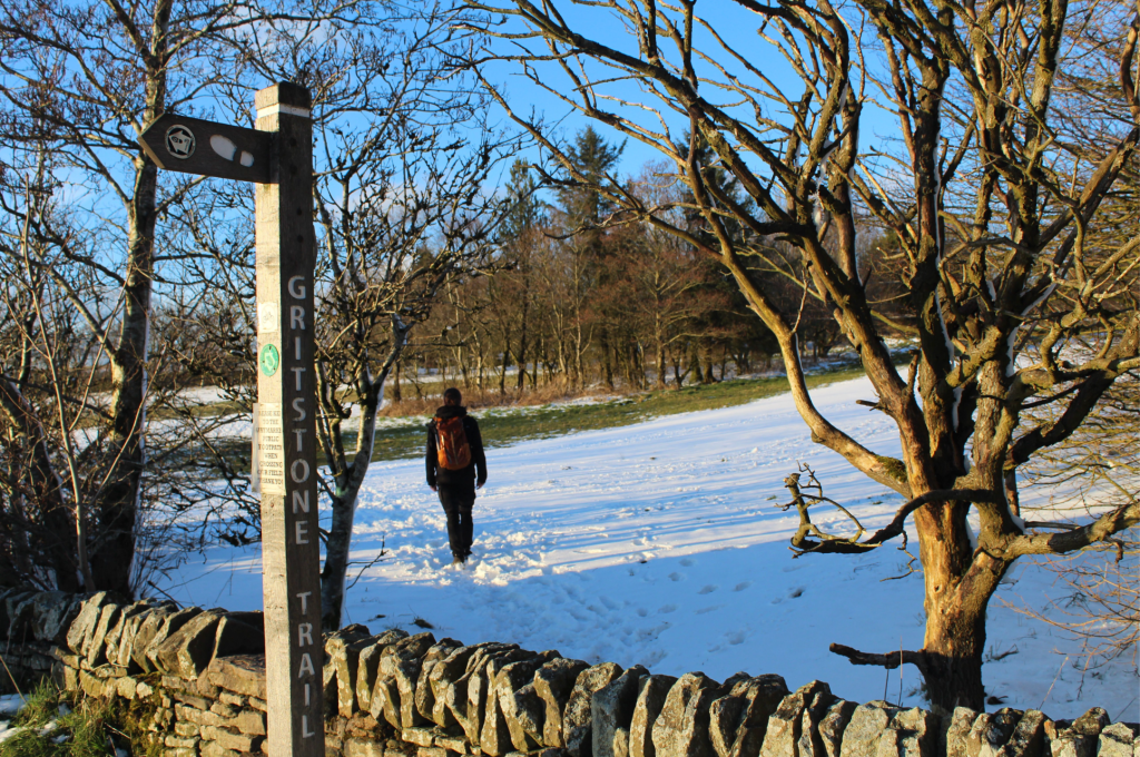
On the Gritstone Trail. Credit: Francesca Donovan
9. SJ 951734: Join the Gritstone Trail, following it through two gates and over the fields for 1km.
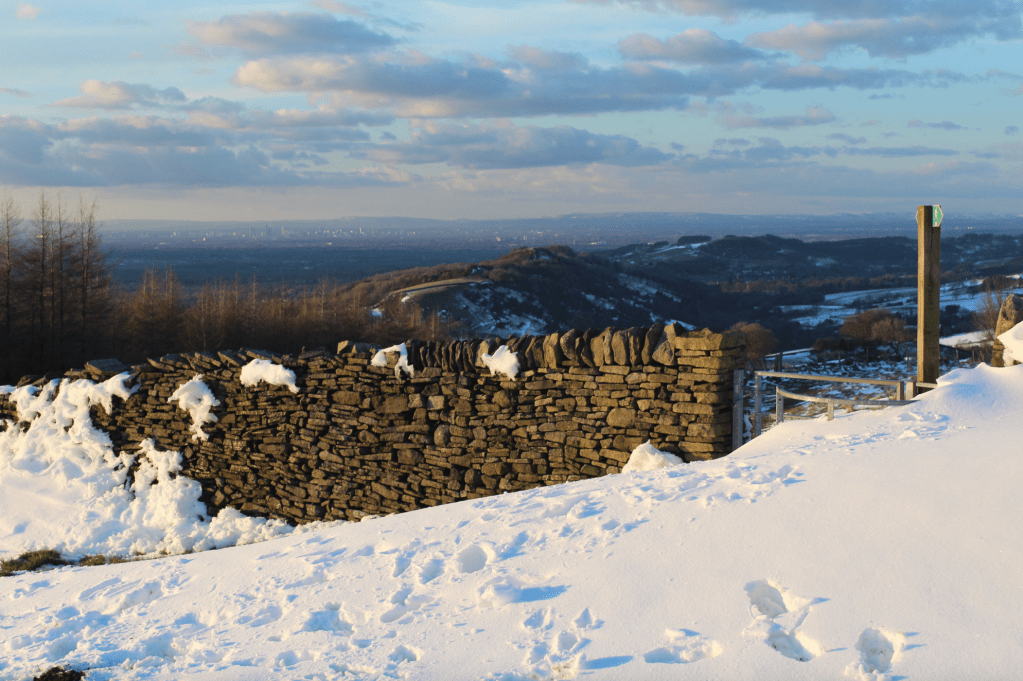
On the Gritstone return with views to Manchester. Credit: Francesca Donovan
10: SJ 948742: At this four-way footpath junction, take the R turn heading E. Follow it through Brink Farm and beyond where you’ll rejoin Buxton New Road.
Further information
Public Transport: Regular trains run from Manchester to Macclesfield. From the bus station, the 58 service to Buxton will take you to Walker Barn where this route starts. Alternatively, there is plenty of parking along this route at either Tegg’s Nose or Macclesfield Forest.
Tourist Information: Macclesfield Visitor Information Centre, www.visitpeakdistrict.com (01625378123)
Discover more walks in the Peak District as mapped by our expert contributors.


