

Its all in the Mynd
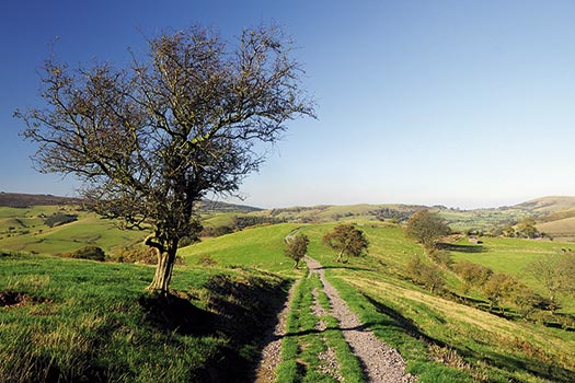
The Met Office was feeling pretty smug since there was definitely an Indian summer on the way. Autumn sunshine and guaranteed blue skies meant there was no time to lose and after several days stuck by a computer I was soon heading west to the nearest bit of decent moorland. The tops of the trees were tinged with gold as I arrived at Little Stretton, from where the mountain-like slopes of the Long Mynd were lost in mist and mellow fruitfulness. A couple of noisy jays dashed across the valley, which was hemmed in by the contrasting colours of yellow ash leaves and rusty bracken. Farmers were busy rounding up sheep and tapping instructions to each other on their mobile phones. Perhaps in the not too distant future we’ll have
virtual shepherding where the flocks are monitored and safely gathered in from a computer back in the farmyard? To fully appreciate the Long Mynd you’ve really got to explore a few of its valleys. Striding out across the top is great for fresh air and the blowing of cobwebs, but many charms lie in its deep folds where shady gorges and steep dingles cut into the hillsides. The tinkling of water was a welcome tonic as babbling streams accompanied me up Ashes Hollow to a spring known as Boiling Well.
Tracks led north over Pole Bank, through thick carpets of fading heather, to where the moorland suddenly drops sharply down to the Shropshire plain. I swung round to look into the valley of the Darnford Brook, set behind a foreground of crimson berried hawthorns, and descended by a string of glowing beech trees. The stream ran silently under dappled sunlight and led the way to Bridges. A sweeping track led up whale-backed Adstone Hill, just as the sun was starting to illuminate the western slopes of the Mynd. This is the best time to appreciate its muscular contours and the low sunlight picked out every ripple and brought the last flushes of heather back to life. Paths fringed by ripe blackberries led east and I followed an old bridleway rising back up to the moor. Tracks over Minton Hill stopped by the edge of Sleekstonebank Hollow and I battled down through pathless vegetation to meet Grindle Hollow and the climb up to the top of Callow.
Across the Stretton valley, Caer Caradoc resembled a sleeping stegosaurus and, in the warm silky dusk, the little clumps of gorse dotted round the summit looked
like miniature Easter Island statues, all facing towards Wales. A raven bade me goodnight, croaking overhead against a pale pink sunset.
ROUTE DESCRIPTION
- Walk up lane opposite village shop leading to campsite at foot of Ashes Hollow. Continue through campsite and walk NW up valley. Fork L at junction of streams and follow valley rising to road at Boiling Well.
- Cross road and walk W onto Pole Bank summit. From here, walk NE on good tracks for 3km. Turn L to drop down towards a plantation, then follow Shropshire Way signs past Betchcott Hill and take path signed on L.
- Descend grassy slopes to Darnford Brook and continue on good paths, past Ratlinghope, to meet lane by stone bridge. Turn R to reach Bridges.
- At road junction turn L, past pub, after 300m take path (forking L) through gate on R leading to Adstone Hill. Walk due S on the track over the hill to reach lane.
- Turn L and follow lane, with bends, for 1km. Pass farmhouse and take path on L through fields to Stanbatch. Turn R on lane for 800m then take bridleway rising S up Long Mynd. 06 Cross road and walk ESE to Minton Hill. Descend Sleekstonebank Hollow, turn L at bottom, and then climb steeply up Grindle Hollow then S onto Callow. Descend eastern slopes to pick up obvious track leading down to Little Stretton.

Its all in the Mynd
The Met Office was feeling pretty smug since there was definitely an Indian summer on the way. Autumn sunshine and guaranteed blue skies meant there was no time to lose and after several days stuck by a computer I was soon heading west to the nearest bit of decent moorland. The tops of the trees were tinged with gold as I arrived at Little Stretton, from where the mountain-like slopes of the Long Mynd were lost in mist and mellow fruitfulness. A couple of noisy jays dashed across the valley, which was hemmed in by the contrasting colours of yellow ash leaves and rusty bracken. Farmers were busy rounding up sheep and tapping instructions to each other on their mobile phones. Perhaps in the not too distant future we’ll have
virtual shepherding where the flocks are monitored and safely gathered in from a computer back in the farmyard? To fully appreciate the Long Mynd you’ve really got to explore a few of its valleys. Striding out across the top is great for fresh air and the blowing of cobwebs, but many charms lie in its deep folds where shady gorges and steep dingles cut into the hillsides. The tinkling of water was a welcome tonic as babbling streams accompanied me up Ashes Hollow to a spring known as Boiling Well.
Tracks led north over Pole Bank, through thick carpets of fading heather, to where the moorland suddenly drops sharply down to the Shropshire plain. I swung round to look into the valley of the Darnford Brook, set behind a foreground of crimson berried hawthorns, and descended by a string of glowing beech trees. The stream ran silently under dappled sunlight and led the way to Bridges. A sweeping track led up whale-backed Adstone Hill, just as the sun was starting to illuminate the western slopes of the Mynd. This is the best time to appreciate its muscular contours and the low sunlight picked out every ripple and brought the last flushes of heather back to life. Paths fringed by ripe blackberries led east and I followed an old bridleway rising back up to the moor. Tracks over Minton Hill stopped by the edge of Sleekstonebank Hollow and I battled down through pathless vegetation to meet Grindle Hollow and the climb up to the top of Callow.
Across the Stretton valley, Caer Caradoc resembled a sleeping stegosaurus and, in the warm silky dusk, the little clumps of gorse dotted round the summit looked
like miniature Easter Island statues, all facing towards Wales. A raven bade me goodnight, croaking overhead against a pale pink sunset.
ROUTE DESCRIPTION
- Walk up lane opposite village shop leading to campsite at foot of Ashes Hollow. Continue through campsite and walk NW up valley. Fork L at junction of streams and follow valley rising to road at Boiling Well.
- Cross road and walk W onto Pole Bank summit. From here, walk NE on good tracks for 3km. Turn L to drop down towards a plantation, then follow Shropshire Way signs past Betchcott Hill and take path signed on L.
- Descend grassy slopes to Darnford Brook and continue on good paths, past Ratlinghope, to meet lane by stone bridge. Turn R to reach Bridges.
- At road junction turn L, past pub, after 300m take path (forking L) through gate on R leading to Adstone Hill. Walk due S on the track over the hill to reach lane.
- Turn L and follow lane, with bends, for 1km. Pass farmhouse and take path on L through fields to Stanbatch. Turn R on lane for 800m then take bridleway rising S up Long Mynd. 06 Cross road and walk ESE to Minton Hill. Descend Sleekstonebank Hollow, turn L at bottom, and then climb steeply up Grindle Hollow then S onto Callow. Descend eastern slopes to pick up obvious track leading down to Little Stretton.


