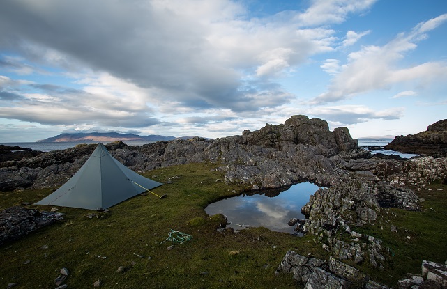
David Lintern finds an idyllic pitch on the Point
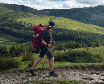
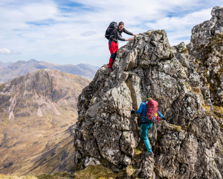
Visiting Skye, the emphasis is often on high-octane adventures. The lure of the Cuillin is strong. Red or black, either variety will do – as long as it’s high, it’s always wild and exciting on the Misty Isle. But, sometimes an exhausting all day epic isn’t what’s called for. Sometimes company, weather or energy levels dictate a gentler approach. This is a walk for when you’ve bagged enough hills, or when the weather is in or the jury is out on the tough stuff – a quiet saunter to the roads end and an atmospheric coastal camp. An easy stroll with some luxuries in the pack might also persuade any sceptical newcomers to the outdoors experience that you aren’t completely bonkers.
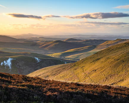
We started out late on our return from a week in Harris, driving down through the fertile peninsula in the south of the island, appropriately nicknamed ‘the Garden of Skye’. Passing the ferry stop at Armadale, we left the car as the golden hour was coating the land in that wonderful honeyed light unique to the Western Isles. Despite the sun there was quite a nip in the air. As the shadows lengthened and the well-defined track rose and fell among the moors, we caught tantalising glimpses of the sea and across to Knoydart.
It’s very easy going this, great for beginners, but the descents are made up of large, loose rocks, so it’s useful to have walking boots or shoes, rather than the wellies we saw a young family in the morning after. After a couple of gates and a couple of miles, we took the signposted turning up the bank and over some rocks towards the sheltered cove of Camas Daraich. Below us a small settlement nestled in a shallow valley, made up of new holiday homes, the odd croft and a few ramshackle vehicles that have seen better days. The cove lay straight ahead, perfectly framing alpenglow on the mainland summits. But the sun was now low in the sky, the sandy shore was chilly in the shadows, and our thoughts turned to making camp and hot food. We continued on and over a muddy, eroded bank on the right of the bay. Shortly after, we descend to meet slippery steps to the beach.
Crossing a stream, a corner is turned to reach one of the most perfect wild campsites I’ve had the pleasure to happen upon. This is the point where the peninsula narrows and the beach on the east side (there are some concrete ‘piers’ here, marked on the map) almost meets the rocks on the west. A few salt-water pools dot the short grasses where we pitched. If you don’t fancy this, there are plenty of easy pitches just a little further on. It’s a craggy wonderland, and offers a fair amount of shelter from the sea breeze, as well as a ton of easy, fun rocks for kids of all ages to clamber over and explore. Which is exactly what we do, but not before the tent is up and the stove is on. As the sun finally sets, we have an incredible view over to Rum, moving through kaleidoscope of oranges, reds, purples and violets.
Another advantage of such a short walk is the luxury of packing proper food and additional fuel to use at camp – fresh mackerel cooked on our small wood stove, our plastic camp cups held wine instead of the more usual soup or tea. I’m not sure if this is glamping, but it’s probably about as close as we’re going to get, and very enjoyable it is too. My other half basked in the relative luxury, and I’m glad I didn’t push for that extra Munro earlier in the day.
We passed a very restful night, the sound of the sea soothing our dreams, and the following morning dawned clear and bright. Some pottering by the beach, coffee in hand, followed by a casual pootle over to the lighthouse. It has changed since I was last here a decade ago, and a solar powered scaffold structure now sits where a small Victorian lighthouse once stood. Probably a lot more efficient, but I couldn’t help but feel a little sad at the slight loss of romance entailed in progress from round to square. The view, however, more than made up for my Luddite tendencies. Rum and Eigg shone implacably under a blazing sun. In the spring, this is a great spot for whale and dolphin watching.
All that was left for us to do was to pick up our bags and head for home, back the way we came, pausing only for a coffee at Armadale Castle. It is worth taking the longer road over to the crofting townships of Taskavaig, Tockavaig and Ord for some really breathtaking views of all the Cuillins lined up in a row. If glamping is this good, maybe the mountains could wait until next time.
Route description
Start/finish: carpark at track end, Aird of Sleat
- Start and Finish: Carpark at track end, Aird of Sleat GR: NG588007
- The walk begins at the car park right at the end of the metalled road from Armadale. Where the A851 ends, take a R turning and follow the B road to the carpark.
- On foot, pass through the farm gate and take the obvious track winding over open moors, which rises and falls gently. The track then descends steeply, meets a gate, and then a stream on your left. At a fence, a waymarked path up the bank on your left takes you up and over more moorland with a fence on your right, and a small mixed settlement below. This leads fairly directly to the beautiful sandy cove of Camas Daraich, well worth the small detour.
- Take the eroded path up onto the rocks on the R side of the cove, after around 10 minutes reaching some steep stone steps to our camping place.
- To reach the lighthouse, continue on over the beach and rejoin the path over smooth grassland to find the very end of the peninsula. Return the way you came, or wander back along assorted sheep paths on the east coast, being careful not to stray too close to the steep cliffs around Creag Mhor.