Ian Battersby finds a trail with a twist along crimson coastal cliffs of an island off an island.
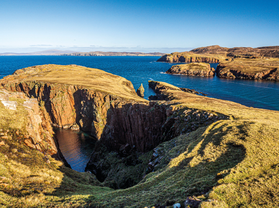
The Shetlands have their roots in both Scotland and Norway, and both traditions have influenced this “Big Red Island” translation for the more lyrical Muckle Roe. Yet, big it is not at only 172m high and 5.5km wide. Muckle Roe is also so close to Mainland – even connected by a short bridge – that it hardly feels like an island. But it’s named is earned somehow. Muckle Roe is remarkably red, with its shade of granite laid bare among cliffs exposed to Atlantic afflictions.
It is these flushed rock faces that attract walkers, and this route makes as much of them as it’s possible to do in a day. If you explore every nook and cranny you’d better bring your bivvy. Inlets dig in and headlands cling on, not wanting to be stranded like numerous sea stacks, cut off and gnawed by unremitting waves. They attract a trickle of walkers and a strong sea bird population, and seals come in for fish. So polish your lenses, because you won’t want to miss a thing.
Muckle Roe: route information
START/FINISH: Little-ayre car park; HU322629 | MAPS: OS Explorer OL469 (1:25k), OS Landranger 3 (1:50k) | DISTANCE: 17.5km / 10.9 miles | ASCENT: 635m / 2080ft | DURATION: 6 hours
1. HU322629: Follow the lane as it bends right past a cottage to a track on the left sign posted to beach and lighthouse. Follow this W, ignoring the turn off to Hams, to reach Muckle Ayre beach. Continue past a ramshackle building, then take a minor path climbing SW along the cliff. The path skirts around Burki Hill, turning NW, past a sheepfold, arriving at two stiles either side of a stream. The path is now obvious, continuing W by a metal fence, then turning NW, passing Loch of Brunthill before dropping to Gilsa Water.
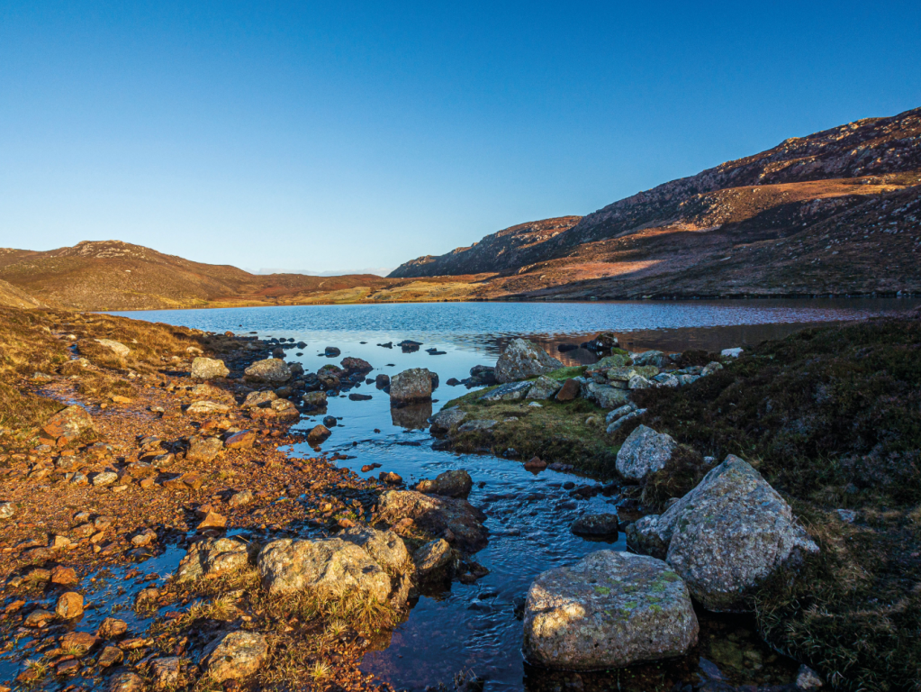
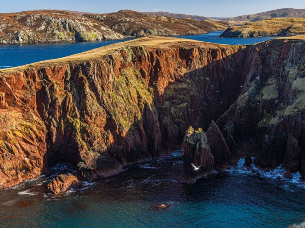
Gilsa Water. Credit: Ian Battersby
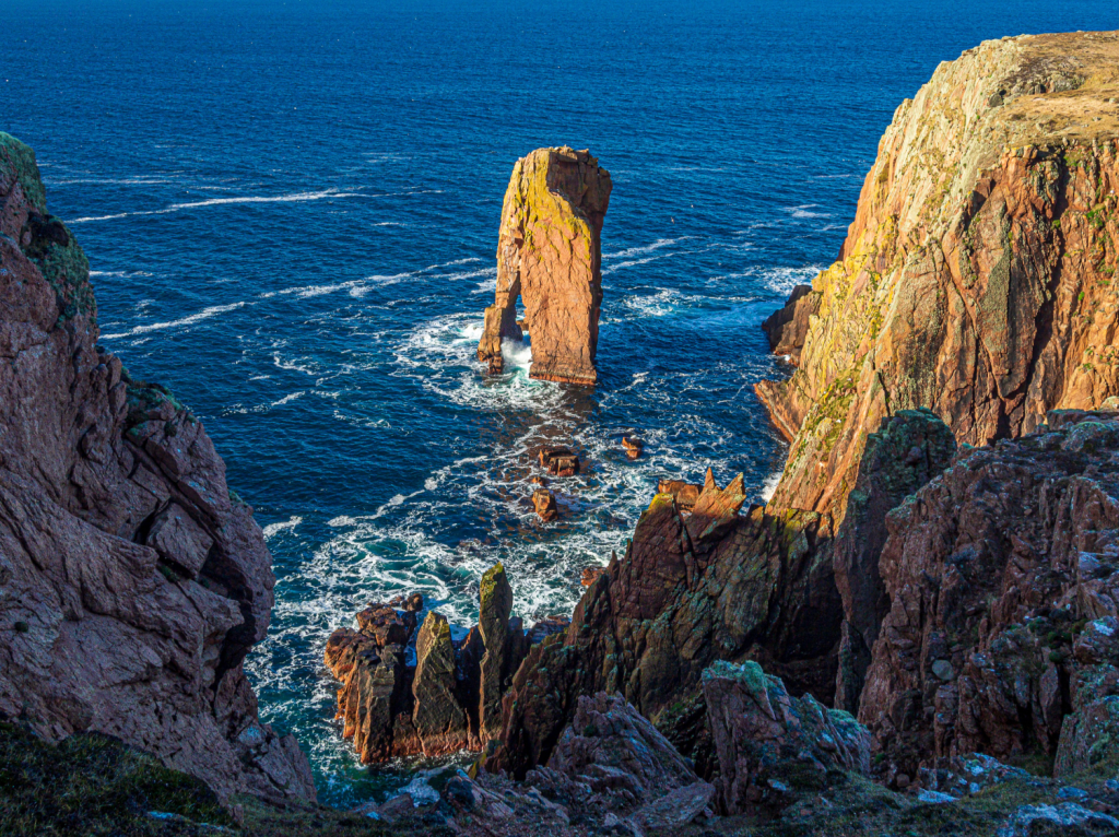
2. HU308630: Turn left at the outflow to the loch, following the path S then W, skirting round Hill of Tongues and veering N around a deep cleft in the cliff before turning S to reach the lighthouse. The path now heads generally NW, dwindling at times through rock-strewn areas, before passing Riding Stack, which appears as a squat, flat-topped pillar of rock. Continue NW past Loch of Rusness to Dandi Geo – a narrow, incising inlet in the cliffs. Continue NW to Spindle, a sharp, conical sea stack, then turn NE, following a fence to a stile at a fence junction at Grusterwick Geo.
Natural arch at Moo Ness. Credit: Ian Battersby
3. HU297649: Cross the stile and follow the coast NW, past an impressive natural arch in a sea stack at Moo Ness, to reach a stile at Knowes of Burg. Cross the stile, heading N past a long, deep inlet on the left, climbing a small, crag-capped hill. The view of the cliffs of North and South Hams to come is outstanding, but first continue N, crossing pasture away from the path and passing above the ruins of Burg to reach the point between Strom Ness and Qui Ness for another dramatic take on this contorted coastline.
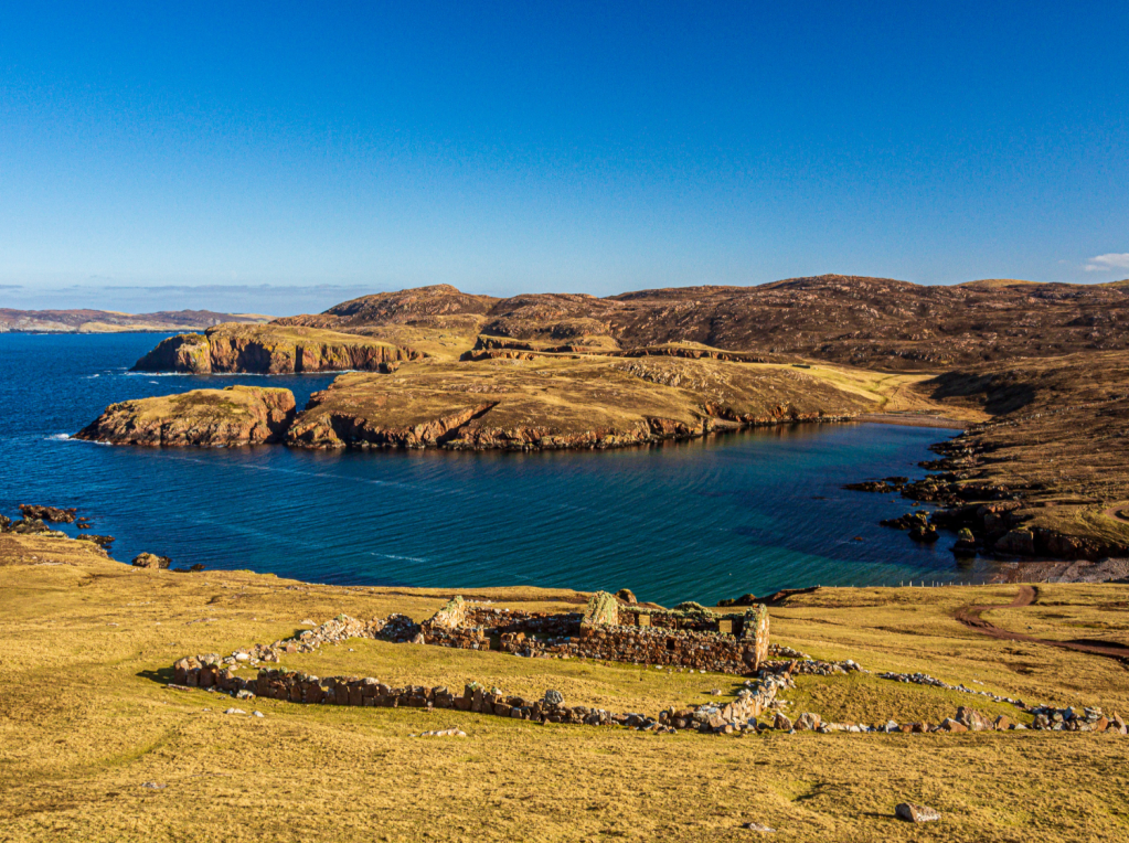
Burg and South Ham. Credit: Ian Battersby
4. HU294656: Head SE to a gate on the coastline of South Ham. Follow the track around a ruin, bending to the N, then leave it at the next bend. Now a minor path stretches 300m NE to a stile in a fence. Cross this and continue NE, crossing a boardwalk at the beach to reach a grassy track. Follow the track, turning E beneath a ruin on the left, before arriving at a signed junction with a stony track at Town Loch.

North Ham. Credit: Ian Battersby
5. HU303658: Turn left, following the track N alongside the loch and signposted to North Ham. Go through a gate and follow the track, now grassy, across the outflow of the loch, then follow the path N alongside the magnificent bay at North Ham. The path now becomes confusing. Head N, climbing up through several ruins, then bear NE up the ridge, through a wall gap and over a low fence, and climb to a cairn at the top of the rise at 112m. Continue NE dropping back to the coastline, and follow it past Erne Stack, cross over a stream, pass a long inlet at Little Ness, and turn N to Brei Ness. Now head S, then N around the jaw dropping Roda Geo. At Lothian Ness an indistinct path follows the coast SE, passing Lee Skerries, with Hill of Otterayre on the right, and drop down to the beach and ford at Otter Ayre.
Roda Geo. Credit: Ian Battersby
6. HU326665: Cross the ford and follow the stony track climbing SE through two gates to reach a tarmac lane at its dead end. Follow the lane SE past cottages, then dropping steeply NE before turning E to a T-junction at Roesound.
7. HU340659: Turn right and follow the lane S, wriggling past houses and Orwick Water, before veering SW to return.
Further information
PUBLIC TRANSPORT: None to start
TOURIST INFORMATION: Visit Scotland, 01595 693434