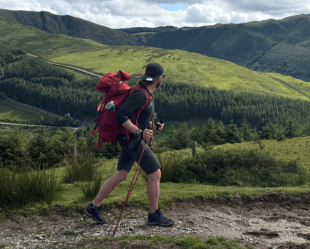
Vivienne Crow finds solitude in the shadow of the fashionable giants of Wasdale on Middle Fell and Seatallan.
Wasdale isn’t all peak-baggers and well-trodden paths; it’s still possible to go off the beaten track in this most spectacular of Lakeland valleys. A walk taking in Middle Fell and Seatallan – topping out at a modest altitude of just 692 metres – might lack the glamorous allure of hiking on England’s highest mountains but it does bring tranquillity and a feeling of ‘escape’ that only our islands’ more remote places can elicit. Faint pathways also reveal sudden, jaw-dropping panoramic of those mighty neighbours, Sca Fell, Scafell Pike, Great Gable, Yewbarrow…
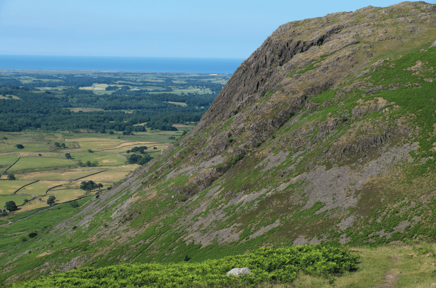
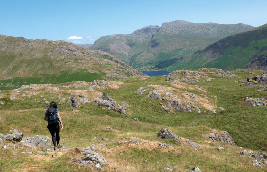
These are breathtaking scenes that also take on a more interesting dimension as the route, in its later stages, drops to the rim of Buckbarrow’s steep, Wastwater-facing slopes. Here, buffeted by the invigorating effects of being on the Lake District National Park’s coastal edge, walkers will undoubtedly want to explore the precipitous ledges and hidden corners for the picture-perfect outlook on some of England’s finest mountain scenery. It’s worth exploring Buckbarrow’s many vantage points, each with their own perspective on Wasdale’s magnificence.
Middle Fell and Seatallan: route description
START/FINISH: Roadside parking on eastern edge of Greendale, 8.3km east of Gosforth, GR NY144056 | MAPS: OS Explorer OL6 (1:25k), OS Landranger 89 (1:50k), Harvey 1:25,000 Superwalker Lake District West | DISTANCE: 11.3km/7 miles | ASCENT: 787m/2,580ft | DURATION: 4-4½ hours
1. NT144056: A fingerpost next to the wall on the north side of the road on the eastern edge of Greendale indicates the start of the footpath. Moving away from the wall, follow the wide, grassy path through the dense bracken. Gaining height, you’re soon able to look back to the formidable-looking cliffs and screes on the far side of Wastwater.
Looking across to Buckbarrow on the climb to Middle Fell. Credit: Vivienne Crow
2. NT143061: Just before the stony path briefly levels off, take the trail on the right. It’s only 1.5km from here to the top of Middle Fell, but the interminable ‘upness’ makes it seem further. Nearing the summit, take either branch when the path forks. Your persistence is rewarded when you reach the summit cairn and are suddenly greeted by a breathtaking panorama of the mountains ringing the head of Wasdale – Sca Fell, Scafell Pike, Great Gable, Yewbarrow…
On top of Middle Fell. Credit: Vivienne Crow
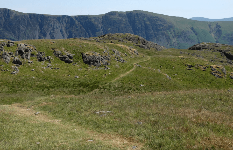
3. NT150072: Take the faint path heading north from the summit. Having dropped to flat ground near the head of Greendale, watch for an indistinct fork in the path. While the clearer route bends left as if to make a direct assault on Seatallan, take the right-hand branch – north-north-west across boggy ground. The eastern and northern slopes of Seatallan – up to the left – are steep and are dotted with scree and loose rock. Our approach is via a grassier chink in the fell’s armour – the north-east ridge – but first we head into remote country near the foot of Haycock’s scree-covered dome. After crossing the bog, the trail skirts the base of Winscale Hows. Beyond this rockier ground, it makes for the Pots of Ashness. It skirts the southern edge of the depression containing these tiny pools. Reaching the western side, bear left when the path forks.
Head south-south-west from the saddle to climb Seatallan. Credit: Vivienne Crow
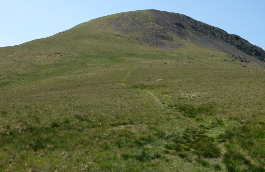
4. NT143092: A grassy saddle is quickly reached. Turn left here (south-south-west). The trail briefly swings south before the final, steep pull (south-west) on to the flat, grassy summit of Seatallan, home to a trig pillar, sprawling cairn and shelter. Unless the weather dictates otherwise, it’s futile to resist the lure of the close-cropped turf here; simply lie back, enjoy the Irish Sea breeze and gaze over to where the outline of England’s two highest mountains dominates the skyline.
Approaching the top edge of Buckbarrow’s crags. Credit: Vivienne Crow
5. NT139083: Take the trail leading south from the trig pillar. It soon swings south-west as it follows the open, grassy ridge gently downhill. On reaching a prominent cairn at the edge of slightly steeper ground, the path veers left (south-east).
Fork right and wind your way south-east between rock outcrops. Credit: Vivienne Crow
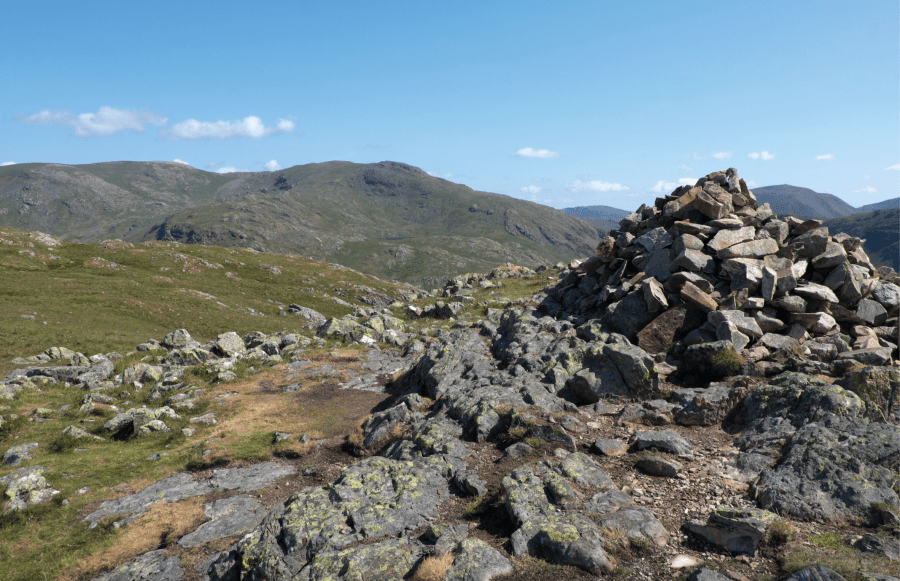
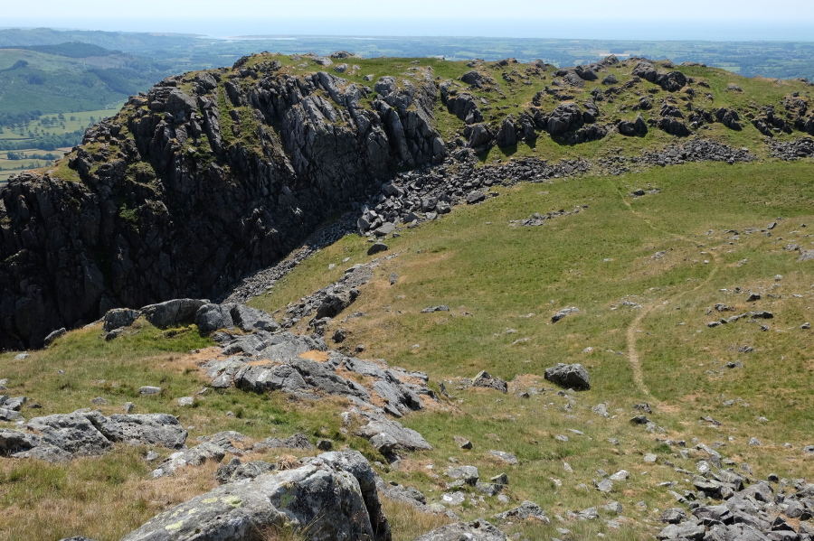
6. NT134063: Immediately after descending from a prominent cairn on Glade How, bear right at a fork and wind your way steadily south-east between rock outcrops to reach the first of several cairn-topped mounds. This is still a little way back from the top of Buckbarrow’s crags, but a second hillock about 300m south-south-east of this first top, nearer the edge, provides a better view of Wastwater and the Scafells.

Wastwater and the Scafells from Buckbarrow. Credit: Vivienne Crow
7. NT136060: It’s worth exploring Buckbarrow’s many vantage points, each with their own perspective on Wasdale’s magnificence. My favourite is the spur to the south-west of this second top. Make your way over to this and then, resuming your onward journey, head north-west to join a trail, along which you turn left. It quickly swings south before assuming a westward line.
Make your way to the spur to the south-west of second top on Buckbarrow. Credit: Vivienne Crow
(Do not attempt to drop directly west from this top as it is protected by a sheer rock face.) The path gradually loses height along the southern edge of the high ground. It then swings south to drop more steeply beside Gill Beck. Turn left when you reach the road, returning to Greendale in 1.6km.
Further information
PUBLIC TRANSPORT: The Wasdale Shuttle bus operates weekends and Bank Holidays in June, July and August only
TOURIST INFORMATION: lakedistrict.gov.uk, 0845 9010845
NEAREST YHA: Wasdale Hall
Discover more walks in the Lake District as mapped by our expert contributors.