Vivienne Crow uses the Settle-Carlisle Railway to visit one of Yorkshire’s Three Peaks; Ingleborough.
Does Yorkshire have mountains? I think we can safely conclude that many of neighbouring Cumbria’s fells, despite their altitude, look and feel like mountains, but Yorkshire? The highest point is Whernside, but it’s really only worthy of the moniker ‘hill’. (I’m sorry, Yorkshire! I love you dearly, but…) The second-highest summit, though, gives me reason to hesitate. Ingleborough. Its north face is a formidable jumble of crags, scree and shattered boulders, its distinctive, tiered outline identifiable from miles away. The flat summit plateau is a bleak place, largely bereft of vegetation and scoured by the wind. This feels like the real thing! Making use of the Settle-Carlisle Railway, I recently walked an Ingleborough linear route from Horton-in-Ribblesdale.
The meandering approach took in some magnificent geological features, including a view of the extensive limestone pavement of Moughton Scars, the dry gorge of Trow Gill, and Gaping Gill, one of Britain’s largest underground caverns. From the summit, a gorgeous path along a moorland ledge then led north-east before dropping steeply from Park Fell to end the linear journey at Ribblehead Station.
Ingleborough linear: route description
START: Horton-in-Ribblesdale Railway Station, GR SD803726 | FINISH: Ribblehead Railway Station, GR SD765789 | MAPS: OS Explorer OL2 (1:25k), OS Landranger 98 (1:50k), Harvey XT40 Yorkshire Dales South-West | DISTANCE: 17.7km/11 miles | ASCENT: 634m/2080ft | DURATION: 5½-6 hours
1. SD803726: Go through the gate in the wall above the Carlisle-bound platform at Horton-in-Ribblesdale. Walk straight across this narrow enclosure and, once through the next gate, veer half-right (north-west) on an obvious path. Cross a farm track, go through another small gate and continue on the same line. The next gate leads on to the access land of the Ingleborough National Nature Reserve. Keep to the waymarked route winding its way steadily uphill through limestone outcrops.

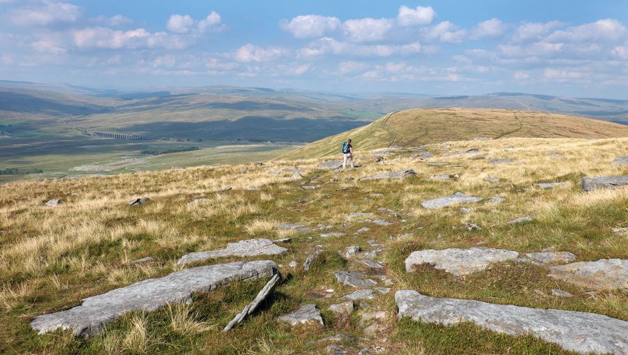
Near the start of the walk, looking back towards Pen-y-ghent. Credit: Vivienne Crow
2. SD790731: Keep straight ahead at a fingerpost, later passing through a gate and following a constructed path across open moorland to reach another fingerpost. Leaving the direct, Three Peaks route on to Ingleborough here, follow the Pennine Bridleway south-west (left) towards Clapham. Easy walking on the close-cropped turf of this broad, hillside ledge is accompanied by views across Moughton Scars to Pen-y-ghent.
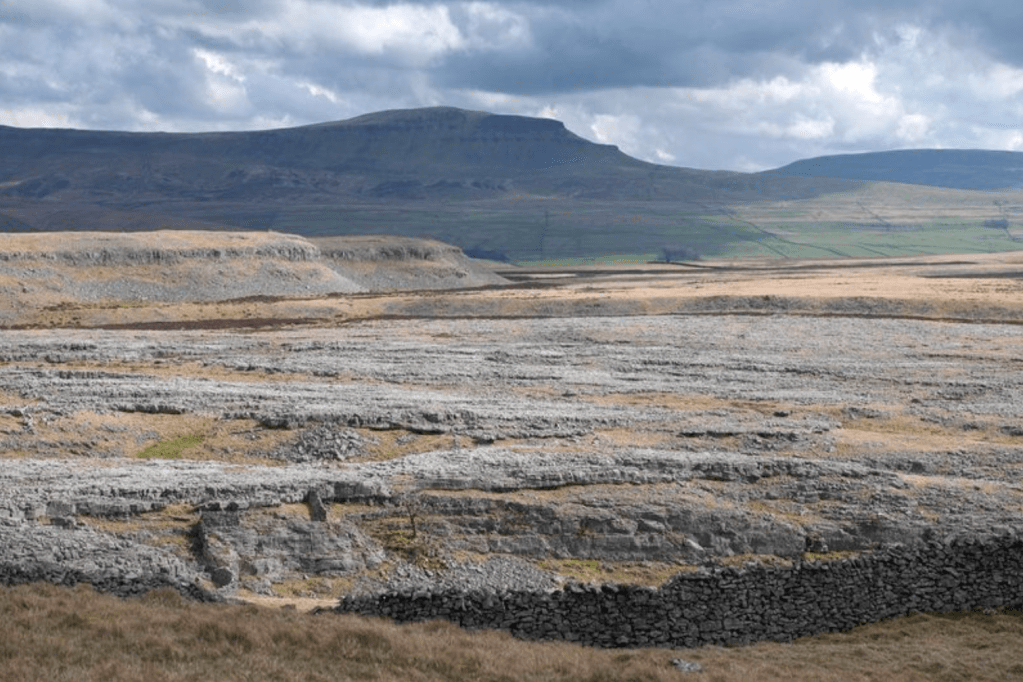
Limestone pavement of Moughton Scars with Pen-y-ghent behind. Credit: Vivienne Crow
3. SD772725: When the path splits, bear right. Keep right at subsequent junctions, eventually dropping through a gate in a wall. Walk downhill towards the cliffs of Trow Gill.
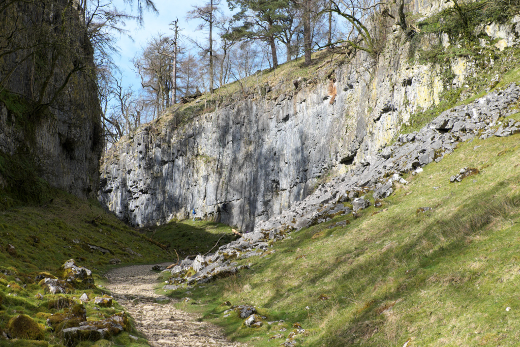
The cliffs of Trow Gill. Credit: Vivienne Crow
4. SD758716: Having reached a gate, don’t go through it; instead, leaving the Pennine Bridleway, continue steeply downhill beside the wall on your left. At the bottom of the drop, follow the wall left into Trow Gill and then turn right. Climb through the dry limestone gorge, the path narrowing as it passes through the nick. Continue uphill beside a wall on the left, crossing this via a gated stile 700m beyond the gorge.

Inside Gaping Gill. Credit: Shutterstock
5. SD752723: From the stile, the route heads north-west across open moorland. Keep right when it splits, soon reaching the fenced head of Gaping Gill, where Fell Beck disappears into a massive hole in the ground, dropping 100m to the subterranean cave floor. Having visited the site, retrace your steps for a few metres and then take the first path on the right beyond the fencing. Later climbing, this eventually leads almost directly to the cairn on Little Ingleborough.
6. SD742735: Head north across this flat shoulder. After two more uphill sections, Ingleborough’s summit plateau is reached. Head west-north-west to reach the trig pillar and cross shelter.
The top of Ingleborough’s north-east ridge. Credit: Vivienne Crow
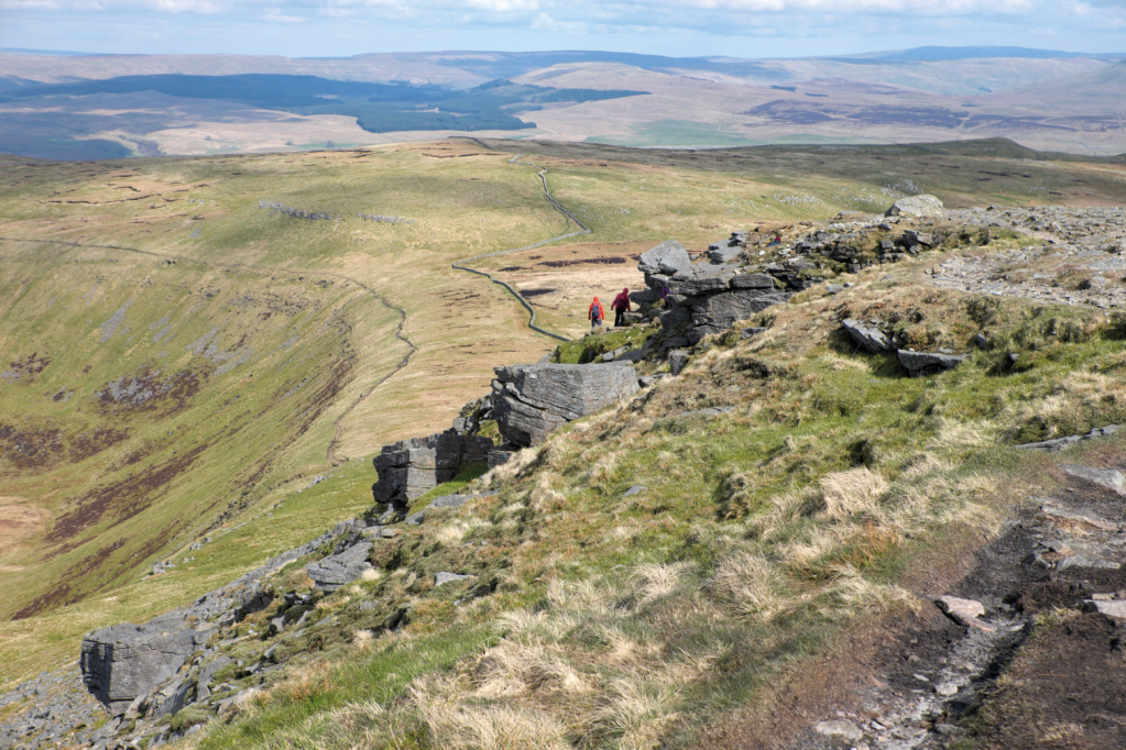
7. SD741745: From the top, walk east-north-east. The path down the north-east ridge can be hard to find, but if you keep to the northern edge of the high ground, you will spot it dropping to the left of the rocks forming the top part of the ridge. On the way down, keep left as another path peels off to the right.
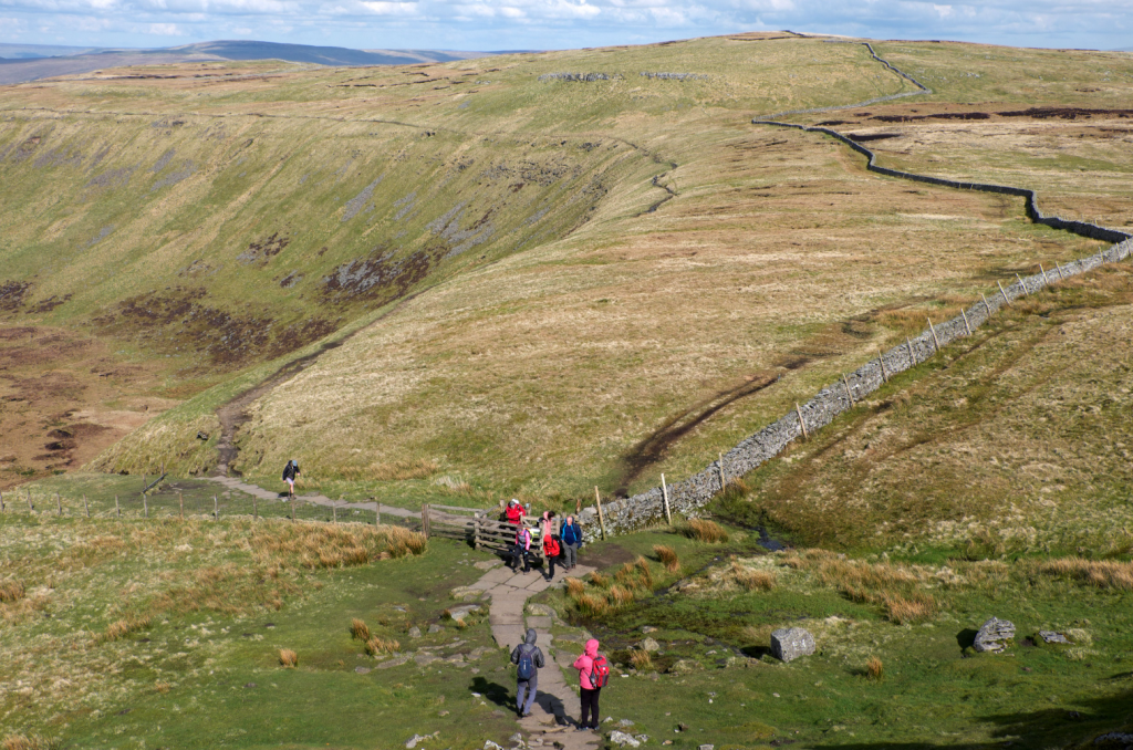
Looking down on the gate at wp8. Credit: Vivienne Crow
8. SD746748: At the bottom of the drop, go through a gate. Continue on the flagstones, but only for a few more metres; immediately after crossing a tiny beck, take the path on the right. Occupying a shelf along the rim of the fell and with the ground falling away in dramatic fashion to the north-west, this trail looks across to Whernside, Yorkshire’s highest hill, and Gragareth, Lancashire’s highest point. It crosses a wall stile and then, after dropping into a saddle, climbs beside a wall. Keep straight on to cut a corner when the wall briefly swings away to the right, but then follow it steeply downhill when you rejoin its line.
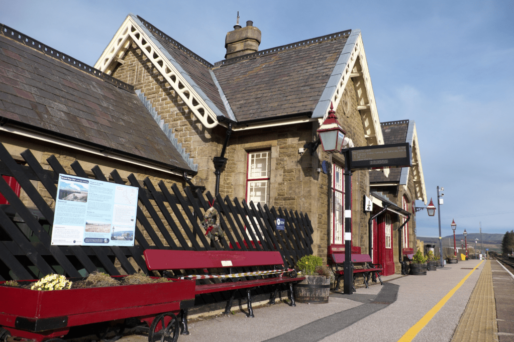
Ribblehead Station. Credit: Vivienne Crow
9. SD767776: Go through the small gate at the bottom of the drop and keep straight ahead, walking with the wall on your right. After the next gate, continue straight ahead on a rough track. Follow this to the B6479 and turn left. Go left again at the T-junction with the B6255. Ribblehead Station’s access lane is on the left, directly opposite the Station Inn.
Further information
PUBLIC TRANSPORT: Both stations are on the Settle-Carlisle Railway run by Northern
TOURIST INFORMATION: Ingleton Tourist Information Centre, 01524 241701
Walk more routes in the North of England, as mapped by our experts.