
Escape the Lulworth Cove and Durdle Door crowds and head east over the Lulworth Ranges, a strenuous but spectacular stretch of coastline, recommends Fiona Barltrop.
The Dorset and East Devon coast – known as the Jurassic coast – is England’s first natural World Heritage Site. It covers 95 miles of stunning coastline, with rocks recording 185 million years of earth’s history, spanning the Triassic, Jurassic and Cretaceous periods. These are laid out from the oldest to the youngest moving west to east. The Heritage Centre at Lulworth Cove is worth a visit to learn more. There is probably no more popular stretch along the South West Coast Path than that between Lulworth Cove and Durdle Door to its west.
This route, however, avoids the crowds and heads east over the Lulworth Army Ranges (open to the public most weekends throughout the year and during school holidays). The Range walks are very well marked. The spectacular coastal stretch is part of the South West Coast Path, so those walking this section of the National Trail need to time it carefully. This is a superb but strenuous walk requiring lots of stamina – not to be missed, even if you cut it short.
Lulworth Ranges: route description
Start/finish: Lulworth Cove car park (SY822800) | Map: OS Explorer OL15 (1:25k) | Distance: 21km/13 miles | Ascent: 1,016m/3,333ft | Duration: 7 hours
1. SY822800: From the car park, turn left back up the road (a path runs alongside) towards West Lulworth. Take the first right turn, Bindon Road, and after 100m a footpath on the right, signposted for the Range Walks.
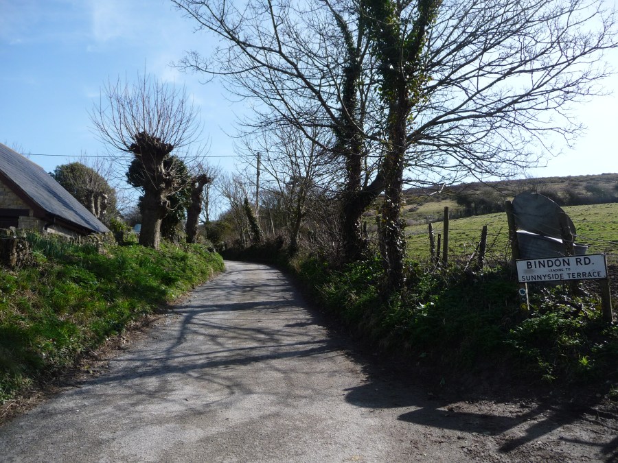
Bindon Road
Credit: Fiona Barltrop
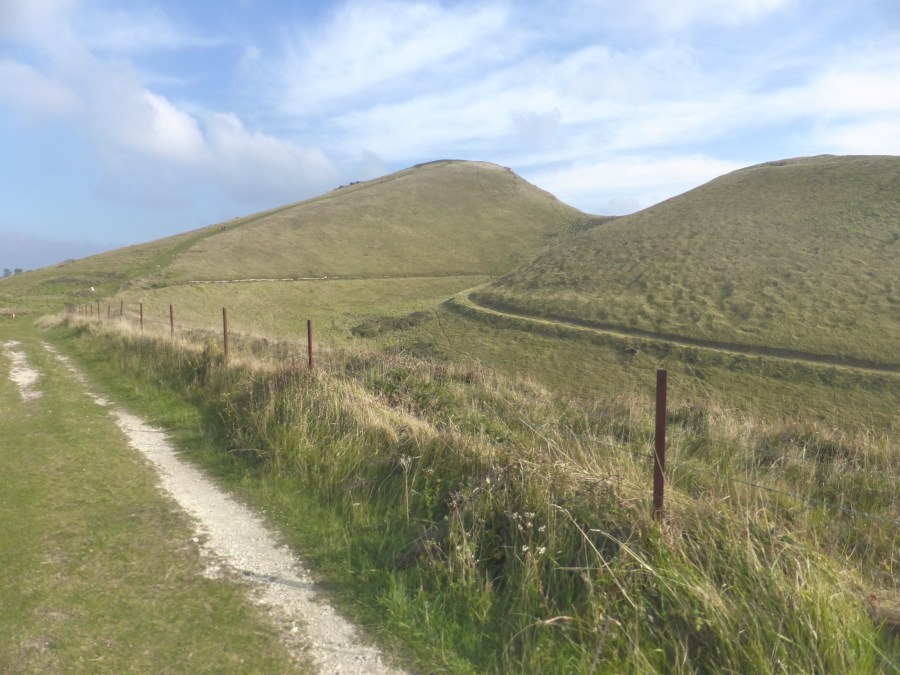
Head diagonally left up the hill and then left along to the fence line. Here turn right up to the top of the hill. Go left through the gate – the Range boundary – and continue eastwards along the crest of Bindon Hill.
View E from Bindon Hill
Credit: Fiona Barltrop
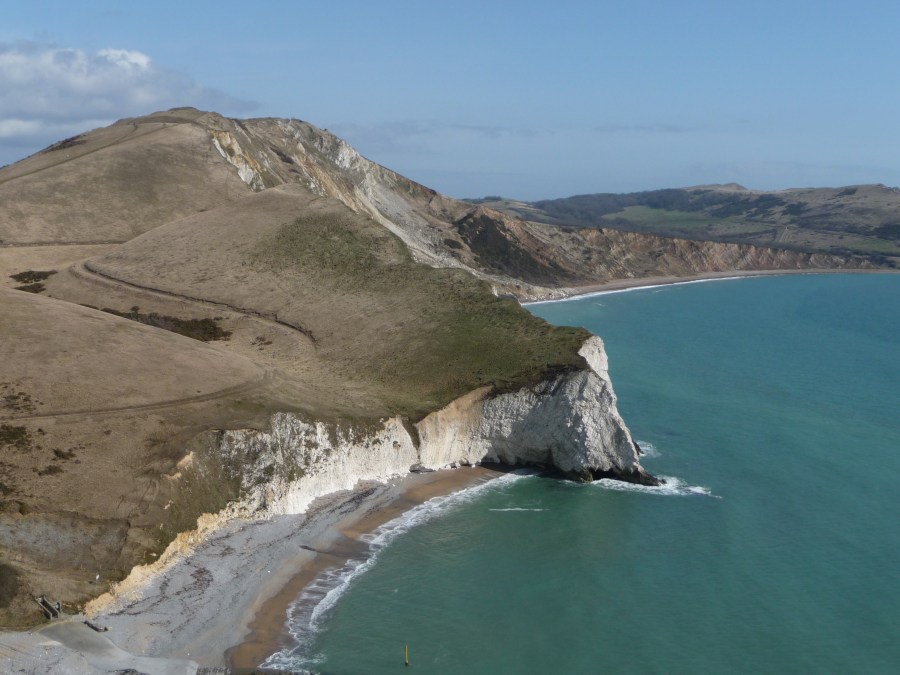
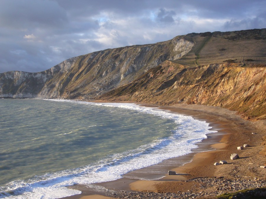
Lulworth Camp and the tank ranges are over to your left. You join up with the route of the South West Coast Path and descend to Arish Mell (superb view on descent).
2. SY854804: From Arish Mell it’s an initially gentle but thereafter quite steep climb up to the Iron Age hill fort known as Flower’s Barrow (you’ll be climbing it again later in reverse – so be prepared!) More splendid views are the reward for all the exertion.
Coast Path from Arish Mell heading towards Flower’s Barrow ahead
Credit: Fiona Barltrop
3. SY865805: From the top of Flower’s Barrow, continue on the Coast Path down to Worbarrow Bay. A well-walked track leads inland from Worbarrow (where there’s an information panel about its history) to the village of Tyneham, a mile away.
Worbarrow Bay
Credit: Fiona Barltrop
It’s worth a detour if you have time, and you could always rejoin the outward route by taking the path that leads directly from Tyneham to Gad Cliff. The story of Tyneham is a poignant one. During the Second World War, its inhabitants were forced to evacuate their homes to allow the army to take over Tyneham Valley as an additional training ground. They assumed they would return but the land was retained for army use. It’s been a contentious issue but almost 80 years of MoD control has, at least, kept development and intensive farming at bay.
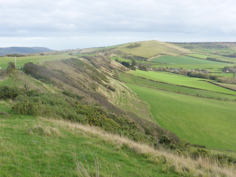
View along ridge shortly before Ridgeway Gate
Credit: Fiona Barltrop
4. SY871797: Carry on along the Coast Path eastwards over Gad Cliff, passing the turn-off on the left for Tyneham. Just after a wooden gate at a waymark stone, leave the Coast Path (which forks right) and take the left fork (signed for Kimmeridge) keeping ahead over Tyneham Cap and along the grassy ridge-top path in the direction of Kimmeridge.
Kimmeridge Bay
Credit: Fiona Barltrop
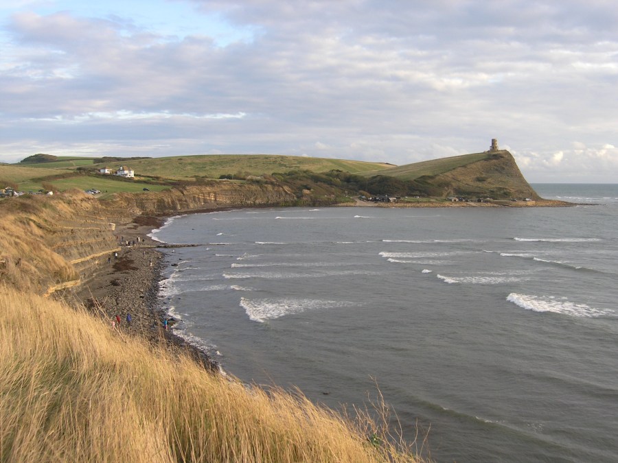
5. SY905802: At the Ridgeway Gate turn right (south) and follow the range boundary down to the Kimmeridge Gate (oil well nearby and information about it). Nearby, too, there’s a fine view over Kimmeridge Bay.
6. SY904792: Now just keep the sea on your left and follow the South West Coast Path all the way back to Lulworth Cove via Gad Cliff, Flower’s Barrow, Arish Mell and Mupe Bay. There’s a steep descent to Mupe Bay, but thereafter the going is easier.
Fossil forest near Lulworth Cove
Credit: Fiona Barltrop
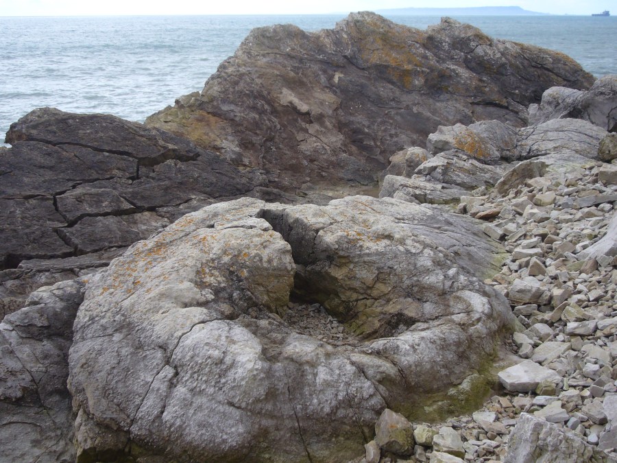
Note the fascinating Fossil Forest on the left (97 steps down and the same back up) shortly before you exit the Ranges through another gate. An information panel gives more detail. The official Coast Path route, as shown on the OS map, involves more ascent (long flight of steps) and descent, but at most states of the tide, you can avoid this by walking along the shingle beach at Lulworth Cove. There are a couple of paths down to the beach, one with steps.
Further information
Tourist information: Lulworth Cove Visitor Centre (01929 400587)
Public transport: X54 bus between Weymouth and Poole via Lulworth Cove; service calls at Wool station.
Explore more walks in South England, as mapped by The Great Outdoors’ expert contributors.


