Ian Battersby combines sections of two long-distance paths: A Pennine Journey and the Dales High Way, to form a circuit around some of the finest landscape scenery of the Howgill Fells.
Just as all roads lead to Rome, all paths lead to The Calf, or at least that seems to be the way of things in the Howgill Fells. Here The Calf round forms a natural hub connecting ridges that radiate out into Cumbria and thus the world. The fells here form an intimate huddle of high, rounded grassy hilltops, with slender flanks sweeping into steep river valleys that divorce them from surrounding, possibly less alluring, hills.
The Dales High Way launches a direct approach from Sedbergh, quickly delivering a high-level promenade along a haughty ridge line overlooking throngs of incising gills. But this route begins along the Pennine Journey path, which shadows the River Rawthey and proves to be an irresistible appetiser, not only for the high-level drama to come, but also for the finale – a descent by one of England’s finest waterfalls.
The Calf Round: route description
START/FINISH: Cross Keys Inn 6km north-east of Sedbergh on A683; SD698969 | MAPS: OS Explorer OL19 (1:25k), Harvey Superwalker XT25 (1:25k) | DISTANCE: 17.7km / 11 miles | ASCENT: 820m / 2,690ft | DURATION: 6 hours
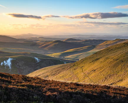
1. SD698969: A footbridge spans the River Rawthey just north of the Cross Keys Inn. Once across follow the bridleway south-west along the Pennine Journey route to a footbridge crossing Cautley Holme Beck. A stony track leads south, climbing a little onto the lower flanks of the Howgill Fells, with views overlooking the river valley to the immense spread of Wild Boar Fell, Swarth Fell, and Baugh Fell, as well the steep flanks of the more immediate Howgills on this side of the river.
Baugh Fell from Cautley Holme Beck.
Credit: Ian Battersby
The path is well signposted through numerous gates as it bypasses a number of modest farmsteads, threading a line through open fell pastures and between thorny limbs. Take the track left of Fawcett Bank Farm, dropping to a bridge crossing Hobdale Beck, just down from a lively cascade, where feisty red squirrels may be glimpsed before reaching Thursgill Farm. Follow the lane south south-west to Buckbank Farm.
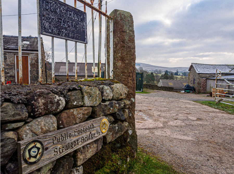
Buckbank Farm.
Credit: Ian Battersby
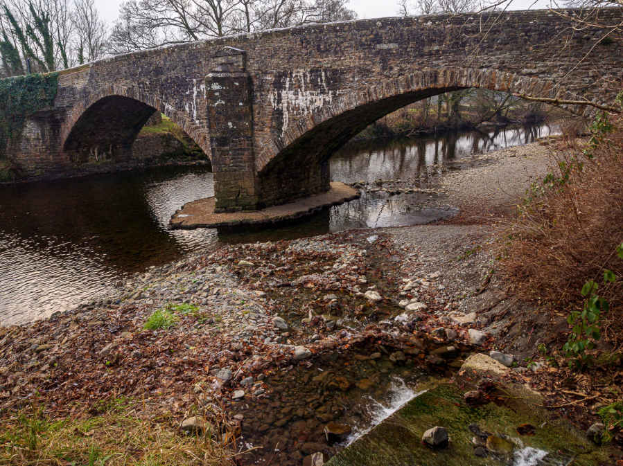
2. SD679929: Take the footpath south through the farm, signposted to Straight Bridge, dropping to the river, and following the river fence over a stile to the bridge. Cross the road and continue by the river, tracking west while admiring shapely Howgill knolls to the north, and mergansers and dippers inhabiting the river. The Rawthey is wide and shallow, trundling behind a screen of tangled trees between stretches of rounded, mossy stones, and bubbling over glistening shelves to reach the A684 bridge.
A684 bridge at Sedbergh.
Credit: Ian Battersby
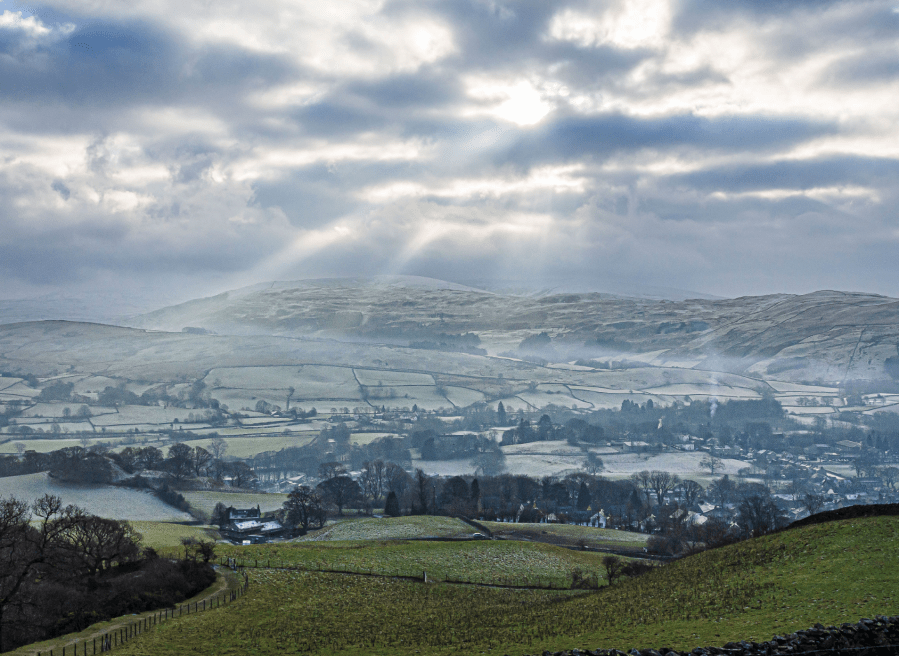
3. SD665920: Turn right along the A684 into Sedbergh. Turn left at the T-junction with the A683 and follow it to a fork junction just after Westwoods Books. Fork right into the narrow, one-way Main Street, keeping the white house on your left, and heading west north-west to the public toilets at Joss Lane.
Sedbergh from Settlebeck Gill.
Credit: Ian Battersby
4. SD659922: Turn right heading north up Joss Lane and the Dales High Way, and follow the bend north-east to the end of the tarmac. Go through a gate and follow the stony track as it turns north to a walker’s gate, from where the path climbs alongside Settlebeck Gill to reach the open fell at a kissing gate.
Bram Rigg Beck from Rowantree Grains.
Credit: Ian Battersby
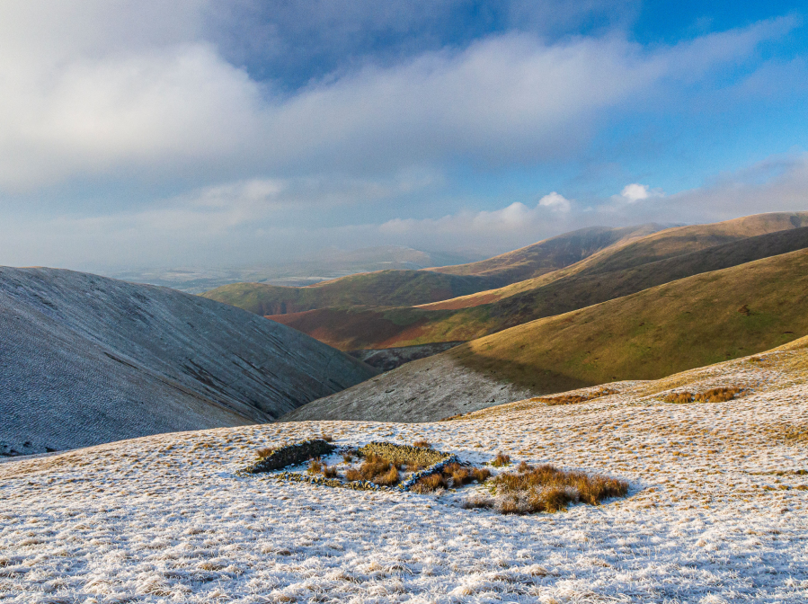
Continue a long climb north up above the gill and turning north north-east to pass Arant Haw and Rowantree Grains before arriving at Brant Fell, where the path dog-legs north-east then north to Calders summit.
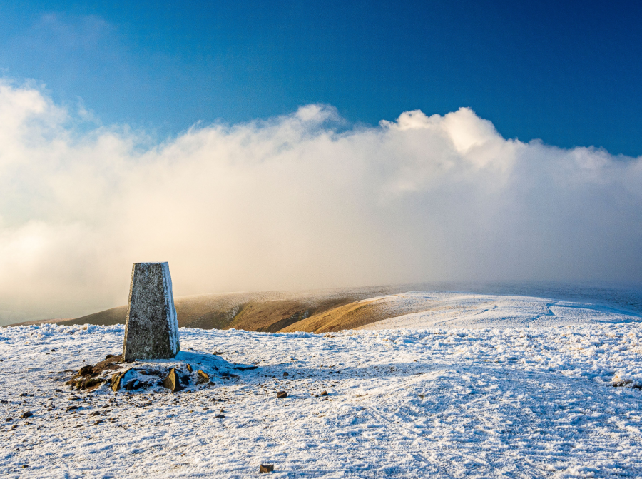
The Calf trig point.
Credit: Ian Battersby
The trig point at The Calf lies 1km north north-west of here along a good track.
Continue along the track, heading north north-east for 500m to a small pond.
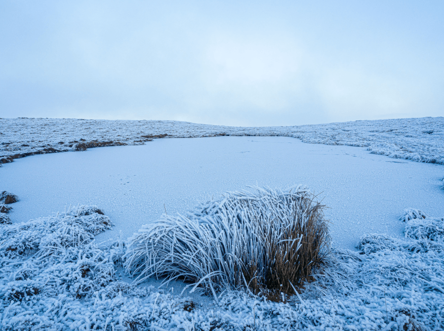
Small pond north-east of The Calf.
Credit: Ian Battersby
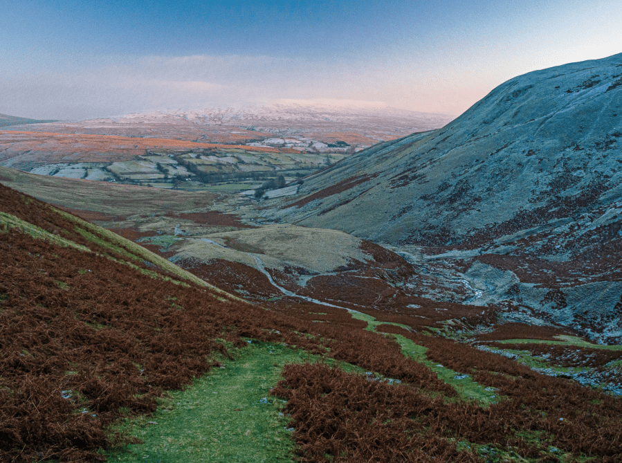
5. SD671975: Now leave the Dales High Way and follow a bridleway east north-east for 500m passing Swere Gill on the right. Leave the bridleway along an unmarked path dropping east not far from Swere Gill before veering away at about 500m in altitude, heading north-east to reach Bowderdale Head. Take the path south-east, dropping steeply towards Cautley Holme Beck, with Cautley Spout crashing into the gill, and follow the beck to the second footbridge that was crossed near the beginning of the walk.
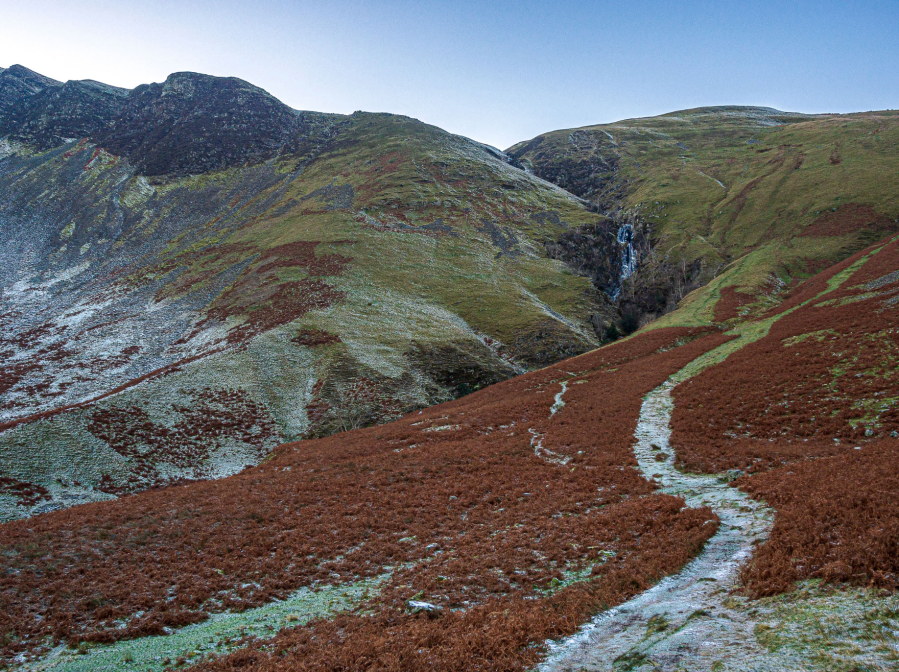
Cautley Spout between Hare Shaw and Cautley Crag.
Credit: Ian Battersby
Retrace steps north-east back to the first footbridge and back to the start.
Further information
PUBLIC TRANSPORT: None to start
TOURIST INFORMATION: Sedbergh Tourist Information, 015396 20125
Discover more walks in the Howgills as mapped by The Great Outdoors’ expert contributors.