
Fiona Barltrop recommends the north-west coastal walk from Strumble Head to Trefin for its dramatic cliff scenery.
Nowhere along Pembrokeshire’s spectacular coastline is the scenery wilder and more dramatic than at Pwll Deri, a bay surrounded by high precipitous cliffs on the west side of the Pencaer peninsula. It lies couple of miles south of Strumble Head, situated on the islet Ynys Meicel (St Michael’s Island) and itself a popular spot for sharing a moment with the local marine life. It’s the location of what is one of the most superbly situated hostels in the country, perched on the cliff top overlooking the sea far below. It’s a great spot for sunsets and seal watching. Yet it has a curious name – meaning pool of the oak trees – for what is such a treeless coast.
The rocky outcrop above it, Garn Fawr, is crowned by an Iron Age fort and provides splendid views from the top: a worthwhile detour from the coast path. Pembrokeshire’s exhilarating coast path has many a wonderful stretch, but the miles between Strumble Head and Trefin via Pwll Deri has to be the wildest and most impressive of them all.
Strumble Head to Trefin: route description
START: Strumble Head – car park/bus stop (SM895412), or road junction bus stop SSE of Strumble Head (SM903399). Considerate roadside parking in Trefin. | MAPS: OS Explorer OL35 (1:25k), OS Landranger 157 (1:50k) | DISTANCE: 20.5 km/12¾ miles | ASCENT: 776m/2546ft | DURATION: 6½ hours
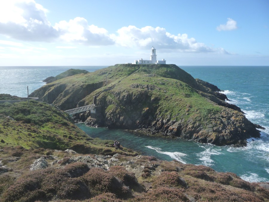
1. SM895412: As and when the Strumble Shuttle is operational again and assuming the same service as in the past, the bus will drop you off at Strumble Head itself in summer, but in winter you’ll need to walk from the road junction just over a mile away, an easy walk along a quiet country lane. Strumble Head is renowned as a spot for watching sea birds, migrant birds and marine life. A former Second World War lookout provides shelter for wildlife-watchers. The lighthouse is situated on the islet Ynys Meicel (St Michael’s Island), separated from the mainland by a narrow gap which is crossed by a footbridge. Built in 1908, it is now automatic. Look out for seals around here. The navigation for this walk is very simple: facing Strumble Head, turn left and keep the sea on your right for the rest of the way!
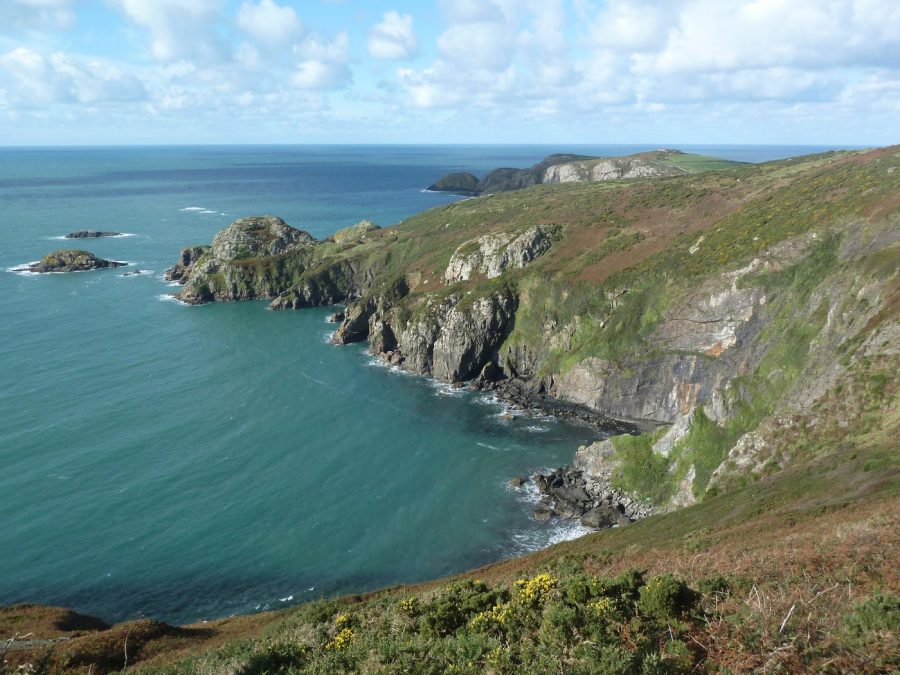
View from cliffs above Pwll Deri.
Credit: Fiona Barltrop
2. SM893388: From the road above Pwll Deri’s Youth Hostel it’s worth making a short detour to climb to the summit of Garn Fawr. Head up the drive to the holiday cottages, then follow the path that climbs directly to the top (trig point). At 213m it’s the highest point on Pen-Caer affording fine views along the coastline in either direction.
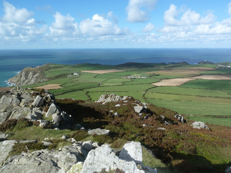
View N twds Strumble Head from top of Garn Fawr.
Credit: Fiona Barltrop
Just below the summit is a First World War lookout point. Descend the same way. The Coast Path follows the road for a short distance passing a memorial to Dewi Emrys, the poet, before turning off right to continue out to the Penbwchdy headland. South of here you begin to lose height as the cliffs get lower.
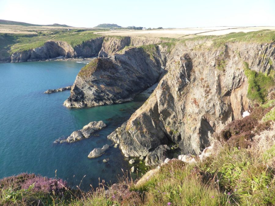
Cliff scenery near Pwllcrochran.
Credit: Fiona Barltrop
Pwllcochran, a deep narrow cleft in the cliffs, is another place to spot seals. NB Look out, too, for choughs which can be seen along this stretch of coastline.

Aber Mawr beach from N.
Credit: Fiona Barltrop
3. SM884351: At Aberbach the stream usually trickles through the pebble bank and is easy to cross, but if not (and you don’t fancy a barefoot wade) there’s an easy alternative route along the valley path inland to the road, right across the bridge and back along the lane on the south side to rejoin the Coast Path. After the shingle beach at Aber Mawr you’re back on the cliff-top again for the next stretch to Abercastle. Though the cliffs from now on are not as high as previously, the scenery is still excellent.

Careg Sampson, Neolithic burial chamber (& sheep shelter).
Credit: Fiona Barltrop
4. SM853336: Abercastle is a picturesque village with a harbour once used for trading; there is a limekiln to the south of the harbour and a ruined granary to the north. Just beyond Abercastle and a short signed diversion inland from the Coast Path is Careg Sampson: a fine example of a Neolithic burial chamber (cromlech), worth making the effort to see. Continue along the coast for another couple of miles turning off left just after Pwll Offa along a footpath signed for Trefin.
Further information
PUBLIC TRANSPORT: The operator of the coastal bus service, the 404 Strumble Shuttle, that usually covers this stretch of coastline has cancelled it from 5th April 2023. A new operator is being sought, but in the meantime the area covered is part of the North Pembrokeshire fflecsi bus scheme – book to be picked up and dropped off anywhere in the zone, www.fflecsi.wales/locations/pembrokeshire. Bus T11, St David’s to Fishguard via Trefin and Goodwick, Mon – Sat (all year). Taxi from Goodwick to Strumble Head.
TOURIST INFORMATION: Fishguard TIC (01437 776636)
NEAREST YHA: Pwll Deri
Discover more walks in Wales as mapped by The Great Outdoors’ expert contributors.


