
A long chalk ridgeline stretching from the sea at one end to the sea at the other. Ronald Turnbull invites you to sample the Wight stuff on the Isle of Wight.
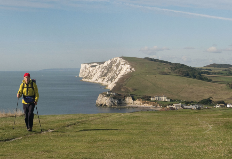
Tennyson Down is the start of the chalk ridge running east across the Isle of Wight, England’s biggest island. That ridgeline makes for fast, freestyle walking, with the wind in your hair and daisies under your feet, great sea views stretching away southwards – interrupted only by the occasional cup of coffee at Freshwater Bay, and a night out somewhere along the way.
If you’ve got a bivvy bag or a very small tent, that night out could be high on St Catherine’s Down, watching the day fade over the sea, wind whispering through the grasses, the smell of salt and gorse, the mind going quiet and the fingers chilly as you wait for the first star to show. Wind-twisted gorse bushes give overnight shelter, while the stone tower of the UK’s oldest lighthouse makes an interesting shape against the sunset and the sea. At Whitecliff, the striped clay cliffs of Alum Bay appear again, having in their underground way walked with you along the length of the island. The lights and urban outline of Portsmouth shine across the fading evening sea. It’s time to come down from the heights of Wight and start looking about for the bus.
Isle of Wight: route guide
START: Colwell Chine, Totland; SZ326878 | FINISH: Bembridge Lifeboat Station; SZ656880 | MAPS: OS Explorer OL29 (1:25k), OS Landranger29 (1:50k) | DISTANCE: 63km / 39 miles | ASCENT: 1,400m /4,600ft | DURATION: 18 hours (over 2 days)
1. SZ326878: From Totland, the island’s westernmost settlement, follow the Coastal Path over the scrubby heathland of Headon Warren to Alum Bay. Descend to the beach.
Alum Bay – Tertiary clay and mudstone.
Credit: Ronald Turnbull
2. SZ305855: Return to the Coastal Path along the clifftop, and follow it southwest to a point above the Needles. Admire the view! Return east along the downland crest to the pillar of Tennyson’s Monument. The downland is named after the Victorian poet, who loved to walk here – though perhaps over shorter distances than today’s. Follow the Coastal Path ahead down to Freshwater Bay.
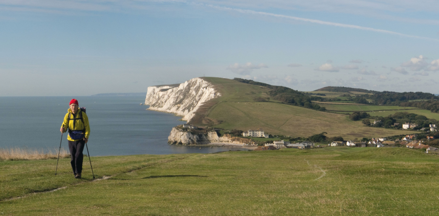
On Freshwater Bay Down.
Credit: Ronald Turnbull
3. SZ345857: Now following the Tennyson Trail, head up along the downland crest eastwards to the trig point at Five Barrows. From here drop east to cross B3399 road. Keep following the Tennyson Trail along the downland crest, soon with woods on your left. The wide path runs along Mottistone Down to cross a minor road. Still with woodland on your left, head up to a track junction. Take the track left, north, to Brightstone Down’s trig point. Turn back right, southeast, to Limerstone Down’s viewpoint.
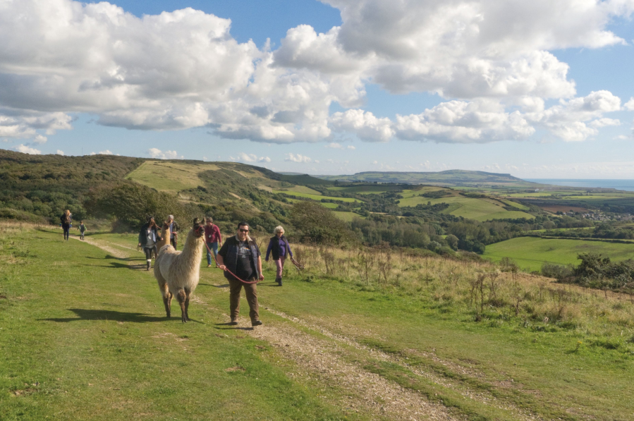
Llama party on Mottistone Down.
Credit: Ronald Turnbull
4. SZ437837: At the viewpoint, drop south off the downland, and follow a subsidiary ridge east to Shorwell with its useful pub. Follow B3399 road southeast for 800m, then take a bridleway south for 1km and turn left on a byway, Dungeonwood Lane, running east to Kingston.
5. SZ479813: Follow B3399 again for 400m. Where it bends right take another byway track southeast. At a tee-junction, turn south to a minor road and right to Chale Green. Here take a streamside path left, southeast, to the pillar of Hoy’s Monument. Turn up onto the crest of St Catherine’s Down and follow it south to the ruined chapel named as the Oratory.
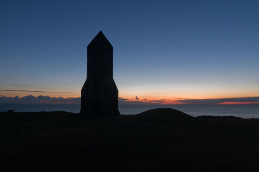
St Catherine’s Oratory, sunset.
Credit: Ronald Turnbull
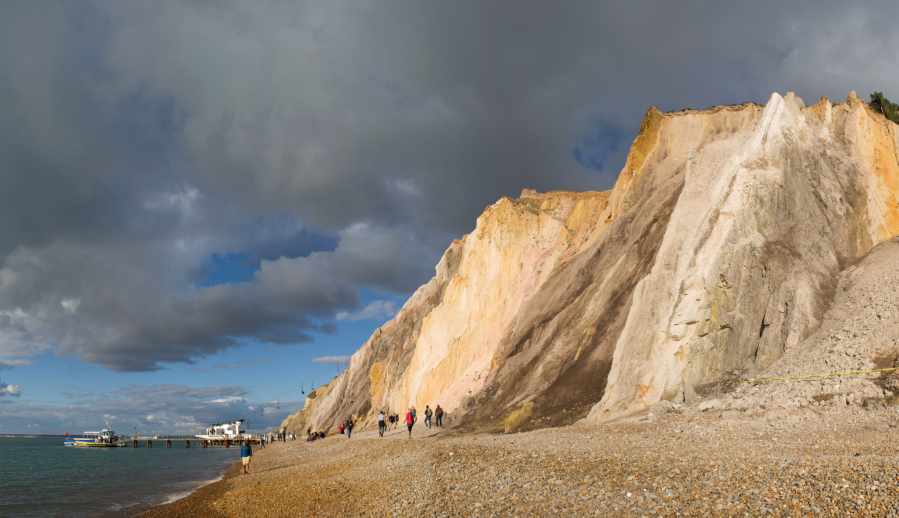
6. SZ493772: Head south down the slippery grass, to cross A3055 onto the Coastal Footpath. It runs east along knobby low cliffs of yellowish rock, the Greensand. It re-crosses the A3055 before turning down to St Lawrence. Head down through the village to low shoreline cliffs at the base of the Undercliff’s landslipped zone. The Coastal Path runs along low clifftops to Ventnor harbour. Here are brash beach huts, enticing tea parlours, and pastel-painted villas jammed edge to edge around the bay.
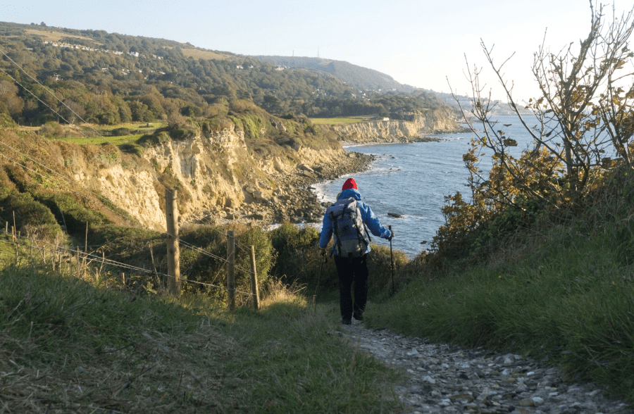
Greensand cliffs: Woody Point to Ventnor.
Credit: Ronald Turnbull
7. SZ563773: Head up north through the town to cross B3327 near Ventnor Farm. A path heads up northeast, a stiff climb onto St Boniface Down. Turn left to the trig point at 235m, and right along a road to the island’s high point. The actual summit is an earth-covered concrete bunker, an observation point from World War Two.
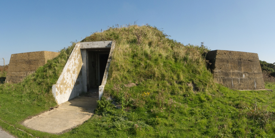
Summit bunker St Boniface Down, Ventnor.
Credit Ronald Turnbull
8. SZ568786: Bend north along Luccombe Down and Shanklin Down, and drop off north for a path to Upper Hyde. Continue north through America Wood then northeast past Ninham to A3056. Downland again gives way to townland: the town being Sandown. Descend east by the railway station to its long beach backed by a tall wall of seaside hotels.
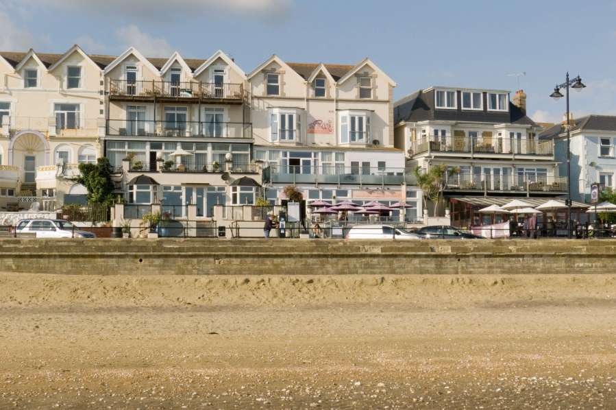
Sandown seafront.
Credit: Ronald Turnbull
9. SZ591832: From here on, it’s the Coastal Path. From Sandown seafront it follows the shore to Bembridge Down’s monument pillar. It continues past Whitecliff Bay. At the edge of Bembridge, take the shoreline path around Foreland to the Lifeboat Station.
Further information
PUBLIC TRANSPORT: Good bus links from Newport to walk start and end and intermediate towns, and ferry ports (Southern Vectis www.islandbuses.info 0871 200 2233) ferries to the island see travel page on www.visitisleofwight.co.uk
TOURIST INFORMATION: Visit Isle of Wight, 01983 521555
Discover more walks in South England as mapped by The Great Outdoors’ expert contributors.


