
Vivienne Crow enjoys a day on Green Crag and Harter Fell taking in the views above Eskdale.
Harter Fell may be only 653m high, but given the way its crag-topped, pyramidal outline towers over the western Lake District valley of Eskdale, you’d be forgiven for thinking it reached a far greater altitude. This walk approaches it from the western base of Hardknott Pass, using a combination of valley paths and intermittent moorland trails to first climb neighbouring Green Crag. (For those who are bagging them, this, like Harter Fell, is also a Wainwright.)
The wild blue yonder of Morecambe Bay and the Irish Sea forms a dreamy backdrop to the first part of the walk but is then replaced by a more sobering scene as the muscular mountains around the head of Upper Eskdale command the walker’s attention. The final part of the route visits one of the region’s most spectacularly located Roman sites – Hardknott Fort, with its eagle’s-eye perspective on the road leading from the coast to the high pass.
Words and images: Vivienne Crow
Green Crag & Harter Fell: route guide
Start/finish: Parking area at Jubilee Bridge, just east of cattle grid at bottom of Hardknott Pass and 4km east of Boot (GR: NY212011) | Distance: 8.2 miles/13km | Duration: 5 to 6 hours | Ascent: 2,300ft/701m | Maps: OS Explorer OL6 (1:25k), OS Landrangers 89 and 96 (1:50k), Harvey 1:25,000 Superwalker Lake District West
1. NY212011: Walk down the road and, just before the cattle grid, drop left to cross Jubilee Bridge. The stony trail climbs right. After two farm gates, leave the main path by bearing right along a lesser trail. For the next 1.8km, this battles through bracken, weaves in and out of woodland, and fords several becks.
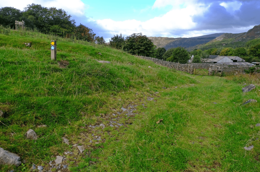
The waymarked track junction near Penny Hill Farm.
Credit: Vivienne Crow
2. NY195006: Nearing Penny Hill Farm, turn left at a waymarked track junction. The route winds its way up the hillside to reach two gates at a wall junction. Go through the gate on the right.
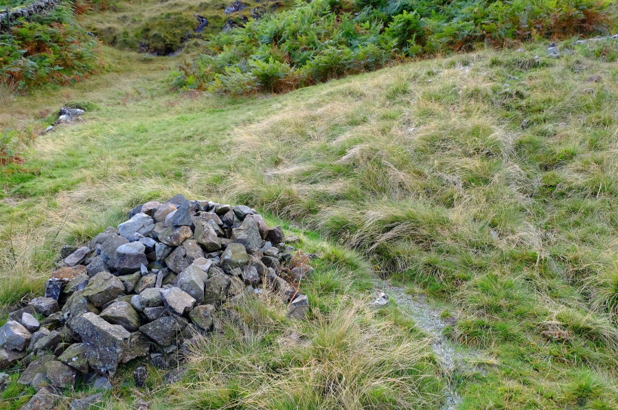
Veer south-west at the cairn.
Credit: Vivienne Crow
3. NY197003: Veer south-west at a cairn. The route resembles a stream bed but quickly becomes more path-like. Its zig-zagging nature and the appearance of retaining walls suggest this is more than a walkers’ trail; it’s actually a peat road once used to bring this fuel down from the fells for use in homes. It’s indistinct in places, so you’ll need to watch for its twists and turns. On reaching a flatter, more open area, it swings south-west again and then, after the remains of a peat hut, veers south-east. The trail keeps in close to the slopes of Kepple Crag to the left and then becomes less clear. It continues south-east for about 220m and then swings south-west for 200m.
4. SD198994: As the ground ahead rises towards some crags, climb south-south-east to reach the higher ground. Aiming slightly east of Great Whinscale, you’ll then find a grassy trail heading south along the bumpy ridge. Beyond The Pike, it drops to a grassy dip. Keep left at a fork on the way down and then climb straight ahead. The trail passes below Green Crag, but then, as Morecambe Bay appears to the south, swing west to climb to the summit cairn.
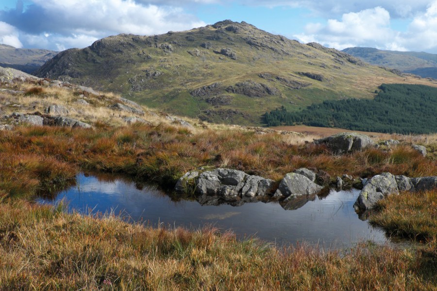
Harter Fell as seen from near Green Crag.
Credit: Vivienne Crow
5. SD200982: Having dropped back down the fell’s eastern side, take a few steps south and then follow a faint trail east. This winds its way generally east-south-east between rocky outcrops and then veers north-east over wetter, featureless ground.
6. SD213985: Go through a gate and follow the trail to a path junction. Cross the beck here to join a path along the forest edge. Go left at the next junction. Leaving the forest at a gate, turn sharp right beside the fence. When it bends right, keep straight ahead on the rough trail to climb Harter Fell.
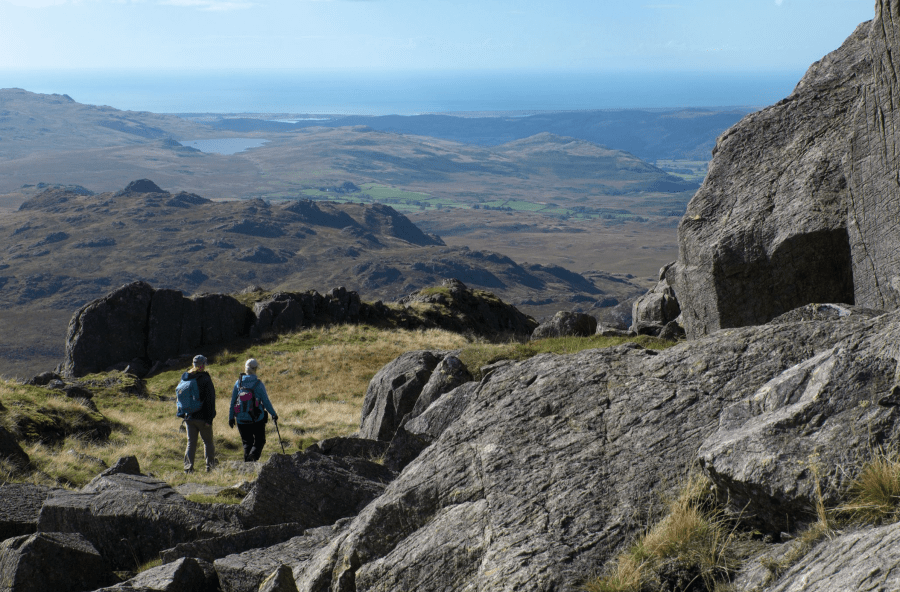
On Harter Fell, looking west towards to the Irish Sea.
Credit: Vivienne Crow
7. SD218996: Reaching the summit area, watch for a smooth slab of rock, about 7m high, to the right of the path. Bear left just before this. You’ll find the trig pillar up to the left whilst the highest rocks are to the right. Return to the smooth slab and continue east. After a few strides, keep left at a faint fork (east, quickly veering north-east). Cross a stile in a fence and continue north-east. Don’t go through the gate in the fence marking the edge of forestry land; keep to the western side of it.
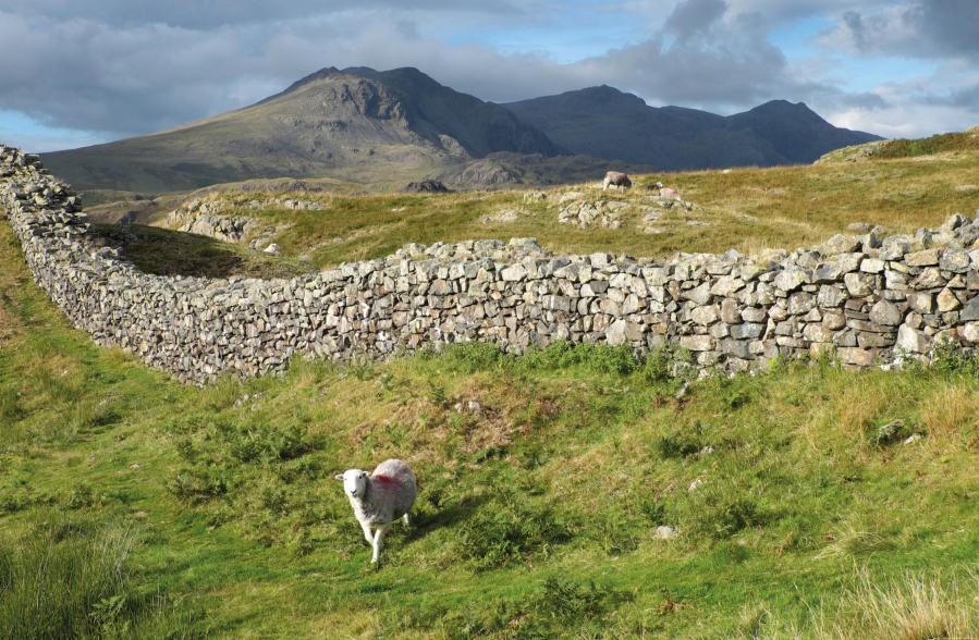
Looking across the walls of Hardknott Fort towards the Scafells.
Credit: Vivienne Crow
8. NY228009: Bear left when the path splits near the fence corner. After a gate, head north-east again. The path soon swings north-west and splits. Keep left. Turn left along the road for 300m. At a left bend, take the path signposted right. Follow it for 420m.
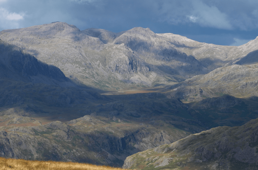
The Scafells dominate the scene on the descent from Harter Fell.
Credit: Vivienne Crow
9. NY221017: Veer south-west to drop to a path crossing a flat area that is said to have been a Roman parade ground. Pass through the middle of Hardknott Fort, entering via the north-east gateway and exiting on the opposite side. The trail descends south and then south-west to the road. Turn right to return to the car park in 340m.
Further information
Transport: None to start
Information: lakedistrict.gov.uk (0845 901 0845)
Nearest YHA: Eskdale


