With daylight at a premium, it’s the right time to explore some of Cumbria’s lesser heights – and Roger Butler says you’ll be surprised at the limestone scenery on Farleton Fell.
Long days in the fells can be tricky in the depths of winter but there are plenty of lesser-known Cumbrian hills which can still offer a satisfying day out. And you don’t always need to climb high for fine views and exhilarating landscapes. Pudding-shaped Farleton Fell – together with its limestone sister Hutton Roof Crags – will certainly give you a walk to remember.
This strange craggy plateau, just southeast of junction 36 on the M6, comprises a bewildering range of rocky pavements, jagged outcrops and naturally weathered sculptures. Gorse-splattered screes rise steeply from the Lancaster Canal and, once up, you can easily spend a few hours exploring the vast array of unexpected cliffs, gullies and terraces. A couple of wind-blown summits provide panoramic views across a fair chunk of northern England, with Ingleborough prominent in the east. This is a proper fell walk with proper limestone but the straightforward ascents and descents mean you’ll be able to make the most of your time on top.
Farleton Fell and Hutton Roof Crags: route description
Start/Finish: By church in Holme, north of Carnforth (GR: SD524788) | Map: OS Explorer OL7 (1:25k) | Distance: 12.5km/7¾ miles | Ascent: 340m/1115ft | Duration: 5 hours
1. SD524788: From the church in the centre of Holme, follow the lane east towards the bridge over the Lancaster Canal. Take the ramp on the right, through stone gateposts, onto the towpath and turn left to walk north and pass beneath four traditional canal bridges. The canal is blocked and culverted at the next road – take cross the stile, cross the road and go through a gate to re-join the towpath. Walk beneath the M6 crossing and leave the canal, up steps, at the next bridge (named Duke’s Bridge on the OS map).
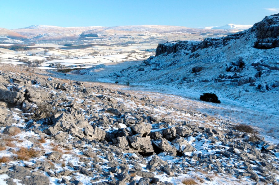
View east from below the summit, with limestone scree and crags and Wild Boar Fell (left) and Ingleborough (right) in the distance.
Credit: Roger Butler
2. SD533807: Turn right on the lane and go straight over the A6070. Walk along the next lane for 100m, with Farleton Fell looming ahead. At Townend Farm, by a sharp right-angle bend, take the path ahead through the field, with hedge on the left, and head uphill towards the left side of a large clump of trees. Cross a stile in the top corner to gain Access Land and turn left for 100m onto the hillside. Paths soon veer steeply uphill, south-east, over a combination of scree and gorse to the plateau-like top of Farleton Knott.
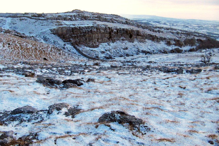
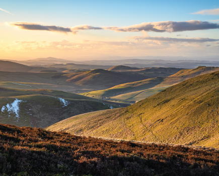
View south from the summit of Farleton Knott, looking towards a long linear amphitheatre formed by the limestone crags.
Credit: Roger Butler
3. SD542804: Walk south for 200m to an obvious stone wall, with limestone pavements and crags now visible in every direction. Turn left, with the wall on the right, to a gate where the wall bends right. Keep ahead on a broad path, initially through a broad gully with steep pavements on the left. The path bends south after 400m, with more pavements on the right and scattered trees on the left. Continue on the path/track, past Newbiggin Crags, and gradually descend rough pasture to a gate with ladder stile at a lane.
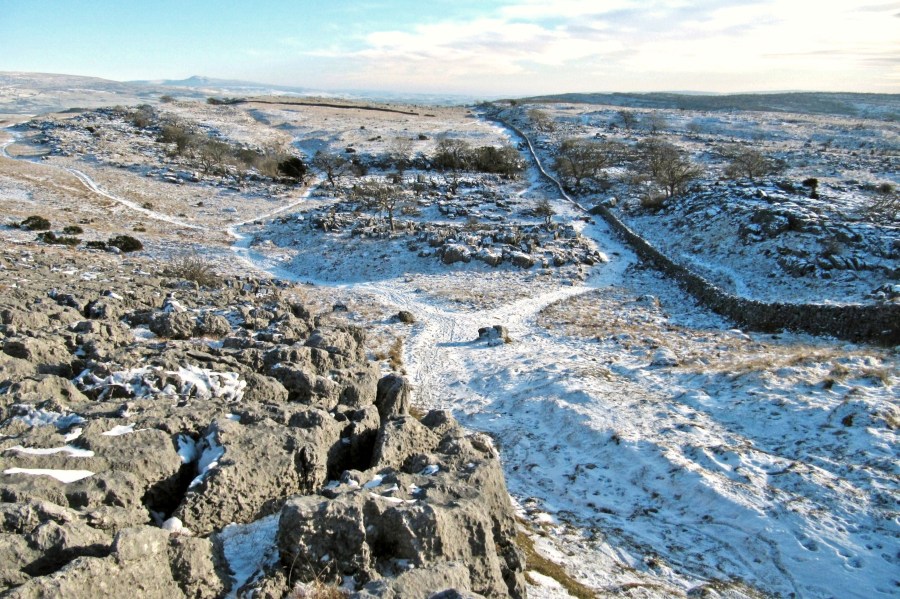
View south east from Farleton Knott – the walk follows the wall towards Newbiggin Crags.
Credit: Roger Butler
4. SD550786: Go straight over to a kissing gate, with nature reserve signs, leading onto Hutton Roof Crags. This can be a confusing area and there are few established paths – keep a wary eye for unexpected cracks and crevices amongst the bushes. Follow the path uphill for 700m, indistinct in places through a shallow valley, and turn right at a low cliff. Keep ahead, with outcrops on the right and bear left over an area of limestone pavement to reach a couple of cairns above a large bare outcrop named Uberash Breast. Another rocky area known as Potslacks lies to the east. The trig point on the south-west summit (274m/899 feet) is a further 400m to the south-south-east, across a scattering of scars with some dense bushes – and past a sculptural boulder known as Turtle Rock which really does look like a tortoise!
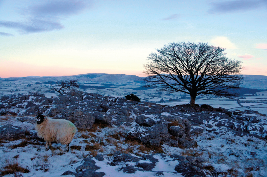
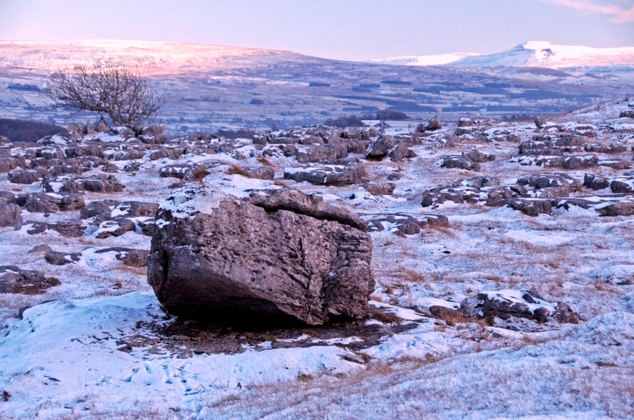
The end of a cold winter’s day on Hutton Roof Crags.
Credit: Roger Butler
5. SD556774: Retrace your steps to the lane, turn left and walk downhill for 1km. Ignore the first path on the right and after a couple of houses take Piper’s Lane (signed no through road) on the right. Follow the right of way ahead, north-west across old parkland at Curwen Woods. Pass a tennis court on the right, cross a track and cross a step stile in the wall by the A6070.
6. SD530784: Cross the road and turn left for 50m. Turn right on the lane which soon crosses both the M6 and the canal to return into Holme.
Further information
Tourist information: Kirkby Lonsdale Tourist Information, 015242 97177
Public transport: Nearest rail station Carnforth. Bus service 555 runs close to the start of the walk.
Explore more walks in North England, as mapped by The Great Outdoors’ expert contributors.