
Find solitude in one of Scotland’s most spectacular hillwalking areas by thinking lower – but not that low, says Craig Weldon.
‘The Torridonian Triptych’ is a phrase you will hear when people talk about the hills north of Torridon village. It’s an unfortunate phrase, because there are really four superlative hills immediately north of Glen Torridon, not three. The D’Artagnan of this tale is Beinn Dearg, unjustly neglected because it isn’t a Munro – but only by the narrowest of margins. At 2,998ft, when standing at the top, only the smallest of dogs in your party will have their head under the magic 3,000ft contour line.
Thanks to the lack of crowds you won’t find an obvious path up or down Beinn Dearg, which presents its own difficulties given the nature of the terrain. Like the rest of Torridon, this hill consists of banded tiers of sandstone cliffs, and there is no shame in taking an out-and-back route to avoid a tricky descent. Treat yourself to a clear day for Beinn Dearg. The navigation might demand it – but so do the views.
Hike Beinn Dearg: route description
START/FINISH: Coire Mhic Nobuil car park; NG869576 | MAPS: OS Explorer 433 (1:25k), OS Landranger 19, 24, 25 (1:50k), Harvey Ultramap Torridon (1:40k), Harvey Superwalker Torridon (1:25k) | DISTANCE: 16km / 10 miles | ASCENT: 1,040m / 3,450ft | DURATION: 7.5 hours
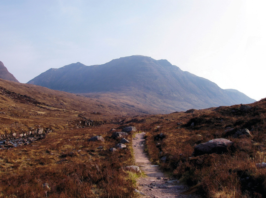
1. NG869576: From the car park, cross the road bridge with views of a waterfall and take the path up the left bank (east side) of the Abhainn Mhic Nòbuil. As the path comes out the trees, there are some lovely sunbathing spots on the river, weather and midges allowing.
2. NG882589: After 1.5km, cross the Abhainn Mhic Nòbuil on a footbridge.
3. NG882591: 150m further on, the path branches. The right fork takes you round the back of Liathach out to Coire Dubh Mòr and Glen Torridon. Take the left fork, heading for the Horns of Alligan or Na Rathanan.
Approach to Beinn Dearg.
Credit: Craig Weldon
4. NG882602: The path follows the tumbling course of the Allt Bealach for a further kilometre, where at 350m altitude, the path branches again. Take the right branch under the steep slopes of Beinn Alligan, heading for the Bealach a’ Chòmhla. As you continue along this rougher path, look at the west face of Beinn Dearg for a likely route up the hill.
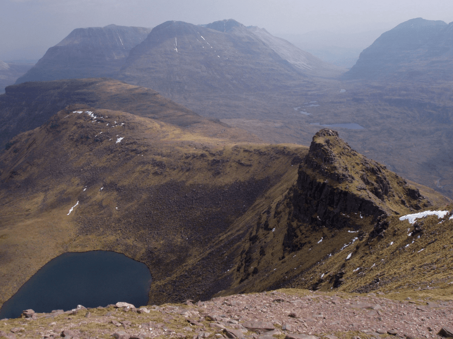
5. NG879614: The point you are most likely to want to leave the path is around NG879614. Head east across rough ground for the base of a wide gully, which will take you high on the north-west shoulder of Stùc Loch na Cabhaig. Follow the ridge to Stùc Loch na Cabhaig – a superb viewpoint.
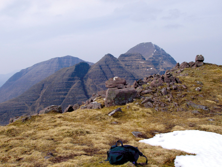
Summit of Stuc Loch na Cabhaig.
Credit: Craig Weldon
6. NG892616: From Stùc Loch na Cabhaig, a pleasant kilometre of ridge walking with mild scrambling near the top takes you to the wide summit of Beinn Dearg. If the weather is closing in or you are otherwise unsure of your navigation, you may wish to retrace your steps.
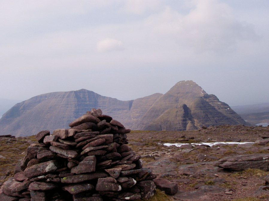
Summit of Beinn Dearg.
Credit: Craig Weldon
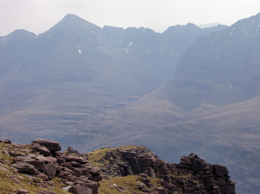
7. NG895608: From the summit of Beinn Dearg, continue along the ridge in a south-easterly then easterly direction for 400m to a col, where a decision needs to be made.
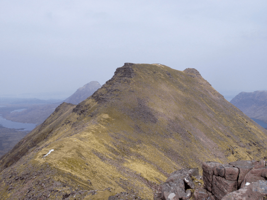
Stuc Loch na Cabhaig from Beinn Dearg.
Credit: Craig Weldon
8. NG898607: Ahead, an easy scramble leads to a short section of cliff, which can be downclimbed at a grade similar to the Am Fasarinen pinnacles of Liathach. If that doesn’t appeal, return to the col and bypass the cliff to the right (south) on steep grassy ledges – take care not to slip here in the wet. After the downclimb, the traverse to Carn na Feòla is straightforward.
The ridge east from Beinn Dearg.
Credit: Craig Weldon
9. NG915611: There aren’t any easy descent routes from Carn na Feòla, as all options are steep and pathless. Your best bet is to head directly south, taking care to avoid crags. However, to stay on the mountain longer, the route I took was to return to the lowest point on Beinn Dearg’s ridge, then head south-west for 300m to NG906604, to pick up a stream to follow diagonally downhill.
Liathach from Beinn Dearg.
Credit: Craig Weldon
10. NG906597: After some steep and tricky terrain, it is a pleasure to reach the path that goes round the back of Liathach. Head west downhill to link up with your ascent route at step 3.
Further information
PUBLIC TRANSPORT: Torridon village is served by Westerbus 705 and DMK 702. The walk starts 4km from Torridon.
TOURIST INFORMATION: Ullapool iCentre, visitscotland.com, 01854 612486
Discover more walks in Scotland as mapped by The Great Outdoors’ expert contributors.


