Vivienne Crow climbs up to walk the Helvellyn range traverse – and walks and walks… until getting the bus home!
Want ridge walking? You’ve got ridge walking! Want to stride out for mile after mile after mile? Yup! This one’s got that too. Want to hike for hours on end without dropping below 620m? No problem! Hiking end-to-end traverse of the entire Helvellyn range traverse takes in a 12km-long line of summits, starting from the 726m Clough Head in the north, stretching to Dollwaggon Pike (858m) in the south and taking in the 950m summit of England’s third highest mountain along the way. Also bagging Great Dodd, Watson’s Dodd, Stybarrow Dodd, Raise, White Side and Nethermost Pike, it hovers around the 750m contour for much of the time.
Of course, it’s a long walk with a fair amount of ascent, but it’s straightforward – mostly on clear paths with only brief spells involving more rugged ground. Better still, this linear route doesn’t require military planning – or even the need for two cars. The 555 bus means the logistics are taken care of. So, what’s stopping you from enjoying one of the Lake District’s longest and best stretches of sustained high-level walking?
Helvellyn range traverse: route description
START: Bus stop opposite Causeway Foot Farm on A591, 3km south of Keswick, GR NY293218 | FINISH: Bus stop at start of Winterseeds’ driveway on A591, 600m north of Grasmere’s Swan Hotel, GR NY336088 | MAPS: OS Explorer OL4 and OL5 (1:25k), OS Landranger 90 (1:50k), Harvey 1:25,000 Superwalker Lake District North and East | DISTANCE: 24.1km/15 miles | ASCENT: 1457m/4780ft | DURATION: 8½-9 hours
1. NY293218: From the bus stop, walk SE along the grass verge and then take the lane signposted Dalebottom on the left. Turn left at a junction and, in 600m, go right up a rough track. After the church, the lane descends. Go right at the next junction and right again at the B5322. Take the track on the left, keeping left near some farm buildings.
2. NY319231: Having followed the track for 400m, cross the fence stile on the right. A faint trail climbs through old quarry workings. At a flat area, veer slightly right to continue steeply uphill. At another flat area, go right for 50m and then head up the slope on the left, quickly crossing a grassy track to gain a trail climbing steeply through conifers. Beyond the stile at the top, keep straight ahead to a wall gate.
3. NY321230: Go through the gate and continue straight on – along a grassy path forming a trench on the hillside. Keep to the clearest path.
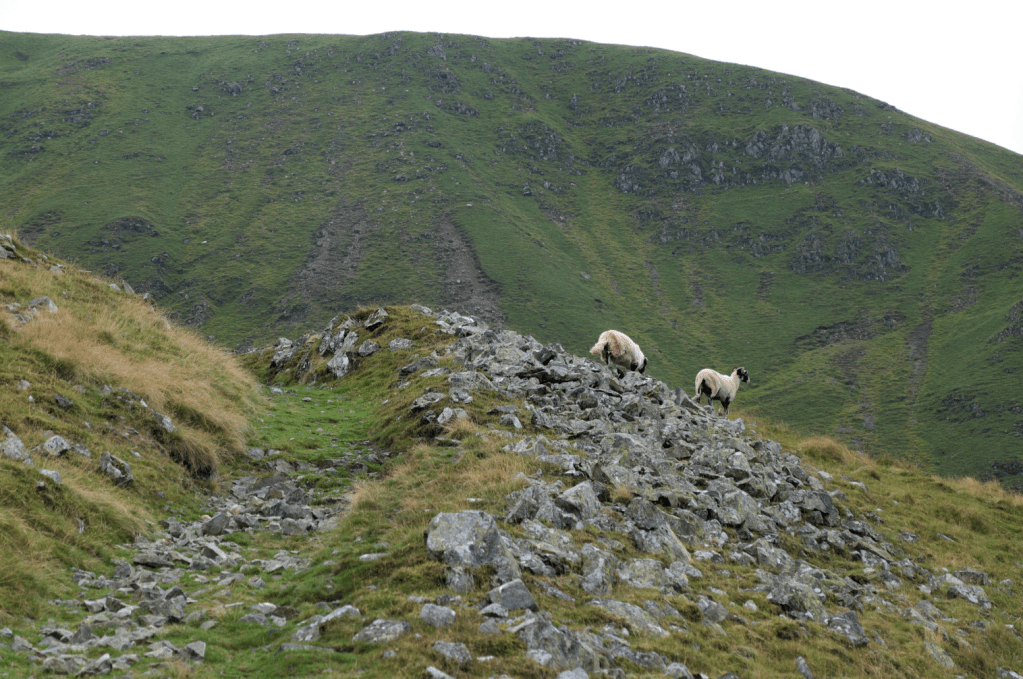
Beyond wp3, the grassy path forms a trench on the fellside. Credit: Vivienne Crow
4. NY330226: About 1.1km beyond the wall, the path reaches the base of scree and boulder-covered slopes. Turn sharp right here, on a rising traverse that makes light work of the steep, scree-covered ground. As rugged ground gives way to easier slopes, bear left at a faint fork for the final pull to Clough Head’s trig pillar.
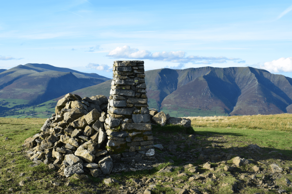
The Clough Head summit. Credit: James Forrest
5. NY333225: Descend SSW. At a dip on the ridge, fork left, passing to the east of Calfhow Pike. Soon after a gate in a fence, the path forks again. Take either option. The clear path disappears just before Great Dodd’s summit; keep climbing in the same direction to reach the cairn.
Catstye Cam from Raise. Credit: Vivienne Crow
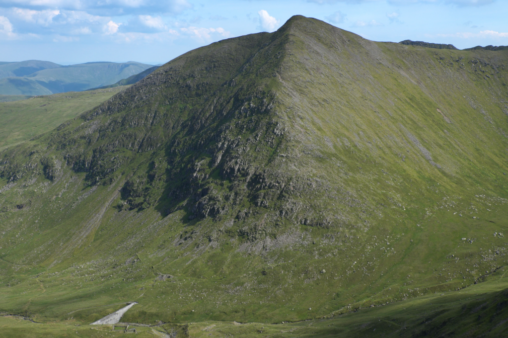
6. NY341205: Head SE to the shelter and then descend SSW on a clear path. About 800m beyond the shelter, join the path to the right (SW), heading to the cairn on Watson’s Dodd. From here, the grassy path swings SE to regain the main ridge path. The clear route then veers SSE to climb Stybarrow Dodd.
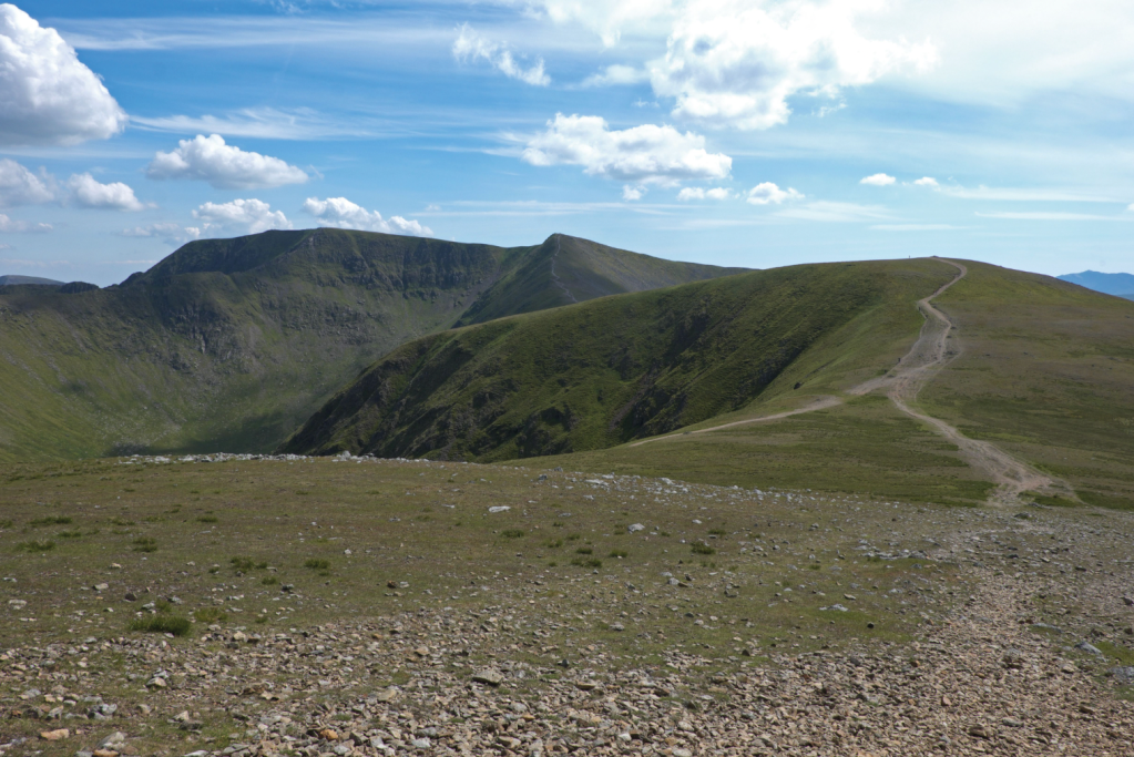
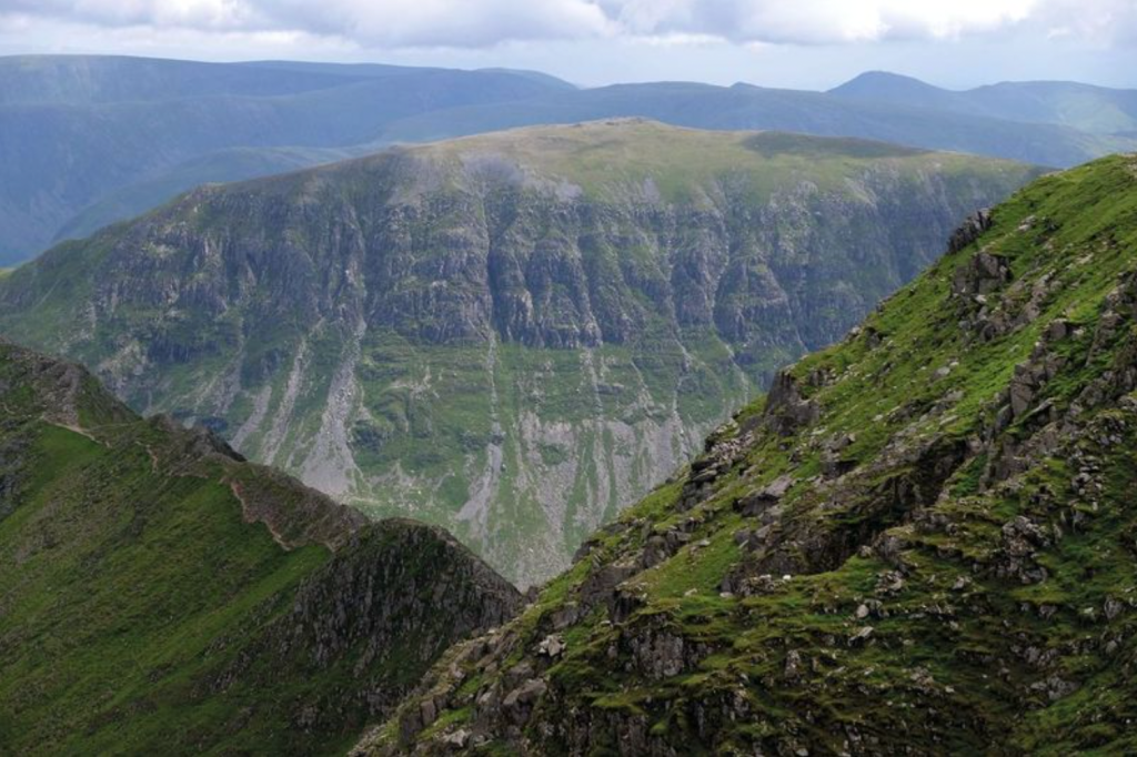
The ridge path beyond Raise climbs White Side and then leads to Helvellyn. Credit: Vivienne Crow
It misses the summit cairn (a few metres to the left) and swings SW, later dropping to Sticks Pass and then climbing to Raise. From Raise’s summit cairn, descend SW to a shallow saddle. White Side is quickly climbed before a narrower ridge leads steeply up to Lower Man. At the top, swing SE to reach Helvellyn’s summit.
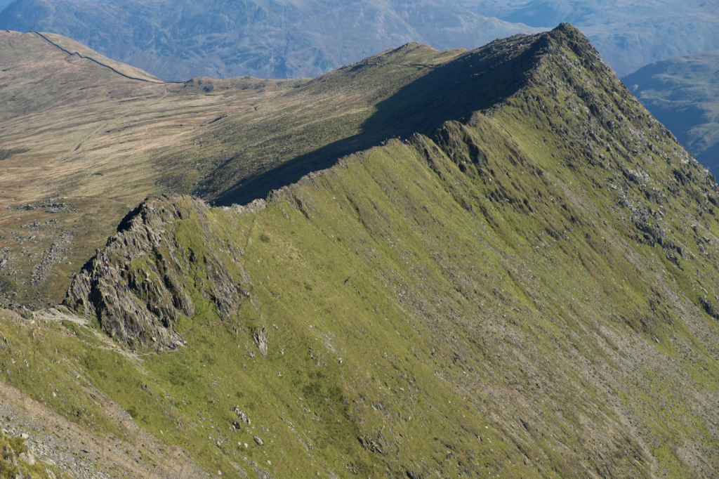
Striding Edge. Credit: Vivienne Crow
7. NY341151: From the trig pillar, drop to the cross-shelter and then keep to the eastern rim of the mountain to peer down on Striding Edge. Soon rejoining the main path, bear left when it forks. It quickly forks again. Bear left to climb to the top of Nethermost Pike and then High Crag, keeping to the fell edge when the path fades. Rejoin the main path beyond High Crag. It dips just before Dollwaggon Pike. Fork left to reach the summit. This narrower trail rejoins the main path beyond Dollywaggon’s summit to drop steeply to Grisedale Tarn.
Looking across Striding Edge to St Sunday Crag. Credit: Vivienne Crow
8. NY351123: Where the path swings E just above the tarn, descend right to cross the outlet stream. Bear right, climbing to a path junction at Grisedale Hause. Keep straight on, crossing an old wall. Later fork left and ford Tongue Gill. You’ll eventually walk with a wall on your right.
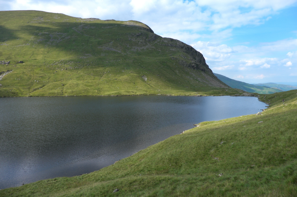
Grisedale Tarn. Credit: Vivienne Crow
9. NY342098: About 120m after this wall ends, drop to the beck. Cross the footbridge over Tongue Gill and bear left, quickly fording Little Tongue Gill. A track heads downstream beside the gill. Turn left along the A591 to reach the bus stop in 370m.
Further information
PUBLIC TRANSPORT: Start and finish points served by 555 Lancaster/Kendal to Keswick bus (www.stagecoachbus.com)
TOURIST INFORMATION: www.lakedistrict.gov.uk, 0845 9010845
Walk more routes in the Lake District, as mapped by our experts.