
Stefan Durkacz walks unfrequented uplands on the borders of Fife and Perth & Kinross on the Cleish Hills.
Straddling the border between West Fife and Perth & Kinross, there’s a surprisingly rugged tract of hill, moor and forest. The Cleish Hills, named after the village that sits at the foot of their northern rampart, are volcanic in origin like nearby Benarty Hill and the Lomond Hills. The highest point, Dumglow, may measure a lowly 379m, but the summit views are marvellous, taking in much of east central Scotland. You’ll find a miniature mountainscape of lochs and crags, quite unfrequented and offering surprising solitude.
The Black Loch in particular, nestled below Dumglow’s summit crags, is a wonderful place to linger as the light fades and stars start to prick the sky. There is rough going aplenty around here. Paths are generally poor, faint or non-existent and there are miles of bog and tussock. Winter is the best time to visit when the busy Loch Glow fishery is closed (the trout fishing season in Scotland is traditionally 15 March to 6 October), although even in season not too many venture beyond the loch. If you’re looking for an energetic half day away from it all, the Cleish Hills are a great choice.
Cleish Hills: route description
Start/Finish: NT 100 955 Small Forestry and Land Scotland parking area just inside entrance to track to the Loch Glow fishery on minor (quite potholed) road between B914 and Cleish village. | Maps: OS 1:50,000 Landranger sheet 58 Perth & Alloa; OS 1:25,000 Explorer sheet 367 Dunfermline, Kirkcaldy & Glenrothes South | Distance: 8.5km/5¼ miles | Ascent: 241m | Duration: 3-4 hours
1. NT 100 955: Take the track towards the private anglers’ car park by the Loch Glow dam. Where the track bends R, ignore another track branching L. Instead keep on the main track as it bears R and gently downhill to the loch.
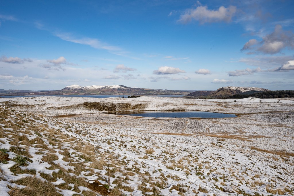
View east from the Inneans over Dow Loch to the Lomond and Benarty hills. Credit: Stefan Durkacz
2. NT 094 957: Go through a gate, bear R and follow the track parallel to the dam. Cross the reservoir outflow by a footbridge. Bear immediately L alongside the concrete outflow channel and go through a ruined fence.
Approaching the forest gate and the climb to Dumglow. Credit: Stefan Durkacz
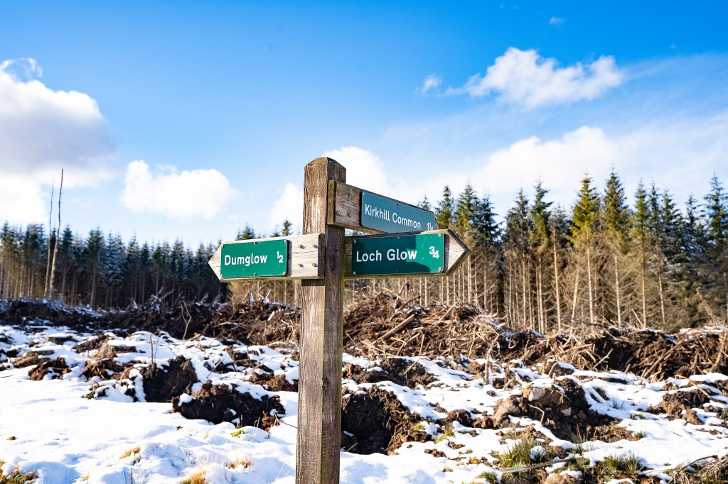
3. NT 093 959: A signpost points the way to Dumglow. Follow a path R through a metal gate in a new deer fence. Climb through new broadleaf plantings towards the southernmost of the Inneans, a cluster of steep-sided, flat-topped little hills. The name is possibly derived from the Gaelic word for anvil. Bear R across the southern slope of the hill. There is a fine view east to the Lomond Hills, Benarty Hill and Loch Leven. Where the path forks, take the R branch which curves gradually west between the southernmost and central Inneans. Make for a gate in the forest fence ahead.
Waymarking in the forest on the way to Dumglow. Credit: Stefan Durkacz
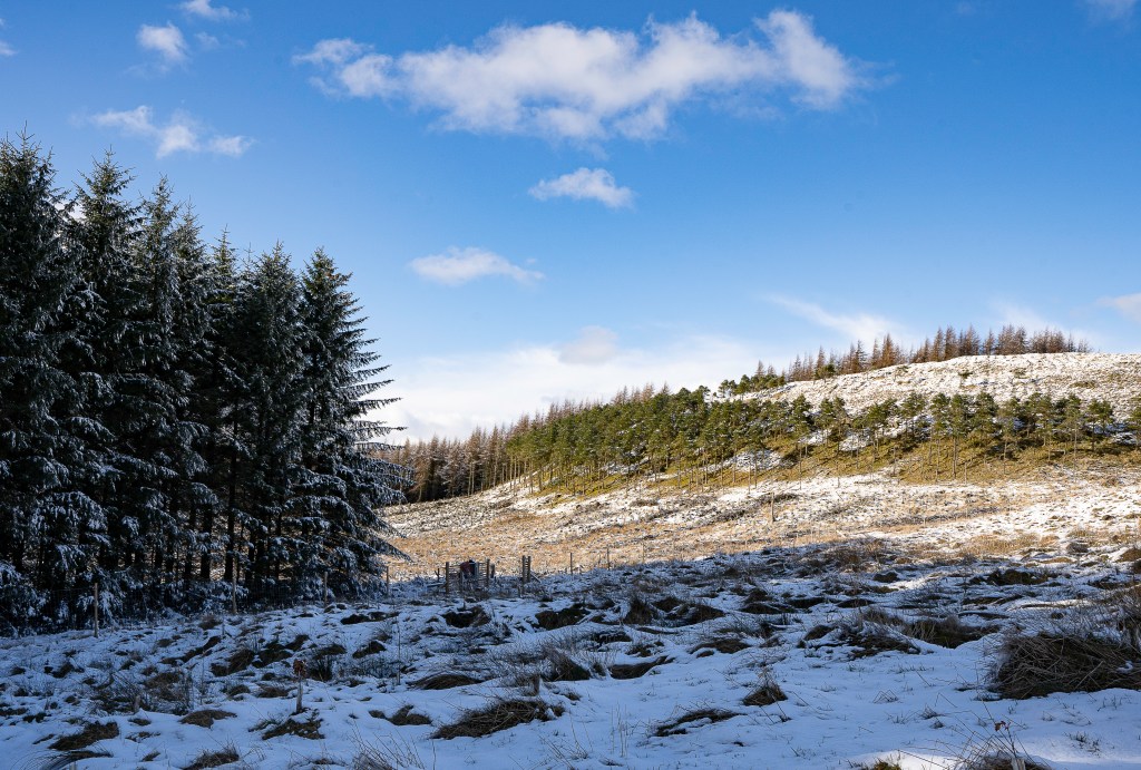
4. NT 087 964: Follow a rough path through the conifer plantation. Recent felling has taken place north of the path, so this section is more open than it was. The lower part of the path is still very wet, however. Where the path crosses the end of a forestry track coming in from the R, a signpost indicates the continuation uphill towards Dumglow.
On the summit of Dumglow looking west to the Ochils. Credit: Stefan Durkacz
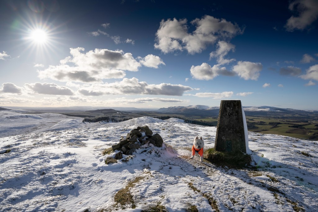
5. NT 081 963: Reaching a fence, the way appears barred by a wall of mature firs. However the path continues through the trees. The way is soon blocked by fallen timber. Pass this on the L and climb the short distance through the last of the trunks to reach open ground. Turn R and follow the edge of the forest to a fence. Cross by a stile and follow the path to the summit of Dumglow (379m) marked by a trig pillar, cairn and vague remains of Iron Age earthworks (there was a hill fort here). The views are stupendous, especially south over West Fife and the Forth, and west along the Ochils towards Stirling.

The steep descent from Dumglow to Windy Gate and Georgeton Hills. Credit: Stefan Durkacz
6. NT 076 965: Continue west, descending steeply to Windy Gate. Where the fence on your R bends L across your path near the foot of the slope, cross it and carry straight on across Windy Gate towards Georgeton Hills. Cross an old wall then another fence to reach the top (349m). The view towards the Ochils is especially fine.

08_Dumglow and the Black Loch from Georgeton Hills. Credit: Stefan Durkacz
7. NT 070 965: Descend south then up to the little hummock of Black Hill. Turn R to follow the crest to its west end as the descent south is awkwardly steep with some outcrops. Bear L and labour across a couple of hundred metres of deep grass tussocks, rushes and bog to reach the easier slopes of Park Hill. Climb bearing R to reach the summit (339m).
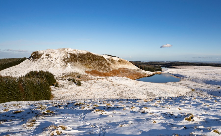
The Black Loch below Dumglow’s crags. Credit: Stefan Durkacz
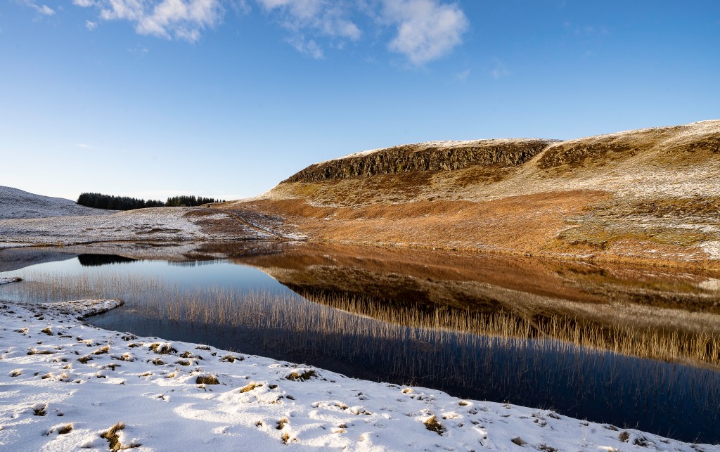
8. NT 068 959: Descend ENE over rough, tussocky ground to the Black Loch. This is a serene, picturesque spot well-named for its inky, often flat-calm waters fringed by rushes and overlooked by crags. Follow a faint path east to the boggy outflow. Cross the burn and follow the wall and fence east with the forest on your L. Recross the burn where it loops back under the wall and into the woods and continue east to Loch Glow.
On the north shore of Loch Glow at the end of the day. Credit: Stefan Durkacz
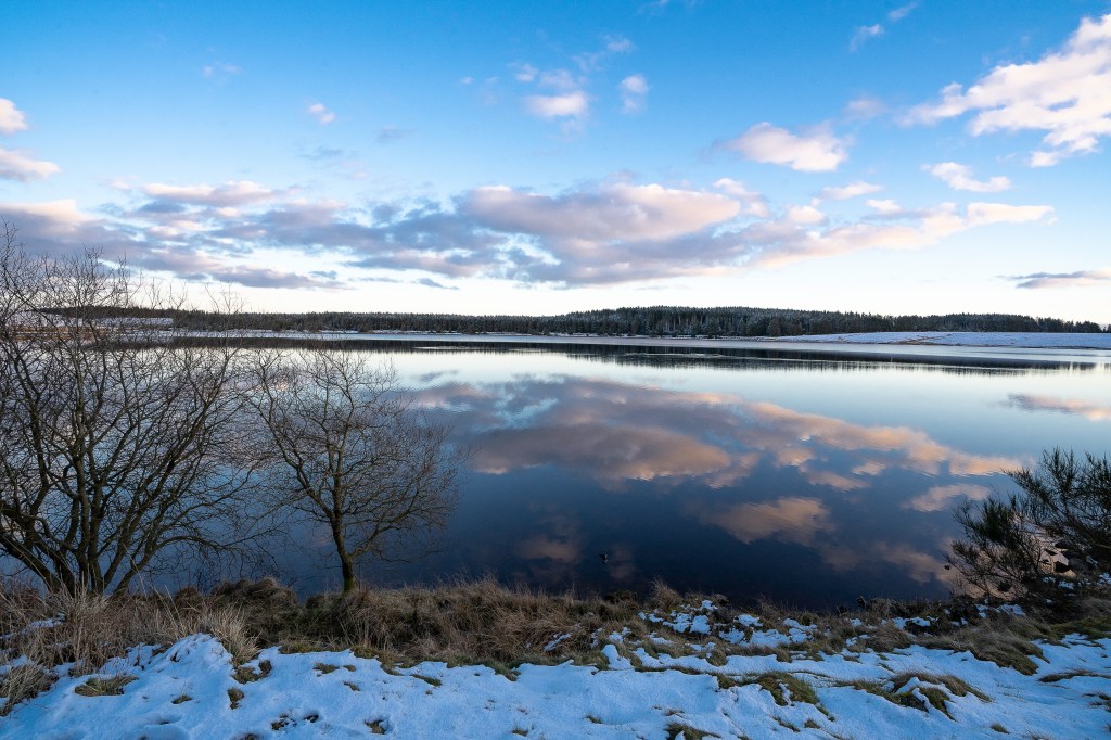
9. NT 082 959: Turn left over a stile and follow the northern shore back to the dam (the southern shore is passable but very wet). Shlep along the boggy shoreline at first, crossing the burn from the Black Loch by a footbridge. Where a second burn enters the loch, the path ascends the bank above the shore, giving quicker, drier going. Back at the dam, retrace your steps to the car park.
Further information
Public transport: None to start
Tourist information: Perth VisitScotland iCentre (Tel: 01738 450600)
Discover more walks in Scotland as mapped by our expert contributors.


